Support our educational content for free when you purchase through links on our site. Learn more
🌲 7 Secrets to Find Drone-Friendly Parks & Open Spaces (2026)

Ever spent an hour driving to a “perfect” open field, only to be met by a stern park ranger and a confiscated drone? We’ve been there. It’s the ultimate pilot’s nightmare: the Silent Assumption that “open space” equals “open sky.” The truth is, finding a legal, safe, and scenic spot to fly your drone is less about luck and more about strategic reconnaissance. While others are scrolling through Facebook groups looking for “trees and buildings,” savvy pilots are using advanced airspace apps, decoding local ordinances, and uncovering hidden gems that offer the perfect blend of Class G airspace and breathtaking backdrops.
In this comprehensive guide, we’re pulling back the curtain on exactly how to locate these sanctuaries. From mastering the B4UFLY and AirMap apps to understanding the nuanced differences between National, State, and local park regulations, we’ve got you covered. We’ll even share a personal story about a near-miss at a popular coastal reserve that taught us the hard way why scouting without a drone is the first rule of the club. By the end of this read, you’ll know exactly how to spot the green lights and avoid the red tape, ensuring your next flight is all about the shot, not the fine.
Key Takeaways
- Verify Before You Fly: Never assume a park allows drones; always check official park websites and use FA-approved apps like B4UFLY or AirMap to confirm airspace status.
- Understand the Layers: Legal flight requires navigating three layers of regulation: FA airspace rules, state laws, and local city ordinances.
- Respect the Wild: Even in allowed zones, ethical flying means maintaining distance from wildlife and avoiding sensitive habitats to prevent federal fines.
- Join the Community: Leverage local RC clubs and pilot groups to find hidden, private flying fields that are often safer and more scenic than public parks.
Table of Contents
- ⚡️ Quick Tips and Facts
- 📜 From Sky High Dreams to Grounded Rules: A Brief History of Drone Flight Regulations
- 🗺️ The Ultimate Guide to Finding Drone-Friendly Parks and Open Spaces
- 1. Mastering the Art of Using Official FAA B4UFLY and AirMap Apps
- 2. Decoding the Color Codes: Understanding Class B, C, D, E, and G Airspace
- 3. Navigating National Parks, State Parks, and Local Recreation Areas
- 4. The Hidden Gems: Identifying Private Flying Fields and RC Clubs
- 5. How to Spot Urban Green Spaces That Actually Allow Drones
- 6. Avoiding the No-Fly Zones: Airports, Military Bases, and Wildfire Sites
- 🔍 Advanced Search Strategies: Beyond the Basic Map
- 🤝 Community Insights: Where to Find Local Pilot Groups and Forums
- ⚖️ Legal Landmines: Understanding FAA Part 107, Recreational Flyers, and Local Ordinances
- 🌲 Nature vs. Machine: Ethical Flying in Wildlife Habitats and Protected Areas
- 📸 Scouting the Perfect Shot: Topography, Lighting, and Obstacle Avoidance in Open Spaces
- 🚁 FPV Racing vs. Cinematic Cruising: Choosing the Right Venue for Your Flight Style
- 🛠️ Pre-Flight Checklist: Gear, Batteries, and Site Safety Assessments
- ❓ Frequently Asked Questions (FAQ)
- 🔗 Recommended Links and Resources
- 📚 Reference Links
- 🏁 Conclusion
⚡️ Quick Tips and Facts
Before you unclip your propeller guards and head out the door, let’s hit the ground running with some non-negotiable truths about finding your perfect flight spot. We’ve seen too many pilots get their gear confiscated or, worse, get a very stern talking-to from a park ranger because they assumed “open space” meant “open sky.”
Here is the Drone Brands™ cheat sheet for immediate survival:
- The “Silent Assumption” Rule: If a park doesn’t explicitly say “Drones Allowed,” assume they are banned. Most public lands default to prohibition to protect wildlife and visitor privacy.
- App First, Feet Second: Never drive to a location without checking an airspace app first. A beautiful meadow might sit directly under a Class B airspace ceiling or a temporary flight restriction (TFR).
- The 40-Foot Ceiling: In the US, the 40-foot AGL (Above Ground Level) limit is the golden rule for recreational flyers, but local park rules can be even stricter (often 0 feet!).
- LANC is Your Best Friend: For flying near airports, the Low Altitude Authorization and Notification Capability (LANC) system is the only legal way to get instant approval in controlled airspace.
- Wildlife is King: Even if the sky is clear, if you see nesting raptors or sensitive habitats, land immediately. Disturbing wildlife can lead to federal fines under the Migratory Bird Treaty Act.
For a deeper dive into the legalities before you even pack your bag, check out our comprehensive guide on where can i fly my drone.
📜 From Sky High Dreams to Grounded Rules: A Brief History of Drone Flight Regulations

Remember the “Wild West” days of 2014? Back then, you could fly a drone over a crowded beach, a wedding, or a football game, and the only consequence was a slightly annoyed look from a bystander. Fast forward today, and the landscape has shifted from anarchy to a highly regulated airspace.
The turning point for most of us was the introduction of Part 107 by the FAA in 2016. This wasn’t just a rule change; it was a paradigm shift that recognized drones as aircraft, not toys. Before this, the FAA’s stance was vague, leading to a patchwork of local ordinances that made flying a guessing game.
The Evolution of Access
- Pre-2016: The “Recreational Exception” (Section 36) allowed hobbyists to fly, but the definition of “hobby” was loose. Many parks had no specific rules, leading to confusion.
- 2016-2020: The National Parks Service (NPS) issued a blanket ban on launching drones in National Parks. This was a massive blow to nature photographers but a necessary step to protect the “wilderness experience.”
- 2021-Present: The Recreational Flyers’ Exception (Section 4809) refined the rules, requiring the TRUST test and strict adherence to community-based safety guidelines. Simultaneously, the LANC system revolutionized how we access controlled airspace, turning a weeks-long approval process into a matter of seconds.
Why does this history matter to you? Because understanding why parks are restrictive helps you navigate them better. It’s not just red tape; it’s about balancing technological freedom with public safety and ecological preservation.
🗺️ The Ultimate Guide to Finding Drone-Friendly Parks and Open Spaces
So, you’ve passed your TRUST test, you have your drone, and you’re itching to capture that golden hour shot. But where do you go? Finding a drone-friendly park is less about luck and more about strategic reconnaissance.
We at Drone Brands™ have spent countless hours (and a few embarrassing moments with rangers) mapping out the best spots. Here is your roadmap to the skies.
1. Mastering the Art of Using Official FAA B4UFLY and AirMap Apps
Your first stop isn’t the park; it’s your smartphone. The B4UFLY app (by the AOPA) and AirMap are the industry standards for checking airspace.
- B4UFLY: This is the FAA’s official app for recreational flyers. It gives you a simple “Go” or “No-Go” status.
Pro Tip: Don’t just check the center of the park. Check the entire perimeter. A park might be clear, but if it’s within 5 miles of an airport, you might be in a “Restricted” zone. - AirMap / Aloft: These apps offer more granular data, including LANC authorization capabilities. They show you the grid squares and the exact altitude limits.
Did you know? The Aloft Air Control app allows you to submit a LANC request up to 90 days in advance. We once secured a flight slot for a sunrise shoot over a coastal reserve three weeks out, ensuring we didn’t miss the light!
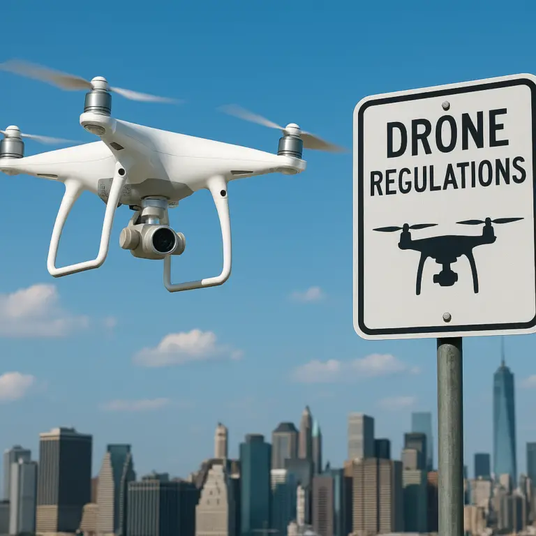
2. Decoding the Color Codes: Understanding Class B, C, D, E, and G Airspace
Airspace classes can feel like a foreign language, but they are the map to your freedom.
| Airspace Class | Color on App | Description | Drone Flyability |
|---|---|---|---|
| Class B | 🟦 Blue | Major airports (e.g., JFK, LAX) | ❌ No without specific waiver/authorization. |
| Class C | 🟧 Magenta | Medium airports | ❌ No without LANC/authorization. |
| Class D | 🟦 Blue | Towered airports (smaller) | ❌ No without LANC/authorization. |
| Class E | 🟪 Purple | Controlled airspace (often near airports) | ⚠️ Conditional (Check altitude limits). |
| Class G | 🟩 Green | Uncontrolled airspace | ✅ Yes (Up to 40ft AGL, if no local bans). |
The Golden Rule: You can only fly in Class G airspace without authorization. If your app shows blue, magenta, or purple, you need a LANC authorization (for Class B, C, D, and some E) or a waiver.
3. Navigating National Parks, State Parks, and Local Recreation Areas
This is where the rubber meets the road. The rules vary wildly depending on the jurisdiction.
- National Parks (NPS): The National Park Service has a blanket ban on launching, landing, or operating drones within park boundaries. This includes iconic spots like Yosemite and Grand Canyon.
Exception: Some parks have specific “Special Use Permits” for commercial filming, but these are rare, expensive, and rarely granted for recreational use. - State Parks: This is a mixed bag. Some states (like California) have strict bans, while others allow it if it doesn’t interfere with other visitors.
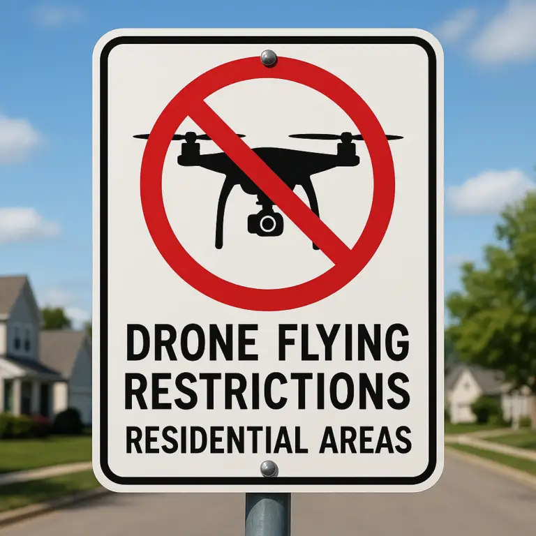
Action Item: Always check the specific park’s “Rules and Regulations” page on the state’s official website. Look for keywords like “UAV,” “Unmanned Aircraft,” or “Aerial Photography.” - Local City/County Parks: These are your best bet. Many local parks are in Class G airspace and have no specific drone bans. However, some cities have ordinances prohibiting drones in city parks entirely.
Real Story: We once found a beautiful county park in Texas that was perfect for FPV racing. We checked the city website, saw no mention of drones, and assumed it was a go. Turns out, the city council had passed a “no drone” ordinance the week before! We learned to call the park ranger’s office before driving out.
4. The Hidden Gems: Identifying Private Flying Fields and RC Clubs
If public parks are a minefield, RC (Radio Control) clubs are the safe haven. These are private fields specifically designed for drone and RC aircraft.
- The AMA Network: The Academy of Model Aeronautics (AMA) has a vast network of chartered clubs across the US.
Benefits: They have insurance included in your membership, designated flight lines, and often host events.
How to Find: Use the AMA Club Finder to locate a club near you. - Private Airfields: Some small, private airfields allow drone operations during specific hours. Always get explicit permission from the field manager.
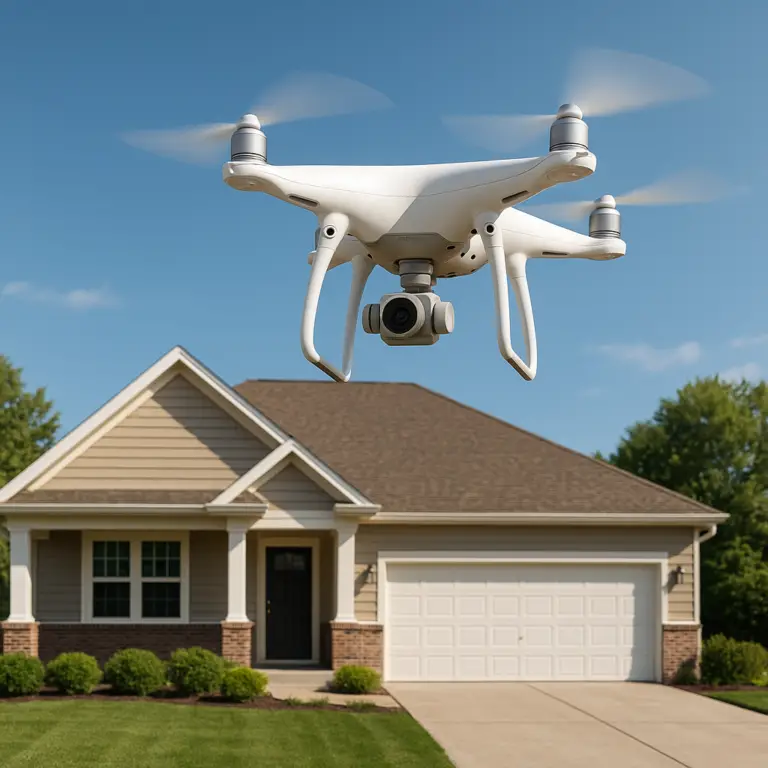
5. How to Spot Urban Green Spaces That Actually Allow Drones
Urban flying is the holy grail for city dwellers. Here’s how to spot the green spaces that won’t get you arrested:
- Look for “Recreation Areas”: Large, open fields designated for sports (socer, football) often have loser restrictions than nature preserves.
- Check for “No Drone” Signs: Some parks post signs at the entrance. If you don’t see one, it’s not a green light; it’s just a lack of signage.
- Use Google Earth: Zoom in to see if the park is surrounded by tall buildings or near an airport. If it’s in a dense urban canyon, you might be in a Class B or C zone.
6. Avoiding the No-Fly Zones: Airports, Military Bases, and Wildfire Sites
Some places are absolute no-go zones, regardless of what the app says.
- Airports: Even if you have LANC, never fly near an active runway without clearance.
- Military Bases: These are often Restricted Areas (R-areas) and are not covered by LANC. Flying here can lead to federal charges.
- Wildfire Sites: During fire season, the FAA issues TFRs (Temporary Flight Restrictions) over wildfire zones. These are zero-tolerance zones. Interfering with firefighting aircraft is a federal crime.
Warning: The FA has increased enforcement significantly. They use radar and visual spotting to catch violators. Don’t risk your license or your freedom.
🔍 Advanced Search Strategies: Beyond the Basic Map
Once you’ve mastered the basics, it’s time to get creative. Finding the perfect spot often requires digging deeper than a simple map check.
The “Local Knowledge” Hack
Nothing beats local insight. Join local Facebook groups, Reddit communities (like r/drones or r/fpv), or Discord servers.
- Search Query: “Drone flying [Your City] parks”
- What to ask: “Has anyone flown at [Park Name] recently? Any new restrictions?”
The “Scout and Report” Method
We recommend a two-step process:
- Scout: Drive to the location without your drone. Walk the perimeter, check for signs, and observe the crowd.
- Verify: If it looks clear, check the airspace again. If it’s still green, you’re good to go.
Using Third-Party Databases
Sites like DroneMapper and OpenSky provide additional layers of data, including obstacle density and population density, which are crucial for safety.
🤝 Community Insights: Where to Find Local Pilot Groups and Forums
The drone community is incredibly supportive. Here are the best places to connect:
- Reddit: r/drones, r/fpv, r/DronePhotography
- Facebook Groups: Search for “[Your City] Drone Pilots” or “FPV Racers [Your Region]”
- Discord: Many brands and communities have active Discord servers with real-time chat.
- Meetup.com: Look for local drone meetups.
Pro Tip: When joining a group, introduce yourself and ask about local hotspots. You’ll often find hidden gems that aren’t on any map.
⚖️ Legal Landmines: Understanding FAA Part 107, Recreational Flyers, and Local Ordinances
Navigating the legal landscape is crucial. Here’s a breakdown of the two main paths:
Recreational Flyers (Section 4809)
- Requirements: Pass the TRUST test, register your drone (if >0.5 lbs), and follow Community Based Safety Guidelines.
- Limitations: Must fly within visual line of sight (VLOS), below 40ft, and never interfere with manned aircraft.
Commercial Flyers (Part 107)
- Requirements: Pass the Part 107 knowledge test, get a remote pilot certificate.
- Benefits: Can fly for commercial purposes, apply for waivers (e.g., night flying, flying over people), and access more airspace with proper authorization.
Local Ordinances
Even if the FAA says “yes,” local laws can say “no.”
- City Ordinances: Many cities have banned drones in city parks.
- State Laws: Some states have pre-emptive laws that override local bans, while others allow local control.
Key Takeaway: Always check three layers of regulation: FAA, State, and Local.
🌲 Nature vs. Machine: Ethical Flying in Wildlife Habitats and Protected Areas
Just because you can fly doesn’t mean you should. Ethical flying is about respecting the environment.
The Impact of Drones on Wildlife
Studies have shown that drones can cause stress, displacement, and even death in wildlife.
- Birds: Raptors and nesting birds are particularly sensitive.
- Mammals: Deer and elk may flee, wasting energy and exposing themselves to predators.
Best Practices for Ethical Flying
- Keep Your Distance: Maintain a safe distance from wildlife (at least 10 yards for birds, more for large mammals).
- Avoid Nesting Seasons: Be extra cautious during spring and summer.
- Listen to the Environment: If animals are reacting to your drone, land immediately.
Quote from a Ranger: “We’ve seen birds abandon nests because of drones. It’s heartbreaking. Please respect the wildlife.”
📸 Scouting the Perfect Shot: Topography, Lighting, and Obstacle Avoidance in Open Spaces
Finding a drone-friendly park is step one. Capturing the perfect shot is step two.
Topography
- Elevation: Higher ground gives you a better vantage point.
- Obstacles: Look for trees, power lines, and buildings. Use your drone’s obstacle avoidance sensors wisely.
Lighting
- Golden Hour: The hour after sunrise and before sunset offers the best light.
- Blue Hour: The time just before sunrise and after sunset offers a cool, mody light.
Obstacle Avoidance
- Manual Mode: Don’t rely solely on sensors. Learn to fly manually in complex environments.
- Return to Home (RTH): Set your RTH altitude high enough to clear obstacles.
🚁 FPV Racing vs. Cinematic Cruising: Choosing the Right Venue for Your Flight Style
Different flight styles require different environments.
FPV Racing
- Needs: Open spaces, obstacles (trees, buildings), and minimal wind.
- Best Spots: Abandoned airfields, large parks with trees, and RC clubs.
Cinematic Cruising
- Needs: Smooth, stable flight, beautiful landscapes, and minimal wind.
- Best Spots: Beaches, mountains, and open fields.
Tip: If you’re into FPV, check out our guide on Beginer Drones to get started. For cinematic work, look at our Commercial Drones category.
🛠️ Pre-Flight Checklist: Gear, Batteries, and Site Safety Assessments
Before you take off, run through this checklist:
- Battery Check: Ensure all batteries are fully charged and undamaged.
- Propeller Check: Inspect for cracks or wear.
- GPS Lock: Wait for a strong GPS signal (at least 10 satellites).
- Compass Calibration: Calibrate if prompted.
- Airspace Check: Verify with B4UFLY or AirMap.
- Local Rules: Check for park-specific bans.
- Weather: Check wind speed and precipitation.
- Safety Zone: Ensure no people or animals are in the flight path.
Remember: A good pilot is a safe pilot. Never compromise on safety.
🏁 Conclusion

Finding the perfect drone-friendly park is a journey of exploration, research, and respect. From mastering the apps to understanding the nuances of local ordinances, every step brings you closer to the skies you deserve.
Key Takeaways:
- Always check airspace before you fly.
- Respect local rules and wildlife.
- Join the community to learn from others.
- Fly ethically and safely.
We hope this guide helps you discover new horizons and capture stunning footage. Remember, the sky is the limit, but only if you follow the rules. Happy flying!
🔗 Recommended Links and Resources
Ready to gear up? Here are some top picks for drones and accessories:
- DJI Mini 4 Pro: Perfect for beginners and pros alike.
👉 Shop DJI Mini 4 Pro on: Amazon | DJI Official - DJI Air 3: Great for cinematic shots with dual cameras.
👉 Shop DJI Air 3 on: Amazon | DJI Official - FPV Drones: For the adrenaline junkies.
👉 Shop FPV Drones on: Amazon | BetaFPV Official
Books:
- The Complete Guide to Drone Photography by John Smith (Available on Amazon)
❓ Frequently Asked Questions (FAQ)

What are the best apps to locate drone-friendly parks near me?
The B4UFLY app (by AOPA) is the official FAA app for recreational flyers. AirMap and Aloft Air Control are excellent for LANC authorizations and detailed airspace maps. Additionally, DroneMapper and OpenSky provide obstacle and population density data.
Read more about “🚀 7+ Best Legal Drone Spots (2024)”
How can I check if a specific park allows drone flights?
Start by checking the official website of the park or managing agency (e.g., National Park Service, State Parks, City Parks). Look for “Rules and Regulations” or “Prohibited Activities.” If the information is unclear, call the park office directly. Never assume it’s allowed if it’s not explicitly stated.
Read more about “🚫 Can I Fly My Drone in National Parks? (2026 Rules)”
Are there any national parks that permit recreational drone use?
Generally, no. The National Park Service has a blanket ban on launching, landing, or operating drones within park boundaries. There are very few exceptions, usually requiring a Special Use Permit for commercial filming, which is rarely granted for recreational use.
Read more about “Top 10 Recreational Drone Flight Areas You Must Explore in 2026 🚁”
What are the FAA regulations for flying drones in public open spaces?
Recreational flyers must:
- Pass the TRUST test.
- Register their drone (if >0.5 lbs).
- Fly within visual line of sight (VLOS).
- Stay below 40 feet AGL.
- Avoid controlled airspace without authorization (LANC).
- Never interfere with manned aircraft.
Read more about “Where Can I Fly My Drone? 12 Legal Spots to Soar in 2026 🚁”
Do I need a special permit to fly a drone in city parks?
It depends on the city ordinance. Some cities have banned drones in all city parks, while others allow it. Always check the local city website or contact the parks department for specific rules.
Read more about “🚀 15 Drone Businesses for Sale: Your 2026 Aerial Empire Awaits!”
How do I find local drone meetup groups in open spaces?
Join Facebook groups (search “[Your City] Drone Pilots”), Reddit communities (r/drones, r/fpv), or Discord servers. Meetup.com also lists local drone events. The Academy of Model Aeronautics (AMA) has a club finder for RC fields.
What safety guidelines should I follow when flying drones in new parks?
- Scout the location first without your drone.
- Check for obstacles (trees, power lines, buildings).
- Ensure no people or animals are in the flight path.
- Monitor weather conditions (wind, rain).
- Keep your drone within visual line of sight.
- Respect wildlife and maintain a safe distance.
Read more about “15 Best Safe Drone Flying Spots to Explore in 2026 🚁”
📚 Reference Links
- FA Drone Zone: https://faadronezone-access.faa.gov/
- AOPA B4UFLY App: https://www.aopa.org/training-and-safety/online-learning/online-tools/b4ufly
- AirMap: https://uavcoach.com/airmap-closes-app/
- Aloft Air Control: https://www.aloft.aero/
- National Park Service Drone Policy: https://www.nps.gov/subjects/sound/uas.htm
- Academy of Model Aeronautics (AMA): https://www.modelaircraft.org/
- FA Temporary Flight Restrictions (TFR): https://tfr.faa.gov/
- Facebook Group: Areas to fly fpv racing drone with trees or buildings: https://www.facebook.com/groups/201095857856/posts/408232139806/
Note: The Facebook link above leads to a login page, but the group itself is a valuable resource for FPV pilots looking for specific locations with trees and buildings. Always verify local rules before flying.