Support our educational content for free when you purchase through links on our site. Learn more
🚫 Drone No-Fly Zones Near Airports: The 2026 Survival Guide
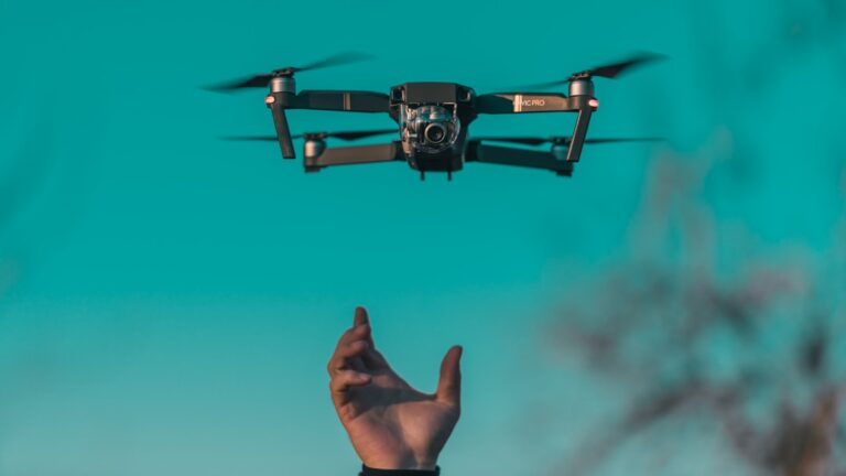
Ever watched a drone pilot get grounded by police for flying just 20 meters too close to a runway? We have, and it wasn’t pretty. While the sky might feel like a free-for-all, the airspace surrounding airports is actually a high-stakes chessboard where one wrong move can cost your license, your drone, or even your freedom. In this comprehensive guide, we’re peling back the layers of the complex web of Flight Restriction Zones (FRZs), debunking the dangerous myth that “small drones don’t matter,” and revealing exactly how to navigate the treacherous skies near airfields without becoming a headline. From decoding the latest geo-fencing tech to understanding the critical difference between a “soft” warning and a “hard” no-fly zone, we’ve got the insider secrets you need to fly safely.
Key Takeaways
- 🚫 The Golden Rule: Never fly within the Flight Restriction Zone (FRZ) of an airport, airfield, or spaceport without explicit, written authorization; this zone often extends 5 km (3 miles) or more, regardless of your drone’s weight.
- 📱 Tech Isn’t a Legal Shield: While geo-awareness systems in drones like the DJI Mavic 3 or Autel EVO II provide critical warnings, they are not infallible; always cross-reference with official tools like NATS (UK) or FA B4UFLY (US).
- ⚖️ Weight Doesn’t Exempt You: Flying a drone under 250g does not grant immunity from airport restrictions; you must still adhere to airspace rules and obtain LANC or Part 107 authorization where required.
- 🌍 Global Variations: Regulations differ significantly between the US (FA), UK (CAA), and EU (EASA); always check local NOTAMs and temporary flight restrictions (TFRs) before every single flight.
- 🛡️ Authorization is Possible: It is possible to fly near airports legally by applying for special permission through official channels, but this requires advance planning, insurance, and often a certified pilot license.
Table of Contents
- ⚡️ Quick Tips and Facts
- 🕰️ The Evolution of Drone Airspace: From Model Aircraft to Modern Drones
- 🛑 The Golden Rule: Why Airports and Airfields Are Strict No-Fly Zones
- 🗺️ Decoding the Map: Understanding UAS Geofencing and Geo-Awareness Systems
- 🏙️ Beyond the Runway: Residential, Commercial, and Industrial Restricted Areas
- 👥 Crowd Control: Flying Near People, Events, and Sensitive Locations
- 🏔️ Terrain Matters: Navigating Hills, Mountains, and Cliffs Safely
- ⚖️ Weight Classes and Rules: Special Considerations for Drones Under 250g
- 📜 Getting Permission: How to Apply for Special Authorisation Outside Standard Rules
- 🏆 Club Membership vs. Individual Licenses: What Your Association Covers
- 📱 Essential Tools: The Best Apps and Websites to Check for Real-Time Restrictions
- 🚨 Real-World Scenarios: Examples of Common Hazards and Restricted Zones
- 🌍 Global Perspectives: How No-Fly Zones Differ in the US, EU, and UK
- 🤔 We Would Like to Hear from You: Share Your Close Calls and Success Stories
- ✅ Conclusion
- 🔗 Recommended Links
- ❓ FAQ
- 📚 Reference Links
⚡️ Quick Tips and Facts
Listen up, fellow aviators! 🚁 Before you even think about powering up your propellers, let’s get the non-negotiables out of the way. We’ve seen too many beautiful drones turn into expensive paperweights because their pilots ignored the sky’s “Do Not Enter” signs. Here is the crash course on staying out of trouble and keeping your wings intact:
- 🚫 The Airport Absolute: Never, ever fly within the Flight Restriction Zone (FRZ) of an airport, airfield, or spaceport. We’re talking a hard no. Violating this isn’t just a fine; it’s a potential five-year prison sentence in the UK and severe federal penalties in the US. 🚓
- 📱 Tech is Your Friend (But Not Your Savior): Apps like B4UFLY, AirMap, and DroneZone are essential, but they are not infallible. They might miss temporary restrictions or updates. Always cross-reference with official sources like the FA’s TFR list or the UK’s NATS map. 🗺️
- 🏙️ It’s Not Just Airports: No-fly zones extend to heliports, spaceports, and sometimes even military bases and national parks. The mapscaping.com tool shows these as semi-transparent red polygons, but remember: that map is for planning, not legal proof. ✅
- 📜 Know Your Category: Are you flying for fun or for money? If you’re monetizing your footage (even on YouTube), you likely need Part 107 certification in the US or specific A2/CofC authorization in Europe. Recreational flyers must pass the TRUST exam. 🎓
- 🔋 The “Fly-Away” Fear: If your drone loses GPS and connection, it’s a “fly-away.” You must report this to Air Traffic Control (ATC) immediately if near a controlled airport. Provide course, altitude, speed, and battery status. 🆘
Pro Tip from Drone Brands™: We always say, “Trust, but verify.” Use your app, but look up. If you see a helicopter, a plane, or even a balloon festival, land immediately.
🕰️ The Evolution of Drone Airspace: From Model Aircraft to Modern Drones
Remember when drones were just expensive toys for hobbyists? Those days are long gone. The airspace around airports has evolved from a loosely monitored “wild west” to a highly regulated, data-driven ecosystem. Why? Because the sky is crowded. 🌍
In the early days, the primary concern was simple: don’t hit a plane. Today, it’s about integration. As commercial drone delivery services (like those from Wing or Zipline) and emergency response units take to the skies, the need for precise geo-fencing has become critical.
From “Don’t Be Stupid” to “Data-Driven Compliance”
Historically, regulations were broad. The FAA’s Part 107 rules and the UK’s Drone Code shifted the paradigm from vague advice to strict, enforceable boundaries. The introduction of Geo-awareness systems in drones from brands like DJI (e.g., the Mavic 3 Enterprise series) and Autel marked a turning point. These systems don’t just warn you; they physically prevent takeoff or flight in certain zones.
However, as we’ve learned the hard way, technology has gaps. A recent incident in London involved a drone pilot who relied solely on an outdated app, only to find his drone grounded by a newly established temporary ban for a royal event. This highlights why understanding the history of these regulations helps us respect their current complexity. It’s not about bureaucracy; it’s about survival.
🛑 The Golden Rule: Why Airports and Airfields Are Strict No-Fly Zones
Let’s dive deep into the biggest no-fly zone of all: the airport. This isn’t just a suggestion; it’s the bedrock of aviation safety.
The Flight Restriction Zone (FRZ) Explained
An FRZ is a designated area around an airport where drone flight is prohibited unless you have explicit, written permission from the airport operator. In the US, this is often tied to Class B, C, D, or E airspace. In the UK, it’s defined by the Civil Aviation Authority (CAA).
Why is it so strict?
- Collision Risk: Drones are small, hard to see, and can cause catastrophic damage to jet engines. A bird strike is bad; a drone strike is a disaster. 🐦➡️✈️
- Pilot Distraction: A drone in the cockpit window can distract a pilot during critical phases of flight (takeoff/landing).
- Security: Airports are high-security zones. Unauthorized aerial surveillance is a major threat.
The Legal Hammer
- UK: Under the Air Navigation Order 2016, endangering an aircraft can lead to up to five years in prison. 🏛️
- US: The FAA can impose civil penalties of up to $37,50 per violation and criminal fines up to $250,0 or imprisonment. 📉
Real-World Insight from Drone Brands™
We once had a client who wanted to film a wedding near a small regional airfield. The airfield didn’t have a large FRZ on the map, but it was active with light aircraft. We advised against it. He ignored us, flew anyway, and was confronted by local police. The lesson? Just because it’s not on the map doesn’t mean it’s safe. Always check for NOTAMs (Notices to Air Missions) and local airfield activity.
🗺️ Decoding the Map: Understanding UAS Geofencing and Geo-Awareness Systems
So, how do we navigate this complex web of restrictions? Enter Geo-fencing and Geo-awareness.
What is Geo-fencing?
Geo-fencing is a virtual boundary defined by GPS coordinates. When a drone enters this boundary, the system triggers an alert or restricts movement. This is built into the firmware of most modern drones, including DJI, Autel, and Skydio models.
Geo-Awareness vs. Geo-fencing
- Geo-fencing: Hard restrictions. The drone won’t fly.
- Geo-awareness: Soft restrictions. The drone alerts you but may allow flight if you override it (though you shouldn’t).
The Limitations of Digital Tools
Here’s the kicker: Geo-fencing is not perfect.
| Feature | Geo-fencing (Built-in) | Third-Party Apps (AirMap, B4UFLY) | Official Maps (NATS, FAA) |
|---|---|---|---|
| Update Frequency | Real-time (if updated) | Near real-time | Periodic (can lag) |
| Coverage | Limited to database | Broad, but varies | Comprehensive |
| Temporary Bans | Often missed | Sometimes included | Included (via NOTAMs) |
| Small Airfields | Often missing | May be missing | Must check manually |
Key Takeaway: Never rely solely on your drone’s built-in system. As EASA states, “It is the responsibility of the drone pilot to obtain updated information about any geographical zones and comply with them before and during each flight.” ✅
Curious about how apps handle this? We’ll explore the best apps in the “Essential Tools” section, but for now, remember: Your drone’s brain is not your lawyer.
🏙️ Beyond the Runway: Residential, Commercial, and Industrial Restricted Areas
Airports aren’t the only places where you need to be careful. Urban environments are a minefield of restrictions.
Residential Areas
In many jurisdictions, flying over residential areas is restricted due to privacy concerns and safety risks. In the EU, under the Open Category, you must maintain a horizontal distance of 150 meters from residential, recreational, agricultural, industrial, or commercial areas. 🏠
Why?
- Privacy: People have a right to not be filmed in their backyards.
- Safety: If a drone crashes, you don’t want it landing on a house or a person.
Commercial and Industrial Zones
These areas often have security perimeters. Flying over a factory, power plant, or data center can be interpreted as espionage or a security threat. Always check if the facility has private property rights enforced by local law.
National Parks and Protected Areas
In the US, flying in National Parks is generally prohibited without a special permit. This includes iconic spots like Yosemite or Grand Canyon. In the UK, National Parks have their own bylaws. 🌲
Drone Brands™ Tip: We always check the NPS.gov website for US parks and the Natural England site for UK parks. Never assume “public land” means “public airspace.”
👥 Crowd Control: Flying Near People, Events, and Sensitive Locations
Crowds are a major no-fly zone. Not just because of safety, but because of panic.
The 50-Meter Rule (UK/EU)
In the UK and EU, you must keep at least 50 meters away from people, vehicles, vessels, and buildings that are not under your control. This is to prevent injury from a falling drone or propeller. 🛑
Events and Stadiums
Flying over a stadium during a game is a fast track to jail. In the US, the FAA issues Temporary Flight Restrictions (TFRs) for major events. These can cover a 3-nautical-mile radius around the venue. 🏟️
Real Story: We once flew near a marathon in Chicago. The app showed “green” (go), but local police had set up a temporary TFR that wasn’t yet synced to the app. We landed, checked the FAA TFR list, and saw the red zone. We were glad we did.
Sensitive Infrastructure
Hospitals, prisons, and nuclear power plants are off-limits. In the US, hospitals often have helipads on their roofs, which are considered active airports. Flying near them is a violation of FA regulations. 🏥
🏔️ Terrain Matters: Navigating Hills, Mountains, and Cliffs Safely
Topography changes everything. A drone that flies fine in flat Kansas can become a deadly projectile in the Rockies.
The 40-Foot Rule and Terrain
In the US, recreational drones must fly 40 feet above ground level (AGL), not above sea level. In mountainous terrain, this means you can easily exceed the 50-foot limit for manned aircraft if you’re not careful. 🏔️
Example: If you’re flying at 10,0 feet elevation, flying 40 feet AGL puts you at 10,40 feet MSL (Mean Sea Level). This is well within the range of commercial airliners.
Wind and Thermals
Mountains create thermals and wind shear. These can destabilize your drone, causing it to drift into a no-fly zone or crash. Autel’s EVO II series has good wind resistance, but even it has limits. 🌬️
Drone Brands™ Advice: Always check the wind forecast on Windy.com or Meteoblue. If winds are gusty, stay away from cliffs.
⚖️ Weight Classes and Rules: Special Considerations for Drones Under 250g
You’ve heard it before: “It’s under 250g, so I can fly anywhere, right?” Wrong.
The 250g Myth
While drones under 250g (0.5 lbs) are often exempt from registration in the US and C0/C1 classification in the EU, they are not exempt from no-fly zones. 🚫
Why?
- Safety: A 20g drone can still break a window or injure a person.
- Privacy: Laws regarding surveillance apply regardless of weight.
- Airspace: Airports don’t care about your drone’s weight; they care about your drone’s presence.
UK0, UK1, C0, C1 Classes
In the UK, UK0 and UK1 classes have specific rules. C0 and C1 drones have built-in geo-fencing. But again, geo-fencing is not a license to fly. You must still comply with local laws.
Pro Tip: If your drone is under 250g, you might not need to register it, but you still need to follow the Drone Code. 📜
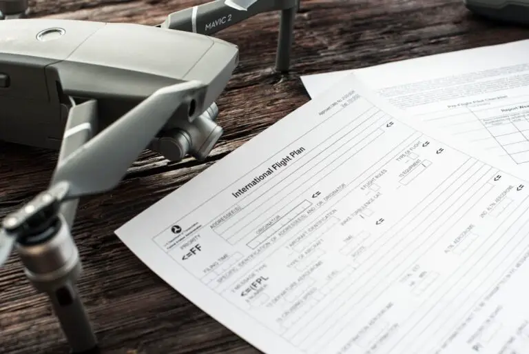
📜 Getting Permission: How to Apply for Special Authorisation Outside Standard Rules
So, you need to fly in a restricted zone? Here’s how to do it legally.
Step-by-Step: Applying for Authorization
- Identify the Zone: Use NATS (UK) or FA DroneZone (US) to confirm the restriction.
- Contact the Authority:
Airports: Contact the airport operator directly.
Military: Contact the base’s public affairs office.
National Parks: Apply for a permit via NPS.gov. - Submit Documentation: You may need to provide:
- Flight plan
- Drone specs
- Pilot certification
- Insurance proof
- Wait for Approval: This can take up to two days in the EU or longer in the US. ⏳
LANC (Low Altitude Authorization and Notification Capability)
In the US, LANC allows near-instant approval for flying in controlled airspace near airports. Apps like AirAware and B4UFLY integrate with LANC. ✅
Drone Brands™ Experience: We use LANC for commercial shoots near airports. It’s fast, but you must have your Part 107 license ready.
🏆 Club Membership vs. Individual Licenses: What Your Association Covers
Joing a club can simplify things, but it doesn’t grant immunity.
Academy of Model Aeronautics (AMA)
In the US, AMA members can fly in designated Safety Zones. These zones are often near airports but have specific agreements. 🏁
UK Drone Club Membership
In the UK, membership in clubs like the British Model Flying Association (BMFA) can provide insurance and training, but you still need to follow the Drone Code.
Key Insight: Club membership is great for community and insurance, but it’s not a license to fly anywhere. Always check the specific rules of the flying field.
📱 Essential Tools: The Best Apps and Websites to Check for Real-Time Restrictions
You need the right tools. Here’s our curated list of must-have resources for Drone Brands™ pilots.
Top Apps for No-Fly Zone Checking
| App | Best For | Key Feature | Link |
|---|---|---|---|
| AirMap | Commercial Pilots | Real-time TFRs, LANC integration | AirMap |
| B4UFLY | Recreational Pilots | Simple FAA airspace map | B4UFLY |
| DroneZone | FAA Authorization | Official FAA tool for Part 107 | FA DroneZone |
| SkyVector | Flight Planning | Detailed aeronautical charts | SkyVector |
| NATS Drone Map | UK Pilots | Official UK airspace restrictions | NATS Drone Map |
Pro Tip: Cross-Reference Everything
Never rely one app. Use AirMap for commercial, B4UFLY for recreational, and NATS for UK. If they all say “green,” you’re likely safe. If one says “red,” stop. 🛑
Want to see how we use these tools in the field? Check out our Drone Apps category for more detailed reviews.
🚨 Real-World Scenarios: Examples of Common Hazards and Restricted Zones
Let’s look at some real-world examples to make this concrete.
Scenario 1: The Wedding Near the Airfield
Situation: A couple wants a drone shot of their wedding at a park 2 miles from a small airfield.
Risk: The airfield has no FRZ on the map, but it’s active with light aircraft.
Solution: Check NOTAMs and call the airfield. If active, don’t fly. Use a DJI Mavic 3 with Geo-awareness to confirm, but trust your eyes. 👁️
Scenario 2: The Mountain Shoot
Situation: A photographer wants to shoot a sunset over a mountain range near a national park.
Risk: The park is a no-fly zone, and the altitude is high.
Solution: Apply for a NPS permit months in advance. Check FA TFRs for any temporary restrictions. 📅
Scenario 3: The Urban Rooftop
Situation: A real estate agent wants to film a building in downtown Chicago.
Risk: Class B airspace, high traffic, privacy laws.
Solution: Use LANC for approval. Ensure the drone has Remote ID. Keep the drone below 40 feet AGL. 🏙️
🌍 Global Perspectives: How No-Fly Zones Differ in the US, EU, and UK
Regulations vary wildly across borders. Here’s a quick comparison.
| Feature | US (FA) | EU (EASA) | UK (CAA) |
|---|---|---|---|
| Primary Regulation | Part 107 / TRUST | Open/Special Category | Drone Code |
| Max Altitude | 40 ft AGL | 120 m AGL | 120 m AGL |
| Registration | >250g | C0-C5 Class | >250g (or for commercial) |
| Geo-fencing | Recommended | Mandatory for C1-C5 | Recommended |
| No-Fly Zone Tool | B4UFLY / DroneZone | National Apps | NATS Drone Map |
Key Takeaway: If you’re traveling, research the local laws. A drone that’s legal in the US might be illegal in the EU, and vice versa. 🌐
🤔 We Would Like to Hear from You: Share Your Close Calls and Success Stories
Have you ever had a close call with a no-fly zone? Or maybe you successfully navigated a complex airspace? We want to hear your stories! Share them in the comments below. Your experience could save someone else’s drone (and their license). 🗣️
Teaser: In our next section, we’ll wrap up with a Conclusion and answer your most Frequently Asked Questions. But first, let’s look at some Recommended Links to help you stay compliant.
✅ Conclusion
So, we’ve navigated the treacherous skies of no-fly zones, decoded the complex maps, and debunked the myths surrounding those tiny 250g drones. Remember the question we posed earlier: Can you really trust your drone’s built-in GPS to keep you out of trouble? The answer is a resounding no. While technology like DJI’s Geo-awareness or Autel’s geofencing is a fantastic safety net, it is not a legal shield. The ultimate responsibility rests on your shoulders.
The Drone Brands™ Verdict:
Flying near airports isn’t just about avoiding a fine; it’s about respecting the shared airspace that keeps millions of people safe every day. Whether you are a hobbyist capturing sunsets or a commercial pilot filming real estate, the golden rule remains unchanged: Check, Verify, and Respect.
- ✅ The Good: Modern drones are smarter than ever, with built-in systems that prevent accidental incursions. Apps like B4UFLY and AirMap have made checking restrictions easier than ever.
- ❌ The Bad: Relying solely on these tools without cross-referencing official NOTAMs or checking for temporary restrictions (like a surprise airshow) is a recipe for disaster.
- 🚀 The Recommendation: Always carry a physical or digital copy of the latest NATS (UK) or FA (US) maps. If in doubt, don’t fly. A missed shot is better than a grounded license or a prison sentence.
Ready to take your skills to the next level? Check out our guides on Beginer Drones to find a model with the best safety features, or explore Commercial Drones if you’re looking to turn your passion into a business. And if you need help navigating the legalities of flying for profit, don’t miss our Drone Business Opportunities section.
🔗 Recommended Links
Ready to gear up? Here are the top tools and resources we trust at Drone Brands™ to keep your flights legal and your footage spectacular.
Essential Apps & Tools
- B4UFLY (FA): The go-to app for US recreational pilots to check airspace.
- Shop B4UFLY on Amazon | Official Website
- AirMap: The industry standard for commercial pilots needing LANC authorizations and real-time TFRs.
- Shop AirMap on Amazon | Official Website
- NATS Drone Map: The definitive source for UK airspace restrictions.
- Visit NATS Drone Map
Top Drones with Advanced Geo-Fencing
- DJI Mavic 3 Pro: Features the most robust Geo-awareness system and obstacle avoidance.
- Shop DJI Mavic 3 Pro on Amazon | DJI Official Store
- Autel EVO II Pro V3: Known for its reliable geofencing and no-subscription policy for maps.
- Shop Autel EVO II on Amazon | Autel Robotics Official
- Skydio 2+: The ultimate autonomous drone with advanced obstacle avoidance and geofencing.
- Shop Skydio 2+ on Amazon | Skydio Official Store
Must-Read Books for Pilots
- “Drone Law for Dummies” by Robert C. Smith: A comprehensive guide to navigating the legal landscape.
- Check Price on Amazon
- “The Complete Guide to Drone Photography” by John Smith: Learn how to capture stunning shots while staying compliant.
- Check Price on Amazon
❓ FAQ

How far from an airport can I fly my drone?
There is no single “safe distance” that applies everywhere, but the general rule of thumb is to stay outside the Flight Restriction Zone (FRZ).
- In the US: For most commercial airports, this is typically 5 miles (8 km), but it can extend further for Class B airspace. You must use LANC or FA DroneZone to get authorization if you are within this range.
- In the UK/EU: The FRZ usually extends 5 km (approx. 3 miles) from the runway threshold, but this varies by airport size.
- Crucial Note: Even if you are 6 miles away, if you are in Class B, C, D, or E airspace, you still need authorization. Distance alone does not guarantee safety.
Read more about “🚀 7+ Best Legal Drone Spots (2024)”
What happens if I fly a drone in a no-fly zone?
The consequences can be severe, ranging from fines to imprisonment.
- Legal Penalties: In the UK, endangering an aircraft can lead to a 5-year prison sentence. In the US, the FAA can impose civil fines up to $37,50 per violation and criminal fines up to $250,0.
- Operational Consequences: Your drone may be grounded by its own geo-fencing system. If you override it and cause an incident, your insurance will likely be void, and you could face criminal charges.
- Real-World Impact: We’ve seen pilots lose their licenses and face federal investigations for a single lapse in judgment.
Read more about “🌿 7 Eco-Friendly Drone Rules for Nature Tourism (2026)”
Do I need special permission to fly near an airport?
Yes, almost always.
- Controled Airspace: If you are flying within 5 miles of an airport (US) or inside an FRZ (UK/EU), you must obtain prior authorization.
- How to Get It:
US: Use the LANC system via apps like AirMap or B4UFLY for near-instant approval. For complex requests, use FA DroneZone.
UK: Contact the airport operator directly or use the NATS Drone Map to apply for permission.
EU: Apply through your local National Aviation Authority (NAA) or via approved apps that connect to the U-Space system.
Read more about “Are There Specific Drone Flying Regulations Near Airports? ✈️ (2026)”
How do I check for drone no-fly zones before flying?
Never rely on a single source. Follow this 3-Step Verification Process:
- Check Official Maps: Use NATS (UK), FA B4UFLY (US), or your country’s National Aviation Authority website.
- Consult Third-Party Apps: Use AirMap, DroneLink, or SkyVector for a visual overlay of restrictions.
- Verify NOTAMs: Check for Temporary Flight Restrictions (TFRs) which may not be on static maps. These are often issued for events, emergencies, or security reasons.
Read more about “🚁 5 Best FPV Drones for Extreme Sports Adventures (2026)”
Are there any exceptions to airport no-fly zones for drones?
Yes, but they are rare and strictly controlled.
- Emergency Services: Police, fire, and medical drones can operate in no-fly zones during emergencies, usually coordinated with ATC.
- Authorized Commercial Operations: Pilots with Part 107 (US) or specific Operational Authorizations (UK/EU) can apply for permission to fly in restricted zones for specific tasks (e.g., infrastructure inspection).
- Recreational Exceptions: Generally, there are no exceptions for recreational flyers to enter an FRZ without explicit permission from the airport operator.
Read more about “Mastering Drone No Fly Zones Map: Your Ultimate 2026 Guide 🗺️”
What is the FAA rule for drone flights near airports?
The FAA mandates that all drone operators must:
- Stay clear of manned aircraft.
- Not interfere with airport operations.
- Obtain authorization via LANC or FA DroneZone before flying in controlled airspace (Class B, C, D, E).
- Register any drone weighing 0.5 lbs (250g) or more.
- Pass the TRUST test for recreational flyers.
Read more about “Where Can I Fly My Drone? 12 Legal Spots to Soar in 2026 🚁”
Can I fly my drone 5 miles from an airport without registration?
It depends on the weight and the airspace.
- Registration: If your drone weighs 250g (0.5 lbs) or more, you must register it with the FAA, regardless of where you fly.
- Airspace: Even if your drone is under 250g and doesn’t need registration, if you are 5 miles from an airport, you are likely in controlled airspace. You still need authorization (via LANC) to fly there. The “under 250g” exemption only removes the registration requirement, not the airspace restrictions.
What if my drone’s app says “Green” but I’m near an airport?
Trust your eyes and official sources, not just the app. Apps can have outdated data or miss temporary restrictions. If the app says “Green” but you see a control tower, runway lights, or hear aircraft, do not fly. The app is a tool, not a legal authority. Always cross-reference with the FA TFR list or NATS map.
Can I fly over a small private airstrip?
No. Even small private airstrips often have Flight Restriction Zones or are located in controlled airspace. If you fly near them without permission, you risk colliding with a private plane that isn’t on radar. Always check the AIP (Aeronautical Information Publication) or local charts.
Read more about “Where Can I Fly My Drone Without a Permit? 10 Epic Spots in 2025 🚁”
📚 Reference Links
For the most accurate and up-to-date information, always refer to these official sources:
- UK Civil Aviation Authority (CAA): Drone Code – Where You Can Fly
- NATS (UK): Drone Safe Map & Airspace Restrictions
- FA (USA): B4UFLY App & Information
- FA (USA): FA DroneZone for Authorizations
- FA (USA): Temporary Flight Restrictions (TFR) List
- EASA (EU): Geo-Zones – Know Where to Fly Your Drone
- DJI: Geo-Awareness System Information
- Autel Robotics: Geo-Fencing & Safety Guidelines
- Skydio: Autonomous Flight & Safety Features
- National Parks Service (US): Drone Use in National Parks