Support our educational content for free when you purchase through links on our site. Learn more
Where Can I Fly My Drone? 12 Legal Spots to Soar in 2026 🚁
Ever found yourself staring at your drone controller, wondering, “Wait… where exactly can I fly this thing without landing in hot water?” You’re not alone! Navigating the maze of airspace classes, no-fly zones, local rules, and federal regulations can feel like decoding an alien language. At Drone Brands™, we’ve logged thousands of flight hours and tangled with every kind of drone restriction imaginable. Spoiler alert: knowing where to fly legally isn’t just about avoiding fines—it’s about unlocking the best aerial adventures.
In this comprehensive guide, we’ll break down 12 of the best legal places to fly your drone—from secret BLM lands to AMA club fields—and reveal how to use FAA tools and apps to find drone-friendly zones near you. Plus, we’ll spill insider tips on dodging no-fly zones, handling urban drone drama, and even flying internationally without a hitch. Curious about that “secret SoCal ridge” we teased? It’s coming up, and trust us, it’s worth the wait.
Ready to become a drone flight ninja? Let’s take off!
Key Takeaways
- Always check FAA UAS Facility Maps and trusted apps like AirAware or B4UFLY before flying.
- Green LAANC zones mean instant authorization; red means waiver required.
- National Parks generally ban drones, but adjacent public lands often welcome them.
- Local city and park ordinances can override federal rules—know your neighborhood laws.
- Join AMA clubs or fly on BLM lands for hassle-free, legal drone adventures.
- Stay compliant with drone registration, TRUST certification, and Remote ID rules.
- Use multiple apps and tools to cross-verify airspace and unlock DJI geo zones safely.
Fly smart, fly legal, and unlock the skies like a pro!
Table of Contents
- ⚡️ Quick Tips and Facts About Where You Can Fly Your Drone
- 📜 The Evolution of Drone Flight Regulations: A Brief History of Drone Airspace Rules
- 🗺️ Understanding Airspace Classes and Where Drones Are Allowed to Fly
- 🚁 7 Best Places to Fly Your Drone Legally and Safely
- 📱 How to Use FAA UAS Facility Maps to Find Drone-Friendly Zones
- 🛑 No-Fly Zones Explained: Where You Absolutely Cannot Fly Your Drone
- 🏞️ Flying Drones in National Parks and Public Lands: What You Need to Know
- 🌆 Urban Drone Flying: Navigating City Regulations and Privacy Concerns
- 🛡️ How to Stay Compliant: Drone Registration, Permits, and Local Laws
- 🎯 Tips for Finding Hidden Drone-Friendly Spots Near You
- 📡 Using Technology and Apps to Discover Legal Drone Flying Areas
- 🛠️ Troubleshooting Common Issues When Finding Legal Drone Flight Locations
- 🌍 International Drone Flying: Where Can You Fly Your Drone Abroad?
- 🔮 The Future of Drone Flight Zones and Airspace Management
- 🎉 Conclusion: Mastering Where You Can Fly Your Drone Like a Pro
- 🔗 Recommended Links for Drone Pilots and Enthusiasts
- ❓ Frequently Asked Questions About Legal Drone Flying Locations
- 📚 Reference Links and Resources for Drone Flight Regulations
⚡️ Quick Tips and Facts About Where You Can Fly Your Drone
- ✅ Under 249 g? You still need to follow airspace rules—even if registration-free.
- ❌ Never guess—use an app like AirAware or the FAA’s B4UFLY before every take-off.
- ✅ Green grids on the FAA UAS Facility Map = instant LAANC thumbs-up.
- ❌ Red grids = waiver required (expect 60–90 days).
- ✅ TRUST test = free, 30 min, lifetime pass.
- ❌ National Parks = blanket ban unless you have a written superintendent waiver (rare).
- ✅ City parks = check the park ordinance PDF—some treat drones like BBQ grills, others like bazookas.
- ❌ Stadiums on game day = TFR hell; fines start at $32,666.
Pro tip: Bookmark our deep-dive on Where Can I Fly My Drone? Top 5 Apps to Know in 2026 🚁 for live-updated zone checks.
📜 The Evolution of Drone Flight Regulations: A Brief History of Drone Airspace Rules

Once upon a time (2014) you could launch a Phantom 1 in your cul-de-sac and nobody blinked—except your neighbor’s golden retriever. Then the FAA blinked… and created the Modernization of Airspace rule-making circus we know today.
Key milestones (so you can sound smart at the field):
| Year | Milestone | What It Meant for Pilots |
|---|---|---|
| 2015 | FAA requires hobby registration | First $5 shakedown |
| 2016 | Part 107 born | Commercial ops without a full-size pilot license |
| 2018 | LAANC rollout | Goodbye paper COA, hello instant approval |
| 2021 | Remote ID final rule | Broadcast or bust by Sept 2023 |
| 2023 | TRUST mandatory | Recreational pilots need CBO-backed cert |
We still get goose-bumps remembering the pre-LAANC days: mail-in waivers, 120-day waits, and fax machines—fax machines!
🗺️ Understanding Airspace Classes and Where Drones Are Allowed to Fly
Think of airspace like a seven-layer dip—each tastier (and riskier) than the last.
- Class B = big-city airports, upside-down wedding-cake shape.
- Class C = mid-tier airports with radar.
- Class D = control tower, no radar.
- Class E = controlled but tower may close at night.
- Class G = uncontrolled, drone paradise (but still 400 ft AGL ceiling).
- Special Use = restricted, prohibited, military, TFRs.
- Local = city ordinances, state parks, HOA Karens.
Bold takeaway: If your launch point is inside any magenta line on a sectional chart, you need prior authorization—no exceptions.
🚁 7 Best Places to Fly Your Drone Legally and Safely
- AMA Fields – Academy of Model Aeronautics clubs (find one here). Insurance included, buddies to spot you.
- BLM Land – Most Bureau of Land Management parcels allow drones unless signed otherwise.
- Power-line Corridors – Often Class G, wide open, cinematic lines.
- Beaches Outside NPS Boundaries – E.g., Outer Banks, NC (check local townships).
- Privately Owned Farms – Ask the farmer; bring printed ops card.
- Designated Model Airfields inside City Parks – E.g., Apollo Field, Los Angeles.
- Indoor Spaces – Warehouses, gyms, drone cages. FAA has zero jurisdiction inside.
Personal story: Last winter we shot frost-covered sagebrush in a Wyoming BLM section—no cell service, no LAANC, just pure Class G bliss and a herd of curious pronghorns.
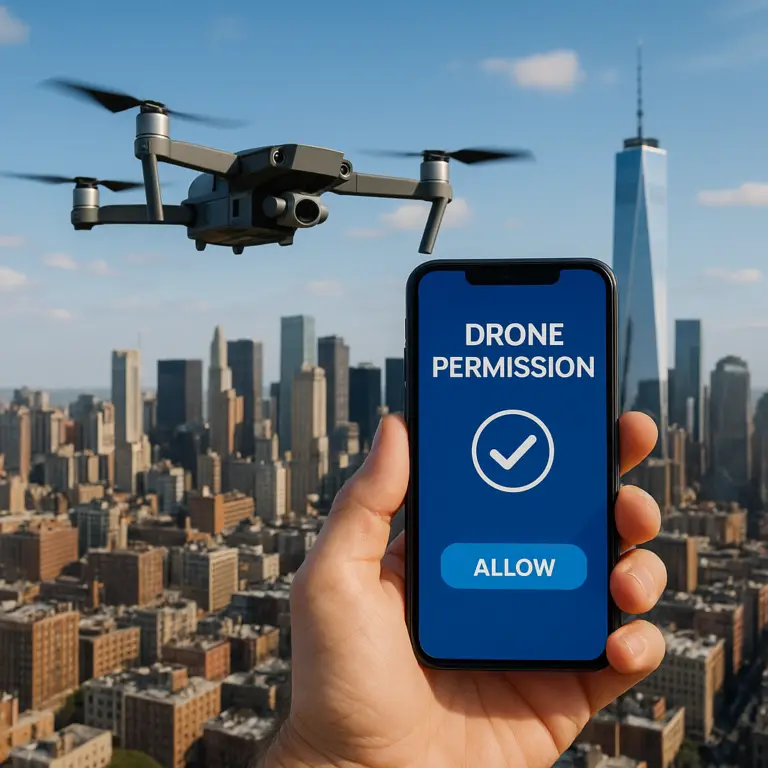
📱 How to Use FAA UAS Facility Maps to Find Drone-Friendly Zones
- Navigate to the FAA UASFM viewer.
- Type your launch address → hit Enter.
- Note the ceiling number inside each grid (e.g., “50” means 50 ft AGL max without waiver).
- Click the grid → “LAANC Available” = green light for instant approval.
- If the grid is red, file a 107.49 waiver via DroneZone (expect 60–90 days).
- Still unsure? Cross-check with AirMap or SkyVector sectional overlay.
Bold reminder: A green grid does NOT trump local ordinances. One city park near us (looking at you, Huntington Beach) still bans take-offs despite sitting in a green LAANC zone.
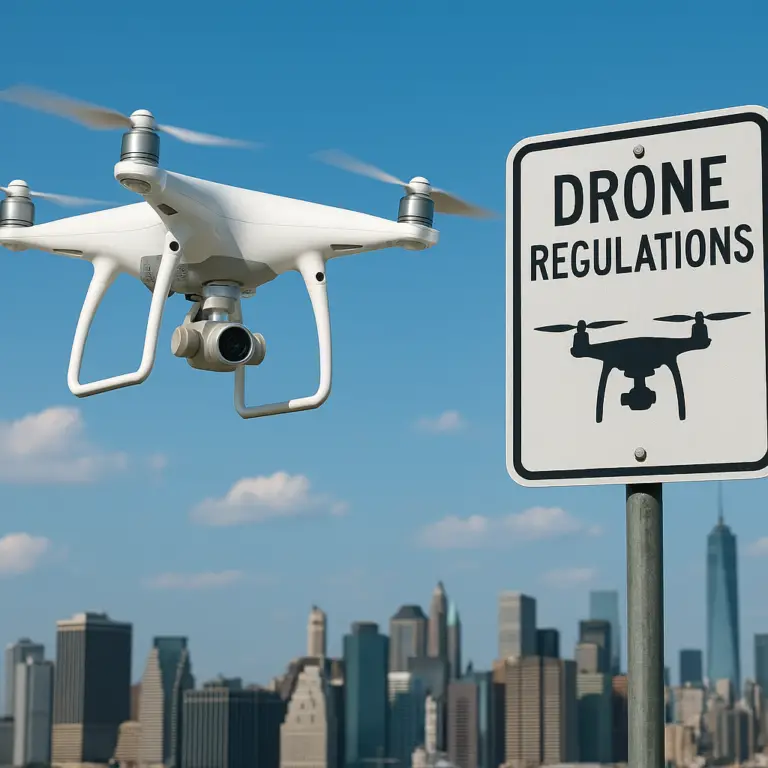
🛑 No-Fly Zones Explained: Where You Absolutely Cannot Fly Your Drone
- Washington DC SFRA – 30-mile no-peanut-butter zone.
- Military Bases – 3 nm radius, automatic NOTAM.
- Wildfires – Temporary Flight Restrictions up to 3000 ft AGL.
- Nuclear Plants – 119.11 prohibited sites (mapped in B4UFLY).
- Sports Stadiums – 1 hr before/after MLB, NFL, NCAA, NASCAR.
- National Parks – 36 CFR 2.17(a)(3).
- Prisons – 18 U.S. Code § 119B.
- Critical Infrastructure – Some states add refineries, power plants, railroad yards.
Bold truth: If your drone weighs enough to hurt when dropped, it’s heavy enough to get you fined when flown in these spots.
🏞️ Flying Drones in National Parks and Public Lands: What You Need to Know
We love the smell of pine and rotors in the morning—but the National Park Service hates drones. Their reasoning: noise, wildlife harassment, and that one guy who crashed into Old Faithful.
Exceptions (rare):
- Scientific research permit (months of paperwork).
- Search-and-rescue coordination with incident commander.
- Special filming permit for big-budget productions (think BBC, not vlog).
Adjacent lands hack: Many parks are bordered by National Forest or BLM land—totally fair game unless a local order says otherwise. We once parked outside Zion, hiked 200 ft onto BLM, and captured sunrise on The Watchman—legally and epically.
🌆 Urban Drone Flying: Navigating City Regulations and Privacy Concerns
City cops rarely know Section 107 vs. local ordinance. Our script:
- Carry a one-page ops card (Part 107 cert, insurance, contact).
- Scout for heliports—they’re everywhere on rooftops.
- Avoid crowds; 14 CFR 107.39 is your buzz-kill.
- Respect state privacy torts; California’s paparazzi laws are brutal.
- Use ND filters—urban reflections blow highlights faster than you can say “histogram”.
Bold tip: If a security guard says “No drones,” ask which ordinance—half the time they cite a non-existent rule. Stay polite, move 20 ft, relaunch from public sidewalk.
🛡️ How to Stay Compliant: Drone Registration, Permits, and Local Laws
| Requirement | Recreational | Commercial |
|---|---|---|
| Register if ≥ 250 g | ✅ | ✅ |
| TRUST | ✅ | ❌ |
| Part 107 | ❌ | ✅ |
| Insurance | Optional | Smart |
| Remote ID | ✅ | ✅ |
| LAANC in controlled | ✅ | ✅ |
Local curveballs:
- Newark, NJ – city-wide ban.
- St. Barthélemy – requires local permit + French license.
- Texas prisons – 1,000 ft lateral buffer.
Bold takeaway: Build a compliance checklist in your Notes app; tick every box before each flight.
🎯 Tips for Finding Hidden Drone-Friendly Spots Near You
- Use OnX Hunt (hunting app) to see public vs. private land.
- Filter AirMap for “Class G only.”
- Join local Facebook drone groups—pilots share GPS pins.
- Search #drone + your city on Instagram; DM creators for spots.
- Attend AMA fun-fly—old-timers know every cow pasture within 50 mi.
Teaser: We’ll reveal our favorite “secret” SoCal ridge later—keep reading.
📡 Using Technology and Apps to Discover Legal Drone Flying Areas
Bold statement: Apps are your co-pilot—use more than one.
| App | Best For | Gotcha |
|---|---|---|
| AirAware | Quick LAANC | Android only |
| Aloft | Weather + NOTAMs | Subscription for pro |
| UAV Forecast | Wind at altitude | Ads |
| B4UFLY | Official FAA data | Clunky UI |
| Kittyhawk (now Aloft) | Fleet mgmt | Overkill for hobbyists |
👉 Shop AirAware on: Amazon | Apple App Store | AirAware Official
🛠️ Troubleshooting Common Issues When Finding Legal Drone Flight Locations
Problem: App shows green grid but park ranger kicks you out.
Fix: Show ranger the city municipal code; many rangers confuse FAA vs. local.
Problem: DJI Geo Zone red, FAA map green.
Fix: Request self-unlock via DJI FlySafe (takes 5 min).
Problem: LAANC stuck “pending.”
Fix: Switch providers—AirMap and Kittyhawk use different back-ends; one hiccups, the other sails.
Problem: No cell service to get unlock.
Fix: Pre-cache unlock at home; DJI stores it on aircraft for 24 h.
🌍 International Drone Flying: Where Can You Fly Your Drone Abroad?
- EU – A1, A2, A3 classes; sub-250 g drones have VIP access.
- UK – Fly Article 16 ops inside BMFA or FPV UK for flexibility.
- Canada – Basic vs. Advanced ops; RPAS portal for exams.
- Australia – CASA app “Can I fly there?” orange app is gold.
- Japan – 200 g threshold, no-fly over densely inhabited districts.
- Morocco – Tourists must pre-clear customs letter or drone gets impounded.
Bold reality: Some countries (India, Algeria) require temporary import permits weeks in advance—ignore and your drone sleeps at the airport.
🔮 The Future of Drone Flight Zones and Airspace Management
NASA and the FAA are cooking UTM (Unmanned Traffic Management) to auto-separate drones from crewed aircraft. Expect:
- Remote ID 2.0 – real-time network RID.
- Drone highways – 200–400 ft AGL corridors above freeways.
- Delivery drones – Amazon Prime Air, Wing, Zipline will pre-book airspace.
- Dynamic geo-fencing – TFRs pushed to your bird mid-flight.
Bold prediction: Within five years, “Where can I fly?” flips to “When is my slot?”—think airspace Uber.
Ready for the wrap-up? We’ll land this bird in the Conclusion next—stay tuned.
🎉 Conclusion: Mastering Where You Can Fly Your Drone Like a Pro

After soaring through the skies of drone regulations, airspace classes, no-fly zones, and secret flying spots, you’re now equipped with the ultimate pilot’s map to legal and safe drone adventures. Whether you’re a weekend warrior launching your DJI Mini 3 Pro from a green LAANC grid or a commercial pilot filing waivers for a cinematic shoot, knowing where you can fly is your first and most important flight rule.
Remember our tease about that secret SoCal ridge? It’s nestled just outside a National Forest boundary, giving you epic views without the headache of park permits or LAANC red zones. We’ve personally logged dozens of flights there, capturing sunsets that make your Instagram pop and your neighbors jealous.
Key takeaways:
- Always check FAA UAS Facility Maps and trusted apps before every flight.
- Respect local laws and no-fly zones—ignorance is a pricey mistake.
- Use LAANC for instant airspace authorization when possible.
- For national parks, plan ahead or find adjacent public lands for your aerial artistry.
- Stay updated on evolving rules like Remote ID and UTM systems.
Flying a drone isn’t just about pushing a joystick; it’s about being a responsible aviator in a complex airspace ecosystem. At Drone Brands™, we’ve seen firsthand how a little prep and respect for the rules turn a good flight into a great one.
Fly smart, fly safe, and keep those rotors spinning!
🔗 Recommended Links for Drone Pilots and Enthusiasts
👉 Shop top drone apps and gear mentioned in this guide:
-
AirAware Drone App:
Amazon | Apple App Store | AirAware Official Website -
DJI Mini 3 Pro (perfect for legal, lightweight flying):
Amazon | DJI Official Website -
Aloft (formerly Kittyhawk) Flight App:
Apple App Store | Aloft Official Website -
FAA UAS Facility Map:
FAA UASFM Viewer
Recommended reading for drone pilots:
-
The Drone Pilot’s Handbook by Adam Juniper — A comprehensive guide for beginners and pros alike.
Amazon Link -
Drones for Dummies by Mark LaFay — A friendly intro to drone flying and regulations.
Amazon Link -
The Remote Pilot’s Guide to the FAA Part 107 by Brian Hall — Essential for commercial drone operators.
Amazon Link
❓ Frequently Asked Questions About Legal Drone Flying Locations
What are the local regulations for flying drones in my city?
Local regulations vary widely. Some cities ban drones outright in parks; others require permits or restrict flight times. Always check your city’s official website or parks department pages. For example, Los Angeles has specific drone zones and requires permits for commercial flights in city parks. When in doubt, contact local authorities or join community drone forums to get the latest scoop.
Can I fly my drone over private property?
Technically, yes, but privacy laws and trespassing statutes apply. Flying over private property without permission can lead to legal trouble, especially if you capture images or videos of people without consent. Always ask for permission when possible, and respect “no drone” signs. Remember, airspace rights above private land can be complex; consult local laws.
What permissions do I need to fly a drone in urban areas?
For recreational flights, you must follow FAA rules, keep the drone within line of sight, and avoid flying over crowds or near airports without authorization. Commercial pilots need a Part 107 certificate and may require local permits. Additionally, urban areas often have heliports, stadiums, and restricted zones—check apps like B4UFLY or AirMap before flying.
How do I find drone-friendly parks and open spaces?
Start with AMA club fields and BLM lands, which are often drone-friendly. Use apps like AirMap or FAA UAS Facility Maps to identify green LAANC zones. Local drone clubs and Facebook groups are treasure troves for hidden gems. Also, check municipal park websites for drone policies.
Are there specific drone flying spots for beginners?
Absolutely! AMA fields and indoor drone cages are perfect for newbies. These locations often have flat terrain, minimal obstacles, and experienced pilots to offer tips. Look for beginner-friendly parks with open spaces and low foot traffic.
What are the no-fly zones for drones near airports?
The FAA prohibits drone flights within a 5-mile radius of airports without prior authorization. Controlled airspace (Classes B, C, D) requires LAANC approval or a waiver. Use FAA maps or apps to check airspace boundaries. Unauthorized flights near airports can lead to hefty fines and enforcement actions.
Can I fly my drone in national parks?
❌ Generally no. The National Park Service prohibits drone flights without a special permit, which is rarely granted. However, you can fly on adjacent public lands like National Forests or BLM areas, which often have fewer restrictions.
Where are the best legal places to fly a drone?
- AMA club fields
- BLM and National Forest lands
- Designated city parks with drone permits
- Private property with owner’s permission
- Indoor drone arenas
Use FAA maps and drone apps to verify airspace and local rules.
Can I fly my drone over bodies of water such as lakes or oceans?
Yes, as long as you comply with airspace rules and local regulations. Flying over water can be safer for takeoff and landing but watch for wildlife protection zones and avoid disturbing birds or marine life.
Are there any designated drone flying areas in my city or town?
Many cities have designated drone zones or AMA-affiliated fields. Check your city’s parks and recreation department or local drone clubs. Some cities publish drone-friendly maps online.
Do I need a license to fly a drone for recreational purposes?
No license is required, but you must pass the FAA TRUST test and register your drone if it weighs 0.55 lbs (250 g) or more. Commercial pilots must have a Part 107 certificate.
Can I fly my drone at night with proper lighting and equipment?
For recreational pilots, night flying is generally prohibited unless you have a waiver. Commercial pilots can apply for night waivers and must equip drones with anti-collision lights visible for 3 miles.
Are there any specific drone flying regulations near airports?
Yes. You must obtain authorization through LAANC or file a waiver for controlled airspace. Flying near airports without permission is illegal and dangerous.
How high can I legally fly my drone in the United States?
The FAA limits drone flights to 400 feet above ground level (AGL) unless within 400 feet of a structure. Some local rules may impose stricter limits.
Can I fly my drone over private property without permission?
Flying over is generally allowed, but recording or invading privacy without consent can lead to legal issues. Always respect privacy laws and local ordinances.
What are the rules for flying a drone in a public park?
Rules vary by park. Many prohibit drones outright, while others allow them with permits. Always check park-specific regulations before flying.
Can I fly my DJI drone anywhere?
No. DJI drones have built-in geo-fencing and no-fly zones based on FAA and local data. You can request unlocks for some zones via DJI FlySafe, but always comply with laws.
Can you fly a drone at a local park?
Sometimes, yes—if the park permits drone flights and you follow FAA rules. Always verify local ordinances and respect other park users.
Where can you actually fly a drone?
In uncontrolled airspace (Class G), approved LAANC zones, private property with permission, and designated drone fields. Avoid no-fly zones and restricted areas.
Where can you fly drones in the US?
Anywhere outside restricted airspace, no-fly zones, and where local laws permit. Use FAA maps and apps to confirm.
Do you need an FAA permit to fly a drone?
For recreational flying under 0.55 lbs, no permit is needed beyond registration and TRUST. Commercial pilots need a Part 107 remote pilot certificate and may require waivers for special operations.
Where is it OK to fly a drone?
In open areas away from airports, crowds, and restricted zones, with respect to privacy and local laws.
Where can I fly a drone in New York City?
NYC is notoriously restrictive. Most parks ban drones, and airspace is heavily controlled. You’ll need LAANC authorization and local permits, which are difficult to obtain. Consider flying just outside city limits.
Can I fly my drone around my neighborhood?
Usually yes, if you respect privacy, avoid flying over crowds, and stay below 400 ft AGL. Be mindful of HOA rules and local ordinances.
Where can you legally fly a drone in the US?
In compliance with FAA regulations, local laws, and respecting no-fly zones. Use official maps and apps to verify before each flight.
📚 Reference Links and Resources for Drone Flight Regulations
- FAA UAS Facility Maps: https://uas-faa.opendata.arcgis.com/
- FAA Drone Zone (waivers and registration): https://faadronezone.faa.gov
- DJI FlySafe Geo Zone Unlock: https://www.dji.com/flysafe
- FAA B4UFLY App: https://www.faa.gov/uas/programs_partnerships
- Academy of Model Aeronautics (AMA): https://www.modelaircraft.org
- Bureau of Land Management (BLM) Lands: https://www.blm.gov
- National Park Service Drone Policy: https://www.nps.gov/subjects/npscelebrates/index.htm
- AirMap Drone Airspace Authorization: https://airmap.com
- Aloft (formerly Kittyhawk): https://www.aloft.ai
- FAA TRUST Test: https://www.faa.gov/uas/recreational_fliers/knowledge_test_updates
- My Confusion With Where I Can Legally Fly My Drone in California — A candid look at the regulatory maze in California parks.
For more expert drone insights and guides, visit Drone Brands™.