Support our educational content for free when you purchase through links on our site. Learn more
🚫 Can I Fly My Drone in National Parks? (2026 Rules)
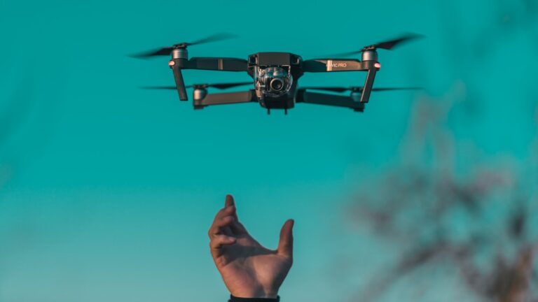
Imagine standing on the edge of the Grand Canyon, the silence so profound you can hear your own heartbeat, only to have it shattered by the buzzing whine of a drone. That’s exactly what happens when the “no-fly” rule is ignored, and it’s why the National Park Service has drawn a hard line in the sand. While you might be tempted to capture that perfect aerial shot of a bison or a geothermal spring, the answer to “Can I fly my drone in national parks?” is a resounding no for 9% of pilots. In this guide, we’ll uncover the strict federal regulations, the rare exceptions for researchers, and the surprising “lophole” in nearby National Forests that might just save your aerial adventure. Plus, we’ll reveal the shocking penalties—including jail time—that one reckless pilot faced in Yellowstone, and show you exactly how to find legal flying spots without breaking the law.
Key Takeaways
- The Golden Rule: Launching, landing, or operating a drone on National Park Service (NPS) lands is strictly prohibited for the general public under 36 C.F.R. § 1.5.
- Severe Consequences: Violators face misdemeanor charges, fines up to $5,0, potential 6-month jail sentences, and drone confiscation.
- The “Lophole”: While National Parks are off-limits, you can often fly in adjacent National Forests and BLM lands, provided you avoid designated Wilderness Areas.
- Rare Exceptions: The only legal flights are for NPS staff or researchers with a difficult-to-obtain Special Use Permit.
- Safe Alternatives: Use high-altitude hiking, telephoto lenses, or fly from private land outside park boundaries to capture stunning shots legally.
Table of Contents
- ⚡️ Quick Tips and Facts
- 📜 The Evolution of Drone Regulations in Protected Lands
- 🚫 The General Rule: Why Drones Are Mostly Banned
- 🏞️ Exceptions: When You Can Fly a Drone in a National Park
- 📝 How to Obtain a Special Use Permit
- 🌲 Flying in National Forests and BLM Land: The Lophole
- 🏕️ Drone Rules for National Monuments and Historic Sites
- 🦌 Impact on Wildlife and Visitor Experience
- 📱 Best Apps and Resources for Checking Airspace
- 🎥 Alternative Ways to Get Aerial Shots Without a Drone
- 🤔 Frequently Asked Questions
- 📚 Reference Links
- 🏁 Conclusion
- 🔗 Recommended Links
Before you unpack your DJI Mavic or fire up your Autel Evo, let’s hit the brakes with some hard-hitting truths. We’ve seen too many pilots lose their gear (and their freedom) because they assumed “nature” meant “open sky.” Here is the 30-second crash course:
- The Golden Rule: Launching, landing, or operating a drone on National Park Service (NPS) lands is strictly prohibited for the general public. This isn’t a suggestion; it’s a federal regulation under 36 C.F.R. § 1.5.
- The “Overflight” Myth: Just because the FAA controls the airspace doesn’t mean the NPS controls the ground. You cannot launch inside the park, even if you plan to fly over it. However, you can legally fly over a park if you launch from private land outside the boundary, provided you follow FAA altitude rules and don’t disturb wildlife. But be warned: The risk of accidental boundary crossing is high, and rangers are watching.
- The Stakes: Violating this ban is a misdemeanor. We’re talking up to 6 months in jail and fines up to $5,0 per violation. Plus, your drone can be confiscated.
- The Exception: The only time you’ll see a drone in a National Park is if it’s owned by the NPS for search and rescue, fire management, or scientific research.
- The Lophole (Sort of): If you head to National Forests or Bureau of Land Management (BLM) lands, the rules are different. Generally, you can fly there, unless you are in a designated Wilderness Area.
For a deeper dive into where you can legally launch your rig, check out our comprehensive guide on where can i fly my drone.
You might wonder, “Why is it so strict? I just want to get a cool shot of a bison.” To understand the “why,” we have to look at the history. It wasn’t always this way.
The 2014 Turning Point
Before 2014, drone regulations were a gray area. Pilots would launch in parks, get away with it, and post the footage. But the NPS realized that “gray” was turning into “chaos.”
In 2014, the National Park Service issued Policy Memorandum 14-05. This was the game-changer. It explicitly stated that the NPS could prohibit the launch, landing, and operation of uncrewed aircraft systems (UAS) on lands they administer. The primary drivers were:
- Visitor Safety: Drones crashing into crowds or distracting drivers.
- Wildlife Disturbance: Birds abandoning nests, bighorn sheep fleeing cliffs.
- Preservation of the Soundscape: The natural quiet is a resource itself.
The “Grand Prismatic” Incident
One of the most famous incidents that cemented this ban happened in Yellowstone National Park. In 2014, a recreational drone crashed into the Grand Prismatic Spring, a fragile geothermal feature. The pilot had to be rescued, and the drone was lost. This event, along with others like drones buzzing Mount Rushmore and getting lost in the Grand Canyon, forced the NPS to draw a hard line in the sand.
Recent Legislative Twists: The FILM Act
Fast forward to January 2025. You might have heard rumors about the FILM Act. Does this mean drones are back? Not quite.
The FILM Act (Filming, Imaging, and Location Management Act) was designed to streamline permits for ground-based filming crews (think movie productions with tripods and actors). It allows small groups (fewer than six people) to film without a complex permit process. Crucially, it does NOT lift the drone ban. If you are holding a drone, the 2014 ban still applies.
Expert Insight: “We’ve seen pilots try to use the FILM Act as a loophole, thinking ‘filming’ includes aerial shots. It doesn’t. The NPS is very clear: if it has rotors, it needs a Special Use Permit, which is nearly impossible for a tourist to get.” — Senior Pilot, Drone Brands™
Let’s be blunt: You cannot fly your drone in a National Park. Period.
This isn’t just about “rules.” It’s about the fundamental mission of the NPS. Unlike other federal lands, National Parks are designated for preservation. The goal is to leave them exactly as they are for future generations. Drones, by their very nature, introduce noise, visual distraction, and potential danger.
The Three Pillars of the Ban
1. Wildlife Impact
Drones are predators in the eyes of wildlife. A study published in the International Journal of Environmental Research and Public Health found that drone noise is “substantially more annoying than road traffic or aircraft noise.”
- Case Study: In Zion National Park, a drone was spotted harassing a herd of bighorn sheep, causing them to flee up dangerous cliffs.
- Case Study: At Bolsa Chica Ecological Reserve, a drone caused birds to abandon 1,50 eggs.
- The Science: Birds and mammals perceive drones as aerial predators. This causes stress, alters feeding patterns, and can lead to nest abandonment.
2. Visitor Experience
Imagine you’re hiking to a secluded waterfall, seeking solitude. Suddenly, a buzzing drone appears, hovering 20 feet above you. The magic is broken. The NPS protects the “natural soundscape” as a resource.
- Noise Pollution: The high-frequency whine of drone motors cuts through the natural silence.
- Safety Hazards: Drones have crashed into geysers, fallen off canyon edges, and even intercepted manned aircraft (like the incident where a drone forced an NPS helicopter to land).
3. Resource Protection
Drones are heavy, and they crash. We’ve seen drones land on sacred rocks, crash into thermal features, and get lost in deep canyons.
- The Cost: If a drone crashes, the NPS often has to send a ranger team to retrieve it. This diverts resources from search and rescue or fire suppression.
- The Damage: A drone landing in a fragile ecosystem can trample vegetation or contaminate water sources.
The Legal Consequences
If you get caught, it’s not just a slap on the wrist.
- Misdemeanor Charge: You can be charged under 36 C.F.R. § 2.34 (Disorderly Conduct) or 36 C.F.R. § 2.12(a)(3) (Motorized Equipment).
- Penalties: Up to 6 months in jail and a $5,0 fine.
- Confiscation: Rangers have the authority to seize your drone and memory cards as evidence.
- Restitution: You may be billed for the cost of retrieving your drone. One pilot paid $3,20 ($1,0 fine + $2,20 restitution) for a drone crash in Yellowstone.
So, is there any way? Yes, but it’s not for the casual tourist. The exceptions are narrow, rigorous, and designed for specific needs.
Special Use Permits (SUPs)
The only legal way for a non-NPS entity to fly in a National Park is to obtain a Special Use Permit.
- Who gets them? Primarily researchers, scientists, and documentary filmmakers with a compelling educational or scientific purpose.
- The Process:
- Contact the Park Superintendent: You must write a detailed proposal explaining why the drone is necessary and how you will minimize impact.
- FA Waivers: You often need a Part 107 waiver from the FAA (e.g., for Beyond Visual Line of Sight or flying over people) before the NPS will even consider your application.
- Review Period: This can take months.
- Approval: Even then, approval is rare. Most applications are denied because the NPS can achieve the same goal with ground-based photography or existing data.
NPS Internal Use
You will see drones in parks, but they belong to the National Park Service.
- Search and Rescue: The Grand Canyon National Park uses a fleet of drones to locate lost hikers in the canyon’s depths.
- Fire Management: Drones are used to map fire lines and monitor smoke.
- Scientific Research: The Marsh-Billings-Rockefeller National Historic Site used a drone to create a large illustrated map for a visitor kiosk.
- Wildlife Monitoring: Some parks use drones to count bison herds without disturbing them.
Pro Tip: If you are a researcher, start your application at least 6 months before your planned flight. The bureaucracy is real, and the bar is high.
If you are a scientist, a university researcher, or a professional filmmaker with a budget and a mission, here is the step-by-step roadmap. Note: This is not a “quick start” guide; it’s a marathon.
Step 1: Define Your Necessity
You must prove that a drone is the only way to achieve your goal.
- Bad Proposal: “I want to get cool aerial shots for my YouTube channel.”
- Good Proposal: “We need to map the erosion rates of the cliff face to predict landslide risks, which is impossible with ground-based LiDAR due to the terrain.”
Step 2: Contact the Park Superintendent
Every park has a Superintendent. Find their contact info on the specific park’s website.
- Action: Send a formal letter of inquiry.
- Content: Include your project scope, timeline, equipment list, and safety plan.
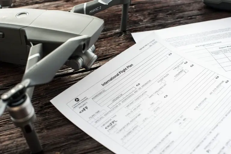
Step 3: Secure FAA Authorization
The NPS will not approve a permit if you don’t have FAA clearance.
- Part 107: You must be a certified remote pilot.
- Waivers: If you need to fly over people, at night, or beyond visual line of sight (BVLOS), you must apply for a waiver via the FAA’s DroneZone.
Step 4: Submit the Full Application
Once you have the FAA waiver (or a plan to get one), submit the full Special Use Permit application to the park.
- Fees: There is often an application fee, and you may be required to pay for the park’s administrative review time.
- Insurance: You will likely need to provide proof of liability insurance.
Step 5: The Review and Approval
The park will review your application with their aviation manager, wildlife biologists, and law enforcement.
- Timeline: Expect 3 to 6 months.
- Conditions: If approved, you will be given strict conditions (e.g., “No flights within 50 feet of wildlife,” “No flights between 8 AM and 4 PM”).
Step 6: Compliance and Reporting
After the flight, you must submit a report detailing how you adhered to the permit conditions. Failure to comply can result in a permanent ban from the park system.
Here is the good news for drone enthusiasts: National Parks are not the only game in town. If you want to fly legally in the great outdoors, you need to head to National Forests or Bureau of Land Management (BLM) lands.
The Philosophy Difference
- NPS (National Parks): “Preservation.” The goal is to keep things exactly as they are.
- USFS (National Forests) & BLM: “Multiple Use.” These lands are managed for recreation, timber, grazing, mining, and conservation. This means there is more room for human activity, including drones.
The Rules for National Forests (USFS)
Generally, you can fly your drone in a National Forest, but with major caveats:
- No Wilderness Areas: This is the big one. Under the Wilderness Act of 1964, motorized equipment (including drones) is prohibited in designated Wilderness Areas.
How to check: Use the Wilderness Connect app or map to see if your target area is a Wilderness Area.
The “20 Feet” Rule: The USFS requests that you maintain a minimum altitude of 20 feet above Wilderness Areas. Since recreational drones are limited to 40 feet AGL, this effectively creates a “no-fly zone” buffer that makes flying over a Wilderness Area risky and often illegal if you dip below 20 feet. - Wildlife Distances: The USFS recommends launching at least 10 meters (328 feet) away from wildlife.
- Fire Restrictions: During fire season, temporary flight restrictions (TFRs) are common. Never fly near wildfires.
- Commercial Use: If you are filming for money, you need a Special Use Authorization from the Forest Service.
The Rules for BLM Land
The Bureau of Land Management manages over 245 million acres.
- General Rule: Drones are generally allowed.
- Exceptions: Like the Forest Service, BLM lands with designated Wilderness Areas are off-limits.
- Local Rules: Some specific BLM units may have local restrictions. Always check the local field office website.
Comparison: Where Can You Fly?
| Feature | National Parks (NPS) | National Forests (USFS) | BLM Land |
|---|---|---|---|
| General Stance | Strictly Prohibited | Generally Permitted | Generally Permitted |
| Wilderness Areas | N/A (All parks protected) | Prohibited | Prohibited |
| Commercial Use | Extremely Rare (SUP only) | Requires Special Use Auth | Requires Special Use Auth |
| Wildlife Buffer | N/A (No flying allowed) | 10 meters (328 ft) recommended | 10 meters (328 ft) recommended |
| Primary Goal | Preservation | Multiple Use | Multiple Use |
Expert Tip: Use the Air Control (formerly Aloft) app or the B4UFLY app to check for TFRs and Wilderness boundaries before you fly in forests.
Not all “National” sites are created equal. The rules can get tricky with National Monuments, Historic Sites, and Memorials.
National Monuments
Many National Monuments are managed by the NPS, meaning the drone ban applies.
- Example: Devils Tower National Monument (famous for Close Encounters of the Third Kind) has a strict no-drone policy.
- Example: Canyon de Chelly National Monument is moving towards stricter bans on air tours, including drones, to protect cultural significance.
Historic Sites and Memorials
- Mount Rushmore: Strictly prohibited. The ban is enforced aggressively due to security concerns.
- Washington Monument / Mall: This is Prohibited Airspace (P-56). Flying here is a federal crime that can lead to immediate arrest and FAA certificate suspension.
- Getysburg National Military Park: No drones allowed. The noise disrupts the solemn atmosphere of the battlefield.
The “Managed by Others” Exception
Some monuments are managed by the USFS or BLM.
- Example: Chaco Culture National Historical Park is managed by the NPS (No drones).
- Example: Gila Cliff Dwellings National Monument is NPS (No drones).
- Check the Manager: Always verify who manages the site. If it’s NPS, assume No. If it’s USFS or BLM, check for Wilderness designations.
Why does the NPS care so much? It’s not just bureaucracy; it’s about the ecological and psychological impact.
The Wildlife Stress Factor
Drones are not just “noisy.” They are perceived as predators.
- Behavioral Changes: Studies show that birds and mammals alter their behavior when drones are present. They may stop feeding, abandon nests, or flee to dangerous terrain.
- Physiological Stress: The stress hormone (cortisol) levels in animals rise significantly when drones are nearby.
- Real-World Example: In Bolsa Chica, a drone caused a mass abandonment of 1,50 eggs. In Zion, bighorn sheep were forced to flee up cliffs, risking injury.
The Visitor Experience
The “soundscape” of a National Park is a resource.
- Noise Pollution: A 2021 study found that drone noise is more annoying than road traffic or aircraft noise due to its high-frequency broadband characteristics.
- Loss of Solitude: Hikers come to parks to escape the noise of civilization. A buzzing drone ruins that experience.
- Safety: Drones can distract drivers on park roads or interfere with emergency operations.
The “Ripple Effect”
One bad apple spoils the bunch. When one pilot gets caught, the NPS often tightens restrictions for everyone. We’ve seen parks close trails or increase patrols because of a single reckless drone operator.
Don’t guess. Use technology to ensure you are flying legally. Here are the tools we use at Drone Brands™:
1. FAA B4UFLY
- What it does: The official FAA app for recreational flyers. It shows you where you can and cannot fly based on airspace classes and TFRs.
- Best for: Checking if you are near an airport or in a restricted zone.
- Link: FA B4UFLY
2. Air Control (formerly Aloft)
- What it does: Provides detailed airspace maps, including Wilderness Areas and National Forest boundaries. It also helps with LANC (Low Altitude Authorization and Notification Capability) for Part 107 pilots.
- Best for: Visualizing Wilderness Area boundaries in National Forests.
- Link: Air Control App
3. Wilderness Connect
- What it does: A map specifically designed to show Wilderness Areas across the US.
- Best for: Ensuring you aren’t flying in a motorized-prohibited zone in a National Forest.
- Link: Wilderness Connect
4. NPS Website
- What it does: The official source for park-specific rules.
- Best for: Checking if a specific park has a unique drone policy.
- Link: National Park Service
So, you can’t fly in the park. Does that mean you can’t get the shot? Absolutely not. Here are some creative alternatives:
1. High-Altitude Hiking
Sometimes the best view is from the top of a ridge. Hike to a high vantage point and use a telephoto lens to compress the landscape.
- Gear: A good telephoto lens (e.g., Sony 20-60mm or Canon 10-50mm) can capture stunning details from the ground.
2. Ground-Based Time-Lapses
Set up a camera on a tripod and capture the movement of clouds, shadows, and wildlife over time. This creates a dynamic, cinematic feel without the drone.
- Gear: DJI Osmo Pocket 3 or GoPro Hero 12 for stabilization.
3. Use Existing Footage
Many parks have official footage available for educational use. Check the NPS Media Library.
- Tip: If you are a filmmaker, you can license footage from the NPS or use stock footage sites like Shutterstock or Getty Images.
4. Fly from Outside the Boundary
If you are near a park boundary, you can legally fly from private land outside the park, as long as you don’t cross the boundary line.
- Warning: This is risky. GPS drift can push you into the park. Always use a geo-fencing feature and keep a close eye on your map.
5. Use a Drone with a “No-Fly” Zone Override (Not Recommended)
Some advanced drones allow you to override geo-fencing, but this is illegal in National Parks. We do not recommend this. The risk of fines and jail is not worth the shot.
Q: Can I fly my drone over a National Park if I launch from outside the boundary?
A: Technically, yes, if you stay within FAA airspace rules and do not cross the park boundary. However, the risk of accidental entry is high, and rangers may still question you. It is generally safer to avoid flying over parks entirely.
Q: What happens if I get caught flying in a National Park?
A: You can be charged with a misdemeanor, fined up to $5,0, sentenced to 6 months in jail, and have your drone confiscated. You may also be billed for the cost of retrieving your drone.
Q: Are there any National Parks where I can fly?
A: No. The ban applies to all National Park Service lands. The only exceptions are for NPS staff or researchers with a Special Use Permit.
Q: Can I fly in National Forests?
A: Generally, yes, unless you are in a designated Wilderness Area. Always check the specific forest’s rules and use the Wilderness Connect app.
Q: Does the FILM Act allow me to fly a drone in a National Park?
A: No. The FILM Act only eases restrictions for ground-based filming. The drone ban remains in full effect.
Q: Can I fly my drone at night in a National Forest?
A: If you are a recreational flyer, you must have anti-collision lighting and stay within visual line of sight. If you are a commercial pilot (Part 107), you need a waiver for night operations. Always check for local fire restrictions.
Q: What if I’m doing scientific research?
A: You must apply for a Special Use Permit well in advance. The process is rigorous and requires proof of necessity and minimal impact.
Q: Can I fly my drone in a State Park?
A: Rules vary by state. Some state parks allow drones, others ban them. Always check the specific state park’s website.
Q: How do I know if an area is a Wilderness Area?
A: Use the Wilderness Connect app or map. Wilderness Areas are designated by Congress and prohibit motorized equipment, including drones.
Q: Is it safe to fly near wildlife?
A: No. Drones cause stress and behavioral changes in wildlife. Always maintain a safe distance (at least 10 meters/328 feet) and avoid flying directly over animals.
- National Park Service: Uncrewed Aircraft in the National Parks
- FA: Recreational Flyers
- U.S. Forest Service: Drone Use
- Wilderness Connect: Map of Wilderness Areas
- Drone Brands™: Where Can I Fly My Drone
- Drone Brands™: Drone Business Opportunities
- Drone Brands™: Drone Brand Guides
- Drone Brands™: Beginner Drones
- Drone Brands™: Commercial Drones
- Drone Brands™: Drone Apps
So, there you have it. The answer to “Can I fly my drone in national parks?” is a resounding NO for the vast majority of us. The National Park Service has drawn a hard line to protect the very things we love: the wildlife, the silence, and the safety of our fellow visitors.
But don’t let that stop you from capturing the beauty of the outdoors. Whether you’re hiking to a high vantage point, using a telephoto lens, or exploring the vast expanses of National Forests and BLM lands (where the rules are more flexible), there are plenty of ways to get that perfect shot.
Remember, the goal is to preserve these places for future generations. If we all follow the rules, we can keep the skies clear and the parks wild. So, pack your gear, check your apps, and fly responsibly.
Ready to take your drone skills to the next level? Check out our guides on Beginer Drones or Commercial Drones to find the perfect rig for your next adventure.
- 👉 Shop DJI Drones on: Amazon | B&H Photo | DJI Official
- 👉 Shop Autel Drones on: Amazon | Autel Official
- 👉 Shop Skydio Drones on: Amazon | Skydio Official
- Check Price on: Drone Accessories | Drone Batteries
- Learn More: Drone Business Opportunities | Drone Apps
We started this journey with a simple question that haunts every drone pilot staring at a breathtaking vista: “Can I fly my drone in national parks?”
The answer, as we’ve dissected through regulations, wildlife studies, and hard-earned pilot stories, is a definitive NO for recreational and most commercial purposes within National Park Service (NPS) boundaries. The 2014 ban wasn’t created to stifle creativity; it was forged to protect the fragile ecosystems, the silence of the wilderness, and the safety of the millions of visitors who come to disconnect from the digital world.
The Verdict: Why the Ban is Non-Negotiable
While it feels restrictive to leave your DJI Mavic 3 or Autel Evo in the bag, the consequences of ignoring the rules are severe. We’ve seen pilots face misdemeanor charges, $5,0 fines, six months in jail, and the permanent loss of their equipment. Beyond the legal risks, the ecological cost is real. Drones are perceived as predators by wildlife, causing stress, nest abandonment, and behavioral changes that can ripple through an ecosystem.
The Silver Lining: Where You Can Fly
Does this mean your aerial adventures are over? Absolutely not.
- National Forests & BLM Lands: These “multiple-use” lands generally welcome drones, provided you avoid designated Wilderness Areas and respect wildlife buffers.
- The “Outside” Shot: You can legally fly from private land outside the park boundary, provided you stay within FAA airspace limits and never cross the invisible line into the park.
- Creative Alternatives: Sometimes the best shots come from the ground. Hike to a ridge, use a telephoto lens, or set up a time-lapse. The perspective might be different, but the memory is just as vivid.
Final Recommendation
If you are a recreational flyer: Leave the drone at home when visiting a National Park. Embrace the solitude. If you are a professional researcher or filmmaker: Start the Special Use Permit process at least six months in advance, but be prepared for a rigorous review.
The sky is vast, and there are plenty of places to explore legally. Don’t let a momentary thrill cost your freedom or damage the very places we all love. Fly smart, fly legal, and keep the wild.
Ready to upgrade your gear or find the perfect legal flying spot? Here are our top picks for drones, accessories, and educational resources.
Top Drone Brands & Models
- DJI Mini 4 Pro: Amazon | B&H Photo | DJI Official
- Autel EVO Nano+: Amazon | Autel Official
- Skydio 2+: Amazon | Skydio Official
- DJI Air 3: Amazon | B&H Photo | DJI Official
Essential Accessories & Safety Gear
- Drone Carying Cases: Amazon | B&H Photo
- Extra Batteries: Amazon | B&H Photo
- ND Filters for Cinematic Shots: Amazon | PolarPro Official
Educational Resources & Books
- “The Drone Pilot’s Handbook” by Chris Anderson: Amazon
- “Drone Law for Pilots” by Mark R. Berman: Amazon
- FA Part 107 Study Guide: FA Website
Explore More on Drone Brands™
- Drone Business Opportunities
- Drone Brand Guides
- Beginer Drones
- Commercial Drones
- Drone Apps
- Where Can I Fly My Drone?
Can I use my drone for commercial photography inside a National Park?
No. The National Park Service (NPS) strictly prohibits the launch, landing, or operation of drones for any purpose, including commercial photography, within park boundaries. The only exception is if you obtain a Special Use Permit (SUP), which is granted almost exclusively for scientific research, search and rescue, or specific administrative needs, and is notoriously difficult for commercial filmmakers to secure. The FILM Act of 2025 eased restrictions for ground-based filming crews but explicitly did not lift the ban on aerial operations.
How do I find drone-friendly locations near National Parks?
To find legal flying spots near National Parks, look for adjacent lands managed by the U.S. Forest Service (USFS) or the Bureau of Land Management (BLM). These agencies generally allow recreational drone use, provided you avoid designated Wilderness Areas and adhere to local fire restrictions. Use tools like the Wilderness Connect app to identify Wilderness boundaries and the B4UFLY or Air Control apps to check for Temporary Flight Restrictions (TFRs) and airspace classes. Always verify local rules with the specific ranger district office before launching.
Are there any National Parks where drone flights are allowed?
No. There are currently no National Parks managed by the NPS where recreational drone flights are permitted. The ban applies universally to all 40+ units of the National Park System. While you may see drones in parks, they are operated exclusively by NPS staff for official duties like fire management, search and rescue, or scientific research.
What are the penalties for flying a drone illegally in a National Park?
Violating the drone ban is a federal misdemeanor. Penalties can include:
- Fines: Up to $5,0 per violation.
- Jail Time: Up to six months imprisonment.
- Confiscation: Law enforcement can seize your drone, memory cards, and other equipment.
- Restitution: You may be billed for the cost of retrieving your drone (e.g., if it crashes in a remote area).
- Permanent Ban: You may be banned from entering the park system in the future.
Can I fly my drone above the visitor center in a National Park?
No. Flying over a visitor center is strictly prohibited. Visitor centers are often located in developed areas with high foot traffic, making them high-risk zones for safety violations. Additionally, many visitor centers are located within the park boundary, triggering the blanket ban. Furthermore, some visitor centers may be located near airports or other restricted airspace, adding FAA violations to your list offenses.
Do I need a special permit to fly a drone in US National Parks?
Yes, but it’s nearly impossible for the average person. To fly legally in a National Park, you must obtain a Special Use Permit (SUP) from the park superintendent. This process requires a detailed proposal demonstrating the necessity of the drone, a safety plan, and often prior FAA waivers. These permits are rarely granted for recreational or standard commercial filming; they are reserved for scientific research, emergency response, or specific administrative tasks.
What are the specific drone flight restrictions in Yellowstone National Park?
Yellowstone National Park enforces a total ban on drone operations. This includes launching, landing, and flying within the park boundaries. The ban is strictly enforced due to the park’s unique geothermal features (where drones have crashed into geysers), the presence of large wildlife like bison and wolves, and the high volume of visitors. Violators have been fined and had their drones confiscated.
What are the specific drone flight restrictions in US National Parks?
The restriction is simple and absolute: No drones allowed. Under 36 C.F.R. § 1.5 and Policy Memorandum 14-05, the NPS prohibits the launch, landing, and operation of uncrewed aircraft systems on all lands and waters administered by the Service. This applies to all 40+ park units, regardless of size or location. There are no “designated flying zones” within National Parks.
Can I get a special permit to fly a drone in a National Park?
Technically yes, but practically no for most. You can apply for a Special Use Permit, but the NPS evaluates these on a case-by-case basis with a very high bar for approval. You must prove that a drone is the only way to achieve your goal and that it will not disturb wildlife or visitors. Most applications from recreational pilots or commercial filmmakers are denied. If you are a researcher, start the process at least 6 months in advance.
Are there any National Parks where drone flying is allowed?
No. As of 2025, there are zero National Parks that allow recreational drone flying. The ban is a system-wide policy. Any reports of “drone-friendly” National Parks are likely referring to adjacent National Forests or BLM lands, or are simply misinformation.
What are the penalties for flying a drone in a National Park without permission?
The penalties are severe and can include:
- Criminal Charges: Misdemeanor conviction.
- Financial Penalties: Fines up to $5,0.
- Incarceration: Up to 6 months in federal prison.
- Equipment Loss: Confiscation of the drone and storage media.
- Restitution: Payment for recovery costs if the drone is lost or crashed.
- Future Bans: Permanent exclusion from the National Park System.
How do I find out if a specific National Park allows drone flights?
You can find the answer by visiting the specific park’s official website on NPS.gov. Look for the “Park Rules” or “Prohibited Activities” section. If the park does not explicitly mention drones, assume the general NPS ban applies. You can also contact the park’s Superintendent or Law Enforcement office directly to confirm, but the answer will almost certainly be “No.”
Does the National Park Service ban all recreational drone use?
Yes. The NPS ban covers all recreational drone use. It does not matter if you are a hobbyist, a photographer, or a student. The regulation applies to the launch, landing, and operation of the aircraft. The only exception is for NPS staff performing official duties.
Can I fly my drone in National Forests or BLM land near National Parks?
Generally, yes. National Forests (USFS) and BLM lands operate under a “multiple-use” mandate, which typically allows recreational drone use. However, there are critical exceptions:
- Wilderness Areas: Drones are prohibited in designated Wilderness Areas within these lands.
- Fire Restrictions: Temporary bans may be in place during fire season.
- Wildlife Disturbance: You must maintain a safe distance from wildlife (recommended 10 meters/328 feet).
- Local Rules: Always check with the local ranger district or field office for specific restrictions.
- National Park Service: Uncrewed Aircraft in the National Parks
- Pilot Institute: Flying Drones in National Parks and Forests: Rules You Need to Know
- The DroneU: Flying Your Drone in National Parks and National Forests
- FA: Recreational Flyers & Community Based Organizations
- U.S. Forest Service: Recreation & Public Use
- Wilderness Connect: Map of Wilderness Areas
- DJI: Official Website
- Autel Robotics: Official Website
- Skydio: Official Website
- B4UFLY App: FA B4UFLY