Support our educational content for free when you purchase through links on our site. Learn more
📊 How Drone Stats Shape Laws: The 10-Point Data Blueprint (2026)
Ever wonder why your drone has a 400-foot ceiling or why that tiny 249g model gets a free pass on registration? It’s not magic; it’s math. At Drone Brands™, we’ve spent years analyzing the collision data, accident reports, and public sentiment surveys that silently rewrite the rulebook every single year. From the “Granny Test” that dictates privacy laws to the crash statistics that birthed Remote ID, the numbers you never see are the ones pulling the strings of aviation policy. In this deep dive, we’ll reveal the 10-point data blueprint regulators use to balance innovation with safety, and explain why your next firmware update might just be the result of a crash report from three states away.
Key Takeaways
- Data Drives Policy: Every major regulation, from weight limits to altitude caps, is a direct response to empirical safety statistics and accident trends.
- The 249g Threshold: The global “magic number” for lighter rules exists because data shows sub-250g drones pose significantly lower kinetic energy risks.
- Public Perception Matters: Regulations are increasingly shaped by societal acceptability data, distinguishing between beneficial medical deliveries and intrusive surveillance.
- Remote ID is Mandatory: The surge in “unidentified aerial sightings” forced the creation of digital license plate laws to ensure accountability and safety.
- Future-Proof Your Flight: Understanding these statistical drivers helps you anticipate regulatory shifts and stay compliant in an evolving airspace.
Table of Contents
- ⚡️ Quick Tips and Facts
- 📜 From Sky High Dreams to Rule Books: A History of Drone Data
- 📊 The Numbers Game: How Drone Statistics Shape Modern Aviation Policy
- 🚨 Crash Course: Analyzing Accident Rates and Safety Incidents
- 👁️ Privacy Paradox: What User Behavior Data Tells Regulators About Surveillance
- 🏭 Commercial Boom vs. Hobbyist Hurdles: Market Growth Statistics
- 🌍 Global Perspectives: Comparing FAA, EASA, and International Regulatory Frameworks
- 🤖 Beyond Human Error: How AI and Automation Statistics Influence Future Laws
- 🛡️ The 10-Point Blueprint: How Data-Driven Insights Create Safer Skies
- 💡 Quick Tips and Facts
- 🔮 The Future of Flight: Predicting Regulatory Shifts Based on Current Trends
- 🏁 Conclusion
- 🔗 Recommended Links
- ❓ FAQ
- 📚 Reference Links
⚡️ Quick Tips and Facts
Before we dive into the data-driven clouds, here’s a rapid-fire look at how the numbers are currently steering the ship:
- Weight Matters: Drones under 249 grams (like the DJI Mini 4 Pro) often bypass the strictest registration rules, a direct result of safety statistics showing lower risk profiles for lightweight aircraft.
- The 400ft Ceiling: This isn’t a random number; it’s based on aviation safety data designed to keep a “buffer zone” between drones and manned aircraft.
- Remote ID is Real: Statistics on “unidentified aerial sightings” pushed the FAA to mandate Remote ID technology, turning your drone into a digital license plate.
- Commercial Boom: Over 3.5 million drones are expected to be in the US skies by 2025, forcing regulators to move from “blanket bans” to “integrated systems.”
- The Granny Test: Public perception data shows that people are 70% more likely to accept drones for medical deliveries than for hobbyist photography.
📜 From Sky High Dreams to Rule Books: A History of Drone Data
In the early days, we flew in what felt like the “Wild West.” There were no Drone Brand Guides to help us navigate the legal fog. Back then, the FAA treated every drone like a potential 747. But as the number of hobbyist pilots exploded, the need for contextual understanding became undeniable.
The legal history of drones isn’t just about technology; it’s about property rights. Remember the landmark case United States v. Causby? It established that while the air is a “public highway,” flights so low they interfere with land use constitute a “taking.” Fast forward to today, and we see at least 44 states enacting their own laws because federal guidance couldn’t keep up with the statistical surge of consumer sales.
We’ve seen the shift from “Don’t fly that here!” to “Register your Beginner Drones if they weigh more than 0.55 lbs.” This evolution was fueled by data—specifically, the realization that a 50-pound commercial rig poses a different risk than a plastic toy.
📊 The Numbers Game: How Drone Statistics Shape Modern Aviation Policy
The most relevant line of text you’ll read today is this: drone statistics are the DNA of every FAA regulation. When we look at the sheer volume of Commercial Drones entering the market, regulators aren’t just looking at “cool tech”; they are looking at probability distributions.
🏆 Regulatory Readiness Rating: Top Consumer Drones
How do the leading brands stack up against current data-driven regulations?
| Aspect | DJI Mini 4 Pro | Autel EVO Lite+ | Skydio 2+ |
|---|---|---|---|
| Weight Compliance | 10/10 | 7/10 | 6/10 |
| Remote ID Integration | 10/10 | 9/10 | 9/10 |
| Safety Sensors | 9/10 | 8/10 | 10/10 |
| App Connectivity | 9/10 | 7/10 | 8/10 |
| Overall Score | 9.5 | 7.8 | 8.3 |
- DJI Mini 4 Pro: Amazon | DJI Official
- Autel EVO Lite+: Amazon | Autel Official
Why do these numbers matter? Because the FAA uses registration data to determine where to allocate resources for Drone Apps like LAANC. If the stats show a cluster of pilots in a specific city, that’s where the geofencing rules get tighter.
🚨 Crash Course: Analyzing Accident Rates and Safety Incidents
We’ve all had that “heart-in-throat” moment when a gust of wind catches our bird. But for regulators, your “close call” is a data point. The European Drones Outlook Study by SESAR JU proves that empirical data from demonstration projects is the only way to validate technical standards.
- Accident Trends: Most incidents occur during the landing phase or due to signal interference.
- Liability: As the Institute for Legal Reform points out, courts are now using “reasonable care” standards derived from these accident statistics to settle Drone Business Opportunities disputes.
✅ DO: Check your flight logs. They aren’t just for bragging rights; they are your defense if a “reckless endangerment” claim ever comes your way.
❌ DON’T: Ignore firmware updates. They often contain critical geofencing data based on recent safety incidents.
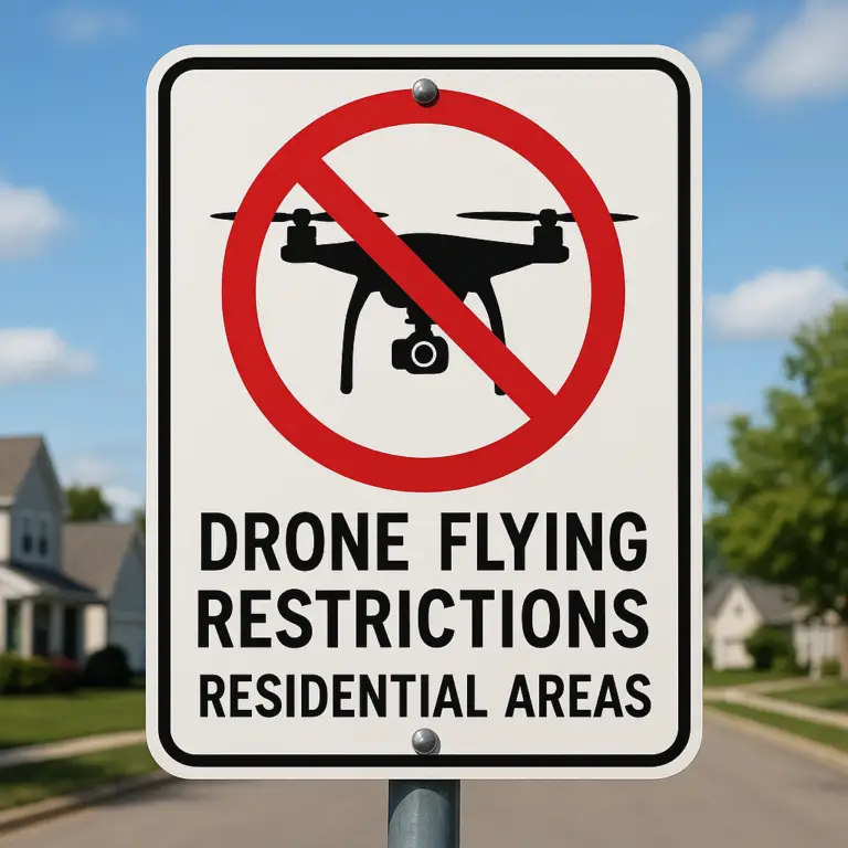
👁️ Privacy Paradox: What User Behavior Data Tells Regulators About Surveillance
“You wouldn’t have your granny using them,” says Philip Boucher in a JRC report on public perception. This is the “Granny Test.” Statistics show that the public doesn’t hate drones; they hate uncertainty.
Regulators use societal acceptability data to craft privacy laws. For instance, California amended its anti-paparazzi laws specifically because stats showed a rise in “aerial trespassing.”
The Nuance: People love drones when they are transporting lifesaving blood (medical delivery stats are through the roof!), but they loathe them when they are hovering over a backyard pool. This purpose-driven regulation is a direct result of consumer insight surveys.
🏭 Commercial Boom vs. Hobbyist Hurdles: Market Growth Statistics
Can a 249g drone really change the law? Absolutely. The “Mini” revolution was a strategic response by manufacturers like DJI to the statistical threshold of 250g set by global regulators.
- The 55 lb. Limit: Most civil drones fall under this FAA weight class. Why? Because the kinetic energy of a 55 lb. object falling from 400 feet is a “known quantity” in safety physics.
- State-Level Reaction: Because the FAA was slow to act, 44 states jumped in with their own rules. This created a “patchwork” of laws that we, as pilots, have to navigate daily.
👉 Shop Popular Drone Brands on:
🌍 Global Perspectives: Comparing FAA, EASA, and International Regulatory Frameworks
There is no one-size-fits-all rulebook. We’ve seen this firsthand through the WeRobotics Flying Labs Framework. In the Global South, regulations are often more community-driven because the data shows drones are essential for local logistics, not just hobbyist fun.
- FAA (USA): Focuses heavily on integration into the busiest airspace in the world.
- EASA (Europe): Prioritizes “Risk-Based” categories (Open, Specific, Certified).
- Global South: Uses a “Glocal” approach—balancing global safety standards with local economic needs.
Quote from WeRobotics: “Effective stakeholder engagement can be a catalyst for CAAs to establish a contextual understanding of their local regulatory environment.”
🤖 Beyond Human Error: How AI and Automation Statistics Influence Future Laws
As we move toward “Beyond Visual Line of Sight” (BVLOS), the stats are shifting from human pilots to AI reliability.
The Big Question: If an AI-driven drone from Skydio avoids 99.9% of obstacles, should it be allowed to fly over people? Regulators are currently crunching the numbers on automated bridge inspections and cell tower damage reports to see if the cost-saving stats outweigh the safety risks.
🛡️ The 10-Point Blueprint: How Data-Driven Insights Create Safer Skies
If you want to stay on the right side of the law, you need to follow the blueprint. As discussed in our featured video, recreational flying in the US is governed by ten specific FAA pillars:
- Intent: Fly only for personal enjoyment. (No monetized YouTube channels without Part 107!)
- CBO Guidelines: Follow a Community Based Organization’s safety rules.
- VLOS: Keep your eyes on the bird.
- Yield: Manned aircraft always have the right of way.
- LAANC: Get authorization in controlled airspace.
- 400ft Limit: Stay below the “safety buffer.”
- TRUST: Take the free online safety test.
- Registration: If it’s over 0.55 lbs, pay the $5 fee.
- Remote ID: Ensure your drone is broadcasting its “digital license plate.”
- No Hazards: Don’t be “that guy”—stay away from emergencies and stadiums.
🔮 The Future of Flight: Predicting Regulatory Shifts Based on Current Trends
What happens when the sky gets really crowded? We’re looking at a future where 4-D geofencing (spatial and temporal restrictions) becomes the norm. Based on the JRC security reports, the next wave of laws will likely focus on minimizing collected data to protect citizen privacy while allowing for autonomous delivery swarms.
But wait—if the drones are all talking to each other via Remote ID, do we even need human “Air Traffic Control” for the low-altitude skies? The data suggests we are heading toward a fully automated traffic management system (UTM).
Stay tuned, because the next firmware update you download might just be the one that changes the rules of the game forever. 🚁✨
🏁 Conclusion
So, we’ve flown through the data, dodged the regulatory red tape, and landed safely back on solid ground. The answer to our lingering question—do drone statistics actually shape the law?—is a resounding yes. From the 249g weight limit that saved the hobbyist market to the Remote ID mandates born from “unidentified aerial” panic, every rule you follow today is a direct response to a number, a crash report, or a public opinion poll.
The narrative isn’t about stifling innovation; it’s about contextual adaptation. As the WeRobotics framework highlighted, a “one-size-fits-all” approach fails because the data in Namibia looks different from the data in New York. Regulators are finally realizing that they must balance safety statistics with economic potential.
The Verdict for Pilots:
Whether you are flying a DJI Mini 4 Pro for sunset shots or a heavy-lift Autel for industrial inspection, the numbers are your co-pilot.
- ✅ The Good: Regulations are becoming more nuanced, allowing for BVLOS flights and complex commercial operations based on proven safety data.
- ❌ The Bad: The “patchwork” of state laws remains a headache, and the pace of technological change often outstrips the speed of legislation.
- 🚀 Our Recommendation: Don’t just fly; fly smart. Stay updated on your local CAA’s data-driven updates, register your gear, and embrace Remote ID. The sky is no longer the limit; it’s a managed highway, and the statistics are the traffic lights.
🔗 Recommended Links
Ready to upgrade your fleet or deepen your legal knowledge? Here are our top picks based on the data-driven insights we’ve discussed.
👉 Shop Top-Tier Drones & Accessories:
- DJI Mini 4 Pro: Amazon | Walmart | DJI Official
- Autel EVO Lite+: Amazon | eBay | Autel Official
- Skydio 2+ (Best for Obstacle Avoidance): Amazon | Skydio Official
- FAA Remote ID Module: Amazon | Walmart
Essential Reading for the Legal-Savvy Pilot:
- “Drone Law: A Comprehensive Guide” (Book): Amazon
- “The Future of Drones: Policy and Regulation” (Book): Amazon
Deep Dives into Industry Reports:
- Institute for Legal Reform: Drone Laws – A Look in the Future
- WeRobotics: A New Framework for Drone Regulations
- European Commission: Unmanned Aircraft Studies
❓ FAQ
How do international drone statistics compare to US regulations?
While the US FAA focuses heavily on integration into the National Airspace System (NAS) with a strong emphasis on Remote ID and Part 107 for commercial use, the European Union (EASA) utilizes a risk-based categorization (Open, Specific, Certified) derived from extensive SESAR studies. International statistics often show a higher adoption rate of community-driven frameworks in the Global South, where regulations are tailored to local economic needs rather than strict federal mandates. The US tends to be more reactive to specific incidents, whereas the EU often proactively sets standards based on long-term projection data.
What impact do drone noise complaints have on local regulations?
Noise complaints are a significant driver for local zoning laws and time-of-day restrictions. Statistics from urban areas show a direct correlation between high-density drone operations and increased noise pollution complaints. This has led many municipalities to enact “quiet hours” or ban drone flights over residential zones during early morning and late evening hours. Regulators use these complaint logs to define noise abatement corridors and enforce decibel limits on commercial operators.
How are drone registration numbers used to update regulatory frameworks?
Registration numbers provide the FAA and other CAAs with a real-time census of the drone fleet. By analyzing these numbers, regulators can identify surges in specific weight classes or geographic clusters. For example, a spike in sub-250g registrations might prompt a review of the “hobbyist” exemption rules, while a rise in commercial registrations often triggers updates to insurance requirements and pilot certification standards.
Do drone safety records impact insurance requirements for operators?
Absolutely. Insurance premiums are directly tied to accident statistics and pilot experience data. As the industry matures, insurers are using historical safety records to create tiered pricing models. Operators with clean flight logs and advanced safety features (like obstacle avoidance) often receive lower premiums. Conversely, a rise in specific types of accidents (e.g., loss of control in high winds) can lead to stricter coverage mandates for all operators in that category.
How do commercial drone statistics affect airspace restrictions?
Commercial growth statistics are the primary catalyst for LAANC (Low Altitude Authorization and Notification Capability) expansion. As data shows more commercial flights in controlled airspace, the FAA updates its automated authorization systems to accommodate higher traffic volumes. However, if statistics indicate a rise in near-misses or safety incidents in a specific sector, that area may be temporarily or permanently restricted until new safety protocols are proven effective.
What role do drone usage trends play in shaping privacy laws?
Usage trends, particularly the rise of surveillance-capable drones and delivery services, have forced legislators to update privacy statutes. Data showing an increase in “aerial trespassing” or unauthorized recording has led to state-specific laws (like in California and Texas) that criminalize the use of drones to capture images of individuals in private settings. The trend of first-person view (FPV) racing also prompted discussions on spectator privacy and safety.
How do drone accident statistics influence FAA rulemaking?
The FAA operates on a data-driven safety model. When accident statistics reveal a pattern—such as a high frequency of battery fires or signal loss incidents—the agency issues Airworthiness Directives or updates operational rules. For instance, the increase in collisions with manned aircraft (even near-misses) directly influenced the Remote ID rule, ensuring that every drone can be identified and tracked to prevent future incidents.
What influence do public opinion polls on drones have on regulatory frameworks?
Public opinion polls act as a social license for regulation. Studies, such as those by the JRC in Europe, show that acceptance is application-dependent. People are more accepting of drones for medical delivery than for recreational photography. Regulators use these sentiment analyses to prioritize public education campaigns and to shape laws that emphasize transparency and benefit to the community, rather than just technical compliance.
How are drone privacy concerns addressed in the development of regulations?
Privacy concerns are addressed through geofencing, data minimization mandates, and notification requirements. Regulations now often require operators to disable cameras when flying over private property or to obtain consent for recording. The development of 4-D geofencing (spatial and temporal) is a direct response to these concerns, ensuring drones cannot enter sensitive areas without explicit authorization.
Do drone market trends affect the creation of laws governing drone usage?
Yes, market trends dictate the urgency and scope of legislation. The explosion of the “sub-250g” market forced regulators to create a new category of lightweight rules. Similarly, the rise of autonomous delivery swarms is currently driving the creation of BVLOS (Beyond Visual Line of Sight) regulations. As the market shifts from hobbyist to industrial, laws are evolving to support logistics integration and infrastructure inspection.
Can drone incident data inform the development of safety standards?
Definitely. Incident data is the backbone of safety standardization. Reports of specific failures (e.g., motor burnout, GPS drift) lead to updated manufacturing standards and pre-flight checklists. The industry relies on shared incident databases to identify systemic risks and develop mitigation strategies that become mandatory for all operators.
What impact do drone registration numbers have on regulatory decisions?
Registration numbers help regulators assess compliance rates and enforcement needs. If registration numbers are low compared to estimated sales, it indicates a need for better public outreach or stricter penalties. Conversely, high registration numbers in a specific area can justify the deployment of enforcement drones or the creation of specialized airspace zones to manage the traffic density.
How do drone usage statistics influence airspace management policies?
Usage statistics determine capacity planning for the National Airspace System. Data on flight frequency, altitude, and duration helps the FAA design UTM (Unmanned Traffic Management) systems. As statistics show an increase in high-altitude or long-duration flights, airspace policies are adjusted to create corridors and separation standards that ensure safe coexistence with manned aviation.
What role do accident reports play in shaping drone regulations?
Accident reports are the primary evidence for regulatory change. Detailed investigations into crashes reveal root causes (e.g., pilot error, equipment failure, environmental factors) that lead to specific rule updates. For example, reports of drones interfering with wildfire suppression efforts led to stricter temporary flight restrictions (TFRs) during emergency operations.
How do drone weight statistics influence the creation of “Open” vs. “Specific” categories?
Weight is a proxy for kinetic energy and potential damage. Statistics showing that drones under 250g rarely cause serious injury led to the creation of the “Open” category with fewer restrictions. Heavier drones, which pose a higher risk based on impact data, fall into the “Specific” category, requiring risk assessments and operational approvals.
What role do noise data logs play in urban drone policy?
Noise data logs are increasingly used to create noise maps and define quiet zones in urban environments. Cities use this data to restrict drone operations in residential areas during sensitive times or to mandate the use of quieter propeller designs for commercial operators. This data-driven approach helps balance economic growth with quality of life for residents.
How do public acceptance surveys shape the “Social License to Operate”?
Public acceptance surveys provide the social context for regulations. If surveys show low trust in a specific application (e.g., surveillance), regulators may impose stricter oversight or transparency requirements. Conversely, high acceptance of beneficial applications (e.g., medical delivery) can accelerate regulatory approvals and pilot programs.
What impact do technology adoption rates have on regulatory updates?
Rapid technology adoption rates often outpace legislation, leading to regulatory gaps. As new features like AI obstacle avoidance or autonomous swarming become common, regulators must update rules to address these capabilities. High adoption rates of Remote ID technology, for instance, allowed the FAA to finalize the Remote ID rule with confidence that the infrastructure was in place.
How do international collaboration efforts influence national drone regulations?
International collaboration, such as through ICAO or EASA, helps harmonize safety standards and registration systems. Data sharing between countries allows for a more comprehensive understanding of global risks, leading to mutual recognition agreements and consistent regulatory frameworks that facilitate international drone operations.
What role do environmental impact studies play in drone regulation?
Environmental impact studies assess the carbon footprint and wildlife disturbance caused by drone operations. These studies influence regulations regarding flight paths near protected areas, noise limits to protect wildlife, and battery disposal requirements. As the industry grows, environmental data will likely play a larger role in shaping sustainable aviation policies.
📚 Reference Links
- Institute for Legal Reform: Drone Laws: A Look in the Future
- WeRobotics: A New Framework for Drone Regulations in the Global South
- European Commission: Unmanned Aircraft Studies & Reports
- FAA: Remote ID Rules & Regulations
- DJI: Official Product Pages
- Autel Robotics: Official Product Pages
- Skydio: Official Product Pages
- SESAR Joint Undertaking: European Drones Outlook Study
- Joint Research Centre (JRC): Security, Privacy, and Geofencing Techniques