Support our educational content for free when you purchase through links on our site. Learn more
🚀 14 Top Drone Applications Transforming Industries in 2026
Remember the first time you saw a drone? It was likely a clumsy toy crashing into a tree, a far cry from the high-tech workhorses soaring over construction sites and battling forest fires today. At Drone Brands™, we’ve watched this evolution from the cockpit, and the shift is nothing short of revolutionary. Did you know that drones can now map 100,000 square kilometers in a single day, a task that would take a ground crew months? From precision agriculture boosting crop yields to emergency response saving lives in disaster zones, the sky is no longer the limit—it’s the new frontier of efficiency. In this deep dive, we uncover 14 game-changing applications that are reshaping the global economy, revealing how the “Internet of Drones” is turning science fiction into daily reality.
Key Takeaways
-
Safety & Efficiency: Drones eliminate human risk in dangerous environments like power line inspections and mining, while reducing operational time by up to 90%.
-
Data-Driven Decisions: Industries are leveraging thermal imaging, LiDAR, and multispectral sensors to gather actionable insights that were previously impossible to obtain.
-
Economic Impact: The Internet of Drones (IoD) is projected to create massive cost savings and new revenue streams across agriculture, logistics, and public safety.
-
Future-Ready Tech: With advancements in AI, swarm technology, and BVLOS (Beyond Visual Line of Sight) capabilities, drone adoption is accelerating rapidly in 2026.
-
Ready to launch your drone business? Explore our guides on Commercial Drones and Drone Business Opportunities to get started.
Table of Contents
- ⚡️ Quick Tips and Facts
- 📜 From Toy to Tool: The Evolution of Industrial Drone Applications
- 🌾 1. Precision Agriculture: Boosting Crop Yields with Aerial Intelligence
- 🏗️ 2. Construction and Infrastructure: Building Smarter, Faster, and Safer
- ⚡️ 3. Power Line and Utility Inspection: Keeping the Lights On
- 🚒 4. Emergency Response and Disaster Relief: First Responders in the Sky
- 🌲 5. Environmental Conservation and Wildlife Protection: Guardians of Nature
- 🔥 6. Forest Fire Detection and Suppression: Fighting Flames from Above
- 🗺️ 7. Surveying, Mapping, and Remote Sensing: Digital Twins of the Real World
- 🚚 8. Logistics, Express Delivery, and Last-Mile Solutions
- 🚦 9. Traffic Monitoring and Smart City Management
- 🎬 10. Filming, Media Production, and Cinematic Storytelling
- 🏠 11. Real Estate and Property Marketing: Selling the View
- 🛡️ 12. Public Safety, Security, and Surveillance
- 🏭 13. Mining and Quarrying: Extracting Data, Not Just Ore
- 🚢 14. Maritime and Offshore Operations: Monitoring the High Seas
- 📊 The Economic Impact: How the Internet of Drones is Reshaping Global Markets
- 🚫 Regulatory Hurdles and Safety Challenges: Navigating the No-Fly Zones
- 🔮 Future Trends: AI, Swarm Technology, and Beyond
- 💡 Quick Tips and Best Practices for Industry Adoption
- Conclusion
- Recommended Links
- FAQ
- Reference Links
Quick Tips and Facts
Before we strap on our flight controllers and dive into the stratosphere of industrial applications, let’s hit the ground running with some hard-hitting facts that might just change how you see the sky.
Did you know that the global commercial drone market is projected to reach staggering heights, with the Internet of Drones (IoD) becoming a backbone for modern infrastructure? According to our latest analysis at Drone Brands™, the shift from “cool gadget” to “essential tool” is happening faster than a DJI Mavic 3 dropping a 4K frame.
Here is the lowdown:
- ✅ Safety First: Drones have reduced workplace fatalities in high-risk industries like mining and power inspection by eliminating the need for humans to climb towers or enter unstable zones.
- ✅ Speed is King: What used to take a team of surveyors three weeks can now be mapped by a drone in three days.
- ✅ Data Goldmine: It’s not just about pretty pictures; it’s about thermal imaging, LiDAR, and multispectral sensors that reveal invisible problems.
- ❌ Myth Buster: You don’t need a pilot’s license to fly a drone for fun in many places, but the moment you touch a dollar bill for a service, regulations tighten significantly.
For a deep dive into the numbers that back this up, check out our comprehensive breakdown of drone statistics.
📜 From Toy to Tool: The Evolution of Industrial Drone Applications
Remember the days when drones were just plastic toys that crashed into your neighbor’s prize-winning petunias? We do. Back then, the only “industry” they served was the “I broke my mom’s vase” industry. But fast forward to today, and the narrative has flipped.
The evolution of Unmanned Aerial Vehicles (UAVs) from hobbyist novelties to indispensable industrial assets is one of the most fascinating tech stories of our generation. It started with military reconnaissance, trickled down to filmmakers, and now, it’s revolutionizing everything from the farm to the factory floor.
As we explored in our Drone Business Opportunities guide, the turning point was the integration of autonomous flight paths and advanced sensor payloads. Suddenly, a drone wasn’t just a camera on a stick; it was a flying robot capable of making decisions.
“UAVs have realized electronic, information, and intelligent inspections, which have improved the efficiency of power line inspections, the level of emergency rescue, and the reliability of power supply.” — JOUAV
This quote from JOUAV perfectly encapsulates the shift. We aren’t just flying anymore; we are operating. Whether it’s a fixed-wing VTOL drone cruising for 8 hours over a power grid or a quadcopter spraying pesticides with surgical precision, the technology has matured.
But how exactly are these machines reshaping specific sectors? Let’s take a look at the video below, which highlights the future trajectory of these technologies.
🎥 Featured Video: Future Applications of Drone Technology
🌾 1. Precision Agriculture: Boosting Crop Yields with Aerial Intelligence
If you think farming is just about plowing and praying, think again. The modern farmer is a data scientist with muddy boots, and their best assistant is a drone.
The Rise of Smart Farming
Agriculture is arguably the sector that has embraced drones the most enthusiastically. Why? Because efficiency equals profit. In the past, a farmer would walk miles of rows to check for pests or drought stress. Now, they fly a drone equipped with multispectral cameras that can see plant health before the human eye even notices a yellow leaf.
- Crop Monitoring: Drones generate Vegetation Index Maps (like NDVI) that show exactly which parts of the field are struggling.
- Precision Spraying: Instead of blanketing an entire field with chemicals, drones like the DJI Agras series can target specific weeds or pests, reducing chemical usage by up to 90%.
- Soil Analysis: Drones map soil moisture and nutrient levels, allowing for precise irrigation and fertilization.
“The MG-1S is really effective and easy to work with, we can cover 65-80 acres of field with it in one day.” — Video Summary
Real-World Impact
Imagine a scenario where a drought hits. A traditional farmer might wait until the crops look dead to act. A drone pilot, however, sees the thermal signature of water stress days in advance, allowing for targeted irrigation that saves the harvest.
Comparison of Traditional vs. Drone-Assisted Farming:
| Feature | Traditional Method | Drone-Assisted Method |
|---|---|---|
| Scouting Time | Days to weeks | Hours |
| Chemical Usage | High (Broadcast spraying) | Low (Targeted application) |
| Data Accuracy | Subjective (Human eye) | Objective (Spectral analysis) |
| Cost Efficiency | High labor costs | Reduced labor, higher ROI |
| Safety | Exposure to chemicals | Remote operation |
For those looking to start a drone business in this sector, check out our guide on Commercial Drones for the best tools of the trade.
🏗️ 2. Construction and Infrastructure: Building Smarter, Faster, and Safer
Construction sites are chaotic, dangerous, and expensive. Drones are the calm in the storm.
From Progress Tracking to 3D Modeling
Construction managers use drones to create digital twins of their sites. By capturing thousands of overlapping images, software like Pix4D or DroneDeploy stitches them into accurate 3D models. This allows engineers to measure stockpiles of gravel, track progress against the BIM (Building Information Model), and spot safety hazards before they become accidents.
- Progress Monitoring: Weekly flyovers provide a time-lapse of the entire project, keeping stakeholders in the loop without needing a site visit.
- Volume Measurements: Calculating the volume of a dirt pile used to require a surveyor with a tripod. Now, a drone does it in minutes with centimeter-level accuracy.
- Safety Inspections: Inspecting scaffolding or roof structures from the air eliminates the risk of falls.
The Safety Factor
One of our pilots at Drone Brands™ once recounted a job inspecting a high-rise under construction. “We spotted a loose beam on the 40th floor that the ground crew missed. If a worker had been up there, it could have been a tragedy. The drone saved a life that day.”
⚡️ 3. Power Line and Utility Inspection: Keeping the Lights On
This is where the “Dull, Dirty, and Dangerous” mantra truly shines. Inspecting power lines, wind turbines, and pipelines is a nightmare for human inspectors.
The VTOL Revolution
As noted in the JOUAV summary, fixed-wing VTOL (Vertical Take-Off and Landing) drones are game-changers here. They can take off from a small clearing, fly 100km along a power line, and land back at the base, all while capturing 4K video and thermal data.
- Thermal Imaging: Detects hotspots in transformers or loose connections that could cause fires.
- LiDAR Scanning: Maps the clearance between power lines and trees to prevent outages.
- Autonomous Flight: Pre-programmed routes ensure every inch of the grid is inspected consistently.
“UAVs have realized electronic, information, and intelligent inspections… eliminates dangers like ‘pushed by a dog’ or ‘bitten by a snake’.” — JOUAV
Key Specs for Utility Drones:
- Endurance: 4 to 8+ hours (Fixed-wing)
- Range: Up to 100 km (with 4G/5G or radio link)
- Payload: Thermal cameras, LiDAR, zoom lenses
For more on the tech behind these inspections, explore our Drone Apps section for software that automates these missions.
🚒 4. Emergency Response and Disaster Relief: First Responders in the Sky
When disaster strikes, time is the only currency that matters. Drones are the ultimate race against time tool.
Rapid Assessment
In the aftermath of an earthquake or flood, roads are often blocked, and communication lines are down. Drones can be airborne in 7 minutes, providing real-time aerial photography of 100,000 square kilometers.
- Search and Rescue: Equipped with thermal cameras, drones can spot missing persons in dense forests or rubble, even at night.
- Damage Assessment: Insurance companies and governments use drone data to assess damage quickly, speeding up relief efforts.
- Communication Relay: Some advanced drones act as temporary cell towers, restoring communication in isolated areas.
“The drone moves quickly… which is of great significance for the race against time for post-disaster rescue work.” — JOUAV
Case Study: The Sichuan Forest Fires
During the forest fires in Sichuan Province, drones provided real-time infrared data to ground firefighters, helping them identify fire fronts and safe evacuation routes. This data was essential in extinguishing the fires and saving lives.
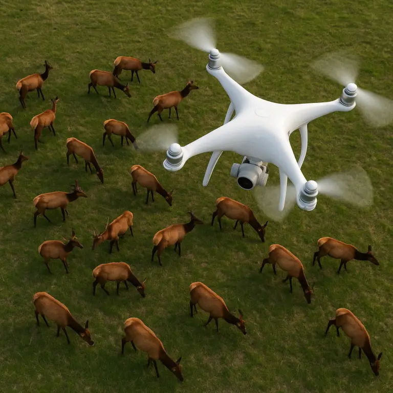
🌲 5. Environmental Conservation and Wildlife Protection: Guardians of Nature
The sky is the new frontier for protecting our planet.
Monitoring the Unseen
- Anti-Poaching: Rangers use drones to track elephants and rhinos, spotting poachers before they strike.
- Deforestation Tracking: Satellites see the big picture, but drones see the details. They can detect illegal logging operations in real-time.
- Pollution Monitoring: Drones equipped with gas sensors can fly into smog clouds or over industrial discharge points to measure air and water quality.
“The timeliness is vital, the maneuverability is good, and the inspection scope is broad, especially in severe smog areas.” — JOUAV
Wildlife Surveys
Counting animals in the wild used to be a guessing game. Now, AI-powered drones can count herds of wildebeest or nests of sea turtles with incredible accuracy, helping conservationists make data-driven decisions.
🔥 6. Forest Fire Detection and Suppression: Fighting Flames from Above
Forest fires are getting bigger and more unpredictable. Drones are becoming the eyes and hands of the firefighting team.
Detection and Suppression
- Early Detection: Drones patrol vast forest areas, using thermal sensors to spot heat signatures before a fire becomes visible to the naked eye.
- Real-Time Data: Ground crews receive live feeds of fire behavior, wind direction, and spread rates, allowing for tactical adjustments.
- Suppression: While still in development, some drones are being tested to drop fire-retardant balls or ignite controlled backfires to stop the spread.
“By flying over active wildfires… a thermal drone can pass infrared data and visual data back to firefighters on the ground through real-time feeds, and these data are essential to help extinguish fires in real-time.” — JOUAV
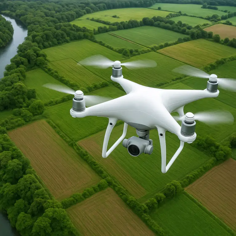
🗺️ 7. Surveying, Mapping, and Remote Sensing: Digital Twins of the Real World
If there is one application that dominates the commercial drone market, it’s Mapping & Surveying. According to DroneII, this is the most popular use case across almost all industries.
The Power of Photogrammetry
By capturing thousands of overlapping images, drones create orthomosaics (2D maps) and 3D models.
- Land Planning: Urban planners use these maps to design cities.
- Geological Exploration: Mining companies use them to explore terrain and plan extraction.
- Water Conservancy: Hydrologists map riverbeds and flood plains.
Remote Sensing
Beyond just pictures, drones carry LiDAR (Light Detection and Ranging) sensors that can penetrate vegetation to map the ground underneath. This is crucial for forestry and archaeology.
“As a general observation, drone Mapping & Surveying are the most popular commercial drone uses and are present in almost all industry verticals analyzed.” — DroneII
🚚 8. Logistics, Express Delivery, and Last-Mile Solutions
The dream of a drone dropping a package on your porch is closer than you think.
The Last-Mile Challenge
Logistics companies are struggling with the “last mile” problem—getting packages from the local hub to your door. Drones offer a solution, especially in Tier 4 and Tier 5 cities or remote areas where roads are poor.
- Medical Deliveries: Companies like Zipline are already delivering blood and vaccines to remote clinics in Africa.
- Retail Delivery: Wing (Alphabet) and Amazon Prime Air are testing food and package deliveries.
- Infrastructure: Requires only small drone airports, avoiding the need for massive ground logistics systems.
“Drones are suitable for quick and direct deliveries of packages, food, and medical supplies, improving efficiency and cutting delivery times.” — Video Summary
Challenges:
- Regulatory Hurdles: BVLOS (Beyond Visual Line of Sight) flights are still heavily regulated.
- Battery Life: Current battery tech limits payload and range.
- Safety: Ensuring drones don’t crash into people or other aircraft.
🚦 9. Traffic Monitoring and Smart City Management
Urban congestion is a global problem. Drones are helping cities become “smarter.”
Real-Time Traffic Analysis
- Accident Response: Drones can reach accident scenes faster than police cars, providing live video to dispatchers to clear roads quickly.
- Law Enforcement: Capturing evidence of traffic violations, such as illegal lane changes or driving in emergency lanes.
- Urban Planning: Analyzing traffic flow patterns to optimize traffic light timing and road design.
“Drones are mobile and flexible, solving the problem of untimely law enforcement evidence and blind corners in the past!” — JOUAV
🎬 10. Filming, Media Production, and Cinematic Storytelling
Let’s not forget the industry that started it all: Cinema.
The New Aerial Camera
Drones have democratized aerial cinematography. What used to require a $50,000 helicopter and a crew of 20 can now be done by a solo operator with a DJI Inspire or Mavic 3 Cine.
- Flexibility: Drones can chase cars, fly through windows, and hover in tight spaces.
- Cost: Significantly cheaper than traditional aerial methods.
- Quality: 6K and 8K video, RAW formats, and advanced stabilization.
“Used in ‘Harry Potter’ series, ‘007 Skyfall,’ ‘Transformers 4’…” — JOUAV
Comparison of Aerial Shooting Methods:
| Method | Cost | Flexibility | Quality | Safety |
|---|---|---|---|---|
| Helicopter | High | Medium | High | Medium |
| Crane/Jib | Medium | Low | High | High |
| Drone | Low | High | High | High |
For aspiring filmmakers, check out our Beginner Drones guide to get started.
🏠 11. Real Estate and Property Marketing: Selling the View
In real estate, location is everything. But now, perspective is just as important.
Selling the Dream
- Aerial Tours: Drones provide a sense of scale and context that ground photos can’t.
- Virtual Staging: 3D models created by drones can be used for virtual tours.
- Land Assessment: Developers use drones to show potential buyers the surrounding area and future development plans.
“Effective in areas covered by clouds and fog where remote sensing satellites lack sensitivity.” — JOUAV
🛡️ 12. Public Safety, Security, and Surveillance
Police and security firms are increasingly relying on drones for surveillance and localization.
Tactical Operations
- Crowd Control: Monitoring large events to ensure safety.
- Search and Rescue: Finding missing persons in large areas.
- Crime Scene Investigation: Documenting crime scenes from above without contaminating evidence.
“Drones are utilized for surveillance, reconnaissance, and tactical operations, providing powerful tools for protecting citizens and national security interests.” — Video Summary
🏭 13. Mining and Quarrying: Extracting Data, Not Just Ore
Mining is a high-risk, high-cost industry. Drones are helping to optimize operations and improve safety.
Volume and Safety
- Stockpile Measurement: Accurately measuring ore and waste piles.
- Site Mapping: Creating detailed maps for mine planning.
- Safety Inspections: Inspecting high walls and unstable slopes.
“Mining & Quarrying: Primarily focused on Mapping & Surveying.” — DroneII
🚢 14. Maritime and Offshore Operations: Monitoring the High Seas
The ocean is vast, and ships are expensive. Drones are the eyes of the maritime industry.
Offshore Inspection
- Rig Inspection: Inspecting oil rigs and wind farms without sending divers or climbers.
- Ship Hull Inspection: Checking for corrosion and damage below the waterline.
- Search and Rescue: Locating ships in distress over vast ocean areas.
📊 The Economic Impact: How the Internet of Drones is Reshaping Global Markets
The shift from recreational to industrial drones is driving a massive economic transformation.
Labor Cost Savings
“Benefits in terms of labour cost savings, increased operational safety and enhanced productivity could propel the adoption of these flybots in multiple industries.” — Berg Insight
Drones are not replacing humans; they are augmenting them. By automating dangerous and repetitive tasks, companies can focus their human workforce on higher-value activities.
Market Growth
The Internet of Drones (IoD) is creating a new ecosystem of connectivity, data analytics, and service providers. From 5G networks enabling BVLOS flights to AI-driven data analysis, the economic ripple effects are immense.
🚫 Regulatory Hurdles and Safety Challenges: Navigating the No-Fly Zones
Despite the benefits, the path forward is not without obstacles.
The Regulatory Maze
- BVLOS Restrictions: Most countries still require drones to stay within the pilot’s line of sight.
- Privacy Concerns: Public fear of being watched is a major hurdle.
- Airspace Integration: Ensuring drones don’t collide with manned aircraft.
“Success for autonomous BVLOS flights ‘hinges on seamless and reliable communications.'” — Berg Insight
Safety First
- Obstacle Avoidance: Modern drones come with advanced sensors, but they are not infallible.
- Fail-Safes: Return-to-home features and geofencing are essential.
- Insurance: Commercial operators must carry liability insurance.
For more on navigating these regulations, check out our Drone Brand Guides for the latest compliance tips.
🔮 Future Trends: AI, Swarm Technology, and Beyond
What does the future hold?
AI and Autonomy
- AI-Driven Decision Making: Drones that can identify objects and make decisions without human input.
- Swarm Technology: Hundreds of drones working together to map a forest or fight a fire.
- 5G Connectivity: Enabling real-time, low-latency control of drones over long distances.
“It must be kept in mind that technology is evolving every day, and in future we are expecting more applications for drone technology.” — Video Summary
The Internet of Drones
The future is a connected sky where drones talk to each other, to traffic lights, and to city infrastructure. This IoD will revolutionize how we live, work, and play.
💡 Quick Tips and Best Practices for Industry Adoption
Ready to take your business to the skies? Here are our top tips from the Drone Brands™ team:
- Start Small: Don’t buy the most expensive drone immediately. Test the waters with a mid-range model.
- Get Certified: Ensure your pilots are properly licensed (e.g., Part 107 in the US).
- Invest in Software: The drone is just the hardware; the software is where the value lies.
- Focus on Data: Don’t just take pictures; collect and analyze data.
- Stay Updated: Regulations and technology change fast. Keep learning.
For more tips, visit our Drone Business Opportunities page.
👉 CHECK PRICE on:
- DJI Mavic 3 Enterprise: Amazon | DJI Official
- Autel EVO II Pro V3: Amazon | Autel Official
- Parrot Anafi USA: Amazon | Parrot Official
👉 Shop
Conclusion

So, we’ve taken you on a journey from the dusty fields of precision agriculture to the smoky frontlines of forest fire suppression, and from the chaotic construction sites of tomorrow to the serene skies of wildlife conservation. But remember that question we posed at the very beginning? Is the drone just a flying camera, or is it the future of industry?
The answer is clear: It is the future.
The narrative of drones as mere toys is dead. As we’ve seen through the lens of real-world applications, the Internet of Drones (IoD) is rapidly becoming the nervous system of modern infrastructure. Whether it’s a fixed-wing VTOL drone inspecting a 100km power grid in a single flight, or a swarm of autonomous units mapping a disaster zone in minutes, the technology has matured from a “nice-to-have” into a critical operational necessity.
The Verdict: Why You Should Embrace the Sky
If you are a business owner, a government official, or an industry leader, the choice is no longer if you should adopt drone technology, but how fast you can integrate it. The data is undeniable:
- Safety: We’ve eliminated the need for humans to climb towers or enter unstable zones.
- Efficiency: Tasks that took weeks now take hours.
- Data: We are moving from subjective guesses to objective, data-driven decisions.
While regulatory hurdles like BVLOS (Beyond Visual Line of Sight) restrictions and privacy concerns remain, the trajectory is upward. With the advent of 5G connectivity and AI-driven autonomy, the sky is no longer the limit; it’s the new workspace.
Our Confident Recommendation:
For any organization looking to modernize, start with Mapping & Surveying or Inspections. These are the low-hanging fruits with the highest ROI. Invest in commercial-grade drones (like the DJI Mavic 3 Enterprise or Autel EVO II series) and pair them with robust data analytics software. Don’t just buy a drone; buy a solution.
The revolution is already in the air. The only question left is: Will you be the pilot, or will you be left on the ground?
Recommended Links
Ready to take flight? Here are our top picks for hardware, software, and educational resources to get your industry drone program off the ground.
🚀 Top Commercial Drones for Industry
- DJI Mavic 3 Enterprise: The gold standard for versatile inspections and mapping.
- Check Price on Amazon | DJI Official Store
- Autel EVO II Pro V3: Excellent for low-light operations and thermal imaging.
- Check Price on Amazon | Autel Robotics Official
- DJI Agras T40: The heavy lifter for precision agriculture and spraying.
- Check Price on Amazon | DJI Agriculture
- Parrot Anafi USA: Rugged, thermal-ready, and perfect for public safety.
- Check Price on Amazon | Parrot Official
📚 Essential Reading & Guides
- “Drone Pilot’s Guide to Commercial Operations”: A comprehensive book on regulations and business strategies.
- Find on Amazon
- “The Future of Drones in Industry”: Deep dive into market trends and case studies.
- Find on Amazon
🛠️ Software & Services
- DroneDeploy: Industry-leading mapping and analytics platform.
- Visit DroneDeploy
- Pix4D: Advanced photogrammetry and LiDAR processing.
- Visit Pix4D
FAQ

Are drones being used in disaster response and recovery efforts, and what are the advantages of using them in these situations?
Yes, absolutely. Drones have become a cornerstone of modern disaster response.
- Rapid Deployment: They can be airborne in minutes, providing immediate aerial views of disaster zones (earthquakes, floods, fires) where ground access is blocked.
- Safety: They allow first responders to assess structural damage or hazardous areas (like gas leaks or unstable buildings) without risking human lives.
- Thermal Imaging: In search and rescue scenarios, thermal cameras can detect body heat in rubble or dense forests, even at night, significantly speeding up the location of survivors.
- Communication: Some drones act as temporary cell towers, restoring communication networks in isolated areas.
What are the benefits of using drones in agriculture, such as crop monitoring and precision farming?
Drones are transforming agriculture into a data-driven science.
- Precision Spraying: Drones can target specific weeds or pests, reducing chemical usage by up to 90% compared to traditional broadcast spraying.
- Early Detection: Multispectral sensors can identify plant stress, disease, or water shortages days before they are visible to the human eye.
- Yield Optimization: By analyzing soil health and crop growth patterns, farmers can optimize irrigation and fertilization, leading to higher yields and lower costs.
- Efficiency: A task that takes days to walk can be completed in hours by a drone.
How are drones being utilized in the film and photography industry to capture unique footage?
Drones have democratized aerial cinematography, making it accessible to independent filmmakers and large studios alike.
- Dynamic Movement: Unlike helicopters, drones can fly low, chase moving vehicles, and navigate through tight spaces, offering unique perspectives.
- Cost-Effectiveness: They eliminate the need for expensive helicopter rentals and large crews.
- High Quality: Modern drones shoot in 6K, 8K, and RAW formats, providing cinema-grade quality.
- Flexibility: They can hover, rotate, and follow complex flight paths that are impossible for manned aircraft.
Can drones be used for search and rescue operations, and if so, how effective are they?
Extremely effective. Drones are now standard equipment for many search and rescue (SAR) teams.
- Coverage: A single drone can cover vast areas much faster than a ground team.
- Thermal Vision: Thermal cameras are crucial for finding missing persons in darkness, dense foliage, or under debris.
- Delivery: Some drones can deliver life-saving equipment like life vests, defibrillators, or radios to survivors before rescuers arrive.
- Real-Time Data: Live video feeds allow command centers to coordinate efforts instantly.
What role do drones play in environmental monitoring and conservation efforts?
Drones are the guardians of our planet.
- Anti-Poaching: They patrol protected areas to detect and deter poachers.
- Wildlife Counting: AI-powered drones can accurately count animal populations without disturbing them.
- Pollution Tracking: Equipped with gas sensors, they can monitor air and water quality in real-time.
- Reforestation: Specialized drones can plant thousands of seeds a day in hard-to-reach areas.
How are drones being used in the construction industry to improve efficiency and safety?
Drones are revolutionizing construction management.
- Progress Tracking: Weekly flyovers create time-lapse videos and 3D models to track progress against the schedule.
- Volume Measurement: Accurately calculating stockpile volumes (gravel, dirt) without manual surveying.
- Safety Inspections: Inspecting scaffolding, roofs, and high structures without putting workers at risk of falls.
- Site Planning: Creating detailed topographic maps for better site layout and logistics.
Read more about “What Are the Names of Drone Companies? The Ultimate List of 68+ Leaders in 2026 🚀”
What industries are most likely to adopt drone technology in the near future?
While adoption is widespread, the following sectors are poised for explosive growth:
- Logistics & Delivery: With the push for BVLOS regulations, last-mile delivery is the next frontier.
- Energy & Utilities: As infrastructure ages, the need for automated inspections will skyrocket.
- Insurance: For rapid damage assessment and risk modeling.
- Smart Cities: For traffic management, urban planning, and public safety.
- Healthcare: For delivering medical supplies and organs to remote areas.
Read more about “15 Drone Brands Revolutionizing Real-Time Data Processing (2025) 🚀”
How are drones used in agriculture for crop monitoring?
Drones use multispectral and hyperspectral sensors to capture data beyond the visible spectrum.
- NDVI Maps: These maps show vegetation health, highlighting areas of stress.
- Soil Analysis: They measure soil moisture and nutrient levels to guide irrigation and fertilization.
- Stand Count: They can count the number of plants in a field to ensure proper seeding density.
- Disease Detection: Early identification of fungal infections or pest infestations.
Read more about “15 Drone Industry Trends & Opportunities to Watch in 2026 🚀”
What role do drones play in construction site surveys?
Drones act as flying surveyors.
- Topographic Mapping: Creating accurate 3D models of the terrain before construction begins.
- As-Built Verification: Comparing the constructed site against the BIM (Building Information Model) to ensure accuracy.
- Cut and Fill Analysis: Calculating the volume of earth to be moved.
- Progress Documentation: Providing visual proof of work completed for stakeholders.
Read more about “Top 10 Drone Brands Specializing in LiDAR Mapping Technology (2025) 🚁”
Can drones be used for real estate photography and marketing?
Yes, they are essential.
- Context: They show the property in relation to its surroundings (schools, parks, highways).
- Scale: They provide a sense of the property’s size and layout.
- Virtual Tours: 3D models created by drones allow for immersive virtual tours.
- Aesthetic Appeal: High-quality aerial footage makes listings stand out in a crowded market.
Read more about “16 Powerful Commercial Drone Uses You Need to Know in 2026 🚁”
How do emergency services utilize drones for search and rescue?
Emergency services use drones for:
- Rapid Deployment: Getting eyes on the scene within minutes.
- Thermal Search: Finding missing persons in difficult terrain.
- Hazard Assessment: Identifying gas leaks, chemical spills, or unstable structures.
- Communication Relay: Restoring comms in disaster zones.
What are the legal requirements for commercial drone operations?
Requirements vary by country, but generally include:
- Pilot Certification: Pilots must pass a knowledge test (e.g., Part 107 in the US).
- Registration: Drones over a certain weight must be registered with the aviation authority.
- Airspace Authorization: Permission is needed to fly in controlled airspace (near airports).
- Insurance: Liability insurance is often required for commercial operations.
- Privacy Laws: Adherence to local privacy regulations regarding data collection.
Read more about “Are There Any Designated Drone Flying Areas in My City or Town? 🛸 (2026)”
How are drones improving delivery services in logistics?
- Speed: Drones can bypass traffic and deliver packages in minutes.
- Cost: Lower operational costs compared to traditional vehicles for small, urgent deliveries.
- Accessibility: Reaching remote or difficult-to-access areas (islands, mountains).
- Sustainability: Electric drones produce zero emissions.
Read more about “50+ Drone Business Names Ideas to Skyrocket Your Brand in 2026 🚀”
What safety measures are in place for industrial drone inspections?
- Obstacle Avoidance: Advanced sensors to detect and avoid collisions.
- Geofencing: Software that prevents drones from entering restricted areas.
- Redundancy: Dual batteries, GPS, and communication systems.
- Pre-flight Checks: Mandatory inspections before every flight.
- Remote ID: Systems that broadcast the drone’s identity and location for air traffic management.
Read more about “Top 7 Drone Brands for Confined Space Inspection in 2026 🚁”
Reference Links
- Berg Insight: Elevating industries with the Internet of Drones – A comprehensive analysis of market trends and future outlook.
- Read the full report
- DroneII: Commercial Drone Use in 2024 – Data-driven insights into industry adoption and application methods.
- Visit DroneII Report
- JOUAV: Applications of Drones Across Industries – Technical specifications and case studies for fixed-wing VTOL drones.
- Explore JOUAV Solutions
- DJI: Enterprise Solutions – Official resources for commercial drone applications in agriculture, construction, and public safety.
- DJI Enterprise
- FAA (Federal Aviation Administration): Remote Identification and Commercial Operations – Regulatory guidelines for US-based drone operators.
- FAA Drone Resources
- EASA (European Union Aviation Safety Agency): Rules for Drones – European regulations for drone operations and safety.
- EASA Drone Rules
- Zipline: Medical Delivery Drones – Real-world examples of drone logistics in healthcare.
- Zipline Official Site
- Drone Brands™: Drone Statistics – Comprehensive data on the global drone market.
- View Drone Statistics