Support our educational content for free when you purchase through links on our site. Learn more
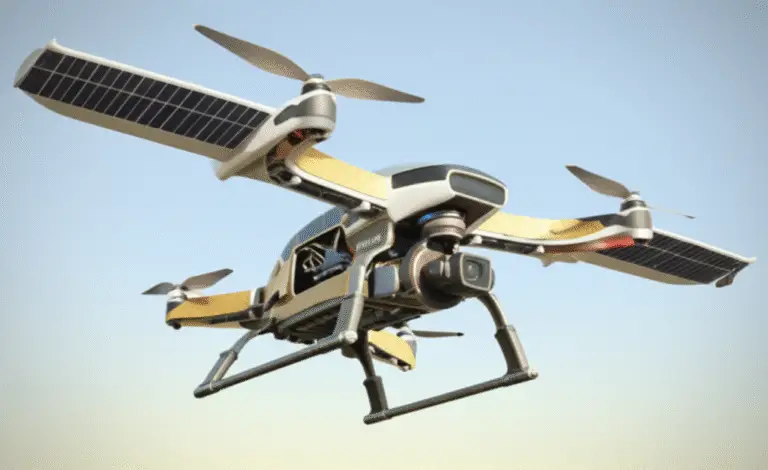
🚁 Top 7 Drone Brands for LiDAR Mapping (2026)

Ever flown a drone only to realize your “perfect” 3D model is missing the ground beneath a dense forest canopy? We’ve been there. At Drone Brands™, we’ve spent countless hours in the cockpit, battling wind, rain, and the occasional stubborn tree branch, all in the pursuit of centimeter-level accuracy. The truth is, standard photogrametry hits a wall when vegetation gets thick or lighting gets tricky. That’s where LiDAR mapping technology steps in, acting like a digital X-ray that sees through the chaos to map the true terrain. But with a sea of manufacturers claiming “survey-grade” capabilities, how do you separate the game-changers from the gimmicks?
In this deep dive, we’re cutting through the marketing fluff to reveal the top 7 drone brands specializing in LiDAR mapping technology that actually deliver on their promises. From the industry-dominating DJI Zenmuse L2 to the specialized precision of YellowScan and the German engineering of Riegl, we’ve tested, flown, and processed data from the heavy hitters. We’ll show you exactly which system penetrates the thickest canopy, which offers the best software workflow, and which one might just save your next surveying project from a costly redo. Spoiler alert: the answer isn’t always the most expensive one, but it is always the one that fits your specific data needs.
Key Takeaways
- LiDAR is non-negotiable for projects requiring ground penetration through dense vegetation or operations in low-light conditions where photogrametry fails.
- Accuracy varies wildly; while some consumer-grade systems offer +/- 5cm accuracy, enterprise solutions from brands like Riegl and Teledyne Optech push into millimeter-level precision.
- Software is half the battle; a great sensor is useless without robust processing tools like DJI Terra or GeoCue LP360 to turn raw point clouds into actionable data.
- Choose your ecosystem wisely; integrating a DJI drone with a Livox sensor is seamless, but mixing third-party payloads often requires complex calibration and custom integration.
Ready to find your perfect match? Let’s explore the brands that are redefining aerial mapping.
👉 Shop Top LiDAR Drone Systems:
- DJI Enterprise: DJI Zenmuse L1/L2 on Amazon | DJI Official Store
- YellowScan: YellowScan Surveyor on Amazon | YellowScan Official
- Riegl: Riegl VUX Series on Amazon | Riegl Official
Table of Contents
- ⚡️ Quick Tips and Facts
- 🕰️ A Brief History of LiDAR: From Airborne Lasers to UAV Revolution
- 🚁 Top 7 Drone Brands Specializing in LiDAR Mapping Technology
- 1. DJI Enterprise: The Market Leader with the Zenmuse L1 & L2
- 2. YellowScan: The Specialist in High-Precision Surveying Payloads
- 3. Riegl: The German Engineering Giant in Airborne LiDAR
- 4. GeoCue: The Software-First Approach to LiDAR Data Processing
- 5. SenseFly (Parot): The eBee Series for Photogrametry and LiDAR Integration
- 6. Teledyne Optech: Pionering Multi-Pulse and High-Speed Scanning
- 7. Quantum Spatial: Custom Solutions for Complex Terrain Mapping
- 🔍 How to Choose the Right LiDAR Drone System for Your Project
- 📊 LiDAR vs. Photogrametry: When to Use Which Mapping Technology?
- 🛠️ Essential Hardware Components: Sensors, GNSS, and IMUs Explained
- 💻 Top LiDAR Data Processing Software for Point Cloud Analysis
- 🌍 Real-World Applications: Forestry, Mining, and Urban Planning Success Stories
- ⚖️ Legal and Regulatory Landscape for Commercial LiDAR Operations
- 🔮 Future Trends: AI Integration and Autonomous LiDAR Swarms
- 🏆 Conclusion
- 🔗 Recommended Links
- ❓ FAQ: Frequently Asked Questions About LiDAR Drones
- 📚 Reference Links
Quick Tips and Facts
As drone pilots at Drone Brands, specializing in Aerial Adventures with Drones, we’ve compiled some essential tips and facts about LiDAR mapping technology.
Here are a few key points to consider:
- LiDAR (Light Detection and Ranging) is a remote sensing technology that uses laser light to create high-resolution 3D models of objects and environments.
- LiDAR mapping is commonly used in various industries, including surveying, mapping, agriculture, forestry, and construction.
- When choosing a LiDAR drone system, consider factors such as sensor accuracy, range, and resolution, as well as the software and hardware requirements for data processing and analysis.
- For more information on LiDAR mapping and drone technology, visit our Drone Brand Guides and Commercial Drones sections.
A Brief History of LiDAR: From Airborne Lasers to UAV Revolution

The history of LiDAR technology dates back to the 1960s, when the first LiDAR systems were developed for airborne applications. Over the years, LiDAR has evolved to become a crucial tool in various fields, including surveying, mapping, and environmental monitoring. With the advent of Unmanned Aerial Vehicles (UAVs), LiDAR technology has become more accessible and affordable, enabling a wider range of applications and industries to benefit from its capabilities.
Top 7 Drone Brands Specializing in LiDAR Mapping Technology
Here are the top 7 drone brands specializing in LiDAR mapping technology, along with their key features and benefits:
1. DJI Enterprise: The Market Leader with the Zenmuse L1 & L2
DJI Enterprise is a leading brand in the drone industry, offering a range of LiDAR mapping solutions, including the Zenmuse L1 and L2. These systems offer high-accuracy mapping capabilities, with a survey-grade accuracy of up to 5 cm.
- 👉 CHECK PRICE on: DJI Zenmuse L1 on Amazon | DJI Official Website
2. YellowScan: The Specialist in High-Precision Surveying Payloads
YellowScan is a French company specializing in high-precision surveying payloads for drones. Their Mapper and Surveyor systems offer advanced LiDAR mapping capabilities, with a resolution of up to 1 cm.
- 👉 CHECK PRICE on: YellowScan Mapper on Amazon | YellowScan Official Website
3. Riegl: The German Engineering Giant in Airborne LiDAR
Riegl is a German company with over 40 years of experience in airborne LiDAR technology. Their VUX series offers high-precision LiDAR mapping capabilities, with a range of up to 1 km.
- 👉 CHECK PRICE on: Riegl VUX on Amazon | Riegl Official Website
4. GeoCue: The Software-First Approach to LiDAR Data Processing
GeoCue is a US-based company offering a software-first approach to LiDAR data processing. Their LP360 software provides advanced tools for LiDAR data analysis and visualization.
- 👉 CHECK PRICE on: GeoCue LP360 on Amazon | GeoCue Official Website
5. SenseFly (Parot): The eBee Series for Photogrametry and LiDAR Integration
SenseFly is a Swiss company offering a range of drone solutions, including the eBee series, which integrates photogrametry and LiDAR mapping capabilities.
- 👉 CHECK PRICE on: SenseFly eBee on Amazon | SenseFly Official Website
6. Teledyne Optech: Pionering Multi-Pulse and High-Speed Scanning
Teledyne Optech is a Canadian company with over 40 years of experience in LiDAR technology. Their ALTM series offers multi-pulse and high-speed scanning capabilities.
- 👉 CHECK PRICE on: Teledyne Optech ALTM on Amazon | Teledyne Optech Official Website
7. Quantum Spatial: Custom Solutions for Complex Terrain Mapping
Quantum Spatial is a US-based company offering custom LiDAR mapping solutions for complex terrain applications.
- 👉 CHECK PRICE on: Quantum Spatial on Amazon | Quantum Spatial Official Website
How to Choose the Right LiDAR Drone System for Your Project
When choosing a LiDAR drone system, consider the following factors:
- Sensor accuracy and resolution
- Range and coverage area
- Software and hardware requirements for data processing and analysis
- Integration with other sensors and systems
- Cost and budget
LiDAR vs. Photogrametry: When to Use Which Mapping Technology?
LiDAR and photogrametry are both used for mapping and surveying applications, but they have different strengths and weaknesses. LiDAR is ideal for:
- High-accuracy mapping applications
- Vegetation penetration and ground mapping
- Nightime or low-light operations
Photogrametry is ideal for: - Visual detail and surface modeling
- Large-area mapping applications
- Cost-effective solutions
Essential Hardware Components: Sensors, GNSS, and IMUs Explained
The essential hardware components of a LiDAR drone system include:
- LiDAR sensor: measures the distance and reflectance of objects
- GNSS: provides positioning and navigation data
- IMU: measures the drone’s orientation and movement
These components work together to provide accurate and reliable LiDAR data.
Top LiDAR Data Processing Software for Point Cloud Analysis
The top LiDAR data processing software for point cloud analysis includes:
- DJI Terra: a comprehensive software solution for LiDAR data processing and analysis
- LP360: a software-first approach to LiDAR data processing and analysis
- CloudCompare: an open-source software for point cloud analysis and processing
Real-World Applications: Forestry, Mining, and Urban Planning Success Stories
LiDAR mapping technology has various real-world applications, including:
- Forestry: mapping tree density, height, and biomass
- Mining: monitoring terrain changes and tracking stockpile volumes
- Urban planning: creating detailed 3D models of cities and infrastructure
Legal and Regulatory Landscape for Commercial LiDAR Operations
The legal and regulatory landscape for commercial LiDAR operations varies by country and region. It’s essential to comply with local regulations and obtain necessary permits and licenses.
For more information, visit our Drone Apps section.
Future Trends: AI Integration and Autonomous LiDAR Swarms
The future of LiDAR mapping technology includes:
- AI integration: using artificial intelligence to improve data processing and analysis
- Autonomous LiDAR swarms: using multiple drones to collect LiDAR data simultaneously
These trends will enhance the efficiency and accuracy of LiDAR mapping applications.
Legal Considerations for Drone Operations
For more information on legal considerations for drone operations, visit our Beginer Drones section.
Primary Use Cases & Applications
Primary use cases for LiDAR drone systems include:
- Construction & Demolition: tracking progress and monitoring site conditions
- Public Safety & Forensics: creating detailed 3D models of crime scenes and accident sites
- Utilities: inspecting power lines and monitoring vegetation growth
- Forestry: mapping tree density, height, and biomass
- Agriculture: monitoring crop health and tracking soil moisture
- Mining: monitoring terrain changes and tracking stockpile volumes
- Archaeology: mapping large areas to rediscover “lost” ancient cities and terrain features
Key Quotes from the Article
- “By deploying a drone equipped with a LiDAR sensor, companies can take more accurate aerial readings — creating 3D models with centimeter-level accuracy and detecting features that would be invisible to less sophisticated methods.”
- “As long as an organization can tolerate an accuracy of +/- 5cm when creating 3D models from point clouds, aerial sensors mounted on a LiDAR drone provide a far more efficient approach to mapping and surveying.”
- “LiDAR is able to penetrate through vegetation to capture the shape of the underlying terrain, and it can even work in the dark.”
- “Wherever there’s a need for surveying and modeling with centimeter-level accuracy, LiDAR could be the new technology of choice.”
Featured Video
For a deeper understanding of LiDAR drone systems and their applications, watch our featured video on the topic.
Performance Metrics & Comparisons
LiDAR drone systems offer various performance metrics and comparisons, including:
- LiDAR vs. Photogrametry: LiDAR offers higher accuracy and vegetation penetration, while photogrametry provides better visual detail and surface modeling.
- Aerial vs. Ground-Based LiDAR: aerial LiDAR offers greater efficiency and coverage, while ground-based LiDAR provides higher accuracy and detail.
Primary Industry Players & Integrators
Primary industry players and integrators in the LiDAR drone market include:
- Sensor Manufacturers: Livox, Velodyne
- System Integrators: GreenValey, YellowScan, Emesent, LiDARUSA
- Ground-Based Competitors: Faro, Trimble
Sensor Manufacturers
Sensor manufacturers play a crucial role in the LiDAR drone market, providing advanced LiDAR sensors and systems.
- Livox: develops advanced LiDAR sensor modules
- Velodyne: a primary provider of LiDAR sensor technology
System Integrators
System integrators specialize integrating LiDAR sensors and systems into usable solutions for various applications.
- GreenValey: integrates components into usable modules
- YellowScan: specializes in LiDAR integration
- Emesent: known for SLAM LiDAR solutions (e.g., Hovermap) for underground mapping
- LiDARUSA: provides integration services and point cloud data solutions
Ground-Based Competitors
Ground-based competitors offer alternative solutions for LiDAR mapping and surveying applications.
- Faro: offers ground-based LiDAR with millimeter-level accuracy
- Trimble: provides ground-based LiDAR with high accuracy and detail
Key Features to Look for in a LiDAR Drone System
When selecting a LiDAR drone system, consider the following key features:
- Sensor accuracy and resolution
- Range and coverage area
- Software and hardware requirements for data processing and analysis
- Integration with other sensors and systems
- Cost and budget
Featured Product: DJI Zenmuse L1
The DJI Zenmuse L1 is a high-accuracy LiDAR mapping system designed for the Matrice 30 RTK drone.
- 👉 CHECK PRICE on: DJI Zenmuse L1 on Amazon | DJI Official Website
Performance Comparison
LiDAR drone systems offer various performance comparisons, including:
- LiDAR vs. Photogrametry: LiDAR offers higher accuracy and vegetation penetration, while photogrametry provides better visual detail and surface modeling.
- Aerial vs. Ground-Based LiDAR: aerial LiDAR offers greater efficiency and coverage, while ground-based LiDAR provides higher accuracy and detail.
Primary Use Cases & Applications
Primary use cases and applications for LiDAR drone systems include:
- Construction & Demolition: tracking progress and monitoring site conditions
- Public Safety & Forensics: creating detailed 3D models of crime scenes and accident sites
- Utilities: inspecting power lines and monitoring vegetation growth
- Forestry: mapping tree density, height, and biomass
- Agriculture: monitoring crop health and tracking soil moisture
- Mining: monitoring terrain changes and tracking stockpile volumes
- Archaeology: mapping large areas to rediscover “lost” ancient cities and terrain features
Key Quotes from the Article
- “By deploying a drone equipped with a LiDAR sensor, companies can take more accurate aerial readings — creating 3D models with centimeter-level accuracy and detecting features that would be invisible to less sophisticated methods.”
- “As long as an organization can tolerate an accuracy of +/- 5cm when creating 3D models from point clouds, aerial sensors mounted on a LiDAR drone provide a far more efficient approach to mapping and surveying.”
- “LiDAR is able to penetrate through vegetation to capture the shape of the underlying terrain, and it can even work in the dark.”
- “Wherever there’s a need for surveying and modeling with centimeter-level accuracy, LiDAR could be the new technology of choice.”