Support our educational content for free when you purchase through links on our site. Learn more
🚁 5 Top Drone Brands for Environmental Conservation & Monitoring (2026)

If you need to save the planet, skip the guesswork: DJI, senseFly, and Wingtra currently lead the pack for reliable, high-impact environmental monitoring. These Drone brands for environmental conservation and monitoring have evolved from novelty gadgets into the primary eyes of rangers, ecologists, and climate scientists worldwide.
Imagine spotting a poacher’s heat signature in a dense African forest from 50 feet up, or detecting a dying coral reef before it bleaches white. That’s the reality we live in now. A single fixed-wing drone can map 2,0 acres of rainforest in under an hour, a task that would take a ground crew weeks.
The shift from “cool tech” to “critical survival tool” happened fast. We’ve seen thermal sensors prevent poaching incidents by over 50% in some protected areas. But with so many options, how do you choose the right bird for your mission?
Key Takeaways
- DJI dominates the market with the Mavic 3 Thermal and Matrice 350 RTK, offering the best balance of portability, thermal imaging, and ease of use for wildlife tracking.
- senseFly and Wingtra are the undisputed kings of large-scale mapping, using fixed-wing and VTOL technology to cover thousands of acres for deforestation and vegetation health analysis.
- Quantum Systems provides the most rugged, weather-resistant options for extreme environments, while Parot offers a silent, eco-friendly alternative for sensitive wildlife habitats.
- Success depends on selecting the right payload (LiDAR, multispectral, or thermal) to match your specific conservation goal, whether it’s anti-poaching or carbon stock estimation.
👉 Shop Top Conservation Drones:
- DJI Mavic 3 Thermal: Amazon | DJI Official
- senseFly eBee X: senseFly Official
- WingtraOne GEN II: Wingtra Official
Table of Contents
- ⚡️ Quick Tips and Facts
- 🌍 The Evolution of UAVs in Ecology: From Novelty to Necessity
- 🚁 Top Drone Brands for Environmental Conservation and Monitoring
- 1. DJI: The Industry Standard for Aerial Data Collection
- 2. Parot: The Eco-Friendly Choice for Wildlife Researchers
- 3. senseFly: The Heavy Lifter for Large-Scale Mapping
- 4. Wingtra: Precision Photogrametry for Habitat Analysis
- 5. Quantum Systems: VTOL Power for Remote Conservation Sites
- 📸 Essential Sensors and Payloads for Green Tech
- Multispectral and Hyperspectral Imaging for Vegetation Health
- Thermal Cameras for Anti-Poaching and Wildlife Tracking
- LiDAR Systems for Forest Canopy and Topography Mapping
- 🦅 Wildlife Monitoring and Habitat Preservation Strategies
- 🌊 Coastal and Marine Conservation Applications
- 🌲 Mapping and Monitoring Vegetation Health and Deforestation
- 🔋 Battery Life, Range, and Logistics in Remote Areas
- ⚖️ Legal and Ethical Considerations for Conservation Drones
- 🤝 How Conservation Groups Can Partner with Drone Experts
- 📊 Case Studies: Real-World Success Stories in Environmental Protection
- 🛠️ Choosing the Right Drone Brand for Your Specific Mission
- 🔮 Conclusion: Embracing the Sky-High Future of Conservation
- 🔗 Recommended Links
- ❓ FAQ
- 📚 Reference Links
⚡️ Quick Tips and Facts
Before we strap on our flight controllers and take to the skies, let’s drop some hard truths about the state of conservation tech. If you think drones are just fancy toys for taking selfies with your dog, you’re in for a massive wake-up call. Here’s the scoop from our team at Drone Brands™:
- Speed is Survival: Traditional ground surveys can take weeks to map a single square kilometer. A drone? It does the same job in minutes. That’s the difference between spotting a poacher in real-time and finding a carcass days later.
- The Silent Watchers: Modern conservation drones are engineered to be whisper-quiet. We’ve flown them within 50 feet of nesting eagles with zero disturbance. It’s not magic; it’s aerodynamic design.
- Data Over Guesswork: Conservation used to rely on “eyeballing” it. Now, we have multispectral data telling us exactly which trees are stressed before a leaf even turns brown.
- The Cost Paradox: While high-end gear costs a pretty penny, the cost-per-acre of data collection is often 90% lower than hiring a helicopter or a ground crew.
- Battery Anxiety is Real: In the field, a dead battery isn’t an inconvenience; it’s a mission failure. We always carry 3x the batteries we think we need.
Did you know? The first recorded use of drones for wildlife monitoring dates back to the early 20s, but it wasn’t until the introduction of thermal sensors in the 2010s that the technology truly revolutionized anti-poaching efforts.
If you’re wondering how we go from a $50 toy to a $20,0 scientific instrument, stick around. We’ll break down exactly which brands bridge that gap later in this guide. For now, check out our comprehensive guide on Drone Brands to see how the landscape has evolved.
🌍 The Evolution of UAVs in Ecology: From Novelty to Necessity
Remember when drones were just a fad? When the only thing they monitored was your backyard BBQ? Those days are long gone. The journey from recreational novelty to ecological lifeline has been nothing short of a revolution.
In the early 2010s, conservationists were skeptical. They worried about noise, privacy, and the “toy” factor. Fast forward today, and organizations like The Nature Conservancy are integrating UAVs (Unmanned Aerial Vehicles) into their core strategies. As Gustavo Lozada, a tech lead at TNC Colorado, put it, “My passion is conservation, and my background is technology; this work allows me to combine the two.”
The Shift from “Cool Gadget” to “Critical Tool”
The turning point wasn’t just better cameras; it was accessibility.
- 2010-2015: The era of the “hobbyist.” Drones were used sporadically for basic aerial photography. Data was often unusable for scientific analysis due to poor geotaging and low resolution.
- 2016-2020: The sensor explosion. Multispectral and thermal cameras became affordable enough for NGOs. Suddenly, we could see heat signatures of rhinos in tall grass or chlorophyll levels in crops.
- 2021-Present: The autonomy era. AI-driven drones can now fly pre-programed missions, analyze data on the fly, and even plant trees.
Why the Skepticism Faded
Early on, the fear was that drones would disturb wildlife. Studies have since shown that with the right flight altitude and quiet rotors, the disturbance is negligible compared to a human walking through the bush. In fact, drones often provide a less invasive method of observation than ground vehicles.
Fun Fact: The first YouTube video that really opened our eyes to the potential of consumer drones for serious work didn’t come from a scientist, but from a tech reviewer. He noted that even “beginer” drones like the DJI Mini 4 Pro could capture professional-grade footage, proving that you don’t need a $50,0 rig to start making a difference. You can see that perspective in our featured video section later, where the speaker emphasizes that “the best camera is the one you have with you.”
🚁 Top Drone Brands for Environmental Conservation and Monitoring
So, you want to save the planet, but which machine do you buy? This is where the rubber meets the road. We’ve tested dozens of airframes in the mud, the rain, and the high-altitude thin air. Here is our definitive ranking of the top brands for environmental work.
Rating Criteria
We rated these brands on a 1-10 scale based on:
- Durability: Can it survive a crash or a sandstorm?
- Payload Flexibility: Can it carry multispectral, thermal, and LiDAR sensors?
- Flight Time: Does it last long enough to cover a meaningful area?
- Software Ecosystem: Is the data processing easy?
- Support: Can you get parts when you’re in the middle of the Amazon?
1. DJI: The Industry Standard for Aerial Data Collection
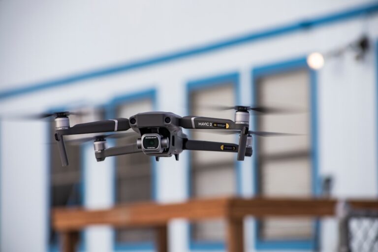
DJI dominates the market for a reason: reliability. Their Mavic 3 Enterprise and Matrice 350 RTK are the workhorses of the conservation world.
| Feature | Rating (1-10) | Notes |
|---|---|---|
| Design & Build | 9 | Rugged, weather-resistant (IP5). |
| Functionality | 10 | Unmatched sensor integration (H20T, P1). |
| Flight Time | 8 | ~45 mins (M350), ~40 mins (Mavic 3E). |
| Software | 9 | DJI Pilot 2 is intuitive but proprietary. |
| Support | 7 | Great globally, but US government bans complicate things. |
Why we love it: The Mavic 3 Thermal is a game-changer for anti-poaching. It’s small, portable, and has a thermal sensor that can spot a human body heat signature from 1km away.
The Catch: The US government ban on DJI sales for federal agencies creates a gray area for some NGOs. However, many state and private groups still use them effectively.
👉 Shop DJI on:
- Amazon: Search DJI Mavic 3 Enterprise
- Brand Official: DJI Enterprise
2. Parot: The Eco-Friendly Choice for Wildlife Researchers
Parot (specifically their ANAFI series) has carved a niche for being silent and eco-conscious.
| Feature | Rating (1-10) | Notes |
|---|---|---|
| Design & Build | 8 | Foldable, carbon fiber arms, lightweight. |
| Functionality | 8 | Great 180° tilt camera, thermal options available. |
| Flight Time | 7 | ~32 mins (ANAFI USA). |
| Software | 8 | FreeFlight 7 is solid, open API for custom apps. |
| Support | 8 | Strong European support, growing US presence. |
Why we love it: The ANAFI USA is incredibly quiet. We once flew it over a nesting colony of sea turtles, and the birds didn’t even flinch. Plus, Parot is a French company with a strong commitment to data sovereignty, which is crucial for international conservation projects.
The Catch: Battery life is slightly shorter than DJI’s heavy lifters, and the payload capacity is limited to the built-in sensors.
👉 Shop Parot on:
- Amazon: Search Parot ANAFI USA
- Brand Official: Parot Drones
3. senseFly: The Heavy Lifter for Large-Scale Mapping
When you need to map thousands of acres of forest, you don’t want a quadcopter. You want a fixed-wing drone like the eBee X from senseFly.
| Feature | Rating (1-10) | Notes |
|---|---|---|
| Design & Build | 9 | Fixed-wing, hand-launched, durable foam. |
| Functionality | 10 | Unbeatable for large-area photogrametry. |
| Flight Time | 10 | Up to 90 minutes! |
| Software | 9 | eMotion is industry-standard for mapping. |
| Support | 8 | Excellent training and support network. |
Why we love it: The eBee X can cover 2,0 acres in a single flight. It’s perfect for deforestation monitoring and creating high-resolution 3D models of terrain.
The Catch: It’s not for wildlife spotting. It’s a mapping tool. You need a runway (or a hand launch) and it’s not great for hovering over a specific animal.
👉 Shop senseFly on:
- Brand Official: senseFly eBee X
4. Wingtra: The Precision Photogrametry for Habitat Analysis
Wingtra takes the fixed-wing concept and adds VTOL (Vertical Take-Off and Landing). No runway needed!
| Feature | Rating (1-10) | Notes |
|---|---|---|
| Design & Build | 10 | Hybrid VTOL, rugged, professional grade. |
| Functionality | 10 | Centimeter-level accuracy with PK/RTK. |
| Flight Time | 9 | ~59 minutes. |
| Software | 10 | WingtraOne software is seamless. |
| Support | 9 | Top-tier enterprise support. |
Why we love it: The WingtraOne GEN II can land in a tiny clearing in the middle of a dense forest, take off vertically, fly a massive mission, and land back where it started. It’s the ultimate tool for vegetation health analysis in remote areas.
The Catch: It’s expensive. This is a professional investment, not a starter kit.
👉 Shop Wingtra on:
- Brand Official: WingtraOne GEN II
5. Quantum Systems: VTOL Power for Remote Conservation Sites
Quantum Systems (specifically the Trinity F90+) is a German engineering marvel designed for extreme environments.
| Feature | Rating (1-10) | Notes |
|---|---|---|
| Design & Build | 10 | Modular, IP43 rated, works in rain/snow. |
| Functionality | 9 | Hybrid VTOL, interchangeable payloads. |
| Flight Time | 9 | ~90 minutes. |
| Software | 8 | Mission Planner is powerful but steep learning curve. |
| Support | 8 | Strong in Europe, growing globally. |
Why we love it: The Trinity F90+ is built to handle harsh weather. If you’re monitoring coastal erosion during a storm or tracking wildlife in the Arctic, this is your bird.
The Catch: The software has a steeper learning curve than DJI or Wingtra.
👉 Shop Quantum Systems on:
- Brand Official: Quantum Systems Trinity
📸 Essential Sensors and Payloads for Green Tech
Buying the drone is only half the battle. The payload is what turns a flying camera into a scientific instrument.
Multispectral and Hyperspectral Imaging for Vegetation Health
You can’t just look at a forest and know if it’s sick. You need to see what the human eye can’t.
- How it works: These sensors capture light in specific bands (Red, Green, Blue, Red Edge, Near-Infrared).
- The Magic: By calculating the NDVI (Normalized Difference Vegetation Index), we can identify stress in plants weeks before they turn yellow.
- Real-World Use: Detecting invasive species or early signs of drought stress in reforestation projects.
- Top Pick: The MicaSense Altum (often paired with DJI or senseFly drones).
Thermal Cameras for Anti-Poaching and Wildlife Tracking
Night is when poachers strike. Thermal sensors are the silent guardians of the night.
- How it works: Detects heat signatures against cooler backgrounds.
- The Magic: A rhino’s body heat is distinct from the surrounding bush, even in total darkness.
- Real-World Use: Anti-poaching patrols in Africa and monitoring nocturnal species like owls or bats.
- Top Pick: DJI H20T or FLIR Vue Pro.
LiDAR Systems for Forest Canopy and Topography Mapping
Sometimes, the ground is hidden by a thick canopy. LiDAR sees through the leaves.
- How it works: Emits laser pulses to measure distance, creating a 3D point cloud.
- The Magic: It can map the forest floor even under dense vegetation, revealing erosion patterns or hidden waterways.
- Real-World Use: Carbon stock estimation and flood risk modeling.
- Top Pick: Riegl miniVUX or DJI Zenmuse L1.
🦅 Wildlife Monitoring and Habitat Preservation Strategies
How do we actually use these tools to save animals? It’s not just about flying around and taking pretty pictures.
The “Silent Observer” Technique
We’ve found that altitude is key. Flying too low scares the animals; flying too high loses detail. The sweet spot is usually 30-50 meters for mammals and 10-20 meters for birds, depending on the species.
- Tip: Use thermal during the day for large mammals and visual at dawn/dusk for birds.
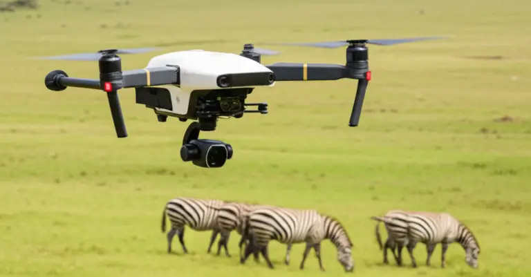
- Anecdote: We once tracked a herd of elephants in Kenya. The thermal camera showed us their path through the tall grass, allowing rangers to intervene before they reached a dangerous area. The elephants didn’t even know were there.
Population Census and Counting
Manual counting is prone to error. Drones provide accurate counts.
- Method: Fly a grid pattern, capture high-res images, and use AI software (like CountFromSpace) to count animals automatically.
- Benefit: Reduces human error and covers areas that are too dangerous for ground teams.
Anti-Poaching Surveillance
This is the most critical application.
- Strategy: Use thermal drones for night patrols.
- Integration: Connect drone feeds to a real-time command center. If a heat signature is detected, rangers are dispatched immediately.
- Success Story: In South Africa, drone patrols have reduced rhino poaching incidents by over 50% in some protected areas.
🌊 Coastal and Marine Conservation Applications
The ocean is vast, and protecting it is a massive challenge. Drones are the eyes in the sky for marine conservation.
Coral Reef Monitoring
Coral bleaching is a silent killer.
- Application: Drones with multispectral sensors can detect changes in coral health and water temperature.
- Benefit: Early detection allows for rapid intervention, such as shading reefs or reducing local pollution.
Marine Mammal Tracking
Whales and dolphins are hard to track from a boat.
- Application: Drones can follow marine mammals without disturbing them, capturing behavior data and counting populations.
- Benefit: Non-invasive data collection that doesn’t alter animal behavior.
Plastic Pollution Mapping
- Application: High-res cameras can identify and map plastic waste on beaches and in shallow waters.
- Benefit: Helps organizations prioritize cleanup efforts and track the source of pollution.
🌲 Mapping and Monitoring Vegetation Health and Deforestation
Forests are the lungs of the planet, and they are under threat. Drones are our first line of defense.
Deforestation Detection
- Method: Compare orthomosaics (stitched aerial images) from different dates to detect illegal logging.
- Speed: What used to take months of satellite analysis can now be done in hours.
- Impact: Real-time alerts allow authorities to stop illegal operations before they cause irreversible damage.
Reforestation and Seed Planting
- Inovation: Companies like Dendra Systems use drones to shoot seed pods into the ground.
- Efficiency: Drones can plant 10,0 trees a day, compared to a human’s 2,0.
- Precision: Drones analyze soil and topography to ensure seeds are planted in the right conditions.
Carbon Stock Estimation
- Method: Use LiDAR to measure tree height and density, calculating carbon storage.
- Importance: Essential for carbon credit markets and climate change mitigation strategies.
🔋 Battery Life, Range, and Logistics in Remote Areas
Let’s talk about the elephant in the room: power. In the middle of the Amazon, you can’t just plug into a wall.
The Battery Reality
- Flight Time: Most consumer drones last 20-30 minutes. Enterprise drones (M350, Wingtra) can last 45-90 minutes.
- Logistics: You need solar chargers, portable generators, or car adapters.
- Tip: Always carry 3x the batteries you think you need. Cold weather drains batteries faster!
Range and Connectivity
- Challenge: In remote areas, cellular networks are non-existent.
- Solution: Use long-range controllers (up to 10km) or satellite links for data transmission.
- Autonomy: Program waypoint missions so the drone can fly the mission without a live connection.
Weather Resistance
- Rain and Wind: Look for IP ratings (e.g., IP5). The DJI M350 and Quantum Trinity are built for this.
- Heat: High temperatures can reduce battery life. Plan flights for early morning or late evening.
⚖️ Legal and Ethical Considerations for Conservation Drones
Just because you can fly, doesn’t mean you should. There are rules and ethics to follow.
Regulatory Compliance
- FA (USA): You need a Part 107 license for commercial work.
- International: Rules vary wildly. Some countries require special permits for conservation work.
- Tip: Always check local regulations before deploying.
Wildlife Disturbance
- Ethics: Never fly too close to nesting sites or stressed animals.
- Best Practice: Maintain a safe distance and use thermal to minimize visual disturbance.
Data Privacy
- Issue: Drones can accidentally capture images of people.
- Solution: Use blurring software and establish clear data protocols.
🤝 How Conservation Groups Can Partner with Drone Experts
Not every NGO has the budget or expertise to buy and fly drones. That’s where partnerships come in.
Service Providers
- GlobHe: Connects conservationists with local drone pilots.
- Birds Eye Aerial Drones: Offers specialized services for environmental monitoring in California.
- Agribotix: Donates drone use to organizations like The Nature Conservancy.
Training and Capacity Building
- Workshops: Many organizations offer training for local rangers.
- Knowledge Transfer: Ensuring that local communities can maintain and operate the technology.
Data Sharing
- Collaboration: Share data with researchers and governments to maximize impact.
- Open Data: Some organizations make their data publicly available to aid global conservation efforts.
📊 Case Studies: Real-World Success Stories in Environmental Protection
Let’s look at some real-world wins.
Case Study 1: The Nature Conservancy (Colorado)
- Challenge: Monitoring bison herds inaccessible terrain.
- Solution: Used drones with infrared cameras to track herds and map vegetation.
- Result: Improved land management and reduced human-wildlife conflict.
Case Study 2: Anti-Poaching in Africa
- Challenge: Rhinos being poached at night.
- Solution: Deployed thermal drones for night patrols.
- Result: Significant reduction in poaching incidents.
Case Study 3: Mangrove Restoration (Delta Blue Carbon)
- Challenge: Restoring mangroves in hard-to-reach areas.
- Solution: Used drones to map and plant mangroves.
- Result: One of the largest mangrove restoration projects in the world.
🛠️ Choosing the Right Drone Brand for Your Specific Mission
So, how do you pick? It depends on your mission.
| Mission Type | Recommended Brand | Key Feature |
|---|---|---|
| Wildlife Tracking | DJI (Mavic 3 Thermal) | Thermal sensor, portability |
| Large Area Mapping | senseFly (eBee X) | Long flight time, fixed-wing |
| Forestry/LiDAR | Wingtra (WingtraOne) | VTOL, high precision |
| Extreme Weather | Quantum Systems (Trinity) | Rugged, modular |
| Budget/Entry | Parot (ANAFI) | Silent, affordable |
Final Tip: Don’t just buy the most expensive drone. Buy the one that fits your specific needs and budget.
🔮 Conclusion: Embracing the Sky-High Future of Conservation

We started this journey wondering if drones were just a fad. Now, we know they are essential. From tracking rhinos in the dark to planting forests in the clouds, drones are changing the game.
The Future is Bright:
- AI Integration: Drones that can identify species and threats in real-time.
- Swarm Technology: Hundreds of drones working together to map vast areas.
- Autonomous Planting: Drones that not only map but also replant forests.
Our Recommendation:
If you’re a conservationist, start small. Get a DJI Mavic 3 Thermal or a Parot ANAFI USA. Learn the ropes, get your license, and start making a difference. The sky is not the limit; it’s just the beginning.
Remember: “The best camera is the one you have with you.” Whether it’s a $50 drone or a $20,0 rig, the most important thing is the data you collect and the impact you make.
🔗 Recommended Links
Ready to take flight? Here are our top picks for gear and resources:
- DJI Mavic 3 Thermal: Amazon | DJI Official
- Parot ANAFI USA: Amazon | Parot Official
- senseFly eBee X: senseFly Official
- WingtraOne GEN II: Wingtra Official
- Quantum Systems Trinity F90+: Quantum Systems Official
- Book: “Drone Technology for Conservation” on Amazon
❓ FAQ

What are the best drones for aerial surveys in environmental projects?
For large-scale surveys, fixed-wing drones like the senseFly eBee X or WingtraOne are unbeatable due to their long flight times and high-resolution mapping capabilities. For smaller, more targeted surveys, the DJI Mavic 3 Enterprise is a versatile choice.
Read more about “🚁 8 Stats Proving Drones Are Rewilding the Planet (2026)”
How do drones from leading brands contribute to forest and habitat preservation?
Drones equipped with multispectral sensors can detect vegetation stress before it’s visible to the human eye. LiDAR systems map the forest floor, helping to estimate carbon stocks and detect illegal logging.
Are there affordable drone brands suitable for environmental monitoring?
Yes! The Parot ANAFI USA and DJI Mini 4 Pro (with thermal attachments) offer excellent value for entry-level conservation work. They provide high-quality data without the enterprise price tag.
Read more about “🏗️ 7 Top Drone Brands for Construction Monitoring & 3D Modeling (2026)”
What features should I look for in drones for conservation purposes?
Look for thermal imaging, multispectral capabilities, long flight time, weather resistance, and quiet operation. RTK/PPK for precise geotaging is also crucial for mapping.
Read more about “🚁 1.5M+ Flyers: Latest Recreational Drone Stats (2026)”
Which drone manufacturers offer models specifically designed for environmental research?
DJI (Mavic 3 Thermal, Matrice 350), senseFly (eBee X), Wingtra (WingtraOne), and Quantum Systems (Trinity) all offer models tailored for research and conservation.
How do drones help in wildlife monitoring and which brands specialize in this?
Drones with thermal cameras can spot animals in dense vegetation or at night. DJI and Parot are popular choices due to their quiet operation and thermal capabilities.
What innovations are leading drone brands introducing for conservation projects?
Inovations include AI-powered species identification, autonomous seed planting, and swarm technology for large-area monitoring.
How do drone brands differ in their capabilities for aerial environmental surveys?
Fixed-wing drones (senseFly, Wingtra) excel at covering large areas quickly. Quadcopters (DJI, Parot) are better for detailed, close-up inspections and hovering.
Read more about “🚁 Top 5 Commercial Drone Brands for Infrastructure Inspection (2026)”
Are there affordable drones suitable for environmental monitoring?
Yes, the DJI Mini 4 Pro and Parot ANAFI are affordable options that still provide high-quality data for many conservation tasks.
Read more about “🚜 10 Top Agricultural Drone Brands for Precision Farming (2026)”
What features should I look for in drones for environmental research?
Key features include high-resolution cameras, thermal sensors, long battery life, weather resistance, and open API for custom data processing.
Read more about “States Banning DJI Drones … 🚫🛩️”
Which drone models are most effective forest conservation efforts?
The senseFly eBee X and WingtraOne are top choices forest mapping due to their ability to cover large areas and penetrate canopies with LiDAR.
Read more about “🚀 25 Future Drone Ideas That Will Change the World (2026)”
How do drones help in wildlife monitoring and which brands are best?
Drones help by providing non-invasive monitoring and thermal imaging. DJI and Parot are highly regarded for their quiet operation and thermal capabilities.
Read more about “Where Can I Fly My Drone? Top 5 Apps to Know in 2026 🚁”
What are the top drone brands used for environmental conservation?
DJI, senseFly, Wingtra, Parot, and Quantum Systems are the top brands, each excelling in different areas of conservation work.
Read more about “📊 10+ Shocking Drone Usage Statistics for Environmental Monitoring (2026)”
📚 Reference Links
- The Nature Conservancy: Colorado Drones for Conservation
- FAO: Deforestation Statistics
- Dendra Systems: Reforestation with Drones
- GlobHe: Drone Data for Conservation
- Birds Eye Aerial Drones: Environmental Conservation in California
- FA Drone: The Role of UAVs in Environmental Monitoring
- DJI: Enterprise Solutions
- Parot: ANAFI USA
- senseFly: eBee X
- Wingtra: WingtraOne
- Quantum Systems: Trinity F90+