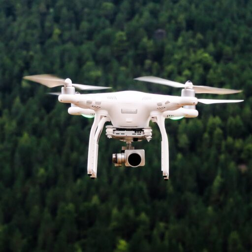
Support our educational content for free when you purchase through links on our site. Learn more
AI Rescue Drones for Backcountry Safety 🚁

AI-powered emergency response drones for backcountry safety can shorten search times, reduce rescuer exposure, and deliver critical eyes over terrain that humans cannot safely reach. Our recommendation is to use them as a human-supervised force multiplier, combining thermal imaging, visible-light zoom, mapping, resilient communications, and trained search-and-rescue teams.
A drone may spot a lost hiker across a canyon, identify a wildfire hot spot, map a washed-out trail, or guide rescuers toward an avalanche debris field. But AI is not a wilderness wizard: dense canopy, snow, heat-soaked rocks, weather, weak signals, and wildlife can all create missed detections or false alarms.
We have watched a thermal camera flag what looked like a person, only to reveal a sun-warmed boulder on the verification pass. We have also seen the reverse: a tiny movement near a treline become a genuine rescue lead once the operator switched from thermal to optical zoom. That second camera angle can be the difference between “keep searching” and “send the team.”
The most capable systems pair AI detection with rugged aircraft such as the DJI Matrice series, autonomous platforms from Skydio, thermal aircraft from Autel Robotics, and emerging long-endurance concepts such as IvedaAir. The winning setup is not necessarily the aircraft with the longest flight time; it is the one that delivers verified information to the right rescuers quickly and safely.
Key Takeaways
- AI drones accelerate wilderness searches by scanning steep, remote, smoky, snowy, or dangerous terrain before ground teams enter.
- Thermal imaging and visible-light zoom work best together. Thermal alerts require human verification because rocks, animals, shadows, and vehicles can mimic people.
- AI does not replace pilots or rescuers. Human oversight remains essential for flight safety, medical decisions, privacy, airspace coordination, and victim extraction.
- The best rescue platforms match the mission: compact multirotors for rapid searches, docked systems for routine patrols, fixed-wing aircraft for broad coverage, and long-endurance rotorcraft for persistent overwatch.
- Weather, battery life, terrain, GPS availability, and communications can limit performance far sooner than a product brochure suggests.
- Drones can support medical supply delivery, but payload integrity, safe drop procedures, authorization, and a trained recipient are all required.
- Backcountry travelers should still carry a personal locator beacon or satellite messenger. A rescue drone can find a location faster when rescuers receive accurate coordinates.
- The strongest programs combine drones with helicopters, ground teams, rescue dogs, GIS mapping, radios, and incident command, rather than treating one aircraft as a complete rescue system.
Table of Contents
-
⚡ Quick Tips and Facts: AI Emergency Drones for Backcountry Safety
-
🏔️ How AI-Powered Emergency Response Drones Are Changing Backcountry Rescue
-
The Role of Public Safety, Search-and-Rescue, and Government Agencies
-
📡 Drone Sensors and Payloads for Wilderness Search and Rescue
-
Choosing Sensors for Forests, Snow, Canyons, and Open Terrain
-
5. Coordinating Ground Teams, Helicopters, and First Responders
-
How Snow, Rocks, Shadows, and Wildlife Confuse Detection Models
-
FAA Rules for Public Safety Drone Operations in the United States
-
Cordinating With Fire Departments, EMS, Police, and Volunteers
-
Using Bright Clothing, Lights, Whistles, and Emergency Beacons
-
🧰 Complementary Technologies for Wilderness Emergency Response
-
📚 Real-World Use Cases and Lessons From Public Safety Operations
-
Humanitarian, Maritime, and Cross-Border Rescue Applications
-
✅ Quick Decision Guide: Are AI Rescue Drones Right for Your Team?
-
Best Fit for Parks, Counties, and Emergency Management Agencies
-
Can rescue drones fly beyond the pilot’s visual line of sight?
-
Are drone operations allowed in national parks and wilderness areas?
Quick Tips and Facts: AI Emergency Drones for Backcountry Safety
A missing hiker does not care whether the rescue aircraft is a quadcopter, helicopter-style UAV, or a flying toaster with excellent thermal imaging. They need eyes overhead, accurate coordinates, and help moving quickly.
At Drone Brands™, we fly and evaluate drones for aerial adventures, public safety, mapping, and difficult terrain. Our short version: AI-powered emergency response drones can dramatically improve wilderness search-and-rescue, but they are force multipliers, not autonomous superheroes.
If you are exploring the commercial side of aerial work, our guide to drone business ideas explains how emergency-response services fit into the broader drone industry.
Quick-reference facts
| Question | Practical answer |
|---|---|
| What does “AI-powered” mean? | Software analyzes live or recorded sensor data to detect people, vehicles, heat signatures, smoke, objects, or unusual movement. |
| Can AI find every lost hiker? | ❌ No. Forest canopy, shadows, snow, rocks, weather, clothing, and weak thermal contrast can all produce missed detections. |
| Why use a drone? | ✅ It can cover steep, dangerous, or inaccessible terrain faster than ground teams and often with less risk. |
| Does AI replace a pilot? | ❌ No. A trained remote pilot, visual observer, incident commander, or qualified mission supervisor remains essential. |
| Are thermal cameras enough? | ❌ No. Thermal imaging is powerful, but it works best when combined with visible-light zoom, mapping, GPS, and human verification. |
| Which drone type lasts longest? | Electric multirotors are agile and quiet; fixed-wing aircraft cover large areas; hybrid and gas-powered rotorcraft can support longer missions. |
| What does IvedaAir claim? | Iveda describes its helicopter-style IvedaAir line as offering more than 150 minutes of flight endurance, AI-assisted analytics, encrypted video, and emergency payload capability. |
| Can drones deliver medical supplies? | ✅ Some systems can carry small emergency payloads, but delivery requires aviation authorization, payload testing, safe drop procedures, and medical coordination. |
| Can drones fly anywhere in the backcountry? | ❌ No. Airspace, national park restrictions, privacy rules, weather, terrain, and aviation regulations still apply. |
| What should hikers carry? | A personal locator beacon or satellite messenger remains one of the best ways to send reliable distress coordinates. See guidance from the National Park Service and NOAA Search and Rescue Satellite-Aided Tracking. |
The 30-second safety takeaway
- Call emergency services early if someone is missing, injured, trapped, or exposed to dangerous weather.
- Share the person’s last known location, planned route, clothing, equipment, medical condition, and phone or beacon coordinates.
- Do not send untrained volunteers into avalanche terrain, wildfire zones, floodwater, or unstable slopes.
- Rescue drones can search, map, illuminate, communicate, and sometimes deliver supplies, but a drone sighting is not the same as a rescue handoff.
- If a drone reaches you, stay visible, conserve energy, and follow instructions from the rescue team.
What these drones can and cannot do
✅ What AI rescue drones do well
- Search large areas without placing a rescuer on a cliff, unstable slope, or active fire line.
- Use thermal and visible cameras together to identify possible people.
- Stream live video to an incident command post.
- Build orthomosaics, elevation models, and damage maps.
- Track smoke, floodwater, vehicles, or moving subjects.
- Relay communications when terrain blocks radio coverage.
- Deliver lightweight items such as tourniquets, radios, blankets, or automated external defibrillator equipment, where the aircraft and mission are approved for that task.
- Maintain overwatch while ground teams approach.
❌ What they do poorly or cannot safely do
- Guarantee detection through dense tree canopy.
- Identify every warm object correctly.
- Operate indefinitely in wind, rain, snow, icing, or smoke.
- Replace wilderness medics, rope teams, avalanche dogs, or helicopters.
- Fly beyond regulatory limits simply because the AI can plot a route.
- Determine a victim’s medical condition from a camera alone.
- Carry heavy rescue loads on a small multirotor.
- Make ethical or tactical decisions without qualified human supervision.
We have watched a thermal operator flag a “person” that turned out to be a sun-warmed boulder. We have also seen a person-shaped gap in vegetation become a real subject on the second camera angle. The best systems create good leads; the rescue team creates certainty.
A useful mental model
Think of AI as a tireless assistant scanning thousands of frames. It highlights suspicious pixels, prioritizes search zones, and notices patterns. The pilot and rescue specialists still ask:
- Is that heat signature a person or animal?
- Is the aircraft looking at the correct slope?
- Can rescuers reach the location safely?
- Has the subject moved?
- Is a helicopter, rope team, boat, or ground crew required?
The 30-second safety takeaway for agencies
For public-safety teams, an effective program usually combines:
- A rugged aircraft with redundant navigation.
- A radiometric or high-resolution thermal camera.
- A visible-light zoom camera.
- A secure command-and-control link.
- A documented search plan.
- Trained pilots and observers.
- A data-sharing procedure compatible with incident command.
- Clear rules for privacy, evidence, and retention.
- A backup aircraft or battery plan.
- Regular exercises in realistic terrain.
For equipment planning, compare our Commercial Drones and Drone Accessories guides before buying a platform that looks impressive in a showroom but sulks in mountain wind.
How AI-Powered Emergency Response Drones Are Changing Backcountry Rescue
A conventional search begins with incomplete information: a last-known point, a rough trail description, a phone that may or may not connect, and weather that is getting worse by the minute. AI-enabled drones add a second layer of intelligence above the terrain.
They can help answer the question rescuers often face first: where should we look next?
From manual search flights to intelligent aerial response
Traditional drone operations typically involve a pilot flying a planned grid while a visual observer or payload operator watches the video feed. That remains useful, especially for small agencies and volunteer teams.
AI adds tools such as:
- Automated person detection.
- Thermal anomaly alerts.
- Object classification.
- Trail and road recognition.
- Smoke and fire-line analysis.
- Change detection between image sets.
- Automated geotaging.
- Search-area prioritization.
- Subject tracking.
- Route planning around terrain and obstacles.
The Federal Aviation Administration treats the aircraft as an unmanned aircraft system, or UAS, regardless of whether an algorithm assists the pilot. In other words, adding AI does not remove aviation responsibility.
Why the shift matters
A payload operator can review one video feed closely. An AI model can scan multiple streams, compare frames, and highlight unusual shapes across a broad search corridor. That can reduce cognitive overload during a stressful mission.
But alerts must be treated as search leads, not proof. A yellow box around a shape is not a medical diagnosis, and “confidence: 92%” does not mean the system is correct 92% of the time in every forest, canyon, or snowfield.
Why remote wilderness missions need AI assistance
Backcountry searches create a particularly nasty combination of problems:
- Large search areas.
- Broken terrain and steep elevation changes.
- Limited roads and landing zones.
- Weak cellular service.
- Rapid weather shifts.
- Nightfall.
- Similar-looking vegetation.
- Clothing that blends with the landscape.
- Fatigued operators and rescuers.
- Multiple simultaneous incidents during wildfire, storms, or flooding.
A drone can reduce some of these pressures by providing an overhead view before ground crews commit to a route. It can also mark hazards that are difficult to see from a trail-level perspective.
The National Search and Rescue Plan emphasizes coordinated search-and-rescue responsibilities across federal, state, local, tribal, and volunteer organizations. AI drones fit into that structure best when they feed useful information to the existing command system rather than operating as an isolated gadget.
The role of public safety, search-and-rescue, and government agencies
A drone program may involve:
- County sheriff’s offices.
- Fire and rescue departments.
- Emergency medical services.
- National, state, and local park authorities.
- Volunteer mountain rescue teams.
- Civil Air Patrol.
- Tribal emergency-management organizations.
- Utility and infrastructure operators.
- Disaster-response contractors.
- Commercial drone service providers.
The strongest programs define responsibilities before an emergency:
| Role | Typical responsibility |
|---|---|
| Incident commander | Sets priorities, approves operational objectives, coordinates agencies. |
| Remote pilot in command | Operates the aircraft and manages aviation safety. |
| Visual observer | Watches airspace, terrain, people, and hazards. |
| Sensor operator | Controls cameras and reviews AI alerts. |
| GIS specialist | Converts imagery into maps, coordinates, and search products. |
| Rescue team leader | Determines how ground, rope, medical, or aviation teams approach. |
| Data custodian | Controls video access, retention, and evidence handling. |
| Public information officer | Communicates verified information to families and the public. |
Perspective from the BRINC emergency-response video
The featured BRINC video presents a useful public-safety perspective: drones can place “eyes on scene in seconds,” provide an AED in a forest emergency, support situational awareness around a port fire, and help de-escalate a dangerous encounter before officers make first entry.
That vision is compelling, but it also reveals the operational requirement hiding underneath: the aircraft must connect to a trained response system. A drone delivering an AED only helps if someone can safely reach the landing or drop location, retrieve the equipment, and use it correctly.
How AI Search-and-Rescue Drones Work
An emergency drone is a chain of systems, not one magic feature. The aircraft, flight controller, sensors, AI software, communications network, mapping platform, and human operators must all cooperate.
Autonomous flight planning and route optimization
Most rescue missions begin with a search area. The area may be based on:
- A last-known GPS coordinate.
- A trailhead and planned route.
- A mobile-phone location.
- A satellite-messenger position.
- Witness reports.
- Avalanche debris modeling.
- Flood or wildfire spread.
- A predicted travel corridor.
The software then divides the area into search segments.
Step-by-step search-grid planning
- Collect the incident data
- Last known point.
- Time last seen.
- Direction of travel.
- Terrain.
- Weather.
- Subject description.
- Available aircraft and sensors.
- Define the operating boundary
- Search polygon.
- No-fly zones.
- Roads, power lines, airports, helipads, and populated areas.
- Safe launch and recovery locations.
- Select the altitude and sensor overlap
- Higher altitude covers more ground but reduces detail.
- Lower altitude improves resolution but increases terrain and obstacle risk.
- Thermal and visible imagery may require different flight paths.
- Set the pattern
- Parallel lawnmower grid.
- Expanding square.
- Contour-following route.
- Point-of-interest orbit.
- Corridor search along a trail or river.
- Add contingency behavior
- Return to home.
- Hold position.
- Land at a safe site.
- Divert around an obstacle.
- Switch to a backup communications link.
- Review the plan
- A human verifies altitude, range, weather, airspace, and battery reserves.
- Launch and adapt
- AI and operators update the search based on terrain, detections, changing weather, and new witness information.
The National Institute of Standards and Technology researches public-safety technology and communications performance, but agencies still need local testing. A route that works in a flat training field may fail immediately in a canyon where radio signals bounce and GPS becomes unreliable.
Computer vision for human detection
Computer vision models analyze pixels for patterns that resemble:
- Human body shapes.
- Heads, limbs, backpacks, or clothing.
- Skin-tone or color contrasts.
- Motion.
- Thermal signatures.
- Reflective materials.
- Emergency blankets.
- Vehicles or overturned equipment.
The model may draw a bounding box or produce a confidence score. The operator then zooms, changes camera angle, compares visible and thermal views, and marks the location.
Why visible-light AI still matters
Thermal cameras are not always the hero. In bright daylight, a high-resolution visible camera may identify:
- A bright jacket.
- A trekking pole.
- A tent.
- A backpack.
- Footprints.
- A reflective emergency blanket.
- A person waving.
Visible imagery also provides context that thermal video often lacks. A warm patch may be a human, animal, sunlit rock, or engine. The visible camera helps explain the scene.
Thermal imaging and nighttime victim location
Thermal sensors detect infrared radiation and display temperature differences. They are useful when:
- A person is warmer than the surrounding ground.
- Night has reduced visible-light contrast.
- A subject is near a snowfield.
- Smoke limits ordinary cameras.
- The search area is too broad for close visual inspection.
However, thermal detection has limits:
- Dense leaves can block or soften a body signature.
- Wet clothing reduces useful contrast.
- Rocks retain heat after sunset.
- Sun-heated surfaces can resemble people.
- Animals produce human-like heat patterns.
- A person under a blanket or canopy may be partially hidden.
- Strong wind can rapidly cool exposed skin and clothing.
- Hot ground can overwhelm a weak signature.
The National Oceanic and Atmospheric Administration explains how heat moves through the environment; that same physics affects thermal search performance. A thermal camera does not “see through” everything. It measures detectable infrared differences from the surfaces it can observe.
LiDAR, radar, GPS, and terrain mapping
LiDAR
LiDAR uses laser pulses to measure distance and can help produce:
- Digital elevation models.
- Canopy and vegetation maps.
- Slope measurements.
- Rockfall and landslide assessments.
- Flood and debris mapping.
It is especially valuable after disasters or when a team needs a detailed terrain model, though LiDAR payloads can add weight and reduce endurance.
Radar
Radar can support:
- Obstacle detection.
- Terrain awareness.
- Poor-visibility navigation.
- Ground or weather observation.
Radar is not a guaranteed person detector. Its usefulness depends on the sensor, frequency, terrain, software, and mission conditions.
GPS and GNSS
GPS or other GNSS positioning allows the aircraft to:
- Follow a search grid.
- Tag imagery.
- Return to a launch point.
- Mark a possible subject.
- Share coordinates with rescuers.
A canyon, dense forest, or electromagnetic interference can weaken positioning. A good system combines satellite navigation with inertial sensors, visual navigation, terrain awareness, and conservative human oversight.
Mapping outputs
| Output | Rescue value |
|---|---|
| Live video | Immediate situational awareness. |
| Geotaged still image | Quick evidence of a possible subject or hazard. |
| Orthomosaic | Broad-area map stitched from overlapping photographs. |
| Digital elevation model | Helps plan routes across slopes, cliffs, and drainage channels. |
| 3D point cloud | Useful for terrain, structures, and landslide analysis. |
| Change map | Shows what changed after a fire, flood, avalanche, or storm. |
Edge AI versus cloud-based drone intelligence
Edge AI
The algorithm runs on the aircraft or local ground station.
Advantages:
- Lower latency.
- Can continue when internet service is unavailable.
- Better for sensitive operations.
- Faster alerts.
- Less dependence on a distant server.
Drawbacks:
- Limited computing power.
- Battery consumption.
- Model updates may require maintenance.
- Performance can vary with onboard hardware.
Cloud AI
The drone transmits data to a remote server for analysis.
Advantages:
- More computing resources.
- Easier model updates.
- Centralized fleet management.
- Convenient multi-agency access.
Drawbacks:
- Requires a reliable connection.
- Adds latency.
- Creates data-security and retention questions.
- May fail in remote terrain.
For backcountry safety, we generally prefer edge or hybrid processing. A drone should be able to raise a local alert even when a mountain blocks the broadband link. Platforms such as IvedaAI emphasize real-time analytics and secure video workflows, while agencies should verify exactly which functions run onboard, at the edge station, or in the cloud.
How drones share live data with rescue teams
A rescue operation may use:
- 4G or 5G.
- LTE.
- Dedicated radio links.
- Mesh networking.
- Microwave links.
- Satellite communications.
- Portable cellular towers.
- A relay drone positioned above a canyon.
- Wired or local storage when no link is available.
Iveda’s published IvedaAir material describes 4G/5G and LTE image transmission and encrypted communications. Those capabilities may be valuable, but coverage remains geography-dependent. A drone cannot create a perfect network simply by flying higher.
A practical data flow
- Camera captures video.
- Onboard or ground AI analyzes frames.
- Operator verifies an alert.
- System records coordinates and time.
- Incident command receives the live view or still image.
- GIS staff place the detection on the operational map.
- Ground or air teams receive the location.
- The drone remains overhead to guide the approach.
The moment that flow breaks, mission quality drops. That is why resilient communications and clear fallback procedures matter as much as camera resolution.
12 Essential Backcountry Emergency Missions for AI Drones
1. Lost hiker and missing-person searches
Missing-person searches are the most obvious fit for AI-assisted drones. A team can search trails, ridgelines, clearings, riverbanks, and likely shelter locations while ground rescuers work from the most probable route.
Best sensor combination
- Thermal camera for temperature contrast.
- High-resolution visible camera.
- Optical zoom.
- Spotlight for night operations.
- Loudspeaker for two-way instructions.
- Accurate GNSS tagging.
- Search-grid software.
Recommended workflow
- Establish the subject profile and last-known point.
- Rank likely movement corridors.
- Search high-probability zones first.
- Use visible and thermal cameras together.
- Verify every AI alert from two angles.
- Mark false positives to prevent repeated searching.
- Keep the drone available to guide rescuers after detection.
A drone does not merely search for a person; it helps allocate scarce rescue resources. That distinction matters when the search area expands faster than the team.
2. Avalanche victim detection
Avalanche response is time-sensitive and hazardous. Drones can help assess the debris field, identify transceiver search zones, and observe secondary avalanche risk.
Useful payloads and functions
- Thermal camera for exposed or partially buried subjects.
- High-resolution visual camera.
- LiDAR or mapping payload for debris measurement.
- Loudspeaker for communication.
- Beacon or communications relay.
- Terrain-aware flight planning.
Critical limitations
- A buried victim may not produce a detectable thermal signature.
- Snow temperature and wind affect contrast.
- Rotor wash can disturb loose snow.
- The aircraft may become difficult to control in spindrift.
- Drone operations must not distract from transceiver, probe, dog, and visual searches.
The American Avalanche Association and local avalanche centers provide terrain and safety resources. A drone should support avalanche professionals, not encourage untrained people to enter a live avalanche path.
3. Wildland fire mapping and early smoke detection
Fire missions require distance, thermal awareness, and strict coordination with crewed aviation. Drones can help identify:
- Active fire edges.
- Hot spots.
- Spot fires.
- Smoke movement.
- Blocked roads.
- Evacuation-route conditions.
- Isolated people or structures.
The National Interagency Fire Center and U.S. Forest Service provide authoritative wildfire information and operational context.
Why AI helps
An algorithm can compare thermal imagery over time and flag a hot spot that is growing or moving. That creates a faster review process for incident teams.
The hard rule
Never launch an unauthorized drone near active wildfire aircraft. Crewed firefighting aircraft may be grounded when an unknown drone enters the airspace, potentially delaying water drops or retardant operations.
4. Flood, flash-flood, and landslide assessment
Drones can inspect areas that are too unstable or isolated for immediate ground access.
They may locate:
- Stranded people.
- Washed-out roads.
- Damaged bridges.
- Blocked drainage channels.
- New landslide scars.
- Vehicles in floodwater.
- Safe landing or approach zones.
Sensor choices
| Situation | Preferred sensor |
|---|---|
| Person in open water | Visible camera, thermal camera, zoom. |
| Mudslide area | RGB mapping camera, LiDAR, thermal for survivors. |
| Destroyed bridge | High-resolution RGB, oblique imaging, LiDAR. |
| Night flood search | Thermal, spotlight, zoom camera. |
| Poor communications | Local recording plus relay aircraft or portable network. |
Water reflections, wet surfaces, and debris can produce confusing imagery. Human interpretation remains essential.
5. Mountain rescue and technical climbing incidents
A drone can inspect a cliff face before sending a rope team, observe a climber’s position, and guide rescuers around rockfall or unstable snow.
Useful functions include:
- Orbiting a cliff or ridgeline.
- Providing live video to a rescue commander.
- Delivering a radio, water, thermal blanket, or small medical kit.
- Using a spotlight or speaker.
- Mapping anchors, ledges, and access routes.
- Monitoring the subject while a team climbs.
A small multirotor is nimble, but wind turbulence around cliffs is unforgiving. A larger aircraft may have better stability but also needs more space and greater separation from the subject.
6. Wilderness medical supply delivery
Medical delivery is one of the most promising and most misunderstood uses. A drone can potentially deliver:
- AED equipment.
- Tourniquets.
- Pressure dressings.
- Hemorrhage-control kits.
- Epinephrine auto-injectors where authorized.
- Naloxone where authorized.
- Water and thermal blankets.
- Radios or satellite communicators.
- Diagnostic equipment.
The American Heart Association provides CPR and AED guidance, while local EMS protocols determine what equipment should be carried and who may use it.
Delivery methods
| Method | Benefits | Risks |
|---|---|---|
| Land and retrieve | Precise and simple for suitable terrain. | Requires a safe landing surface. |
| Lower by winch | Useful above a trail, boat, or ledge. | Adds weight, complexity, and entanglement risk. |
| Controlled drop | Fast over open ground. | Payload damage, landing uncertainty, bystander hazard. |
| Release in a protective container | Reduces impact risk. | Still requires accurate placement and retrieval. |
The phrase “minutes matter,” used by GlobalMed CEO Joel E. Barthelemy in Iveda’s emergency-response discussion, captures the medical case well. Yet speed without a safe handoff can create another emergency. The delivery plan needs a recipient, instructions, location confirmation, and a medically appropriate payload.
7. Emergency communications and cellular relay support
A drone can act as a temporary communications node above a canyon or disaster area. This may help:
- Rescue teams coordinate.
- A stranded traveler send a message.
- A command post reach crews beyond a ridge.
- A medical team transmit patient information.
- A public-safety agency share maps and video.
Relay missions consume endurance and may require a larger aircraft or tethered system. A battery multirotor hovering as a relay may not stay aloft long enough for a prolonged incident.
8. Remote trail, bridge, and road damage inspection
After storms, earthquakes, avalanches, and wildfires, drones can inspect access routes before crews travel.
AI can assist with:
- Cracked bridge decks.
- Missing trail sections.
- Fallen trees.
- Washed-out roads.
- Rockfall.
- Flood depth indicators.
- Power-line damage.
- Blocked culverts.
High-resolution mapping creates a record for engineers and emergency managers. It can also reveal a safer alternative route for rescuers.
9. Water rescue on remote lakes and rivers
Drones can provide an overhead view of:
- A person overboard.
- A capsized kayak.
- A swimmer carried downstream.
- A stranded rafting group.
- Ice-water incidents.
- Debris hazards.
Thermal cameras are less reliable over water because the surface may be near body temperature, wind disturbs the signature, and reflections confuse visual detection. A zoom camera, spotlight, loudspeaker, and flotation payload may be more useful.
A drone should not fly so close to a rescue boat or helicopter that it creates a collision hazard. The U.S. Coast Guard provides maritime safety resources and remains the relevant authority for many water-rescue contexts.
10. Severe weather, storm, and lightning response
Drones can inspect damage after a storm, but launching during active lightning, severe wind, hail, or tornado conditions may be unsafe.
After the danger passes, they can identify:
- Downed lines.
- Blocked roads.
- Isolated homes.
- Roof damage.
- Flooded crossings.
- Broken communication infrastructure.
- Safe access routes.
AI change detection is particularly useful when before-and-after imagery exists.
11. Wildlife conflict and conservation patrols
Backcountry safety includes preventing dangerous interactions between people and wildlife. Drones can monitor:
- Illegal campfires.
- Wildlife corridors.
- Injured animals.
- Poaching indicators.
- Human-wildlife conflict zones.
- Crowded trail conditions.
The U.S. Fish and Wildlife Service provides conservation guidance. Operators must balance safety with disturbance concerns. A drone that helps locate an injured hiker could also stress nesting birds or drive wildlife toward roads if used carelessly.
12. Post-disaster damage documentation
Once immediate rescue priorities are addressed, drones help document:
- Burn perimeters.
- Flood extent.
- Landslide volume.
- Damaged infrastructure.
- Search coverage.
- Recovery progress.
- Environmental change.
AI can compare imagery across dates, but agencies should preserve original files and metadata. An AI-generated map is a useful product; it should not replace the original evidence.
Drone Sensors and Payloads for Wilderness Search and Rescue
Thermal cameras for heat signatures
Thermal performance depends on more than sensor resolution. Consider:
- Detector resolution.
- Lens field of view.
- Optical zoom.
- Digital zoom quality.
- Refresh rate.
- Radiometric capability.
- Temperature range.
- Image stabilization.
- Calibration.
- Low-temperature performance.
- Weather sealing.
A thermal camera with a narrow field of view may identify a distant subject clearly but search slowly. A wide lens covers more ground but may produce tiny, ambiguous signatures.
High-resolution zoom cameras
Visible-light zoom is valuable for:
- Confirming thermal alerts.
- Reading trail signs.
- Identifying clothing.
- Inspecting vehicles.
- Examining cliff ledges.
- Communicating with a subject through gestures or a speaker.
A good rescue payload usually allows the operator to switch quickly between wide, medium, and narrow views. If the pilot has to fight the interface while the drone drifts toward a tree, the camera specification becomes academic rather quickly.
Multispectral and hyperspectral imaging
These sensors can reveal differences in vegetation, moisture, soil, or materials that ordinary RGB cameras miss. They are more relevant to:
- Fire and vegetation stress.
- Search-area mapping.
- Landslide assessment.
- Water contamination.
- Environmental monitoring.
They are less likely to be the first-choice payload for a fast missing-hiker search unless the mission includes broader terrain analysis.
Speaker, spotlight, strobe, and searchlight payloads
Speaker
A speaker can deliver instructions such as:
- “Stay where you are.”
- “Help is coming.”
- “Move toward the clearing.”
- “Wave your flashlight.”
- “Do not cross the river.”
Sound quality and terrain matter. A canyon can echo instructions into confusion, so messages should be short and repeated.
Spotlight and strobe
These help with:
- Night identification.
- Signaling.
- Landing-zone marking.
- Drawing attention to the aircraft.
A spotlight can also reduce night vision for the subject or rescuers if used carelessly. Use controlled intensity and avoid dazzling pilots or ground teams.
Medical payloads and emergency supply drops
Payload systems need:
- Secure attachment.
- Weight and balance testing.
- Impact protection.
- Temperature control where necessary.
- Tamper evidence.
- Drop-location confirmation.
- Retrieval instructions.
- Decontamination procedures.
- Chain-of-custody documentation.
An AED is not a “drop anything anywhere” object. It must arrive intact, remain accessible, and be used by someone trained or guided by emergency dispatch.
Choosing sensors forests, snow, canyons, and open terrain
| Terrain | Strong sensor package | Main challenge |
|---|---|---|
| Dense forest | Thermal, zoom RGB, LiDAR, obstacle sensing | Canopy blocks line of sight. |
| Snowfield | Thermal, RGB, mapping camera | Snow can hide victims and create low contrast. |
| Rocky canyon | Thermal, zoom RGB, terrain radar, relay communications | GPS and radio shadowing. |
| Open desert | Thermal, RGB, multispectral optional | Heat-soaked ground and few visual clues. |
| Wetland | Zoom RGB, thermal, mapping camera | Water reflections and soft landing areas. |
| Wildfire zone | Thermal, RGB, smoke-penetrating workflows, mapping | Crewed aircraft and turbulent heat plumes. |
| Coastal or maritime | Thermal, zoom RGB, spotlight, long-range link | Wind, salt, glare, and moving water. |
Best AI Drone Features for Backcountry Safety
Obstacle avoidance in cliffs, trees, and narrow canyons
Obstacle avoidance may use:
- Stereo vision.
- Time-of-flight sensors.
- LiDAR.
- Radar.
- Infrared proximity sensing.
- Terrain databases.
- Visual-inertial navigation.
No system detects every branch, wire, rock face, or moving object. Thin wires and low-contrast branches remain difficult for many systems.
Skydio is well known for autonomous navigation and obstacle avoidance in environments where operators cannot maintain constant camera awareness. That does not mean a Skydio aircraft can safely squeeze through every forest. We still recommend conservative speed, clear abort routes, and a human watching the environment.
Beyond-visual-line-of-sight flight capabilities
BVLOS operations may extend coverage, but they create additional requirements:
- Airspace authorization.
- Detect-and-avoid procedures.
- Reliable command-and-control links.
- Strategic observers or surveillance systems.
- Lost-link behavior.
- Aircraft and operator qualification.
- Coordination with crewed aviation.
The FAA BVLOS resources are the appropriate starting point in the United States. AI autonomy is not a waiver. An algorithm that “knows” a route is clear does not automatically satisfy an aviation regulator.
Return-to-home and emergency landing systems
A rescue aircraft should have configurable behavior for:
- Low battery.
- Lost link.
- GNSS degradation.
- Motor or engine problems.
- Geofence limits.
- Suden weather changes.
- Operator incapacitation.
Return-to-home is only safe if the aircraft knows where home is, can follow a clear route, and has enough energy to return. Over a canyon or forest, an automated return may lead toward terrain. We prefer systems that allow mission-specific emergency points and terrain-aware recovery planning.
Wind, rain, cold, and high-altitude durability
Backcountry missions punish weak hardware. Evaluate:
- Maximum sustained wind.
- Gust tolerance.
- Operating temperature.
- Precipitation rating.
- Battery heating and insulation.
- Propeller performance at altitude.
- Engine or motor behavior in thin air.
- Salt and corrosion resistance.
- Ice accumulation risk.
- Landing-gear clearance.
A gas-powered helicopter-style platform such as IvedaAir is positioned for longer endurance and high-wind or remote operations. Its published materials describe more than 150 minutes of flight time. That is a manufacturer claim, not an independent test result; payload, altitude, wind, temperature, fuel, and flight profile can change real endurance substantially.
Long-endurance battery and hybrid power systems
| Aircraft type | Strengths | Trade-offs |
|---|---|---|
| Small electric multirotor | Fast launch, precise hovering, compact logistics | Shorter endurance, wind sensitivity. |
| Enterprise electric multirotor | Strong payload and sensor integration | Requires batteries, charging, and rotation planning. |
| Fixed-wing | Efficient large-area coverage | Cannot hover easily; needs launch and recovery space. |
| VTOL fixed-wing | Efficient cruise plus vertical takeoff | More complex, often less flexible in tight terrain. |
| Gas-powered rotorcraft | Long endurance, potential heavy payload | Noise, fuel handling, maintenance, vibration. |
| Hybrid-electric aircraft | Endurance plus electric maneuvering | Cost, complexity, and service requirements. |
| Tethered drone | Persistent overwatch and communications | Limited movement and tether-management challenges. |
Encrypted communications and data security
Public-safety video can include:
- Medical information.
- Private property.
- Children.
- Law-enforcement activity.
- Critical infrastructure.
- Tactical positions.
- Protected wildlife locations.
Look for:
- Encryption in transit and at rest.
- User authentication.
- Role-based access.
- Audit logs.
- Secure firmware updates.
- Data-retention controls.
- Device-management tools.
- Supply-chain documentation.
- FIPS validation when required.
- Trusted procurement status.
Iveda describes IvedaAir options involving AES-encrypted communications, NDA and TAA compliance, and potential FIPS 140-3 validated cryptographic modules. Agencies should verify the exact configuration and certification status of the aircraft, ground station, software, and communications equipment they intend to purchase.
Remote identification and flight logging
Remote ID helps authorities identify certain operating drones and their control location. The FAA Remote ID page explains the U.S. requirements.
Flight logs should preserve:
- Pilot identity.
- Launch and landing times.
- Aircraft serial number.
- Battery or engine data.
- GPS track.
- Camera settings.
- Sensor detections.
- Manual overrides.
- Communications interruptions.
- Incident notes.
A detailed log can reveal why a detection occurred, whether a search segment was actually covered, and whether a later image was altered.
Comparing AI-Powered Rescue Drone Platforms
There is no universal “best rescue drone.” A volunteer mountain team, a coastal fire department, and a federal disaster unit have different needs.
Platform comparison table
| Platform or brand | Best fit | Notable strengths | Watch-outs |
|---|---|---|---|
| DJI Matrice 30T | General public safety and inspection | Integrated thermal/zoom options, compact enterprise design | Endurance and payload are below long-endurance rotorcraft. |
| DJI Matrice 350 RTK | Heavy enterprise sensor work | Larger payload ecosystem, RTK, rugged workflow | Requires more logistics, training, and transport. |
| DJI Matrice 3TD | Automated dock deployments | Compact thermal/zoom platform for routine missions | Smaller payload and weather envelope than larger systems. |
| DJI Dock 2 | Remote recurring patrols | Automated launch, charging, and mission scheduling | Site infrastructure, airspace, and connectivity are significant. |
| Skydio X10 | Autonomous navigation and inspection | Obstacle avoidance, visual and thermal payload choices | Autonomy still needs conservative mission planning. |
| Autel EVO Max 4T | Thermal and zoom field operations | Enterprise thermal/zoom package, obstacle avoidance | Verify agency procurement, software, and support requirements. |
| Teal 2 | Small public-safety and defense missions | Night-focused imaging and compact deployment | Payload and endurance suit specific missions, not every rescue job. |
| BRINC Lemur | First response and tactical awareness | Public-safety design, indoor or close-proximity response concepts | Not a long-range wilderness survey aircraft. |
| IvedaAir | Long-duration aerial intelligence | Helicopter-style design, published 150+ minute endurance claim, payload potential | Independent field ratings and broad customer test data remain limited. |
Ratings snapshot
These scores are our mission-fit ratings, not manufacturer ratings. A score of 10 means excellent for a specific emergency-response category, not universally superior.
| Platform | Endurance | Thermal/search | Autonomy | Payload flexibility | Remote deployment | Backcountry fit |
|---|---|---|---|---|---|---|
| DJI Matrice 30T | 7/10 | 8/10 | 7/10 | 6/10 | 6/10 | 8/10 |
| DJI Matrice 350 RTK | 8/10 | 9/10 | 7/10 | 10/10 | 5/10 | 9/10 |
| DJI Dock 2 + Matrice 3TD | 7/10 | 8/10 | 9/10 | 5/10 | 10/10 | 8/10 |
| Skydio X10 | 7/10 | 8/10 | 9/10 | 6/10 | 6/10 | 8/10 |
| Autel EVO Max 4T | 7/10 | 8/10 | 7/10 | 6/10 | 6/10 | 7/10 |
| Teal 2 | 6/10 | 8/10 | 7/10 | 4/10 | 7/10 | 7/10 |
| BRINC Lemur | 5/10 | 5/10 | 7/10 | 5/10 | 5/10 | 5/10 |
| IvedaAir | 10/10 claimed endurance | Not independently established | 8/10 claimed integration | 9/10 claimed potential | 6/10 | 9/10 for persistent missions |
DJI Matrice series for search-and-rescue operations
The DJI Matrice family is widely used across inspection, public safety, and mapping. Models such as the Matrice 30T combine thermal imaging, visible cameras, laser rangefinding, and enterprise flight controls in a relatively portable package.
Strengths:
- Mature accessory ecosystem.
- Broad operator familiarity.
- Thermal and zoom payload availability.
- Strong mapping and mission-planning support.
- Compact options for rapid deployment.
Drawbacks:
- Battery endurance remains finite.
- Heavy payload configurations require larger aircraft.
- Agencies may have procurement or cybersecurity requirements that need separate review.
- AI detections depend on the software configuration and operating conditions.
DJI Dock automated drone stations
A drone dock can place an aircraft near a repeat-risk location:
- A mountain road.
- A wildfire perimeter.
- A remote park entrance.
- A flood-prone corridor.
- A utility or communications site.
The DJI Dock 2 supports automated missions, but a dock is not a magic shed. It needs:
- A secure site.
- Reliable power.
- Connectivity.
- Weather suitability.
- Maintenance.
- Airspace approval.
- Human mission oversight.
- A recovery plan when the aircraft cannot return.
Skydio autonomous flight and obstacle avoidance
Skydio focuses heavily on autonomous navigation and obstacle avoidance. This is attractive for complex terrain where a pilot must look at the subject, not constantly steer around branches.
Best use cases:
- Trail and infrastructure inspection.
- Cliff and canyon observation.
- Following a moving subject.
- Mapping in cluttered environments.
- Rapid deployment by teams with limited sensor-operator staffing.
Limitations:
- No obstacle system is omniscient.
- Thin wires, reflective surfaces, rain, fog, and low light can challenge perception.
- The aircraft still requires legal and operational oversight.
- Following a person is not the same as safely rescuing them.
Autel Robotics enterprise thermal drones
Autel Robotics offers enterprise aircraft with thermal and zoom capabilities. These can be useful where agencies want an alternative procurement path or a particular payload and software arrangement.
Before deployment, verify:
- Local service and repair support.
- Data handling.
- Software update policy.
- Controller ergonomics.
- Battery availability.
- Thermal image quality in the intended terrain.
- Compatibility with existing incident-management workflows.
Teal drones for public safety and defense missions
Teal Drones positions compact aircraft for defense and public-safety missions, including night operations. A small platform can be carried by a single responder and launched quickly.
That portability is valuable, but smaller aircraft generally mean:
- Less payload capacity.
- Shorter endurance.
- Greater wind sensitivity.
- Less powerful zoom.
- Reduced communications range in difficult terrain.
IvedaAir and AI-enabled remote aerial intelligence
Iveda’s published announcement describes IvedaAir as an autonomous rotary-wing UAV line using a gas-powered GX10-F100 platform. The company says the aircraft offers:
- More than 150 minutes of flight endurance.
- Helicopter-style stability.
- AI-assisted object and anomaly detection through IvedaAI.
- 4G/5G and LTE video transmission.
- Encrypted communications.
- Emergency payload capability.
- Applications in search and rescue, public safety, maritime security, disaster response, and remote logistics.
The company’s CEO, David Ly, described the design as intended for missions where conventional drones were not designed to operate, emphasizing “extended flight endurance, real payload capability, and advanced AI intelligence.”
Our pilot perspective is cautiously positive: a long-endurance rotorcraft could be highly useful for persistent overwatch, coastal wind, broad wilderness searches, and communications relay. However, the available announcement and the related Yahoo Finance report do not provide independent flight-test data, customer reviews, detection benchmarks, or detailed payload endurance curves.
So we would ask for:
- Endurance with the intended thermal payload.
- Maximum operating altitude.
- Wind and precipitation limits.
- Noise measurements.
- Fuel logistics.
- Maintenance intervals.
- Link performance in canyon terrain.
- AI false-positive and false-negative results.
- BVLOS approvals or operational history.
- Demonstrated medical payload procedures.
Heavy-lift, hybrid, and long-endurance systems
Long-endurance platforms may offer more useful time overhead, but they are not automatically better. A two-hour aircraft that takes an hour to mobilize may lose to a compact drone in a 20-minute medical search.
Use a heavy or long-endurance aircraft when you need:
- Persistent coverage.
- Broad-area patrol.
- Larger sensors.
- Communications relay.
- Supply delivery.
- High-wind stability.
- Extended maritime or wilderness overwatch.
Use a compact electric multirotor when you need:
- Fast launch.
- Tight-space hovering.
- A quick thermal sweep.
- Portable response.
- Low logistical burden.
Drone-in-a-box systems for rapid deployment
Automated stations can shorten response time by keeping the aircraft near the incident area. They are strongest for predictable missions:
- Daily trail patrols.
- Wildfire watch.
- Flood monitoring.
- Infrastructure inspections.
- Park perimeter checks.
- Remote facility security.
They are weaker when the missing person may be anywhere across a huge, irregular wilderness area. A dock’s value depends on where it is installed, not just how autonomous the aircraft is.
AI Drone Workflow: From 911 Call to Rescuer Handoff
1. Receiving the emergency alert
The initial report should capture:
- Who is missing or injured.
- Last known location.
- Time last seen.
- Intended destination.
- Clothing and backpack color.
- Phone and beacon details.
- Medical conditions.
- Weather exposure.
- Known hazards.
- Whether a vehicle, animal, or companion is involved.
A vague report creates a vague search. Dispatchers should ask simple, structured questions and avoid delaying launch when the situation is clearly life-threatening.
2. Launching from a base station or mobile command unit
The aircraft may launch from:
- A sheriff’s office.
- A fire station.
- A park operations center.
- A mobile command vehicle.
- A trailhead.
- A helicopter staging area.
- An automated dock.
Before launch, the crew checks:
- Battery, fuel, or engine status.
- Propellers and airframe.
- Camera lens and gimbal.
- Firmware and geofence status.
- Weather.
- Airspace.
- Crew communications.
- Home and emergency landing points.
- Search polygon.
- Nearby crewed aircraft.
3. Building a search grid with AI
The operator imports maps and creates a route based on:
- Probability of detection.
- Terrain.
- Time since last contact.
- Expected walking speed.
- Visibility.
- Subject age and condition.
- Shelter locations.
- Trail intersections.
- Water sources.
- Cliffs and hazards.
AI can rank sectors, but local rescuers often know details that the software does not: a seasonal trail, a washed-out bridge, a shortcut used by climbers, or a notorious false track.
4. Detecting, classifying, and verifying a possible victim
When the system flags an object:
- The aircraft maintains a safe position.
- The pilot confirms flight stability.
- The sensor operator switches between thermal and visible cameras.
- The team checks movement and shape.
- The position is recorded.
- A second pass confirms the observation.
- Incident command decides whether to redirect rescuers.
- The drone remains available for communication and guidance.
Never rush a low-altitude approach simply because an AI box appeared on screen. We once watched an operator improve a questionable detection simply by widening the view and recognizing the terrain around it. Context rescued the algorithm.
5. Coordinating ground teams, helicopters, and first responders
The drone team shares:
- Coordinates.
- Elevation.
- Access route.
- Subject description.
- Thermal or visible image.
- Hazard information.
- Wind and weather.
- Recommended approach direction.
- Whether the subject appears mobile.
Ground teams may use the drone as an overhead guide. Helicopters may use its information but require strict airspace separation and communication. The FAA UAS guidance and local aviation procedures govern these interactions in the United States.
6. Preserving evidence and producing an incident record
After the mission, preserve:
- Original video.
- Still images.
- Flight logs.
- AI alerts.
- Operator annotations.
- Search-grid files.
- Communications records.
- Weather observations.
- Pilot and observer names.
- Maintenance status.
- Chain-of-custody information.
This helps evaluate performance and supports later investigations, insurance claims, or legal proceedings.
AI Detection Accuracy, False Alarms, and Human Oversight
Why AI can miss a person in dense wilderness
A model may fail when:
- The subject is under trees.
- Clothing matches the ground.
- The body is partially submerged.
- The person is motionless.
- The camera angle is too steep.
- The resolution is too low.
- Smoke, fog, or rain obscures the scene.
- Thermal contrast is weak.
- The subject is near a hot rock or vehicle.
- The search speed is too high.
A negative result means “not detected under those conditions,” not necessarily “not there.”
How snow, rocks, shadows, and wildlife confuse detection models
Common false positives include:
- Deer.
- Elk.
- Bears.
- Warm rocks.
- Tree stumps.
- Campfires.
- Vehicle exhaust.
- Sunlit patches.
- Reflective emergency blankets.
- Shadows shaped like limbs.
The solution is not simply to turn down the AI sensitivity. A lower threshold may find more people but generate more alerts. A higher threshold reduces workload but risks missing a subject.
Human-in-the-loop verification for critical decisions
Human oversight should include:
- A qualified pilot supervising flight.
- A sensor operator reviewing detections.
- A rescue specialist interpreting terrain.
- An incident commander approving tactical movement.
- Medical professionals guiding medical payloads.
- A privacy or evidence officer handling sensitive data when appropriate.
AI should prioritize attention, not make irreversible decisions alone.
Evaluating precision, recall, response time, and coverage
Precision
Of all alerts generated, how many were valid targets?
Recall
Of all real people or objects in the search area, how many did the system detect?
Response time
How long from dispatch to:
- Launch?
- First image?
- Detection?
- Verified coordinates?
- Rescuer arrival?
Coverage
How much of the intended search area was actually observed at the required resolution?
| Metric | What it reveals | Why it matters |
|---|---|---|
| Precision | False-alarm workload | Too many false alerts exhaust operators. |
| Recall | Missed-subject risk | Low recall can create dangerous false confidence. |
| Detection range | Sensor usefulness | A person may be visible but not identifiable. |
| Time to alert | AI and link latency | Minutes matter in exposure and medical emergencies. |
| Search coverage | Mission completeness | A “clear” sector may not have been properly observed. |
| Link uptime | Communications resilience | A brilliant sensor is useless if the feed disappears. |
| Battery reserve | Recovery safety | A drone must return, not merely search. |
| Human verification rate | Operational discipline | Confirms AI is being used assistance. |
Independent testing should use realistic forests, snow, dusk, night, rain, clothing, terrain, and movement. A manufacturer demonstration on a bright day in an open field tells only part of the story.
Benefits of AI Emergency Drones for Backcountry Safety
Faster search coverage across difficult terrain
A drone can cross ravines, talus fields, rivers, and steep slopes without waiting for a ground team to find a safe route. That can improve the speed of the first search assessment.
Lower risk for search-and-rescue personnel
Before sending responders into a dangerous area, an aircraft can inspect:
- Avalanche debris.
- Rockfall zones.
- Fire edges.
- Floodwater.
- Ice conditions.
- Cliff systems.
- Damaged structures.
This does not eliminate risk, but it helps teams choose informed risks.
Better situational awareness for incident command
A live overhead view can reveal:
- Which road is open.
- Where smoke is moving.
- Whether a person is still moving.
- Whether a landing zone is clear.
- Which ridge is blocking communications.
- How many vehicles or people are in an area.
- Whether conditions are deteriorating.
The Federal Emergency Management Agency recognizes remote-sensing tools as useful for disaster operations, though each agency must establish its own procedures.
Reduced dependence on crewed helicopters
Drones are often cheaper and easier to launch than helicopters, and they do not put a pilot and crew into the same hazards. They can also search narrow or low-altitude areas where a helicopter is impractical.
They do not replace helicopters for:
- Long-distance evacuation.
- Heavy rescue.
- Hoist operations.
- Large medical teams.
- Severe-weather missions.
- High-altitude patient extraction.
Improved night, smoke, and low-visibility operations
Thermal cameras and low-light sensors may provide useful information when ordinary visual observation fails. Yet smoke, fog, precipitation, and thermal clutter can challenge them too.
The practical benefit is not “the drone sees through darkness.” It is the drone may preserve useful contrast when the human eye cannot.
Reliable documentation for planning and recovery
Geotaged imagery supports:
- Search-area accountability.
- Damage assessment.
- Access planning.
- Training reviews.
- After-action reports.
- Infrastructure repair.
- Environmental monitoring.
That documentation can also expose weaknesses. If the map shows that a team never covered a canyon floor, the uncomfortable truth is valuable.
Limitations and Risks of Autonomous Rescue Drones
Battery life, range, and weather constraints
Published flight time usually assumes favorable conditions and a light or standard payload. Real missions reduce endurance through:
- Wind.
- Cold.
- High altitude.
- Hovering.
- Climbing.
- Heavy sensors.
- Searchlights.
- Communications equipment.
- Reserve requirements.
- Repeated takeoffs and landings.
For this reason, we plan to land with a meaningful reserve, not with the battery icon already looking nervous.
GPS-denied environments and radio shadowing
Canyons and dense forests can interrupt:
- GNSS positioning.
- Cellular service.
- Radio links.
- Video transmission.
- Remote-pilot awareness.
Mitigations include:
- Visual-inertial navigation.
- Terrain-aware systems.
- Relay aircraft.
- Portable repeaters.
- Mesh networks.
- Preplanned emergency landing sites.
- Local recording.
- Conservative flight profiles.
No mitigation is perfect. An aircraft that cannot reliably communicate or determine its position should not continue deeper into a canyon merely because the route looks good on the tablet.
Tree canopies, caves, and complex terrain
AI works from what the sensor can observe. A person inside a cave, under heavy canopy, beneath an overhang, or inside a vehicle may be invisible from above.
Ground teams, dogs, beacons, cameras, and acoustic methods remain essential complements.
Cybersecurity, hacking, and data privacy
Potential risks include:
- Unauthorized access to live video.
- Stolen credentials.
- Compromised firmware.
- Exposed flight paths.
- Sensitive location disclosure.
- Ransomware against the command platform.
- Insecure cloud storage.
- Uncontrolled third-party analytics.
Use strong authentication, segmented networks, regular updates, least-privilege access, and documented retention rules. The Cybersecurity and Infrastructure Security Agency offers general cybersecurity resources relevant to public-safety technology.
AI bias and incomplete training data
A detection model may perform differently based on:
- Skin tone.
- Clothing color.
- Body position.
- Age.
- Disability-related posture.
- Terrain.
- Weather.
- Camera angle.
- Lighting.
- Regional vegetation.
Agencies should test with diverse subjects, clothing, terrain, and conditions. A model trained on urban scenes may not perform well in alpine snow or desert scrub.
When a drone should not be used
Do not launch, or stop the mission, when:
- Crewed aircraft are operating nearby without coordination.
- Weather exceeds aircraft limits.
- The pilot cannot maintain safe control.
- The link is unstable.
- The mission would endanger bystanders.
- The aircraft would disturb wildlife during a sensitive period.
- The search area is inside a prohibited or restricted zone.
- The team lacks a safe recovery plan.
- The aircraft cannot carry the required sensor or payload.
- A ground or helicopter response is clearly more appropriate.
Regulations, Airspace Rules, and Ethical Use
FAA rules for public safety drone operations in the United States
The FAA’s UAS rules determine how many drone operations are conducted in the United States. Public-safety agencies should identify whether their flight is:
- A civil operation under Part 107.
- A public aircraft operation.
- An operation covered by a specific waiver or authorization.
- A contracted service operating under the relevant certificate or authority.
The aircraft’s AI capability does not change the legal responsibility to operate safely.
Part 107, public aircraft operations, and waivers
Part 107 addresses pilot certification, operational limitations, airspace, night operations, and other requirements. Agencies may have additional options, but they need counsel from aviation specialists and their own regulatory authority.
Common issues include:
- Operations over people.
- Night operations.
- Moving vehicles.
- Controlled airspace.
- BVLOS.
- Emergency operations.
- Temporary flight restrictions.
- Operating from public lands.
- Evidence and privacy.
BVLOS operations and airspace authorization
Beyond-visual-line-of-sight missions can expand search coverage, but require careful planning. Agencies should document:
- How aircraft separation is managed.
- How lost-link events are handled.
- How other air traffic is detected.
- Who has authority to stop the mission.
- How communications are secured.
- What geographic areas are approved.
Remote ID requirements
The FAA Remote ID guidance explains when and how Remote ID applies. Some public-safety and emergency circumstances may involve different treatment, but an agency should not assume an emergency label removes every requirement.
National parks, wilderness areas, and local restrictions
Drone use may be restricted or prohibited in:
- National parks.
- Wilderness areas.
- Wildlife refuges.
- State parks.
- Tribal lands.
- Special-use airspace.
- Wildfire zones.
- Airport approach areas.
The National Park Service drone policy is a key reference for federal park units. Emergency-response exceptions and agency authorities can be fact-specific, so coordinate with the park or land manager whenever possible.
Privacy, consent, and responsible aerial surveillance
A rescue mission should collect only what it needs. Good practices include:
- Define the mission purpose.
- Avoid unnecessary focus on private homes.
- Restrict access to authorized personnel.
- Blur or redact unrelated people where appropriate.
- Set retention periods.
- Publish agency policy.
- Log who accessed footage.
- Separate rescue information from unrelated surveillance.
Backcountry solitude does not erase privacy rights. The fact that a drone can see something does not mean the agency should record it indefinitely.
AI governance and EU AI Act considerations
Organizations operating in Europe should review the European Commission’s AI Act resources. High-risk classifications and obligations depend on the specific use, system, operator, and context.
For emergency drones, governance should address:
- Human oversight.
- Accuracy and monitoring.
- Data protection.
- Incident reporting.
- Documentation.
- Cybersecurity.
- Transparency.
- Fundamental rights.
Building an AI Drone Program for Search-and-Rescue Teams
Defining mission requirements and coverage areas
Begin with incidents, not aircraft brochures. Review the past several years:
- Where do people go missing?
- How long does ground access take?
- Which weather conditions delay response?
- How often are thermal searches required?
- Are cliffs, forests, snowfields, or water dominant?
- Is a communications relay needed?
- Are missions local or multi-county?
- What payloads are realistically useful?
Then create mission tiers:
| Tier | Mission | Suggested aircraft |
|---|---|---|
| 1 | Rapid local thermal sweep | Compact enterprise multirotor. |
| 2 | Mountain or forest search | Thermal/zoom multirotor with mapping support. |
| 3 | Persistent overwatch | Long-endurance rotorcraft or docked system. |
| 4 | Large-area mapping | VTOL fixed-wing or mapping aircraft. |
| 5 | Medical payload delivery | Aircraft tested and approved for the specific payload. |
Selecting aircraft, sensors, and ground control software
Evaluate the complete system:
- Aircraft.
- Controller.
- Cameras.
- AI software.
- Mapping platform.
- Communications.
- Batteries or fuel.
- Cases and chargers.
- Spares.
- Training.
- Maintenance.
- Data storage.
- Support.
A camera that produces excellent video but cannot export geotaged detections into the agency’s mapping system may slow the rescue process.
Drone docking stations and remote deployment
A dock can be valuable when:
- The incident location is predictable.
- Power and connectivity are stable.
- Weather exposure is manageable.
- The agency can monitor missions continuously.
- Maintenance staff can inspect the station.
- The airspace authorization is established.
Do not install a dock simply because automation sounds futuristic. Place it where it shortens response time and improves coverage.
Training pilots, observers, and incident commanders
Training should include:
- Aviation regulations.
- Aircraft operation.
- Thermal interpretation.
- Night flight.
- Mountain wind.
- Emergency procedures.
- Communications failure.
- Airspace coordination.
- Privacy and evidence.
- AI limitations.
- Medical payload handling.
- Wildlife disturbance.
- Tabletop exercises.
The Association for Uncrewed Vehicle Systems International and National Association of Search and Rescue offer industry and rescue resources, though agencies should also use locally relevant training.
Creating standard operating procedures
An SOP should answer:
- Who can request a launch?
- Who approves the mission?
- Who controls the aircraft?
- Who communicates with air traffic?
- What happens on lost link?
- What happens when a helicopter arrives?
- How are AI alerts verified?
- Who releases coordinates?
- How is footage stored?
- When does the team stop searching?
- How are batteries, fuel, and spares managed?
Coordinating with fire departments, EMS, police, and volunteers
Create a shared vocabulary:
- Search sector.
- Possible detection.
- Confirmed subject.
- Landing zone.
- Emergency landing point.
- No-fly area.
- Airspace hold.
- Communications relay.
- Handoff complete.
Joint exercises should include at least one failure. Have the cellular link disappear, thermal camera fail, or a second aircraft arrive unexpectedly. A smooth drill proves the happy path; a broken drill reveals the real program.
Maintenance, battery management, and equipment readiness
Readiness checks should include:
- Airframe inspection.
- Propeller or rotor condition.
- Battery health.
- Fuel quality and supply.
- Camera calibration.
- Firmware version.
- Memory-card space.
- Controller condition.
- Spare parts.
- Weather-seal inspection.
- Case and transport security.
For gas-powered systems, add:
- Engine inspection.
- Fuel storage.
- Oil and filter schedule.
- Vibration monitoring.
- Exhaust and heat management.
- Refueling safety.
Measuring program success with operational metrics
Track:
- Dispatch-to-launch time.
- Launch-to-first-image time.
- Search area per sortie.
- Verified detections.
- False-alert rate.
- Missed detections discovered later.
- Link uptime.
- Aircraft downtime.
- Battery or fuel failures.
- Rescuer hours avoided.
- Number of unsafe entries prevented.
- Successful payload deliveries.
- Privacy incidents.
- Training hours.
Avoid measuring success only by total flight hours. A short flight that finds someone quickly may be more valuable than a long patrol that produces beautiful video and no useful decision.
Cost, Staffing, and Deployment Considerations
Aircraft and sensor selection
The cheapest aircraft is rarely the least expensive system. Include:
- Aircraft.
- Thermal payload.
- Batteries or fuel.
- Charging or fueling equipment.
- Cases.
- Spares.
- Software licenses.
- Mapping tools.
- Communications.
- Insurance.
- Pilot training.
- Maintenance.
- Data storage.
- Dock infrastructure.
Pilot staffing and remote operations
A small team may combine pilot and sensor operator roles for simple flights. Complex rescue missions benefit from separate roles:
- Pilot.
- Visual observer.
- Payload operator.
- GIS specialist.
- Mission supervisor.
Fatigue matters. A pilot searching a forest at night while managing weather, airspace, battery, and obstacle alerts can miss important information.
Connectivity, software, and data storage
Ask vendors:
- Can the aircraft operate without cloud access?
- Where is data stored?
- Can an agency export original files?
- How long are recordings retained?
- Can multiple agencies view the same mission?
- Is there an API for GIS or computer-aided dispatch?
- What happens during an outage?
- Can the software run on government-controlled infrastructure?
Insurance, compliance, and ongoing training
Agencies should consider:
- Aircraft and liability insurance.
- Privacy impact assessments.
- Records-management policy.
- Cybersecurity review.
- FAA compliance.
- State and local law.
- Procurement rules.
- Medical-device or medication handling requirements.
- Annual proficiency checks.
Build, buy, or partner with a drone service provider
Build in-house
Benefits:
- Immediate availability.
- Institutional knowledge.
- Better integration with agency operations.
- Consistent personnel.
Drawbacks:
- Training and maintenance burden.
- Staff availability.
- Regulatory responsibility.
- Capital equipment management.
Contract a provider
Benefits:
- Specialized pilots.
- Access to advanced aircraft.
- Flexible surge capacity.
- Less equipment maintenance.
Drawbacks:
- Mobilization time.
- Vendor availability during regional disasters.
- Data ownership questions.
- Less familiarity with local terrain.
Partner model
A hybrid model combines an in-house rapid-response aircraft with a contracted long-endurance or heavy-lift provider. For many rural agencies, that is a practical balance.
Testing and Evaluating an AI Search-and-Rescue Drone
Mission-based field testing
Do not test only hovering and camera movement. Run realistic scenarios:
- Lost hiker at dusk.
- Motionless subject under trees.
- Snowfield search.
- Canyon with poor communications.
- Wildfire perimeter inspection.
- Flooded trail crossing.
- Medical supply handoff.
- False thermal target.
- Aircraft lost-link event.
Thermal detection tests in realistic terrain
Use volunteers or approved training dummies wearing:
- Dark clothing.
- Bright clothing.
- Wet clothing.
- Backpacks.
- Emergency blankets.
- Winter layers.
Place them:
- In shade.
- Near rocks.
- Under partial canopy.
- Beside water.
- In snow.
- On a trail.
- In a vehicle.
- At different distances and elevations.
Record both successful and missed detections.
Communications and endurance trials
Measure:
- Video delay.
- Control-link range.
- Link recovery.
- Battery consumption in wind.
- Fuel consumption under payload.
- Return-to-home reserve.
- Performance at altitude.
- Relay performance.
- Local recording during outage.
Safety drills and failure scenarios
Test:
- GPS loss.
- Compass disagreement.
- Low battery.
- Engine or motor fault.
- Camera failure.
- Suden crewed aircraft arrival.
- Bystander entering the operating area.
- Lost controller.
- Weather deterioration.
- Emergency landing.
Questions to ask drone manufacturers and vendors
- What independent testing supports detection claims?
- What are the false-positive and false-negative rates?
- Is the AI trained on wilderness data?
- Which functions work offline?
- What is the endurance with every intended payload?
- What are the wind and precipitation limits?
- How does the system behave during lost link?
- What happens when GPS is unreliable?
- Can the aircraft export original metadata?
- Where is data stored?
- What cybersecurity certifications apply?
- Are spare parts and repairs available?
- What is the operator training requirement?
- Can the system integrate with our CAD, GIS, or incident-command platform?
- Are medical payloads tested in real conditions?
- What customer references can we contact?
Backcountry Traveler Safety: What Hikers Should Know
How to make yourself easier for rescue drones to detect
If you are stranded:
- Move to an open area only if it is safe.
- Wear or expose bright clothing.
- Use a flashlight or headlamp at night.
- Wave slowly when you see a search aircraft.
- Use an emergency blanket to create flashes in daylight.
- Create a large ground signal.
- Stay near your last known coordinates unless moving is safer.
- Avoid entering dense brush, avalanche terrain, or unstable slopes just to become visible.
Thermal visibility is not guaranteed. A reflective blanket may be excellent for visible detection but may not produce a strong thermal signature.
Using bright clothing, lights, whistles, and emergency beacons
Carry:
- Bright outer layers.
- Headlamp with spare batteries.
- Whistle.
- Signal mirror.
- Personal locator beacon.
- Satellite messenger.
- Emergency blanket.
- Fire-starting equipment where legal and safe.
- Basic first-aid kit.
The American Red Cross provides general emergency-preparedness guidance, while land managers provide local rules.
Why you should carry a personal locator beacon
A personal locator beacon can send a distress signal through satellite systems when cellular service is absent. A satellite messenger may also support two-way text communication.
Remember:
- Register the beacon where required.
- Test it according to manufacturer guidance.
- Carry it on your body, not buried in a pack.
- Keep it accessible.
- Know how to activate SOS.
- Do not activate it casually.
What to do when you hear or see a rescue drone
- Stay where you are if moving creates risk.
- Make yourself visible.
- Wave or use a light.
- Follow speaker instructions.
- Do not throw objects at the aircraft.
- Do not chase it.
- Conserve battery and warmth.
- Tell rescuers about injuries and hazards when communication is established.
A drone may leave and return, especially if it needs to change batteries, relay coordinates, or guide a ground team. Do not assume that disappearing aircraft means the search has ended.
Sharing GPS coordinates and filing a useful trip plan
Before leaving, share:
- Trailhead.
- Route.
- Destination.
- Expected return time.
- Vehicle details.
- Companions.
- Emergency contacts.
- Medical conditions.
- Equipment.
- Planned alternates.
Your phone location may be inaccurate in a canyon or under canopy. A personal locator beacon provides a stronger backup for many remote trips.
Complementary Technologies for Wilderness Emergency Response
Satellite messengers and personal locator beacons
These devices often provide the first reliable location clue. A drone can then use that coordinate to search the surrounding terrain.
Mobile mesh networks and portable cell towers
Portable repeaters and mesh nodes can extend communications among:
- Ground rescuers.
- Drones.
- Command vehicles.
- Medical teams.
- Park staff.
A communications plan should identify where the relay goes and how it is powered.
GIS mapping and digital elevation models
GIS turns drone imagery into operational decisions:
- Which slope is safest?
- Which trail is blocked?
- Where can a helicopter land?
- Which sector has not been searched?
- How far is the subject from the nearest road?
- Which route avoids avalanche debris?
The U.S. Geological Survey provides authoritative geospatial resources that can support planning.
Robotic ground vehicles and rescue beacons
Ground robots may enter:
- Collapsed structures.
- Tunnels.
- Caves.
- Contaminated areas.
- Fire-damaged buildings.
Rescue beacons, avalanche transceivers, RECCO systems, and canine teams remain valuable because they use different detection methods.
Helicopters, human spoters, and traditional rescue methods
Traditional tools still excel at:
- Heavy lifting.
- Evacuation.
- Hoist rescue.
- Close medical care.
- Human judgment.
- Scent detection.
- Probe searches.
- Rope access.
The safest model is multi-modal rescue: drones scan and guide, humans verify and treat, helicopters move people when necessary.
Real-World Use Cases and Lessons From Public Safety Operations
Search-and-rescue drone deployments
Across public-safety programs, the recurring pattern is simple:
- The drone reaches the area quickly.
- The camera reduces uncertainty.
- The team identifies a likely location.
- Ground responders verify and assist.
- The drone continues overwatch or returns for another task.
Published vendor stories often highlight successful detections, but agencies should also ask how many missions produced no detection, how often weather canceled flights, and how many alerts were false.
Wildfire intelligence and evacuation support
Drones can provide an updated view when smoke, terrain, or road closures make ground information stale. Thermal mapping can show hot spots and fire edges, while visible imagery can help inspect evacuation routes.
The major operational conflict is airspace. An unauthorized drone can ground the very aircraft carrying water or retardant. This is why wildfire drone programs need formal aviation coordination.
Avalanche and winter rescue operations
Winter missions demonstrate both drone value and limitation. A drone can quickly inspect a debris field, but buried victims may require transceivers, probes, dogs, and trained rescuers.
Cold also reduces battery performance, while wind and snow reduce flight stability. A winter drone kit needs heated battery storage and realistic reserve planning.
What successful programs have in common
Successful teams tend to have:
- A clear mission scope.
- Trained operators available at all times.
- Simple launch procedures.
- Reliable aircraft maintenance.
- Good maps.
- Strong agency relationships.
- Legal and privacy policies.
- Practice in bad weather and darkness.
- Human verification of AI alerts.
- Honest after-action reviews.
Lessons from drone missions that went wrong
Common failures include:
- Launching without checking the airspace.
- Trusting the battery estimate in strong wind.
- Treating a thermal alert as a confirmed person.
- Losing the video link in a canyon.
- Searching too high for too long.
- Failing to record the exact coverage area.
- Sending too many people into a hazard after a weak detection.
- Assuming a consumer aircraft can perform a public-safety mission.
- Forgeting that the rescue drone itself needs a safe landing or recovery plan.
The lesson is not “do not use drones.” It is design the mission so that one weak component does not collapse the entire rescue effort.
The Future of AI-Powered Backcountry Emergency Response
Swarm drones and cooperative search patterns
Multiple drones could divide a search area, relay communications, and share detections. This may improve coverage, but it also increases:
- Airspace complexity.
- Collision risk.
- Communications demands.
- Operator workload.
- Evidence-management requirements.
A swarm is not automatically efficient. Without excellent coordination, it becomes several aircraft competing for one radio channel.
Predictive risk mapping and preventive patrols
AI may combine:
- Weather.
- Trail traffic.
- Terrain.
- Historical incidents.
- Fire conditions.
- Avalanche forecasts.
- River levels.
- Time of day.
- Event schedules.
The result could be a risk map that tells agencies where to stage aircraft and rescuers before trouble occurs.
Predictive tools should guide preparedness, not label people or communities as dangerous. Data quality and fairness matter.
Autonomous medical delivery and first-aid support
Future systems may deliver:
- Defibrillators.
- Bleding-control kits.
- Antidotes.
- Oxygen equipment.
- Diagnostic sensors.
- Video-enabled medical support.
The aircraft may also provide instructions through a speaker or tablet. Still, medical protocols, payload integrity, and human care remain central.
Real-time digital twins of wilderness incidents
A digital twin could combine:
- Live drone video.
- Terrain models.
- Weather.
- Rescue-team locations.
- Subject coordinates.
- Road and trail status.
- Aircraft tracks.
- Hazard layers.
Incident command could test routes virtually before sending a team. The challenge will be keeping the model accurate when conditions change quickly.
Humanitarian, maritime, and cross-border rescue applications
Long-endurance aircraft such as the IvedaAir concept may be relevant beyond backcountry rescue:
- Coastal search.
- Disaster logistics.
- Remote medical support.
- Maritime surveillance.
- Humanitarian corridors.
- Infrastructure emergencies.
- Communications restoration.
Iveda also describes a possible pathway for converting retired full-size helicopters into autonomous aircraft. That concept could create larger-payload systems, but conversion, certification, maintenance, and safety validation would be substantial.
Quick Decision Guide: Are AI Rescue Drones Right for Your Team?
Best fit for small volunteer rescue organizations
Start with a portable, serviceable platform rather than a complex long-endurance aircraft. Prioritize:
- Thermal capability.
- Simple controls.
- Spare batteries.
- Training.
- Reliable local support.
- Clear mutual-aid agreements.
A compact enterprise drone may deliver more real-world value than a sophisticated aircraft no one can maintain.
Best fit for parks, counties, and emergency management agencies
Consider a layered fleet:
- Compact thermal multirotor for rapid response.
- Larger aircraft for advanced mapping.
- Docked aircraft for predictable patrols.
- Contractor access for heavy-lift or long-endurance missions.
- Shared data standards across agencies.
Best fit for fire and law-enforcement departments
Prioritize:
- Airspace coordination.
- Secure communications.
- Night capability.
- Evidence management.
- Public-safety training.
- Interoperability.
- Robust maintenance.
- Clear privacy policy.
For tactical operations, the BRINC approach shown in the featured video illustrates how a drone can provide first look, communication, and specialized access support. Wilderness missions typically require a different aircraft and longer-range sensor strategy.
When conventional search methods remain the better choice
Use ground teams, dogs, beacons, boats, or helicopters when:
- The subject is buried.
- The environment blocks aerial observation.
- The victim needs immediate physical care.
- The aircraft cannot operate safely.
- The area is too small to justify a launch delay.
- The search requires scent or probe detection.
- Heavy extraction is required.
- Airspace is saturated with crewed aircraft.
The strongest rescue teams do not ask, “Can a drone do this?” They ask, “Which combination of tools gets this person help safely?”