Support our educational content for free when you purchase through links on our site. Learn more
Are There Any Designated Drone Flying Areas in My City or Town? 🛸 (2026)

Ever found yourself itching to launch your drone but unsure where it’s actually legal and safe to fly? You’re not alone. At Drone Brands™, we’ve logged countless hours navigating the maze of local laws, FAA regulations, and community guidelines to find the best spots for aerial adventures. Spoiler alert: there are designated drone flying areas in most cities and towns, but finding them can feel like a treasure hunt without the right map.
In this comprehensive guide, we’ll reveal how to uncover these hidden gems—from FAA-recognized fields and AMA club sites to drone-friendly city parks and digital tools that act as your personal airspace co-pilots. Plus, we’ll share insider tips on handling nosy neighbors, avoiding fines, and even where to grab a coffee after your flight. Curious about how to get instant permission to fly near airports? Stick around for the LAANC lowdown that could save your next mission!
Key Takeaways
- Designated drone flying areas exist in most cities but vary widely by location and local laws.
- Use apps like Aloft and B4UFLY to check real-time airspace restrictions and find approved zones.
- The Academy of Model Aeronautics (AMA) offers thousands of safe, insured flying fields nationwide.
- National Parks are off-limits for drone flights — don’t risk hefty fines!
- Local ordinances can restrict drone use in city parks even if FAA airspace is clear.
- Passing the FAA’s TRUST test is mandatory for recreational flyers.
- LAANC authorization allows near-instant permission to fly in controlled airspace near airports.
- Join local drone clubs or FPV racing groups to access exclusive flying areas and community support.
Table of Contents
- ⚡️ Quick Tips and Facts
- 📜 From the Wild West to Controlled Skies: The Evolution of Drone Airspace
- 📍 How to Find Designated Drone Flying Areas Near You
- 📱 Digital Co-Pilots: The Best Apps for Checking Local Airspace
- 🏆 AMA Flight Fields: The “Country Clubs” of the Drone World
- 🌳 City Parks vs. National Parks: Navigating Local Ordinances
- ☕️ Propellers and Pours: Finding Drone-Friendly Social Hangouts
- 🛡️ The “Karen” Factor: Managing Public Perception and Privacy
- 🛰️ Understanding LAANC: Getting Instant Permission to Fly
- 🏁 Conclusion
- 🔗 Recommended Links
- ❓ Frequently Asked Questions
- 📚 Reference Links
⚡️ Quick Tips and Facts
Before you spin up those motors on your DJI Mini 4 Pro or Autel EVO Lite, here’s the “too long; didn’t read” version of finding a spot to fly:
- Check the App First: Never assume a park is “open.” Use the B4UFLY app (now powered by Aloft) to check for temporary flight restrictions (TFRs).
- AMA is Your Best Friend: The Academy of Model Aeronautics (AMA) has thousands of pre-approved flying sites across the US.
- National Parks are a No-Go: Generally, launching, landing, or operating a drone in National Parks is ❌ strictly prohibited.
- The 400ft Rule: No matter where you are, stay below 400 feet to avoid a nasty encounter with a Cessna.
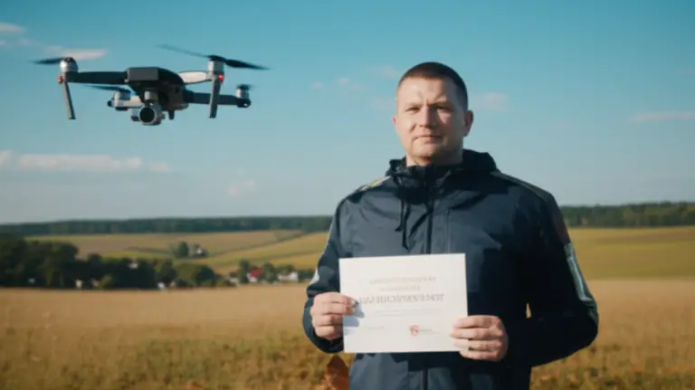
- TRUST is Mandatory: If you’re flying for fun, you must pass the FAA’s TRUST (The Recreational UAS Safety Test). It’s free and easy!
- Local Laws Matter: Even if the FAA says the airspace is clear, your city might have a “no takeoff/landing” ordinance for local parks.
📜 From the Wild West to Controlled Skies: The Evolution of Drone Airspace
Remember the early 2010s? We certainly do. Back then, flying a drone felt like the Wild West. You’d strap a GoPro to a white plastic DJI Phantom 1, cross your fingers, and hope it didn’t fly away into the sunset. There were no apps, no LAANC, and very few rules.
As drones became more popular (and affordable), the Federal Aviation Administration (FAA) realized they couldn’t just let us buzz around airports. The transition from “toy” to “unmanned aircraft” changed everything. Today, the sky is partitioned like a giant 3D chessboard. While it feels more restrictive, these “designated areas” and digital authorizations actually give us more freedom to fly safely without the fear of a federal fine landing in our mailboxes.
📍 How to Find Designated Drone Flying Areas Near You
Finding a spot isn’t just about looking for an empty field. You need to find a place where you are both legally allowed to be and welcome to fly.
- Search for “FRIA” Sites: The FAA has established FAA-Recognized Identification Areas (FRIAs). These are specific locations where you can fly drones without Remote ID equipment. Most of these are club-managed fields.
- Check Municipal Websites: Search for your city’s “Parks and Recreation” department. Many cities, like San Francisco or New York City, have specific parks (like Flushing Meadows) where drone flight is permitted.
- Google Maps Satellite View: We often use satellite view to find “dead zones”—industrial parks on weekends or large, empty parking lots. Just ensure you aren’t over private property without permission!
| Type of Area | Permission Level | Best For |
|---|---|---|
| AMA Club Fields | High (Membership usually required) | Beginners & Heavy Lifters |
| Local City Parks | Varies (Check local signs) | Casual Flying & Photography |
| State Parks | Medium (Often requires a permit) | Scenic Cinematography |
| National Parks | ❌ Prohibited | Nothing (Leave it in the car!) |
📱 Digital Co-Pilots: The Best Apps for Checking Local Airspace
You wouldn’t go hiking without a map, so don’t fly without an airspace app. These are the tools we use every single day at Drone Brands™:
- Aloft (formerly AirMap): This is the gold standard. It shows you controlled airspace, restricted zones, and allows you to apply for LAANC (Low Altitude Authorization and Notification Capability) in seconds.
- B4UFLY: The official FAA app. It’s simple, clean, and tells you a definitive “Proceed with Caution” or “Do Not Fly.”
- UAV Forecast: Essential for checking wind speeds at different altitudes. A “designated area” is useless if there’s a 30mph gust waiting to snatch your Skydio 2+.
- DJI Fly Safe Portal: If you fly a DJI drone, their internal geofencing might stop you from taking off even if you have FAA permission. Check their Fly Safe Map before you head out.
🏆 AMA Flight Fields: The “Country Clubs” of the Drone World
If you want a guaranteed, legal, and supportive place to fly, look no further than the Academy of Model Aeronautics (AMA). Think of these as country clubs for people who prefer propellers over putters.
Why fly at an AMA field?
- Safety First: They have established flight lines and safety officers.
- Community: You’ll meet veteran pilots who can help you tune your BetaFPV drone or give you tips on your Autel settings.
- Insurance: Membership often includes liability insurance, which is a huge weight off your shoulders.
You can find a local club using the AMA Club Finder.
🌳 City Parks vs. National Parks: Navigating Local Ordinances
This is where it gets tricky. The FAA controls the air, but the city controls the dirt.
✅ City Parks: Many cities are “drone-neutral.” If there isn’t a sign saying “No Remote Controlled Aircraft,” you are usually good to go. However, always be respectful of people having picnics or playing sports. ❌ National Parks: Since 2014, the National Park Service has banned the launching, landing, or operation of drones. This includes places like Yosemite or the Grand Canyon. If you get caught, the fines are astronomical, and they might even confiscate your gear.
Pro Tip: If you’re in a State Park, check the specific state’s website. For example, Utah State Parks are generally drone-friendly but require a small permit fee in some locations.
☕️ Propellers and Pours: Finding Drone-Friendly Social Hangouts
Who says drone flying has to be a solitary hobby? We love finding spots where we can fly and then grab a brew (coffee or otherwise).
In many tech-heavy cities, “Drone Cafes” or hobby shops with indoor tracks are popping up. If you’re into FPV (First Person View) racing, look for local “MultiGP” chapters. They often meet at breweries or large warehouses for “Micro” races using drones like the Tiny Whoop.
The Golden Rule of Social Flying: Never fly over people! Even if the brewery owner says it’s cool, the FAA says it’s a no-no unless you meet very specific Category 1-4 requirements.
🛡️ The “Karen” Factor: Managing Public Perception and Privacy
We’ve all been there. You’re minding your own business, capturing a beautiful sunset with your DJI Air 3, and someone approaches you to complain about “spying.”
How to handle it like a pro:
- Be Polite: A smile goes a long way.
- Show, Don’t Tell: Offer to let them look at the screen. Once people see the wide-angle lens, they realize you can’t actually see into their bathroom window.
- Have Your Paperwork: Keep your TRUST certificate and FAA Registration handy. It shows you’re a professional, not a nuisance.
- Wear a Vest: It sounds silly, but wearing a high-visibility neon vest makes you look “official,” and people are 90% less likely to bother you.
🛰️ Understanding LAANC: Getting Instant Permission to Fly
“But I live right next to a small airport!” Don’t panic. You can often still fly there thanks to LAANC.
LAANC is an automated system that connects pilots to Air Traffic Control. If you want to fly in a “controlled” zone (Class B, C, D, or E), you open the Aloft app, put in your flight plan, and—if it’s under the pre-approved altitude—you get a text message authorization in seconds.
✅ Do: Check the “Grid” altitude. If the grid says 200ft, don’t ask for 400ft, or you’ll be denied. ❌ Don’t: Fly in controlled airspace without this authorization. The FAA’s radar will see you.
🏁 Conclusion

Finding a designated drone flying area in your city doesn’t have to be a scavenger hunt. By using tools like B4UFLY, joining the AMA, and respecting local park ordinances, you can fly with confidence. Remember, the best pilots aren’t just the ones with the coolest tricks; they’re the ones who keep the skies safe for everyone.
So, did you find that perfect spot on the map yet? Or are you still worried about the local “No Drone” signs? Check the links below to get your legal ducks in a row before your next takeoff! 🚀
🔗 Recommended Links
- Find an AMA Club Near You
- Take the FAA TRUST Test (Free)
- Register Your Drone with FAA DroneZone
- Buy the DJI Mini 4 Pro on Amazon
- Check the DJI Fly Safe Geo Map
❓ Frequently Asked Questions
1. Can I fly my drone in my own backyard? Yes, usually! However, if you live in restricted airspace (like near the White House or a major airport), you still need authorization. Also, check for local noise ordinances.
2. Do I need a license to fly for fun? You don’t need a “license” like a pilot’s license, but you must pass the TRUST test and carry the certificate with you.
3. What happens if I fly in a “No Fly Zone”? Your drone might not even take off if it has geofencing (like DJI). If it does, you risk heavy fines from the FAA and potential criminal charges depending on the severity.
4. Are there any indoor drone parks? Yes! Many cities have indoor FPV tracks or “Drone Zones” in science museums. Search for “Indoor FPV racing” in your area.
5. Can I fly over a beach? Generally yes, but be careful. Many coastal towns have local laws against drones on beaches during tourist season to protect privacy and safety.
6. Is the B4UFLY app free? Absolutely. It is a free service provided by the FAA in partnership with Aloft.
7. Do I have to register a “Mini” drone? If it weighs less than 250g (like the DJI Mini 3) and you are flying strictly for recreation, you do not need to register it with the FAA.
8. Can I fly at night? Yes, as long as your drone has anti-collision lights visible for 3 statute miles and you follow all other safety rules.
9. What is a TFR? A Temporary Flight Restriction. These happen during sporting events, presidential movements, or wildfires. Always check your app before flying!
10. Can I fly near a school? It’s not illegal by FAA standards (unless it’s restricted airspace), but it is highly discouraged and often against school board policies.
11. How high can I fly? The legal limit for recreational and Part 107 pilots is 400 feet above ground level.
12. What is Remote ID? It’s like a digital license plate for your drone. Most new drones (post-2023) have it built-in.
📚 Reference Links
- FAA Official Drone Regulations
- Academy of Model Aeronautics (AMA)
- Aloft Air Control Platform
- National Park Service Drone Policy
⚡️ Quick Tips and Facts
Before you spin up those motors on your DJI Mini 4 Pro or Autel EVO Lite, here’s the “too long; didn’t read” version of finding a spot to fly:
- Check the App First: Never assume a park is “open.” Use the B4UFLY app (now powered by Aloft) to check for temporary flight restrictions (TFRs).
- AMA is Your Best Friend: The Academy of Model Aeronautics (AMA) has thousands of pre-approved flying sites across the US.
- National Parks are a No-Go: Generally, launching, landing, or operating a drone in National Parks is ❌ strictly prohibited.
- The 400ft Rule: No matter where you are, stay below 400 feet to avoid a nasty encounter with a Cessna.
- TRUST is Mandatory: If you’re flying for fun, you must pass the FAA’s TRUST (The Recreational UAS Safety Test). It’s free and easy!
- Local Laws Matter: Even if the FAA says the airspace is clear, your city might have a “no takeoff/landing” ordinance for local parks.
📜 From the Wild West to Controlled Skies: The Evolution of Drone Airspace
Remember the early 2010s? We certainly do. Back then, flying a drone felt like the Wild West. You’d strap a GoPro to a white plastic DJI Phantom 1, cross your fingers, and hope it didn’t fly away into the sunset. There were no apps, no LAANC, and very few rules.
As drones became more popular (and affordable), the Federal Aviation Administration (FAA) realized they couldn’t just let us buzz around airports. The transition from “toy” to “unmanned aircraft” changed everything. Today, the sky is partitioned like a giant 3D chessboard. While it feels more restrictive, these “designated areas” and digital authorizations actually give us more freedom to fly safely without the fear of a federal fine landing in our mailboxes.
📍 How to Find Designated Drone Flying Areas Near You
Finding a spot isn’t just about looking for an empty field. You need to find a place where you are both legally allowed to be and welcome to fly.
- Search for “FRIA” Sites: The FAA has established FAA-Recognized Identification Areas (FRIAs). These are specific locations where you can fly drones without Remote ID equipment. Most of these are club-managed fields.
- Check Municipal Websites: Search for your city’s “Parks and Recreation” department. Many cities, like San Francisco or New York City, have specific parks (like Flushing Meadows) where drone flight is permitted.
- Google Maps Satellite View: We often use satellite view to find “dead zones”—industrial parks on weekends or large, empty parking lots. Just ensure you aren’t over private property without permission!
| Type of Area | Permission Level | Best For |
|---|---|---|
| AMA Club Fields | High (Membership usually required) | Beginners & Heavy Lifters |
| Local City Parks | Varies (Check local signs) | Casual Flying & Photography |
| State Parks | Medium (Often requires a permit) | Scenic Cinematography |
| National Parks | ❌ Prohibited | Nothing (Leave it in the car!) |
📱 Digital Co-Pilots: The Best Apps for Checking Local Airspace
You wouldn’t go hiking without a map, so don’t fly without an airspace app. These are the tools we use every single day at Drone Brands™:
- Aloft (formerly AirMap): This is the gold standard. It shows you controlled airspace, restricted zones, and allows you to apply for LAANC (Low Altitude Authorization and Notification Capability) in seconds.
- B4UFLY: The official FAA app. It’s simple, clean, and tells you a definitive “Proceed with Caution” or “Do Not Fly.”
- UAV Forecast: Essential for checking wind speeds at different altitudes. A “designated area” is useless if there’s a 30mph gust waiting to snatch your Skydio 2+.
- DJI Fly Safe Portal: If you fly a DJI drone, their internal geofencing might stop you from taking off even if you have FAA permission. Check their Fly Safe Map before you head out.
🏆 AMA Flight Fields: The “Country Clubs” of the Drone World
If you want a guaranteed, legal, and supportive place to fly, look no further than the Academy of Model Aeronautics (AMA). Think of these as country clubs for people who prefer propellers over putters.
Why fly at an AMA field?
- Safety First: They have established flight lines and safety officers.
- Community: You’ll meet veteran pilots who can help you tune your BetaFPV drone or give you tips on your Autel settings.
- Insurance: Membership often includes liability insurance, which is a huge weight off your shoulders.
You can find a local club using the AMA Club Finder.
🌳 City Parks vs. National Parks: Navigating Local Ordinances
This is where it gets tricky. The FAA controls the air, but the city controls the dirt.
✅ City Parks: Many cities are “drone-neutral.” If there isn’t a sign saying “No Remote Controlled Aircraft,” you are usually good to go. However, always be respectful of people having picnics or playing sports. ❌ National Parks: Since 2014, the National Park Service has banned the launching, landing, or operation of drones. This includes places like Yosemite or the Grand Canyon. If you get caught, the fines are astronomical, and they might even confiscate your gear.
Pro Tip: If you’re in a State Park, check the specific state’s website. For example, Utah State Parks are generally drone-friendly but require a small permit fee in some locations.
☕️ Propellers and Pours: Finding Drone-Friendly Social Hangouts
Who says drone flying has to be a solitary hobby? We love finding spots where we can fly and then grab a brew (coffee or otherwise).
In many tech-heavy cities, “Drone Cafes” or hobby shops with indoor tracks are popping up. If you’re into FPV (First Person View) racing, look for local “MultiGP” chapters. They often meet at breweries or large warehouses for “Micro” races using drones like the Tiny Whoop.
The Golden Rule of Social Flying: Never fly over people! Even if the brewery owner says it’s cool, the FAA says it’s a no-no unless you meet very specific Category 1-4 requirements.
🛡️ The “Karen” Factor: Managing Public Perception and Privacy
We’ve all been there. You’re minding your own business, capturing a beautiful sunset with your DJI Air 3, and someone approaches you to complain about “spying.”
How to handle it like a pro:
- Be Polite: A smile goes a long way.
- Show, Don’t Tell: Offer to let them look at the screen. Once people see the wide-angle lens, they realize you can’t actually see into their bathroom window.
- Have Your Paperwork: Keep your TRUST certificate and FAA Registration handy. It shows you’re a professional, not a nuisance.
- Wear a Vest: It sounds silly, but wearing a high-visibility neon vest makes you look “official,” and people are 90% less likely to bother you.
🛰️ Understanding LAANC: Getting Instant Permission to Fly
“But I live right next to a small airport!” Don’t panic. You can often still fly there thanks to LAANC.
LAANC is an automated system that connects pilots to Air Traffic Control. If you want to fly in a “controlled” zone (Class B, C, D, or E), you open the Aloft app, put in your flight plan, and—if it’s under the pre-approved altitude—you get a text message authorization in seconds.
✅ Do: Check the “Grid” altitude. If the grid says 200ft, don’t ask for 400ft, or you’ll be denied. ❌ Don’t: Fly in controlled airspace without this authorization. The FAA’s radar will see you.
🏁 Conclusion
So, are there designated drone flying areas in your city or town? The answer is: it depends — but with the right tools and knowledge, you can find safe, legal, and fun spots to take your drone for a spin. From AMA club fields acting like the country clubs of drone flying, to city parks with varying local ordinances, and the digital co-pilots like Aloft and B4UFLY apps guiding your way, the skies are more accessible than ever — as long as you play by the rules.
We’ve seen how National Parks remain off-limits, but state parks and municipal areas often welcome responsible flyers. The key takeaway? Always check local regulations and airspace restrictions before flying. And don’t forget to pass the FAA’s TRUST test — it’s your ticket to responsible recreational flying.
If you’re a drone pilot looking for community, consider joining an AMA club or an FPV racing group. These communities not only provide designated flying areas but also invaluable support and camaraderie.
Remember our little teaser about finding that perfect spot on the map? Now you know: it’s a mix of official FAA-recognized zones, city ordinances, and a bit of detective work with apps and local resources. Fly smart, fly safe, and keep those propellers spinning!
🔗 Recommended Links
👉 Shop Popular Drones & Gear:
- DJI Mini 4 Pro: Amazon | DJI Official Website
- Autel EVO Lite: Amazon | Autel Robotics Official
- Skydio 2+: Amazon | Skydio Official
- BetaFPV Drones: Amazon | BetaFPV Official
Helpful Books on Drone Flying & Regulations:
❓ Frequently Asked Questions
What are the penalties for flying a drone in a restricted or prohibited area?
Flying in restricted airspace, such as near airports or National Parks, can lead to heavy fines, confiscation of your drone, and even criminal charges in severe cases. The FAA enforces these rules strictly to protect manned aircraft and public safety. For example, flying in a National Park can result in fines up to $5,000 or more. Always check airspace restrictions using apps like Aloft or the FAA’s B4UFLY app before flying.
How can I obtain a permit or license to fly my drone in restricted areas?
For controlled airspace near airports, you can apply for LAANC (Low Altitude Authorization and Notification Capability) through approved apps like Aloft or AirMap. This system provides near-instant permission for flights under specific altitude limits. For other restricted areas, such as some state parks or private properties, you may need to contact local authorities or park management for permits. Commercial pilots must have a Part 107 Remote Pilot Certificate from the FAA to operate in many restricted zones.
What are the restrictions on flying drones near airports or other sensitive areas?
Drones are generally prohibited within a 5-mile radius of airports without prior authorization. Flying near military bases, stadiums during events, or emergency response areas is also restricted. The FAA’s Remote ID and geofencing technology on many drones help prevent unauthorized flights in these zones. Always use apps like B4UFLY to verify your location before flying.
Can I fly my drone in national parks or wildlife reserves?
No. The National Park Service has banned drone flights in all National Parks since 2014 to protect wildlife and visitor experience. Violations can result in significant fines and confiscation of your drone. For wildlife reserves, rules vary, but many prohibit drones to avoid disturbing animals. Always check specific park websites or contact park authorities.
Are there any specific rules for flying drones in urban versus rural areas?
Yes. Urban areas often have more restrictions due to population density, privacy concerns, and proximity to airports. Many cities have ordinances banning drone flights in public parks or over crowds. Rural areas tend to have fewer restrictions but watch out for private property and agricultural zones. Regardless of location, always follow FAA altitude limits (under 400 feet) and avoid flying over people.
What are the local regulations and laws regarding drone flying in my area?
Local laws vary widely. Some cities like Sammamish, WA explicitly prohibit drone flights in city parks, while others designate specific areas for drone use (e.g., Abilene, TX’s Seabee Park). Check your city or county’s Parks and Recreation website or municipal codes. The FAA governs airspace, but local governments control land use and can impose additional restrictions.
How can I find approved drone flying zones near me?
Start with the FAA’s FRIA list and the AMA Club Finder for recognized flying fields. Use apps like Aloft or B4UFLY to see real-time airspace restrictions and nearby approved zones. Check local government websites for city or county-designated parks or fields. Satellite imagery can help identify open spaces, but always verify legality before flying.
Are there specific parks or open spaces designated for drone flying?
Yes, but they are rare and vary by location. For example, Abilene, TX has Seabee Park as a designated drone flying area managed by the Abilene RC Society. Many AMA clubs maintain flying fields that are open to members and sometimes guests. Most city parks do not allow drones unless explicitly stated. Always look for signage or official announcements.
Do I need a permit to fly a drone in my city or town?
It depends. Recreational flyers generally do not need permits unless flying in restricted or controlled airspace. Commercial operators require FAA Part 107 certification and may need local permits for certain locations. Some cities require permits for drone use in public parks or events. Always check local regulations before flying.
What safety guidelines should I follow when flying drones in public areas?
- Keep your drone within line of sight.
- Fly below 400 feet.
- Avoid flying over people or moving vehicles.
- Respect privacy—don’t fly near private homes without permission.
- Check weather conditions.
- Pass the FAA’s TRUST test.
- Carry your FAA registration and TRUST certificate.
- Use geofencing and no-fly zone apps to avoid restricted areas.
Are there any drone flying clubs or communities in my area?
Most likely, yes! The Academy of Model Aeronautics (AMA) has thousands of clubs nationwide. FPV racing groups like MultiGP also host local chapters. Joining a club gives you access to designated flying fields, insurance, and a community of experienced pilots. Use the AMA Club Finder to locate clubs near you.
How can I check if my drone flying location is restricted or a no-fly zone?
Use official apps like Aloft or the FAA’s B4UFLY app to check airspace status. DJI drones have built-in geofencing that prevents takeoff in many restricted zones. Always cross-reference with local government websites and FAA NOTAMs (Notices to Airmen) for temporary flight restrictions.
📚 Reference Links