Support our educational content for free when you purchase through links on our site. Learn more
Discover the Ultimate FAA Drone No Fly Zone Map: 10 Essential Areas You Must Avoid! 🚫
Are you ready to take your drone flying to new heights? Before you do, it’s crucial to understand the FAA drone no fly zone map! This indispensable tool not only keeps you informed about where you can and cannot fly but also protects you from hefty fines and potential legal trouble. Did you know that flying in restricted airspace can lead to penalties of up to $32,666? 😱 In this article, we’ll explore the ins and outs of the FAA drone no fly zone map, highlight ten key areas you must avoid, and provide you with tips to ensure a safe and enjoyable flying experience.
So, whether you’re a seasoned pilot or just starting out, buckle up as we navigate the skies of drone regulations together! ✈️
Key Takeaways
- Understand the FAA Drone No Fly Zone Map: Essential for safe flying and avoiding penalties.
- Know the 10 Key Restricted Areas: Familiarize yourself with the most critical no fly zones to ensure compliance.
- Stay Updated on Regulations: The FAA frequently updates rules, so always check for the latest information.
- Plan Your Flights Wisely: Use the map to plan safe routes and avoid restricted airspace.
- Join the Drone Community: Collaborate and learn from fellow drone enthusiasts for a better flying experience.
Ready to explore the skies responsibly? Check out our recommended resources and tools for drone pilots to enhance your flying experience! 🌐
Table of Contents
- Quick Tips and Facts
- Understanding the FAA Drone No Fly Zone Map
- How to Navigate the Drone No Fly Zone Map Effectively
- Recreational Flying vs. Commercial Operations: Know the Rules
- Nine Essential Rules for Recreational Drone Flying
- The Importance of Staying Updated: FAA Regulations
- Exploring the Best Geospatial Resources for Drone Pilots
- Become Our Supporter: Join the Drone Community!
- Quickmaptools.com: Your Go-To for Mapping Resources
- Learn More About Drone Regulations and Safety
- Work With Us: Collaborate on Drone Projects
- Subscribe Via Email for the Latest Updates
- Conclusion
- Recommended Links
- FAQ
- Reference Links
Quick Tips and Facts
Before we dive into the world of FAA drone no fly zone maps 🚁, let’s start with a crucial question: Can I fly my drone around my neighborhood? 🤔. Understanding the basics of drone flying and the regulations surrounding it is essential for any drone enthusiast. Here are some quick tips and facts to get you started:
- Always check the FAA drone no fly zone map before flying your drone 🗺️
- Register your drone if it weighs between 250 grams and 55 pounds 📝
- Keep your drone in sight at all times 👀
- Don’t fly near airports, national parks, or other restricted areas 🚫
- Follow community-based guidelines for recreational flying 🤝
For more information on drone regulations, visit our Drone Laws and Regulations page.
Understanding the FAA Drone No Fly Zone Map
The FAA drone no fly zone map is a crucial tool for drone pilots 🗺️. It helps you navigate the complex world of drone regulations and ensures that you’re flying safely and responsibly. Here’s what you need to know:
What is the FAA Drone No Fly Zone Map?
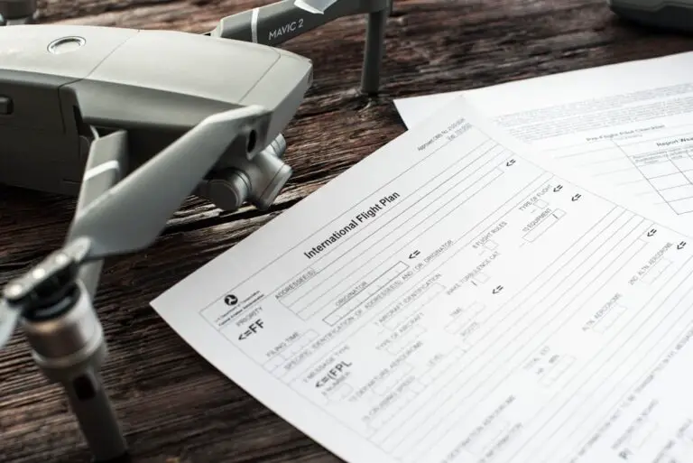
The FAA drone no fly zone map is an online tool that provides information on restricted airspace 🚫. It’s designed to help drone pilots avoid flying in areas where it’s not allowed.
How to Use the FAA Drone No Fly Zone Map
Using the FAA drone no fly zone map is easy 📊. Simply enter the location where you want to fly your drone, and the map will show you any restricted areas 🗺️. You can also use the map to plan your flight route and avoid any potential hazards.
For more information on how to use the FAA drone no fly zone map, visit the FAA website.
How to Navigate the Drone No Fly Zone Map Effectively
Navigating the drone no fly zone map can be complex 🗺️. Here are some tips to help you use it effectively:
Step 1: Enter Your Location
Enter the location where you want to fly your drone 📍. The map will show you any restricted areas in that location.
Step 2: Check for Restricted Areas
Check the map for any restricted areas 🚫. These areas may include airports, national parks, or other areas where drone flying is not allowed.
Step 3: Plan Your Flight Route
Plan your flight route to avoid any restricted areas 🗺️. You can use the map to plan a safe and responsible flight route.
For more information on planning your flight route, visit our Drone Business Opportunities page.
Recreational Flying vs. Commercial Operations: Know the Rules
Recreational flying and commercial operations have different rules 📝. Here’s what you need to know:
Recreational Flying
Recreational flying is for fun and personal use 🎉. If you’re flying for recreational purposes, you need to follow the FAA’s recreational flying rules.
Commercial Operations
Commercial operations are for business use 📊. If you’re flying for commercial purposes, you need to follow the FAA’s Part 107 rules.
For more information on recreational flying and commercial operations, visit our Drone Industry News page.
Nine Essential Rules for Recreational Drone Flying
Here are the nine essential rules for recreational drone flying 📝:
- Fly for Recreational Purposes: Only fly for fun and personal use 🎉.
- Follow Community-Based Guidelines: Follow guidelines set by community-based organizations 🤝.
- Maintain Visual Line of Sight: Keep your drone in sight at all times 👀.
- Don’t Interfere: Don’t interfere with manned aircraft or other drones 🚫.
- Get Airspace Authorization: Get authorization to fly in controlled airspace 🗺️.
- Fly Below 400 Feet: Fly below 400 feet above ground level 📏.
- Pass the TRUST Exam: Pass the recreational UAS safety test 📚.
- Register Your Drone: Register your drone if it weighs between 250 grams and 55 pounds 📝.
- Don’t Operate Dangerously: Don’t operate your drone in a way that could harm people or property 🚫.
For more information on recreational drone flying, visit our Beginner Drones page.
The Importance of Staying Updated: FAA Regulations
Staying updated on FAA regulations is crucial 📊. The FAA regularly updates its regulations to ensure safe and responsible drone flying. Here’s what you need to know:
Why Stay Updated?
Staying updated on FAA regulations helps you avoid fines and penalties 🚫. It also helps you fly safely and responsibly.
How to Stay Updated
You can stay updated on FAA regulations by visiting the FAA website 📊. You can also sign up for our newsletter to get the latest updates on drone regulations 📣.
Exploring the Best Geospatial Resources for Drone Pilots
As a drone pilot, you need the best geospatial resources to plan and execute your flights 🗺️. Here are some of the best resources available:
FAA Drone Zone
The FAA Drone Zone is a comprehensive resource for drone pilots 📊. It provides information on airspace restrictions, weather, and other factors that affect drone flying.
Airmap
Airmap is a popular platform for drone pilots 📈. It provides real-time airspace information and helps you plan safe and responsible flights.
For more information on geospatial resources, visit our Drone Brand Guides page.
Become Our Supporter: Join the Drone Community!
Join our drone community to get the latest updates on drone regulations and technology 📣. As a supporter, you’ll get access to exclusive content, discounts, and more 🎁.
Why Join?
Joining our drone community helps you stay updated on the latest developments in the drone industry 📊. It also helps you connect with other drone enthusiasts and learn from their experiences.
Quickmaptools.com: Your Go-To for Mapping Resources
Quickmaptools.com is a great resource for mapping tools 🗺️. It provides a range of tools to help you plan and execute your drone flights.
Why Use Quickmaptools.com?
Using Quickmaptools.com helps you save time and effort 🕒. It provides a range of mapping tools in one place, making it easy to plan and execute your drone flights.
Learn More About Drone Regulations and Safety
Learning more about drone regulations and safety is essential for any drone pilot 📚. Here are some resources to help you get started:
FAA Website
The FAA website is a comprehensive resource for drone regulations and safety 📊.
Drone Safety Guidelines
Drone safety guidelines provide tips and best practices for safe and responsible drone flying 📝.
Work With Us: Collaborate on Drone Projects
We’re always looking for collaborators to work on drone projects 🤝. If you’re a drone enthusiast or a business looking to use drones, we’d love to hear from you.
Why Collaborate?
Collaborating with us helps you get the most out of your drone projects 📈. We provide expertise, resources, and support to help you achieve your goals.
Subscribe Via Email for the Latest Updates
Subscribe to our newsletter to get the latest updates on drone regulations, technology, and industry news 📣. We’ll keep you informed about the latest developments in the drone industry.
Why Subscribe?
Subscribing to our newsletter helps you stay updated on the latest developments in the drone industry 📊. It also helps you get exclusive content, discounts, and more 🎁.
Conclusion
 lens. These are the tools that help me capture my Unsplash images! Also, not pictured is my Panasonic GX7 and it’s 25mm lens. I needed them to take the picture. :) by Drone Brands")
In summary, understanding the FAA drone no fly zone map is essential for any drone pilot looking to navigate the skies safely and legally. This tool not only helps you avoid restricted areas but also ensures that you’re flying responsibly and in compliance with FAA regulations.
Positives:
- User-Friendly Interface: The map is easy to navigate, allowing you to quickly find restricted areas.
- Comprehensive Information: It provides detailed information about airspace restrictions, including Temporary Flight Restrictions (TFRs).
- Essential for Safety: Using the map can prevent costly fines and ensure the safety of your flights.
Negatives:
- Not Always Real-Time: Some areas may not reflect the most current restrictions, so it’s crucial to double-check before flying.
- Complexity for New Pilots: New drone pilots may find the amount of information overwhelming at first.
Overall, we confidently recommend utilizing the FAA drone no fly zone map as your go-to resource for safe drone flying. By staying informed and adhering to the regulations, you can enjoy your aerial adventures without the worry of penalties or accidents. So, are you ready to take to the skies? 🚀
Recommended Links
-
👉 Shop FAA Drone No Fly Zone Map Resources:
-
Books on Drone Regulations:
FAQ

What are the current FAA regulations for flying drones in no-fly zones?
The FAA prohibits flying drones in designated no-fly zones, which include areas around airports, military bases, and certain national parks. Violating these regulations can result in fines, penalties, and even criminal charges. For the most current regulations, always refer to the FAA website.
How do I find my location on the FAA drone no-fly zone map to plan my flight?
To find your location on the FAA drone no-fly zone map, simply enter your address or GPS coordinates into the search bar on the map interface. The map will highlight any nearby restricted areas, allowing you to plan your flight accordingly.
Can I fly my drone near airports or other restricted areas, and what are the penalties for violating FAA rules?
Flying near airports or other restricted areas is strictly regulated. You must obtain authorization to fly in controlled airspace, typically through the LAANC system. Penalties for violating FAA rules can include fines ranging from hundreds to thousands of dollars, depending on the severity of the infraction.
Are there any exceptions or waivers available for flying drones in FAA-designated no-fly zones, and how do I apply for them?
Yes, there are exceptions and waivers available for certain situations, such as emergency services or specific commercial operations. To apply for a waiver, you must submit a request through the FAA Drone Zone and provide detailed information about your intended flight and its purpose.
What should I do if I encounter a no-fly zone while flying?
If you encounter a no-fly zone while flying, the best course of action is to immediately land your drone and avoid flying in that area. Always check the FAA drone no fly zone map before your flight to ensure you’re aware of any restrictions.
How often is the FAA drone no-fly zone map updated?
The FAA drone no-fly zone map is updated regularly, but it’s essential to check for any temporary flight restrictions (TFRs) that may not be reflected in real-time. Always verify the latest information before flying.
Reference Links
- FAA – UAS Regulations
- FAA Drone Zone
- CBS News – FAA Drone Ban in New Jersey
- Mapscaping – Drone Fly Zones
- Drone Fly Zone
By following these guidelines and utilizing the resources available, you can ensure a safe and enjoyable flying experience. Happy flying! 🚀