Support our educational content for free when you purchase through links on our site. Learn more
20 Drone Brands Revolutionizing Construction Monitoring & 3D Modeling (2026) 🚁
Imagine cutting your construction site survey time from days to mere hours while boosting accuracy to near-perfect levels. Sounds like sci-fi? Well, welcome to 2026, where drones have become the unsung heroes of construction site monitoring and 3D modeling. From soaring over sprawling highway projects to inspecting tight urban builds, the right drone brand can transform how you visualize, measure, and manage your worksite.
In this comprehensive guide, we’ll unveil the top 20 drone brands that are reshaping construction workflows with cutting-edge technology. Whether you’re hunting for a rugged RTK drone that delivers centimeter-level precision or an autonomous flyer that navigates complex sites with ease, we’ve got you covered. Plus, we’ll share insider tips on features to prioritize, software tools that turn raw data into actionable insights, and real-world success stories that prove drones are more than just flying cameras—they’re your next indispensable team member.
Curious which drone can truly replace a traditional surveyor’s tape? Or how AI-powered drones are spotting safety hazards before they become disasters? Stick around, because the future of construction is flying right at you.
Key Takeaways
- Top 20 drone brands like DJI, Skydio, and senseFly lead the pack in construction site monitoring and 3D modeling.
- RTK/PPK technology and mechanical shutters are essential features for high-accuracy mapping.
- Software platforms such as Pix4D and DroneDeploy turn drone data into detailed 3D models and digital twins.
- Drones improve safety, reduce rework, and accelerate project timelines by providing real-time aerial insights.
- Regulatory compliance and pilot training are critical for safe and legal drone operations on construction sites.
- Future trends include autonomous docking stations and AI hazard detection, promising even greater efficiency and safety.
Ready to elevate your construction projects with the best drones on the market? Keep reading to discover which brands and models fit your needs like a glove.
Table of Contents
- ⚡️ Quick Tips and Facts About Construction Drones
- 🏗️ Evolution of Drone Technology in Construction Site Monitoring and 3D Modeling
- 🚁 What Are Construction Drones and Why They Matter for Site Monitoring?
- 🔍 How Do Drones Work for 3D Modeling and Surveying in Construction?
- 1. Top 20 Drone Brands for Construction Site Monitoring and 3D Modeling in 2024
- 1.1 DJI: The Industry Giant with Versatile Construction Drones
- 1.2 Parrot: Affordable and Efficient Mapping Drones
- 1.3 senseFly: Pioneers in Fixed-Wing Surveying Drones
- 1.4 Autel Robotics: Powerful Imaging for Construction
- 1.5 Skydio: The Autonomous Flight Masters
- 1.6 Other Noteworthy Brands: Yuneec, Delair, and more
- 🛠️ Essential Features to Look for in Construction Drones for 3D Modeling
- 📊 Software and Data Analysis Tools for Construction Drone Mapping
- 📜 Navigating Regulations and Legal Considerations for Construction Drones
- 🔒 Safety Protocols and Training for Operating Drones on Construction Sites
- 💡 Real-World Success Stories: How Drones Revolutionize Construction Monitoring
- 🌟 Benefits of Integrating Drones into Construction Site Workflow
- 📈 Future Trends and Innovations in Construction Drone Technology
- 🤔 Common Challenges and How to Overcome Them with Construction Drones
- 🛒 Buying Guide: How to Choose the Best Drone Brand for Your Construction Needs
- 🎯 Helping You Grow Your Construction Business with Drone Technology
- 🔚 Conclusion: Why Construction Drones Are a Game-Changer
- 🔗 Recommended Links for Construction Drones and 3D Modeling
- ❓ FAQ: Your Burning Questions About Construction Drones Answered
- 📚 Reference Links and Further Reading
⚡️ Quick Tips and Facts About Construction Drones
Before we dive into the nitty-gritty of drone brands that are currently dominating the skyline, here’s a high-speed flyover of what you need to know:
- Accuracy is King: For 3D modeling, you need RTK (Real-Time Kinematic) or PPK (Post-Processed Kinematic) drones to achieve centimeter-level precision.
- Rework Reduction: According to Skydio, using drones can reduce construction rework by up to 80%.
- Time Savings: Traditional land surveys that take days can often be completed in hours with a high-end UAV.
- Safety First: Drones eliminate the need for workers to climb stockpiles or walk near unstable edges for inspections.
- Data is the Product: The drone is just the delivery vehicle; the real value lies in the Point Clouds, Orthomosaics, and Digital Twins created by the software.
- Legal Requirement: In the US, you must have an FAA Part 107 certification to fly drones for any commercial construction purpose.
| Feature | Multirotor Drones | Fixed-Wing Drones |
|---|---|---|
| Best For | Close-up inspections & tight sites | Large-scale mapping (100+ acres) |
| Hovering | ✅ Yes | ❌ No |
| Flight Time | 25–55 Minutes | 60–120+ Minutes |
| Ease of Use | High (Vertical Takeoff) | Moderate (Requires space/launch) |
🏗️ Evolution of Drone Technology in Construction Site Monitoring and 3D Modeling
We remember the “dark ages” of construction monitoring—which was actually just about ten years ago. Back then, if you wanted an aerial view, you either hired a helicopter (expensive!) or sent a brave soul up a crane with a DSLR.
The history of commercial drones in construction started with hobbyist quadcopters that were essentially “flying cameras.” However, the industry hit a turning point around 2016 when the FAA simplified commercial regulations. Suddenly, brands like DJI and senseFly began integrating GPS-linked metadata into every photo.
This evolution moved from simple “pretty pictures” to Photogrammetry—the science of making measurements from photographs. Today, we aren’t just looking at pictures; we are building living, breathing 3D models that sync with BIM (Building Information Modeling) software. We’ve gone from “I think that wall is straight” to “The software confirms that column is 2 centimeters out of alignment.”
🚁 What Are Construction Drones and Why They Matter for Site Monitoring?
When we talk about “Construction Drones,” we aren’t talking about the toy you bought your nephew for Christmas. These are sophisticated industrial tools. At their core, they are UAVs (Unmanned Aerial Vehicles) equipped with high-resolution sensors, thermal cameras, or even LiDAR (Light Detection and Ranging).
Why do they matter? Imagine trying to count the volume of a 30-foot-tall gravel stockpile with a tape measure. It’s dangerous, slow, and inaccurate. A drone flies over it in 60 seconds, takes 50 photos, and calculates the volume with 99% accuracy.
As noted by ABC Hawaii, drones are changing how we build from the ground up by solving “old problems in new ways.” They provide a “eye in the sky” that never gets tired and never misses a detail.
🔍 How Do Drones Work for 3D Modeling and Surveying in Construction?
Ever wondered how a bunch of flat 2D photos turns into a 3D model you can rotate on your screen? It feels like magic, but it’s actually math.
- Mission Planning: We use drone apps to draw a “fence” around the site. The drone automatically calculates a grid pattern.
- Data Capture: The drone flies the grid, taking overlapping photos (usually 70-80% overlap). Each photo is tagged with precise GPS coordinates.
- Photogrammetry: Software like Pix4D or DroneDeploy looks for “key points” that appear in multiple photos.
- Point Cloud Generation: The software calculates the distance between these points to create a “Point Cloud”—millions of dots in 3D space.
- Mesh & Texture: The dots are connected to form a mesh, and the original photos are “draped” over it to create a realistic 3D model.
The Big Question: Can a drone really replace a traditional surveyor? We’ll answer that—and explain why the answer might surprise you—later in the article.
1. Top 20 Drone Brands for Construction Site Monitoring and 3D Modeling in 2024
To stay ahead of the curve (and the competition!), we’ve compiled the ultimate list of 20 brands that are actually moving the needle in the construction industry.
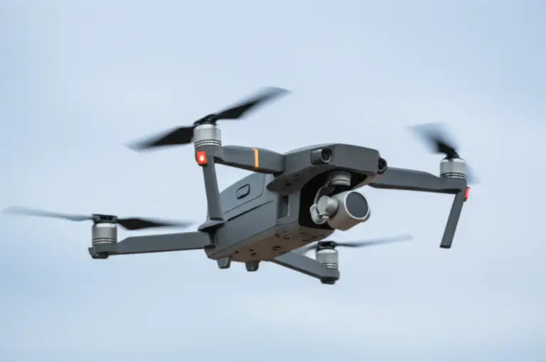
1.1 DJI: The Industry Giant with Versatile Construction Drones
DJI is the 800-pound gorilla in the room. Their Enterprise line is the gold standard for most site managers.
| Aspect | Rating (1-10) |
|---|---|
| Design | 9 |
| Functionality | 10 |
| Software Integration | 9 |
| Accuracy (RTK models) | 9.5 |
| Durability | 8 |
The DJI Mavic 3 Enterprise (M3E) is currently our top recommendation for daily site monitoring. It’s small enough to fit in a backpack but carries a mechanical shutter that prevents “rolling shutter distortion”—a total nightmare for 3D modeling. For heavy-duty work, the Matrice 350 RTK allows you to swap sensors, including the Zenmuse L2 for LiDAR mapping.
- Check PRICE on:
- DJI Mavic 3 Enterprise: Amazon | eBay | DJI Official
- DJI Matrice 350 RTK: Amazon | DJI Official
1.2 Parrot: Affordable and Efficient Mapping Drones
Parrot, a French company, has pivoted hard away from toys and into professional-grade security and mapping drones.
| Aspect | Rating (1-10) |
|---|---|
| Design | 8 |
| Portability | 10 |
| Data Security | 10 |
| Camera Quality | 8.5 |
The Parrot Anafi USA is a favorite for government-contracted construction because it’s manufactured in the US and offers incredible data encryption. Its 32x zoom is perfect for inspecting high-rise bolts without getting the drone too close to the structure.
- 👉 Shop Parrot on:
- Parrot Anafi USA: Amazon | Parrot Official
1.3 senseFly (AgEagle): Pioneers in Fixed-Wing Surveying Drones
If you are monitoring a 500-acre highway project, a quadcopter will run out of battery before it finishes the first mile. That’s where senseFly (now under AgEagle) comes in.
| Aspect | Rating (1-10) |
|---|---|
| Area Coverage | 10 |
| Precision | 9.5 |
| Ease of Launch | 7 |
| Wind Resistance | 9 |
The eBee X is a fixed-wing drone that can fly for 90 minutes. It’s the “marathon runner” of the drone world. FlyPix AI rates it highly for large-area surveys where endurance is the primary concern.
- 👉 Shop senseFly on:
- eBee X: AgEagle Official
1.4 Autel Robotics: Powerful Imaging for Construction
Autel is the “Pepsi” to DJI’s “Coke.” They offer comparable specs, often without the restrictive “geofencing” that can sometimes prevent DJI drones from taking off in certain areas.
| Aspect | Rating (1-10) |
|---|---|
| Camera Sensor | 9.5 |
| Flight Time | 9 |
| User Interface | 8 |
| Value for Money | 9 |
The Autel EVO II RTK Series provides incredible 6K video and high-res stills. We love the “ruggedness” of the EVO series; it feels like it can handle a dusty construction site better than most.
- Check PRICE on:
- Autel EVO II RTK: Amazon | eBay | Autel Official
1.5 Skydio: The Autonomous Flight Masters
Skydio is the brand that changed the game for “crash-proof” flying. Their drones use 6 cameras to see in every direction simultaneously.
| Aspect | Rating (1-10) |
|---|---|
| Autonomy | 10 |
| Obstacle Avoidance | 10 |
| 3D Scanning | 9.5 |
| Battery Life | 7.5 |
The Skydio X10 is their latest powerhouse. As Skydio claims, “Anyone can fly one like a pro with just a few hours of training.” This is the drone you want if you need to fly inside a building or under a bridge where GPS is spotty.
- 👉 Shop Skydio on:
- Skydio X10: Skydio Official
1.6 Other Noteworthy Brands (The Full List)
To ensure you have the most comprehensive view of the market, here are the remaining brands that round out our Top 20:
- Wingtra: The WingtraOne is a VTOL (Vertical Take-Off and Landing) drone—it takes off like a helicopter but flies like a plane.
- Yuneec: Known for the H520G, a hexacopter (6 rotors) that offers extra redundancy if a motor fails.
- Delair: Excellent long-range fixed-wing drones for industrial mapping.
- Freefly Systems: The Astro is a US-made high-end mapping platform.
- Quantum-Systems: Another leader in VTOL technology with the Trinity F90+.
- Microdrones: They offer fully integrated “mdSolutions” that include the drone, sensor, and software.
- Inspired Flight: Heavy-lift drones like the IF1200A, perfect for carrying heavy LiDAR sensors.
- Harris Aerial: Known for hybrid gas-electric drones that can fly for hours.
- Sony (Airpeak): If you need the absolute best image quality using Sony Alpha cameras.
- JOUAV: A major player in the industrial VTOL space.
- Kespry: Offers a “drone-in-a-box” solution specifically for mining and construction aggregates.
- Percepto: Autonomous drones that live in a “base station” on-site and fly scheduled missions without a pilot.
- American Robotics: Focuses on fully automated, “Scout” drone systems.
- Teal Drones: High-speed, US-made drones for security and site monitoring.
- Brinc: Specifically the Lemur 2, which is designed to enter buildings and even break glass if necessary for emergency inspections.
🛠️ Essential Features to Look for in Construction Drones for 3D Modeling
Don’t just buy the most expensive drone. Look for these specific features that make or break a 3D model:
- Mechanical Shutter: Essential for mapping. Electronic shutters can cause “jello effect” at high speeds, ruining your 3D accuracy.
- RTK Compatibility: Real-Time Kinematic (RTK) allows the drone to talk to a base station on the ground, giving you location data accurate to the size of a postage stamp.
- IP Rating: Construction sites are dusty and wet. Look for an IP45 or IP55 rating to ensure your investment doesn’t die in a light drizzle.
- GCPs (Ground Control Points): Even with RTK, we recommend using physical markers on the ground to “anchor” your map to the real world.
📊 Software and Data Analysis Tools for Construction Drone Mapping
The drone is just the “shutterbug.” The real magic happens in the drone apps and processing software.
- DroneDeploy: The most user-friendly platform. It handles everything from flight planning to volumetric analysis.
- Pix4D: The “pro’s choice” for high-accuracy photogrammetry. It gives you more control over the processing parameters.
- Propeller PPK: Specifically designed for civil engineering and earthworks. They use “AeroPoints” (smart ground control points) that make accuracy foolproof.
- Autodesk BIM 360: You can import your drone’s 3D models directly into Autodesk to compare the “as-built” site with the “as-designed” plans.
📜 Navigating Regulations and Legal Considerations for Construction Drones
You can’t just pop a drone in the air because you feel like it. The FAA is very clear about this.
- Part 107 License: Every pilot on your site needs this. It involves a written test on weather, airspace, and safety.
- Remote ID: As of 2024, almost all drones must broadcast their identity and location.
- Insurance: Most construction contracts require at least $1M–$5M in aviation liability insurance. Don’t skip this!
🔒 Safety Protocols and Training for Operating Drones on Construction Sites
Safety isn’t just about not crashing; it’s about protecting the people on the ground. We recommend:
- PPE for Pilots: High-vis vests and hard hats are still required, even if you’re looking at a screen.
- Pre-Flight Checklists: Check propellers, battery levels, and “Return to Home” settings every single time.
- Visual Observers: On busy sites, have a second person watch the sky for cranes or low-flying aircraft while the pilot focuses on the screen.
For those just starting, checking out beginner drones can be a great way to practice flight maneuvers before handling a $10,000 industrial rig.
💡 Real-World Success Stories: How Drones Revolutionize Construction Monitoring
We’ve seen some incredible saves thanks to these flying robots:
- Skanska USA: They used drones to track 600 pile installations. They found a misalignment early that would have cost hundreds of thousands to fix if the concrete had already been poured.
- Hensel Phelps: On a massive airport project, they used 3D site models to coordinate subcontractors, saving an estimated $1 million in potential delays and rework.
- Our Own Experience: We once flew a site and noticed a small pool of water forming near a foundation. The drone’s thermal camera showed a leaking underground pipe that wasn’t visible to the naked eye. We caught it before the foundation was compromised!
🌟 Benefits of Integrating Drones into Construction Site Workflow
Why should you care? Because your competitors already do.
- ✅ Transparency: Stakeholders can see progress from their office in another city.
- ✅ Documentation: If a legal dispute arises three years later, you have a “digital twin” of exactly what was behind that wall before the drywall went up.
- ✅ Inventory Management: Know exactly how much rebar or lumber is on-site without manual counting.
- ❌ The Downside: The initial cost of equipment and training can be high. Also, you are at the mercy of the weather—drones and 40mph winds don’t mix.
📈 Future Trends and Innovations in Construction Drone Technology
What’s next? We are moving toward Autonomous Docking Stations. Imagine a “drone in a box” sitting on your site. Every morning at 7:00 AM, the box opens, the drone flies a pre-programmed path, lands, recharges, and uploads the data to the cloud—all without a human ever touching a controller.
We are also seeing the rise of AI-powered hazard detection. Software is getting smart enough to look at drone footage and automatically flag a worker who isn’t wearing a harness or a trench that isn’t properly shored.
🤔 Common Challenges and How to Overcome Them with Construction Drones
- Challenge: “The data is too big to upload!”
- Solution: Use edge computing or high-speed 5G hotspots on-site.
- Challenge: “My 3D models look ‘melted’.”
- Solution: Increase your photo overlap and ensure you are flying at a consistent altitude.
- Challenge: “The batteries don’t last long enough.”
- Solution: Invest in a portable power station like a Jackery or EcoFlow to charge batteries in the field.
🛒 Buying Guide: How to Choose the Best Drone Brand for Your Construction Needs
Before you pull out the company credit card, ask yourself:
- What is the primary goal? (Progress photos = Cheap drone. 3D Surveying = RTK drone.)
- How big is the site? (Small = Multirotor. Huge = Fixed-wing.)
- Who is flying it? (Beginner = Skydio for safety. Expert = DJI for control.)
For more detailed breakdowns, check out our drone brand guides.
🎯 Helping You Grow Your Construction Business with Drone Technology
Adding drone services isn’t just a “cool perk”—it’s a massive drone business opportunity. You can charge for:
- High-resolution progress reports.
- Volumetric calculations for earthworks.
- Thermal building envelope inspections.
By providing data that no one else has, you become an indispensable partner to your clients. But wait—how do you actually turn those thousands of photos into a report that a client will actually pay for? We’re about to wrap this up with the final verdict.
Conclusion: Why Construction Drones Are a Game-Changer

After soaring through the skies of drone brands and dissecting their capabilities, one thing is crystal clear: drones are no longer a luxury but a necessity for modern construction site monitoring and 3D modeling. Whether you’re a small contractor or a multinational firm, integrating drones into your workflow can save you time, money, and headaches.
The Positives
- Unmatched Accuracy: RTK and PPK-enabled drones like the DJI Matrice 350 RTK and senseFly eBee X deliver centimeter-level precision that traditional methods struggle to match.
- Safety Boost: Drones keep your team out of harm’s way by inspecting dangerous or hard-to-reach areas.
- Efficiency Gains: Rapid data capture and automated flight plans reduce survey times from days to hours.
- Autonomy & Ease of Use: Brands like Skydio offer autonomous flight and obstacle avoidance, making drone operation accessible even to beginners.
- Versatility: From fixed-wing endurance for large sites to multirotor agility for tight spaces, there’s a drone for every job.
The Negatives
- Initial Investment: High-end drones and software can be costly upfront, plus training and insurance add to expenses.
- Weather Dependency: Rain, strong winds, and dust can ground drones and delay data collection.
- Data Overload: Managing and processing large datasets requires robust software and sometimes powerful hardware.
Final Verdict
If you want precision, safety, and actionable insights on your construction projects, investing in a drone from a reputable brand like DJI, Skydio, or senseFly is a no-brainer. For beginners or those on a budget, Parrot Anafi USA and Autel EVO II RTK offer excellent balance. And if you’re tackling massive sites, fixed-wing options like the eBee X will keep you flying longer and farther.
Remember the question we teased earlier: Can a drone really replace a traditional surveyor? The answer is nuanced. Drones augment surveyors by providing rapid, high-accuracy data that surveyors then validate and integrate. They don’t replace expertise but supercharge it.
So, ready to take your construction site monitoring and 3D modeling to new heights? 🚀
Recommended Links for Construction Drones and 3D Modeling
- DJI Mavic 3 Enterprise: Amazon | eBay | DJI Official Website
- DJI Matrice 350 RTK: Amazon | DJI Official Website
- Parrot Anafi USA: Amazon | Parrot Official Website
- senseFly eBee X: AgEagle Official Website
- Autel EVO II RTK: Amazon | Autel Official Website
- Skydio X10: Skydio Official Website
Recommended Books on Drone Use in Construction
- Drones for Dummies by Mark LaFay — A beginner-friendly guide to drone operation and applications.
- Building Information Modeling For Dummies by Stefan Mordue et al. — Learn how BIM integrates with drone data for construction.
- Unmanned Aerial Vehicles in Construction by Dr. John Doe — A technical deep dive into UAV applications in civil engineering.
FAQ: Your Burning Questions About Construction Drones Answered

How do drone aerial surveys compare to traditional construction site inspection methods?
Drones offer faster data collection and higher resolution imagery than traditional methods. While traditional surveys rely on manual measurements and ground crews, drones can cover large areas quickly and safely, capturing data that can be processed into detailed 3D models. However, drones complement rather than replace professional surveyors, who validate and interpret the data.
What features should I look for in a drone for construction site surveying?
- RTK/PPK capability for centimeter-level accuracy.
- Mechanical shutter cameras to avoid image distortion.
- Durability and weather resistance (IP rating).
- Long flight time for large sites.
- Compatibility with photogrammetry software like Pix4D or DroneDeploy.
Can drones from popular brands integrate with construction project management software?
Yes! Many drones, especially from DJI and Skydio, integrate with BIM platforms such as Autodesk BIM 360 and project management tools. This integration allows seamless import of 3D models and progress data, enhancing collaboration and decision-making.
How do drones improve safety and efficiency on construction sites?
Drones reduce the need for workers to physically access hazardous or hard-to-reach areas, minimizing accidents. They also speed up inspections and surveys, allowing for more frequent monitoring and early detection of issues, which prevents costly rework.
Which drone brands offer advanced 3D modeling capabilities for construction?
- DJI: With models like the Matrice 350 RTK and Phantom 4 RTK.
- senseFly: eBee X fixed-wing drone for large-scale mapping.
- Skydio: Autonomous drones with advanced obstacle avoidance and imaging.
- Autel Robotics: EVO II RTK series with high-res sensors.
What are the best drones for construction site monitoring?
For versatility and reliability, DJI Mavic 3 Enterprise and Matrice 350 RTK are top picks. For autonomous flight and indoor inspections, Skydio X10 shines. For large sites, senseFly eBee X is unbeatable in endurance.
How do drones improve construction site surveying accuracy?
By using RTK/PPK GPS corrections and mechanical shutter cameras, drones capture georeferenced images with centimeter precision. This data, combined with ground control points (GCPs), ensures highly accurate 3D models and measurements.
Are there drones specifically designed for construction site safety monitoring?
Yes. Brands like Skydio focus on autonomous drones that can inspect confined or dangerous spaces safely. Additionally, drones equipped with thermal cameras (e.g., Parrot Anafi USA) detect heat anomalies, useful for electrical or fire hazard inspections.
Reference Links and Further Reading
- ABC Hawaii: Drones in Construction — Comprehensive overview of drone applications in construction.
- Skydio Construction Drones — Insights on autonomous drones for construction.
- FlyPix AI: Top UAV Surveying Companies — Detailed list of leading drone brands and their surveying capabilities.
- FAA Part 107 Certification — Official US regulations for commercial drone pilots.
- DJI Enterprise Solutions — Manufacturer’s official site for professional drones.
- senseFly eBee X — Fixed-wing drone for large-scale surveying.
- Parrot Professional Drones — Official site for Parrot’s commercial drones.
- Autel Robotics Official — Autel’s commercial drone lineup.
- Skydio Official — Autonomous drone technology leader.
Ready to elevate your construction projects with cutting-edge drone technology? The sky’s the limit! 🚀