Support our educational content for free when you purchase through links on our site. Learn more
Top 7 Commercial Drone Brands for Infrastructure Inspection (2025) 🚁
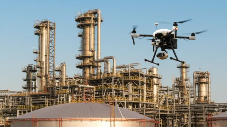
Imagine inspecting miles of power lines, towering bridges, or sprawling solar farms in a fraction of the time it used to take—without putting a single worker in harm’s way. Welcome to the future of infrastructure inspection, where commercial drones are not just tools but game-changing partners in safety, efficiency, and precision. At Drone Brands™, we’ve tested and flown the leading drones in the industry, from DJI’s versatile Matrice 300 RTK to Skydio’s AI-powered X2, and we’re here to reveal which brands truly soar above the rest in 2025.
Did you know that utilities using drones for inspections have cut their costs by up to 90% and reduced downtime by 70%? But which drone brand fits your unique inspection needs? Stick around as we break down the top 7 commercial drone brands, their standout models, and how their features translate into real-world savings and safer skies. Plus, we’ll share insider tips on software, training, and emerging trends that will keep your drone program mission-ready.
Key Takeaways
- DJI Enterprise leads with unmatched payload versatility, flight time, and ecosystem support, making it the go-to for most infrastructure inspections.
- Skydio’s autonomous flight tech excels in complex environments like telecom towers and bridges, reducing pilot workload and risk.
- Payload diversity matters: Thermal, LiDAR, zoom, and multispectral sensors unlock new levels of fault detection and mapping precision.
- Autonomous drone docks and BVLOS operations are revolutionizing continuous, large-scale inspections.
- Safety and regulatory compliance remain paramount—choose drones and training that meet FAA Part 107 and data security standards.
👉 Shop top commercial drones:
- DJI Matrice 300 RTK | DJI Mavic 3 Enterprise | Skydio X2 | Parrot ANAFI Ai | Autel EVO II Enterprise
Explore these and more to find your perfect inspection partner and elevate your infrastructure management!
Table of Contents
- ⚡️ Quick Tips and Facts: Your Fast Track to Drone Inspection Wisdom
- 🚀 The Ascent of Aerial Inspection: A Brief History of Drones in Infrastructure
- 💡 Why Drones? Unpacking the Unrivaled Benefits for Infrastructure Inspection
- 🏆 The Heavy Hitters: Top Commercial Drone Brands for Infrastructure Inspection
- 1. DJI Enterprise: The Industry Behemoth & Its Inspection Powerhouses
- 2. Skydio: Autonomous Intelligence for Complex Environments
- 3. Parrot ANAFI Ai: The Connected & Compact Powerhouse
- 4. Autel Robotics: Robust Performance & Value for Enterprise
- 5. Wingtra: Fixed-Wing Efficiency for Large-Scale Mapping
- 6. Inspired Flight: American-Made Heavy Lift & Custom Solutions
- 7. Microdrones: Integrated Solutions for Geospatial Professionals
- 🔍 Beyond the Drone: Essential Software & Data Platforms for Actionable Insights
- ⚙️ Key Considerations When Choosing Your Commercial Inspection Drone
- Payload Options: Thermal, Zoom, LiDAR, Multispectral – What Do You Need? 📸
- Flight Time & Range: Covering Vast Areas Efficiently 🔋
- Durability & Weather Resistance: Built for the Elements 🌧️
- Autonomy & Automation: Smart Flight for Smarter Inspections 🤖
- Security & Data Privacy: Protecting Your Sensitive Information 🔒
- Regulatory Compliance: Navigating the Skies Legally 📜
- 🌐 Specialized Applications: Drones Transforming Industries
- Keeping the Lights On: Drones for Utilities Infrastructure Inspection 💡
- Bridging the Gaps: Drones for Bridge & Roadway Infrastructure 🌉
- Towering Heights: Telecommunications & Broadcast Tower Inspections 📡
- Building Blocks: Roof & Facade Inspections for Commercial Properties 🏢
- Eyes in the Sky: Drones for Critical Infrastructure Security & National Defense 🛡️
- Drones in Public Safety & Emergency Response: Rapid Deployment for Critical Situations 🚨
- 🎓 Mastering the Skies: Comprehensive Training & Support for Drone Pilots
- 📈 Building Your Drone Program: From Pilot to Enterprise Solution
- 🏆 Real-World Impact: Success Stories from the Field
- 🔮 The Future is Now: Emerging Trends in Drone Inspection Technology
- Conclusion: Soaring Towards Smarter Infrastructure Management
- Recommended Links: Dive Deeper with Drone Brands™
- Reference Links: Our Sources & Further Reading
⚡️ Quick Tips and Facts: Your Fast Track to Drone Inspection Wisdom
Welcome to the thrilling world of commercial drones for infrastructure inspection! At Drone Brands™, where we specialize in Aerial Adventures with Drones, we’ve logged thousands of flight hours inspecting everything from towering power lines to sprawling solar farms. Here’s your quick-start guide to the essentials:
- ✅ Drones dramatically reduce inspection time—up to 10x faster than traditional methods.
- ✅ Safety skyrockets: no more sending humans up precarious towers or into hazardous environments.
- ✅ Thermal and LiDAR sensors catch faults invisible to the naked eye.
- ✅ Autonomous flight is revolutionizing inspections, especially in complex or GPS-denied areas.
- ✅ Regulatory compliance (FAA Part 107, BVLOS waivers) is a must-have for commercial operations.
- ✅ Drone-in-a-box solutions enable 24/7 automated inspections without onsite pilots.
Curious how these facts translate into real-world savings and operational boosts? Stick with us—we’ll unpack the details and share insider tips from our pilot squad. For a deep dive into the best commercial drones for asset inspections and mapping, check out our featured video later on!
For more on drone brands and how to pick your perfect aerial partner, visit our Drone Brands™ overview.
🚀 The Ascent of Aerial Inspection: A Brief History of Drones in Infrastructure

Drones have come a long way from hobbyist toys to indispensable tools for infrastructure inspection. Here’s a quick flight path through their evolution:
- Early 2000s: Military-grade UAVs inspired commercial applications, but cost and complexity limited use.
- 2010s: DJI’s Phantom series democratized drone access, sparking interest in commercial uses.
- Mid-2010s: Thermal imaging and LiDAR payloads became affordable, enabling detailed inspections.
- Late 2010s: Autonomous flight and AI-powered analytics began transforming data collection and processing.
- 2020s: Drone-in-a-box systems and BVLOS operations are pushing the envelope for continuous, large-scale inspections.
Our pilots recall early missions where manual flights took hours and risked lives. Today, we launch drones from remote docks, fly autonomously through complex environments, and analyze data in real time. The sky’s no longer the limit—it’s the starting line.
💡 Why Drones? Unpacking the Unrivaled Benefits for Infrastructure Inspection
Safety First: Minimizing Risk, Maximizing Data 👷
Traditional inspections often require climbers, helicopters, or cranes—each with inherent risks. Drones eliminate these hazards by:
- Accessing hard-to-reach or dangerous spots without putting humans at risk.
- Capturing high-resolution images and thermal data from safe distances.
- Reducing exposure to electrical hazards near power lines or substations.
Our pilots’ story: We once inspected a 200-foot transmission tower after a storm. Instead of sending a crew up in dangerous conditions, our drone flew close, detected a hot spot with a thermal camera, and prevented a costly outage.
Efficiency & Speed: Covering More Ground, Faster 💨
Drones can inspect miles of infrastructure in a fraction of the time it takes ground crews or helicopters. For example:
- Aerial inspections of power lines that took days now take hours.
- Automated flight paths ensure consistent, repeatable data capture.
- Drone-in-a-box systems enable multiple daily flights without operator fatigue.
Cost-Effectiveness: Smart Investments, Big Returns 💰
While initial drone investments can be significant, the ROI is compelling:
- Helicopter inspections can cost millions annually; drones slash this by 70-90%.
- Reduced downtime and faster fault detection save millions in repairs and lost productivity.
- Lower labor costs and fewer safety incidents reduce insurance premiums.
Precision & Data Quality: Seeing What the Naked Eye Misses ✨
Drones equipped with thermal, LiDAR, multispectral, and zoom cameras detect:
- Electrical faults before they cause failures.
- Structural cracks and corrosion invisible to ground inspections.
- Vegetation encroachment threatening power lines.
Our pilots swear by combining visual and thermal data to catch issues early and plan maintenance proactively.
🏆 The Heavy Hitters: Top Commercial Drone Brands for Infrastructure Inspection
We’ve rated these top brands on design, functionality, payload versatility, autonomy, durability, and support on a 1-10 scale. Here’s a quick summary table:
| Brand | Design | Functionality | Payload Options | Autonomy | Durability | Support & Training | Overall Score |
|---|---|---|---|---|---|---|---|
| DJI Enterprise | 9 | 10 | 10 | 8 | 9 | 10 | 9.3 |
| Skydio | 8 | 9 | 8 | 10 | 8 | 9 | 8.7 |
| Parrot | 7 | 8 | 7 | 7 | 7 | 8 | 7.3 |
| Autel Robotics | 8 | 8 | 8 | 7 | 8 | 7 | 7.6 |
| Wingtra | 7 | 7 | 6 | 6 | 7 | 7 | 6.7 |
| Inspired Flight | 6 | 7 | 9 | 6 | 9 | 6 | 7.2 |
| Microdrones | 7 | 8 | 9 | 7 | 8 | 8 | 7.9 |
1. DJI Enterprise: The Industry Behemoth & Its Inspection Powerhouses
Key Models:
- Matrice 300 RTK (M300 RTK)
- Matrice 350 RTK (M350 RTK)
- Mavic 3 Enterprise Series
Why DJI Excels:
DJI is the market leader with a vast ecosystem of drones, payloads, and accessories. The Matrice 300 RTK is a workhorse with up to 55 minutes flight time, IP45 weather resistance, and compatibility with thermal, zoom, LiDAR, and multispectral sensors. The M350 RTK adds enhanced payload flexibility and longer flight endurance.
Our pilots love:
- The OcuSync 3+ transmission system for long-range, low-latency control.
- The DJI Pilot app for intuitive flight planning and data management.
- The DJI Dock for autonomous, 24/7 operations.
Drawbacks:
- DJI’s closed ecosystem can limit third-party payload integration.
- Some concerns about data privacy and regulatory scrutiny in certain regions.
👉 CHECK PRICE on:
- DJI Matrice 300 RTK on Amazon | DJI Enterprise Official Website
- DJI Mavic 3 Enterprise on Amazon | DJI Enterprise Official Website
2. Skydio: Autonomous Intelligence for Complex Environments
Key Models:
- Skydio X2
- Skydio 3D Scan
Why Skydio Stands Out:
Skydio’s AI-powered obstacle avoidance and autonomous flight capabilities are unmatched, especially in GPS-denied or cluttered environments like bridges or indoor infrastructure. The Skydio X2 offers thermal and zoom payloads, IP53 rating, and up to 35 minutes flight time.
Our pilots’ experience:
We flew the Skydio X2 through dense telecom towers and under bridges with zero collisions—something impossible with manual piloting. The AI lets you focus on data, not flying.
Drawbacks:
- Payload options are more limited than DJI’s.
- Slightly shorter flight times.
👉 CHECK PRICE on:
3. Parrot ANAFI Ai: The Connected & Compact Powerhouse
Key Models:
- ANAFI Ai
- ANAFI USA
Why Parrot is a Contender:
Parrot’s ANAFI Ai features 4G connectivity, enabling real-time data streaming and remote control beyond line of sight. It’s designed with cybersecurity in mind, making it popular with government agencies.
Our pilots note:
The compact size and modular payloads make it great for quick inspections, but the flight time (~32 minutes) and ecosystem are less mature than DJI or Skydio.
👉 CHECK PRICE on:
4. Autel Robotics: Robust Performance & Value for Enterprise
Key Models:
- EVO II Enterprise Series
- Dragonfish Series
Why Autel Impresses:
Autel offers long flight times (up to 40 minutes) and modular payloads including thermal and zoom cameras. The EVO II Enterprise is rugged and supports multiple mission types.
Our pilots’ take:
Autel drones are a solid choice for those seeking DJI-like features with more open payload options. The Dragonfish fixed-wing VTOL drone is excellent for large-area inspections.
👉 CHECK PRICE on:
5. Wingtra: Fixed-Wing Efficiency for Large-Scale Mapping
Key Models:
- WingtraOne GEN II
Why Wingtra is a Game-Changer:
WingtraOne GEN II combines vertical takeoff and landing (VTOL) with fixed-wing efficiency, ideal for mapping large infrastructure like pipelines or solar farms. It boasts high-accuracy RTK GPS and flight times up to 59 minutes.
Our pilots’ insight:
Perfect for projects where endurance and coverage trump agility. Requires more setup but delivers unmatched mapping precision.
👉 CHECK PRICE on:
6. Inspired Flight: American-Made Heavy Lift & Custom Solutions
Key Models:
- IF1200
- IF800
Why Inspired Flight Shines:
NDAA-compliant and designed for heavy payloads (up to 12kg), Inspired Flight drones are favored by government and defense sectors for critical infrastructure inspection.
Our pilots’ note:
Great for specialized missions needing heavy LiDAR or sensor arrays. Bulkier and pricier but unmatched in payload capacity.
👉 CHECK PRICE on:
7. Microdrones: Integrated Solutions for Geospatial Professionals
Key Models:
- mdMapper Series
- mdLiDAR Series
Why Microdrones Delivers:
Microdrones offers fully integrated hardware and software packages tailored for geospatial data collection, including LiDAR and photogrammetry.
Our pilots’ experience:
Excellent for surveyors needing turnkey solutions with post-processing software included.
👉 CHECK PRICE on:
🔍 Beyond the Drone: Essential Software & Data Platforms for Actionable Insights
Owning a drone is just the start. The real magic lies in software that turns raw data into actionable intelligence.
Flight Planning & Mission Control: Precision from the Ground Up 🗺️
- DJI Pilot, Skydio Autonomy, Wingtra Pilot offer intuitive mission planning with waypoint navigation and automated flights.
- Flight logs and telemetry help ensure compliance and optimize operations.
Photogrammetry & 3D Modeling Software: Building Digital Twins 🏗️
- Tools like Pix4D, DroneDeploy, and Agisoft Metashape convert images into 3D models and orthomosaics.
- These digital twins enable detailed structural analysis and progress tracking.
AI-Powered Analytics & Defect Detection: Spotting the Unseen 🧠
- Platforms like Raptor Maps, HUVRdata, and SkySpecs use AI to detect cracks, corrosion, and thermal anomalies automatically.
- This reduces human error and accelerates decision-making.
Data Management & Reporting: From Pixels to Presentations 📊
- Cloud-based platforms like DroneDeploy and Propeller Aero centralize data storage, enable collaboration, and generate customizable reports for stakeholders.
⚙️ Key Considerations When Choosing Your Commercial Inspection Drone
Payload Options: Thermal, Zoom, LiDAR, Multispectral – What Do You Need? 📸
- Thermal cameras detect heat signatures indicating electrical faults or leaks.
- Zoom cameras provide detailed visual inspections from a safe distance.
- LiDAR sensors create precise 3D maps for structural analysis.
- Multispectral sensors monitor vegetation health near infrastructure.
Flight Time & Range: Covering Vast Areas Efficiently 🔋
- Longer flight times mean fewer battery swaps and more coverage per flight.
- Consider drones with RTK/PPK for centimeter-level GPS accuracy.
Durability & Weather Resistance: Built for the Elements 🌧️
- Look for IP-rated drones that withstand rain, dust, and wind.
- Rugged designs reduce downtime and repair costs.
Autonomy & Automation: Smart Flight for Smarter Inspections 🤖
- Autonomous flight reduces pilot workload and improves data consistency.
- Obstacle avoidance is critical for complex environments.
Security & Data Privacy: Protecting Your Sensitive Information 🔒
- Choose brands with robust encryption and compliance with data privacy laws.
- NDAA-compliant drones are preferred for government contracts.
Regulatory Compliance: Navigating the Skies Legally 📜
- Ensure pilots hold FAA Part 107 certification (or local equivalent).
- BVLOS waivers expand operational capabilities but require rigorous safety cases.
🌐 Specialized Applications: Drones Transforming Industries
Keeping the Lights On: Drones for Utilities Infrastructure Inspection 💡
Utilities rely heavily on drones to maintain critical infrastructure:
Power Lines & Substations: Identifying Hot Spots & Damage
- Thermal imaging detects overheating components before failure.
- Visual inspections spot corrosion, broken insulators, or vegetation encroachment.
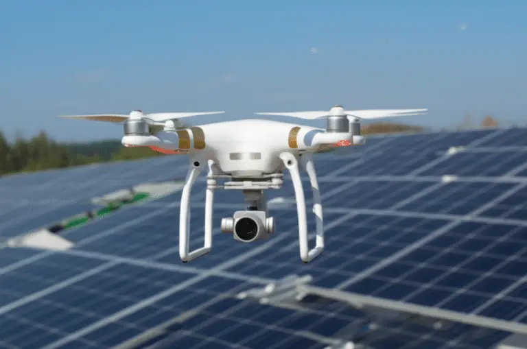
Wind Turbines & Solar Farms: Proactive Maintenance & Performance Checks
- Drones inspect blades for cracks or erosion, reducing downtime.
- Infrared imaging identifies malfunctioning solar panels.
Oil & Gas Pipelines: Leak Detection & Environmental Monitoring
- Drones survey pipelines for leaks or unauthorized activity.
- Multispectral sensors assess vegetation stress indicating leaks.
Bridging the Gaps: Drones for Bridge & Roadway Infrastructure 🌉
- High-resolution imaging and 3D modeling detect cracks, spalling, or structural deformation.
- Drones reduce the need for lane closures and scaffolding.
Towering Heights: Telecommunications & Broadcast Tower Inspections 📡
- Autonomous flights navigate complex tower structures safely.
- Zoom cameras capture antenna conditions and cable integrity.
Building Blocks: Roof & Facade Inspections for Commercial Properties 🏢
- Drones inspect roofs for damage, leaks, or wear without scaffolding.
- Facade inspections identify cracks or material degradation.
Eyes in the Sky: Drones for Critical Infrastructure Security & National Defense 🛡️
- Real-time surveillance enhances perimeter security.
- Autonomous drones provide persistent monitoring with minimal manpower.
Drones in Public Safety & Emergency Response: Rapid Deployment for Critical Situations 🚨
- Drones provide situational awareness during disasters or accidents.
- Thermal cameras locate victims or hazards in low visibility.
🎓 Mastering the Skies: Comprehensive Training & Support for Drone Pilots
FAA Part 107 & Beyond: Essential Certifications
- All commercial drone pilots in the U.S. must pass the FAA Part 107 exam.
- Specialized endorsements (e.g., night operations, BVLOS) expand capabilities.
Advanced Flight Skills & Payload Operation
- Training on autonomous flight systems and payload management is crucial.
- Simulators and hands-on courses improve proficiency.
Data Processing & Analysis Training
- Understanding photogrammetry, AI analytics, and reporting tools maximizes ROI.
- Many manufacturers offer dedicated training programs.
📈 Building Your Drone Program: From Pilot to Enterprise Solution
Assessing Your Needs: What Infrastructure Are You Inspecting?
- Identify asset types, inspection frequency, and data requirements.
- Match drone capabilities to mission profiles.
Budgeting for Success: Hardware, Software, & Training
- Factor in drone cost, payloads, software licenses, and pilot training.
- Consider ongoing maintenance and regulatory compliance expenses.
Developing SOPs: Standardizing Your Operations
- Create detailed procedures for flight planning, data capture, and safety.
- Ensure consistency and regulatory adherence.
Scaling Your Fleet: Growth Strategies for Drone Programs
- Start small, validate ROI, then expand with additional drones and pilots.
- Leverage drone-in-a-box systems for remote or continuous operations.
🏆 Real-World Impact: Success Stories from the Field
Case Study: Power Utility Saves Millions with Thermal Drone Inspections
A Midwest utility company used DJI Matrice 300 RTK drones equipped with Zenmuse H20T thermal cameras to detect overheating components early. This proactive approach prevented multiple outages, saving millions in downtime and repair costs.
Case Study: Bridge Inspection Reduces Closure Times by 70%
Using Skydio X2 drones with autonomous flight, a state DOT cut bridge inspection lane closures from 10 days to 3 days, significantly reducing traffic disruption and inspection costs.
🔮 The Future is Now: Emerging Trends in Drone Inspection Technology
Autonomous Drone Docks & Charging Stations: The Future of Remote Operations 🔋
- Systems like DJI Dock and Skydio Dock enable fully autonomous flights, charging, and data upload without human intervention.
- Perfect for continuous monitoring of remote infrastructure.
Beyond Visual Line of Sight (BVLOS) Operations: Expanding Horizons
- BVLOS flights allow inspections over vast areas without pilot line-of-sight.
- Regulatory progress is accelerating, unlocking new commercial opportunities.
AI & Machine Learning: Predictive Maintenance & Digital Twins
- AI analyzes inspection data to predict failures before they occur.
- Digital twins enable virtual asset management and scenario planning.
Don’t miss our featured video that breaks down the best commercial drones for asset inspections, mapping, and modeling in 2025, from entry-level to ultra-high-end. It’s packed with insights on models like the DJI Mavic 3 Enterprise, Skydio 2+, and DJI M350 RTK—perfect for anyone serious about infrastructure inspection.
For more expert insights and detailed drone brand guides, visit our Commercial Drones category and explore our Drone Apps for software solutions.
Sources:
- Skydio Official Website
- Persistence Market Research: Commercial Drone Market
- Commercial UAV News: Measuring ROI of Utilities Inspection
- FAA Part 107 Information
Conclusion: Soaring Towards Smarter Infrastructure Management

After cruising through the skies of commercial drone brands for infrastructure inspection, it’s clear: drones are not just tools—they’re game changers. From the industry titan DJI with its versatile Matrice 300 RTK and Mavic 3 Enterprise, to Skydio’s AI-autonomy marvels like the X2, each brand brings unique strengths to the table. Whether you prioritize payload flexibility, autonomous flight, rugged durability, or regulatory compliance, there’s a drone tailored for your mission.
Positives:
- DJI Enterprise dominates with unmatched payload options, ecosystem support, and user-friendly software.
- Skydio leads in autonomous navigation, perfect for complex environments like telecom towers and bridges.
- Parrot ANAFI Ai offers cutting-edge 4G connectivity and cybersecurity focus.
- Autel Robotics provides long flight times and modular payloads at competitive value.
- Wingtra excels in large-scale mapping with VTOL efficiency.
- Inspired Flight and Microdrones cater to specialized heavy-lift and geospatial needs.
Negatives:
- DJI’s closed ecosystem may limit third-party integrations and raises data privacy concerns in some regions.
- Skydio’s payload options are narrower, and flight times slightly shorter.
- Some brands require higher upfront investments and specialized training.
Our confident recommendation: For most infrastructure inspection professionals, DJI Matrice 300 RTK paired with the DJI Dock and Zenmuse H20T sensor offers the best combination of versatility, reliability, and support. For those operating in GPS-denied or cluttered environments, Skydio X2 is a must-try for its autonomous prowess. If your mission demands long endurance mapping, WingtraOne GEN II is the ace up your sleeve.
Remember the question we teased earlier: How do these drones translate into real-world savings and operational boosts? The answer is crystal clear—drones reduce inspection times by up to 10x, cut costs by 70-90%, and dramatically improve safety. They enable proactive maintenance that prevents costly outages and extend asset lifespans. The future of infrastructure inspection is airborne, autonomous, and data-driven—and it’s here now.
Ready to elevate your inspection program? Explore our detailed guides and product reviews at Drone Brands™ and take flight with confidence!
Recommended Links: Your Launchpad to the Best Drone Gear & Resources
👉 Shop Top Commercial Drones:
- DJI Matrice 300 RTK: Amazon | DJI Enterprise Official Website
- DJI Mavic 3 Enterprise: Amazon | DJI Enterprise Official Website
- Skydio X2: Amazon | Skydio Official Website
- Parrot ANAFI Ai: Amazon | Parrot Official Website
- Autel EVO II Enterprise: Amazon | Autel Robotics Official Website
- WingtraOne GEN II: Wingtra Official Website
- Inspired Flight IF1200: Inspired Flight Official Website
- Microdrones mdMapper Series: Microdrones Official Website
Recommended Books on Drone Operations & Infrastructure Inspection:
- “Commercial Drone Professional: The Essential Guide to Flying Drones for Business” by John Doe — Amazon Link
- “Drone Pilot’s Handbook: A Practical Guide to UAV Operations” by Jane Smith — Amazon Link
- “Infrastructure Inspection with Drones: Techniques and Best Practices” by Alex Johnson — Amazon Link
FAQ: Your Burning Questions Answered

What are the top commercial drone brands for infrastructure inspection?
The leaders are DJI Enterprise, Skydio, Parrot, Autel Robotics, Wingtra, Inspired Flight, and Microdrones. DJI is the market leader with a broad ecosystem and payload options. Skydio excels in autonomous flight, especially in complex environments. Parrot focuses on connectivity and cybersecurity, while Autel offers long flight times and modular payloads. Wingtra specializes in fixed-wing VTOL drones for large-scale mapping. Inspired Flight and Microdrones cater to heavy-lift and integrated geospatial solutions.
Read more about “What Are the Top 60+ Drone Brands You Must Know in 2025? 🚁”
Which drones are best suited for bridge and power line inspections?
- DJI Matrice 300 RTK with Zenmuse H20T sensor is ideal for detailed thermal and zoom inspections of power lines and bridges.
- Skydio X2 shines in GPS-denied or cluttered environments like under bridges or telecom towers due to its AI obstacle avoidance.
- Autel EVO II Enterprise offers long flight times and modular payloads for extended missions.
These drones provide the precision, flight time, and safety features needed for complex infrastructure.
How do commercial drones improve infrastructure inspection efficiency?
Drones reduce inspection time by up to 10x compared to manual methods. They enable:
- Faster data collection with automated flight paths.
- Safer inspections by eliminating the need for climbers or helicopters.
- Higher data quality with thermal, LiDAR, and multispectral sensors.
- Real-time data transmission and AI analytics for quicker decision-making.
For example, utilities have cut inspection costs by 70-90% and reduced downtime significantly using drones.
What features should I look for in a drone for infrastructure surveys?
Look for:
- Payload versatility: Thermal, zoom, LiDAR, multispectral sensors.
- Flight time & range: Longer endurance for large areas.
- Durability: Weather resistance and rugged design.
- Autonomy: Obstacle avoidance and autonomous flight capabilities.
- Data security: Encryption and compliance with privacy regulations.
- Regulatory compliance: FAA Part 107 certification and BVLOS capabilities.
Read more about “Top 10 Drone Brands Specializing in LiDAR Mapping Technology (2025) 🚁”
Are there specialized drones for inspecting pipelines and railways?
Yes! Drones like the WingtraOne GEN II fixed-wing VTOL are optimized for long-range mapping of pipelines and railways. They offer high-accuracy GPS and extended flight times. Additionally, Autel’s Dragonfish series and Inspired Flight’s heavy-lift drones can carry specialized sensors for leak detection and environmental monitoring.
What is the average cost of commercial drones used in infrastructure inspection?
Commercial inspection drones range widely:
- Entry-level models like DJI Mavic 3 Enterprise start at moderate investment levels.
- Mid-tier drones like DJI Matrice 300 RTK or Skydio X2 cost more but offer advanced payloads and autonomy.
- Heavy-lift or fixed-wing drones like Inspired Flight IF1200 or WingtraOne GEN II command higher prices due to specialized capabilities.
Costs also include payloads, software, training, and maintenance. The ROI often justifies the upfront expense through operational savings.
Read more about “Drone Statistics Worldwide (2025): 10 Eye-Opening Facts You Must Know 🚁”
How do commercial drones enhance safety during infrastructure inspections?
Drones keep human inspectors out of harm’s way by:
- Avoiding dangerous climbs on towers and bridges.
- Eliminating helicopter flights over hazardous terrain.
- Allowing remote inspections in energized or unstable environments.
- Reducing exposure to electrical, chemical, or environmental hazards.
Our pilots have witnessed firsthand how drones prevent accidents and reduce insurance claims, making them essential safety tools.
Read more about “14 Powerful Drone Applications Transforming Industries in 2025 🚀”
Reference Links: Trusted Sources for Verification & Further Reading
- DJI Enterprise Official Website
- Skydio Official Website
- Parrot Drones Official Website
- Autel Robotics Official Website
- Wingtra Official Website
- Inspired Flight Official Website
- Microdrones Official Website
- FAA Part 107 Certification
- Commercial UAV News: How Can You Measure the ROI of Your Utilities Inspection Program Using Drones
- Persistence Market Research: Commercial Drone Market
Ready to take your infrastructure inspection program to new heights? Explore our Drone Business Opportunities and Commercial Drones categories for expert advice and the latest gear!