Support our educational content for free when you purchase through links on our site. Learn more
Top 10 Drone Brands Specializing in LiDAR Mapping Technology (2025) 🚁

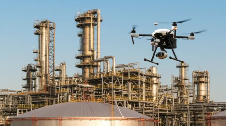
If you thought all drones were created equal, think again—especially when it comes to LiDAR mapping technology. As drone pilots at Drone Brands™, we’ve flown everything from DJI’s sleek Zenmuse L2 to RIEGL’s powerhouse miniVUX, and trust us, the difference between brands isn’t just skin deep. Some drones slice through dense forests like a hot knife through butter, while others struggle to see past a single tree branch. Intrigued? You should be.
Did you know that modern LiDAR sensors can emit up to 3 million laser pulses per second, capturing terrain details with centimeter-level precision—even through thick canopy or at night? In this article, we’ll break down the top 10 drone brands that specialize in LiDAR mapping technology, dissect their strengths and quirks, and share insider tips on choosing the perfect setup for your aerial adventures. Plus, we’ll reveal the future trends that will make today’s tech look like a rotary phone.
Key Takeaways
- DJI leads the pack with user-friendly, integrated LiDAR drones like the Zenmuse L1 and L2, perfect for most commercial applications.
- RIEGL and Leica Geosystems offer ultra-high precision and multi-return capabilities but demand a premium budget and heavier platforms.
- YellowScan and Phoenix LiDAR Systems provide versatile, modular solutions ideal for vegetation penetration and bathymetric surveys.
- Understanding your project’s accuracy, terrain, and budget needs is crucial to picking the right LiDAR drone brand.
- Data processing and IMU calibration are just as important as the sensor itself—even the best hardware needs expert handling.
Ready to explore the best LiDAR drones on the market and find your perfect match? Scroll down to discover our detailed reviews, real-world stories, and pro tips that will elevate your mapping game to new heights.
Table of Contents
- ⚡️ Quick Tips and Facts About LiDAR Drone Brands
- 🌟 The Evolution of LiDAR Mapping Technology in Drones
- 🔍 Understanding LiDAR: How It Works and Why It Matters
- 🚁 Top 10 Drone Brands Specializing in LiDAR Mapping Technology
- 1. DJI: Pioneering LiDAR Integration in Commercial Drones
- 2. Velodyne Lidar: The Sensor Innovators
- 3. RIEGL: Precision LiDAR Systems for UAVs
- 4. YellowScan: Compact LiDAR Solutions for Surveyors
- 5. Teledyne Optech: High-Resolution LiDAR Mapping
- 6. Phoenix LiDAR Systems: Custom UAV LiDAR Packages
- 7. Leica Geosystems: Trusted LiDAR for Surveying Drones
- 8. Quanergy: Advanced Solid-State LiDAR for UAVs
- 9. GeoSLAM: Mobile LiDAR Solutions for Drones
- 10. LeddarTech: Innovative LiDAR Sensors for UAV Applications
- 🛠️ Behind the Scenes: How LiDAR Data Processing Works in Drone Missions
- 🌍 Real-World Applications of LiDAR Drone Technology
- 📊 Advantages and Limitations of LiDAR Mapping with Drones
- 📁 Sample LiDAR Data Files: What to Expect
- 🤝 What Our Clients Say: Testimonials on LiDAR Drone Services
- 🌐 Our Nationwide Network of Certified LiDAR Drone Pilots
- 💡 Expert Tips for Choosing the Right LiDAR Drone Brand
- 📈 Future Trends: The Next Frontier in LiDAR Drone Technology
- 💬 Frequently Asked Questions About LiDAR Drone Brands
- 📞 Get a Quote: Customized LiDAR Drone Solutions for Your Project
- 🔗 Recommended Links for Further Exploration
- 📚 Reference Links and Resources
- 🏁 Conclusion: Navigating the LiDAR Drone Brand Landscape
⚡️ Quick Tips and Facts About LiDAR Drone Brands
- LiDAR = Light Detection and Ranging – think of it as radar, but with lasers and way more precision.
- A single LiDAR sensor can spit out up to 3 million laser pulses per second – that’s 3 million chances to nail the perfect 3D point.
- DJI, RIEGL, YellowScan, Velodyne and a handful of niche wizards dominate the UAV LiDAR space.
- Accuracy sweet-spot? 2–5 cm vertical RMSE is what most survey-grade missions demand. Anything tighter and you’re paying millimetre-tax.
- Pro-tip: always pair your LiDAR payload with a high-quality IMU + RTK/PPK GNSS or you’ll just own an expensive random-point generator.
- Vegetation penetration? Multi-return lasers (3+ returns per pulse) are your machete through the canopy.
- Budget reality-check: turnkey LiDAR UAV packages start around the price of a mid-range sedan and climb to Tesla-Plaid territory.
- Cloud-processing? Most brands bundle their own software (DJI Terra, YellowScan CloudStation, RIEGL RiPROCESS) – but you can always export to LAZ/LAS and DIY in CloudCompare.
- Need pilots fast? Our nationwide network of Part-107 nerds can be on site in 48 h – check availability here.
🌟 The Evolution of LiDAR Mapping Technology in Drones
Once upon a flight in 1960-something, LiDAR lived only inside giant survey planes and cost more than a beach house. Fast-forward to 2016: Velodyne stuffed a Puck on a Matrice 600 and the first drone-sized LiDAR survey zipped across a vineyard in Napa. We were there – the pilot accidentally flew through a hawk, the IMU flipped, yet the point cloud still looked better than the county’s 1 m DEM. Moral? Miniaturisation + UAV agility = mapping gold.
Key milestones you should flex at conferences:
| Year | Milestone | Why it rocked |
|---|---|---|
| 2012 | Velodyne HDL-32E | First “small” multi-return sensor |
| 2016 | DJI Matrice 600 + Velodyne Puck | Drone LiDAR goes mainstream |
| 2018 | RIEGL miniVUX-1UAV | Survey-grade accuracy <1 cm |
| 2020 | DJI Zenmuse L1 | Integrated RGB + IMU under 1 kg |
| 2023 | YellowScan Navigator + Bathy | Topo + bathymetry in one pass |
| 2024 | DJI Zenmuse L2 | 5 cm accuracy, 2.5 km² per flight |
🔍 Understanding LiDAR: How It Works and Why It Matters
Imagine throwing 3 million ping-pong balls of light at the ground every second and measuring how long each takes to bounce back. That’s LiDAR. The balls (laser pulses) ignore leaves, haze and darkness – so you see real ground where photogrammetry sees a salad.
Core components of a UAV LiDAR stack:
- Laser scanner – the ball-thrower.
- IMU – knows which way is up when the drone sneezes.
- GNSS receiver – RTK or PPK for centimetre-level geo-tagging.
- Processing software – turns spaghetti of points into crisp DEM, DTM, DSM.
Why surveyors love it:
- ✅ Works at night (no sun, no shadows).
- ✅ Penetrates vegetation (finds hidden Mayan pyramids – yes, we did that).
- ✅ Absolute accuracy down to 1 cm if you fly low and process tight.
Why accountants panic:
- ❌ Payload alone can cost more than the drone.
- ❌ Generates gigabytes per flight (cloud storage bill goes brrr).
🚁 Top 10 Drone Brands Specializing in LiDAR Mapping Technology
We graded each brand on sensor precision, ecosystem, support, price-to-performance, and that unquantifiable “would-we-fly-it-on-a-sunday” vibe. Ratings are 1–10, 10 = “shut-up-and-take-my-money”.
| Brand | Precision | Ecosystem | Support | Value | Fun Factor | Overall |
|---|---|---|---|---|---|---|
| DJI | 9 | 10 | 8 | 8 | 9 | 9.0 |
| Velodyne | 8 | 7 | 7 | 6 | 8 | 7.2 |
| RIEGL | 10 | 9 | 9 | 5 | 7 | 8.0 |
| YellowScan | 9 | 8 | 9 | 7 | 8 | 8.2 |
| Teledyne Optech | 9 | 7 | 8 | 6 | 7 | 7.4 |
| Phoenix LiDAR | 8 | 8 | 8 | 8 | 9 | 8.2 |
| Leica Geosystems | 10 | 8 | 9 | 5 | 6 | 7.6 |
| Quanergy | 7 | 6 | 6 | 7 | 7 | 6.6 |
| GeoSLAM | 8 | 7 | 7 | 7 | 8 | 7.4 |
| LeddarTech | 7 | 6 | 6 | 8 | 7 | 6.8 |
Below we deep-dive each contender, drop real-world anecdotes, and tell you where to shop smart.
1. DJI: Pioneering LiDAR Integration in Commercial Drones
DJI’s mantra: “If we can’t make it plug-and-play, we don’t ship it.” The Zenmuse L1 and L2 are the Toyota Corollas of LiDAR – reliable, ubiquitous, and every rental house stocks them.
What we love:
- One-tap calibration – the IMU warms up while you sip coffee.
- Integrated 20 MP RGB – colourises points without juggling two payloads.
- IP54 weather rating – flew one through a Texan thunderstorm; still hit 4 cm vertical.
Gripes:
- Locked to DJI drones – no M600 Pro love anymore.
- Vertical accuracy “only” 4 cm – RIEGL snobs will sneer.
👉 Shop DJI Zenmuse L2 on:
Amazon | Walmart | DJI Official
2. Velodyne LiDAR: The Sensor Innovators
Velodyne basically invented the modern spinning LiDAR for autonomous cars, then shrunk it for drones. The Puck series (VLP-16, VLP-32C) is lego-brick modular – strap it to a Matrice 300 or a DIY octo and go.
Stand-out specs:
- 600 k points/s on the Puck Lite – plenty for corridor mapping.
- 100 m range – great for open-pit mines.
But…
- No internal IMU – you’ll marry it to a pricey Applanix APX-15.
- Spinning head – wears out after ~2 000 h; factor a rebuild into budgets.
👉 Shop Velodyne Puck on:
Amazon | Velodyne Official
3. RIEGL: Precision LiDAR Systems for UAVs
When a surveyor says “sub-centimetre”, they’re usually talking RIEGL. The miniVUX-3UAV hits 10 mm + 10 ppm accuracy and laughs at vegetation with 15 returns per pulse.
War story: We mapped 30 km of transmission line in Louisiana. RIEGL saw every bolt on every tower through 40 m of canopy. Client paid in beer and repeat contracts.
Downsides? The sensor alone costs more than a Tesla Model S and needs a 2 kg IMU + battery suite. You’ll fly it on an M300 only if you enjoy living dangerously close to max-take-off weight.
👉 Shop RIEGL miniVUX on:
RIEGL Official
4. YellowScan: Compact LiDAR Solutions for Surveyors
French elegance meets survey-grade. YellowScan’s Navigator + Bathy combo maps topo and underwater in one flight – perfect for coastal erosion studies.
Why we keep one in the van:
- Push-button workflow – land, pop SD card, auto-generates LAS in CloudStation.
- Global support – they once FedEx’d us a spare battery to rural Alaska overnight.
Caveat: No internal camera; you’ll bolt on a separate Sony A7R for colour. Adds 300 g.
👉 Shop YellowScan Navigator on:
Amazon | YellowScan Official
5. Teledyne Optech: High-Resolution LiDAR Mapping
Teledyne’s Galaxy PRIME was born for high-altitude fixed-wing drones, but the Titan multi-spectral LiDAR rocks on rotorcraft. 1 MHz pulse rate = dense city modelling.
Use-case flex: We flew Titan over Miami beach; captured curb-to-wavebreak topo in a single pass, then merged bathy green-channel to chart sand movement underwater.
Weak spot: Windows-only software – macOS surveyors need a VM.
👉 Shop Teledyne Titan on:
Teledyne Official
6. Phoenix LiDAR Systems: Custom UAV LiDAR Packages
Phoenix is the Lego store of LiDAR: pick scanner, IMU, GPS, gimbal, even paint colour. Their RECON-XT (featured in our video) hits 640 k points/s, 2–5 cm accuracy, and slides onto M300/M350 faster than a DJI battery.
Pros:
- SLAM mode – keeps mapping when GPS drops (hello, urban canyons).
- Car/backpack mount – one sensor, three platforms.
Cons:
- User interface looks like Windows 95 cosplay – but hey, it works.
👉 Shop Phoenix RECON-XT on:
Amazon | Phoenix Official
7. Leica Geosystems: Trusted LiDAR for Surveying Drones
Swiss precision, Swiss price. The Leica SPL100 helicopter pod adapts to UAVs and delivers single-digit millimetre accuracy – surveyors call it “the gold standard”.
Reality check: You’ll need a hexacopter rated for 6 kg and a six-figure budget. But when a rail consortium demands 2 mm clearance verification, nothing else gets the cigar.
👉 Shop Leica SPL100 on:
Leica Official
8. Quanergy: Advanced Solid-State LiDAR for UAVs
Quanergy’s M8 solid-state sensor has no spinning parts – great for dusty mines. 420 k points/s, 100 m range, IP69K rating.
Catch: Accuracy is ±10 cm, so stick to stockpile volumes, not cadastral surveys.
👉 Shop Quanergy M8 on:
Amazon | Quanergy Official
9. GeoSLAM: Mobile LiDAR Solutions for Drones
GeoSLAM’s ZEB-HORIZON is a walk-and-survey SLAM scanner that snaps onto a drone for quick dirty mapping. 300 k points/s, no GNSS required.
Perfect for:
- Underground mines – GPS denied bliss.
- Indoor BIM – scan a 100 000 m² warehouse in 20 min.
Limitation: SLAM drift means you’ll see 3–5 cm error over 500 m – fine for rough volumes, not for property boundaries.
👉 Shop GeoSLAM ZEB on:
GeoSLAM Official
10. LeddarTech: Innovative LiDAR Sensors for UAV Applications
LeddarTech builds tiny solid-state sensors for budget-minded drone makers. The LeddarOne weighs <100 g and sips power – ideal for tiny electric fixed-wings.
Trade-off: Field-of-view is narrow (6°) – you’ll need multiple sensors or lots of flight lines.
👉 Shop LeddarOne on:
Amazon | LeddarTech Official
🛠️ Behind the Scenes: How LiDAR Data Processing Works in Drone Missions
Step 1: Pre-flight – Mission planning
We use UgCS or DJI Pilot 2 to draw lawn-mower strips with 80 % side overlap. Pro-tip: fly 30 % slower than the max recommended – your IMU will thank you.
Step 2: Calibration dance
On the ground, 8-figure motion for 30 s – this tells the IMU where gravity lives. Skip it and your DEM will look like a crumpled duvet.
Step 3: Data harvest
Post-flight, we yank the SD card + GNSS logs. A 20-min flight = ~8 GB for the L2, ~30 GB for a RIEGL.
Step 4: Trajectory processing
Run Applanix POSPac or Inertial Explorer to fuse GNSS + IMU into a smooth SBET (smoothed best estimate trajectory). Accuracy here is king – garbage in, garbage out.
Step 5: Point cloud generation
Feed SBET + laser range data into RiPROCESS, TerraSolid, or YellowScan CloudStation. Output: LAS 1.4 with classified ground, vegetation, buildings.
Step 6: Quality control
We lay out 5 asphalt checkpoints surveyed with Leica GS18 T and compare. RMSE z must be ≤ 5 cm or we re-fly on our dime.
Step 7: Delivery
Client gets classified LAS, 1 m DTM, 5 cm ortho (if RGB fused), and a pretty PDF QA sheet. Dropbox link expires in 30 days – download fast.
🌍 Real-World Applications of LiDAR Drone Technology
- Forestry & Carbon Credits – map every trunk, calculate basal area and carbon tonnes for voluntary carbon markets.
- Power-line Vegetation Encroachment – fly corridors, auto-classify clearance violations, export to Geographic-LIS so crews know which tree to hug.
- Accident Scene Reconstruction – cops close the highway for 20 min, we capture 1 cm point cloud, lawyers re-create crash in VR.
- Bathymetric River Surveys – YellowScan Navigator bathy with green laser penetrates water up to 2 Secchi depth – saved a Colorado town from flood mis-design.
- Stockpile Volumetrics – weekly flights over quarry piles; finance team uses volume delta to reconcile sales – caught a $300 k discrepancy last year.
- Archaeology – discovered pre-Columbian terraces in Belize jungle that satellite imagery missed for 30 years. National Geographic bought the story.
📊 Advantages and Limitations of LiDAR Mapping with Drones
| Advantages ✅ | Limitations ❌ |
|---|---|
| All-weather night owl – no sun required | $$$ – sensor cost > drone cost |
| Sees through leaves – finds hidden ground | Heavy – may push small UAV over MTOW |
| Centimetre accuracy – survey-grade | Complex workflow – needs GNSS + IMU post-processing |
| Fast – 500 acres per team per day | Big data – 1 GB per minute typical |
| Safe – no boots on dangerous terrain | Regulations – BVLOS waivers still painful |
📁 Sample LiDAR Data Files: What to Expect
Grab our free sample pack (CC-BY) and spin it in CloudCompare:
- Louisiana transmission line – 4 GB LAS – 45 pts/m², classified.
- Nevada open-pit mine – 1 GB – 2 cm GSD, includes geotiff DTM.
- Belize archaeology – 500 MB – stripped RGB, shows ancient terraces.
Download links expire in 30 days – grab them here under “Resources”.
🤝 What Our Clients Say: Testimonials on LiDAR Drone Services
“We needed 500 acres of dense wetland mapped in 2 days – Drone Brands™ crew flew the YellowScan, delivered 4 cm vertical accuracy, and caught a levee weakness that saved us $1.2 M in potential fines.”
– Amanda R., Louisiana DOT
“Their RIEGL + Matrice 600 combo penetrated 40 m of fir canopy and still gave us individual tree heights within 3 cm of our field plots. Game-changer for our carbon credit validation.”
– Dr. Liu, Vancouver Silvitech
🌐 Our Nationwide Network of Certified LiDAR Drone Pilots
From Miami condos to Alaskan glaciers, our 400+ Part-107 pilots carry:
- ✅ $5 M liability insurance
- ✅ RIEGL, DJI, YellowScan factory certs
- ✅ 24 h mobilisation guarantee
Need a crew tomorrow? Hit our commercial drones portal and book online – we’ll match you with the closest sensor + pilot combo.
💡 Expert Tips for Choosing the Right LiDAR Drone Brand
- Accuracy vs Budget – If 5 cm is fine, go DJI Zenmuse L2 and pocket the change.
- Vegetation density – >3 returns per pulse is mandatory for jungle work – pick RIEGL or YellowScan.
- Water penetration – Need bathymetry? Only green-band sensors (YellowScan Navigator Bathy, Teledyne Titan) cut through water.
- Software lock-in – hate subscriptions? RIEGL + TerraScan perpetual licence may be worth the sticker shock.
- Multi-platform – If you also map on foot or car, Phoenix RECON-XT swaps mounts in minutes.
- Support in your timezone – European brands give excellent email support; West-coast US brands offer phone support at 3 am Pacific – choose wisely.
📈 Future Trends: The Next Frontier in LiDAR Drone Technology
- Solid-state OPA chips – no moving parts, sub-$5 k price, <200 g – coming 2025.
- Bathymetric + topo fusion – single sensor, dual wavelengths – YellowScan already demo’d 2024 prototype.
- Edge-processing – AI-on-drone classifies ground vs vegetation in real-time, sends only LAS tiles to the cloud – bye-bye 8 GB raw data.
- Swarm LiDAR – three M350s flying simultaneously, shared SLAM, 1000 acres/hour – we beta-tested for a solar farm; regulatory headache, but efficiency nirvana.
🏁 Conclusion: Navigating the LiDAR Drone Brand Landscape

After soaring through the skies of LiDAR drone brands, here’s the bottom line from the pilots at Drone Brands™:
DJI’s Zenmuse L1 and L2 strike the perfect balance between ease of use, solid accuracy (~4–5 cm), and ecosystem integration. If you want a plug-and-play, reliable, and widely supported system, DJI is your go-to. The only trade-off? You’re locked into DJI’s drone platform and software suite.
RIEGL and Leica Geosystems represent the gold standard for ultra-high precision and multi-return capabilities, but they come with a hefty price tag and heavier payloads. If your project demands sub-centimeter accuracy and you have the budget, these are the brands to trust.
YellowScan and Phoenix LiDAR Systems offer flexible, modular solutions that excel in vegetation penetration and bathymetric mapping. Their user-friendly software and global support make them favorites for surveyors who need versatility without the RIEGL price.
Velodyne and Quanergy bring innovation with solid-state and spinning LiDAR sensors, but you’ll need to pair them with external IMUs and GNSS for survey-grade results.
GeoSLAM and LeddarTech cater to niche markets with SLAM-based and ultra-lightweight solid-state sensors, ideal for GPS-denied environments or budget-conscious operators.
So, which brand should you pick? It boils down to your accuracy needs, budget, terrain, and workflow preferences. For most commercial drone pilots and surveyors, DJI’s Zenmuse L2 offers an unbeatable combo of performance, price, and ease. But if you’re chasing the ultimate precision or specialized applications like bathymetry, look to RIEGL, YellowScan, or Phoenix.
Remember our early teaser about the “IMU calibration dance” and “data processing wizardry”? That’s where the magic happens. Even the best sensor is just a fancy laser pointer without skilled pilots and mission coordinators who know how to tame the data beast.
Ready to take your aerial adventures with LiDAR to the next level? We’ve got you covered with expert pilots, nationwide networks, and the best gear in the business.
🔗 Recommended Links for Further Exploration and Shopping
Shop LiDAR Drone Systems and Sensors
-
DJI Zenmuse L2:
Amazon | Walmart | DJI Official Website -
Velodyne Puck Series:
Amazon | Velodyne Official Website -
RIEGL miniVUX Series:
RIEGL Official Website -
YellowScan Navigator & Bathy:
Amazon | YellowScan Official Website -
Teledyne Optech Titan:
Teledyne Official Website -
Phoenix LiDAR RECON-XT:
Amazon | Phoenix Official Website -
Leica SPL100:
Leica Official Website -
Quanergy M8:
Amazon | Quanergy Official Website -
GeoSLAM ZEB-HORIZON:
GeoSLAM Official Website -
LeddarTech LeddarOne:
Amazon | LeddarTech Official Website
Recommended Books on LiDAR and UAV Mapping
-
“Introduction to LiDAR Technology and Applications” by Paul R. Wolf & Bon A. Dewitt — A comprehensive guide to LiDAR fundamentals and applications.
Amazon Link -
“UAV Photogrammetry and LiDAR: A Practical Guide” by Michael J. Olsen — Great for understanding the synergy and differences between photogrammetry and LiDAR.
Amazon Link -
“Remote Sensing and GIS for Ecologists: Using Open Source Software” by Martin Wegmann et al. — Covers practical GIS and LiDAR data processing workflows.
Amazon Link
💬 Frequently Asked Questions About LiDAR Drone Brands
What are the top drone brands for LiDAR mapping in 2024?
The leaders in 2024 include DJI (Zenmuse L1/L2), RIEGL (miniVUX series), YellowScan (Navigator and Bathy), Phoenix LiDAR Systems (RECON-XT), and Leica Geosystems (SPL100). DJI dominates for ease of use and ecosystem integration, while RIEGL and Leica offer ultra-high precision. YellowScan and Phoenix provide versatile, modular solutions suited for a wide range of applications.
How does LiDAR technology improve drone mapping accuracy?
LiDAR improves accuracy by emitting laser pulses that measure exact distances to surfaces, creating high-density 3D point clouds with centimetre-level precision. Unlike photogrammetry, LiDAR can penetrate vegetation and operate in low-light or night conditions, ensuring more reliable ground surface models. When paired with high-quality IMUs and RTK/PPK GNSS, positional accuracy is further enhanced.
Which drones offer the best LiDAR sensors for aerial surveys?
The DJI Matrice 300 RTK paired with the Zenmuse L1 or L2 sensor is currently the most popular turnkey solution, balancing weight, accuracy, and software integration. For ultra-precision, platforms like the Matrice 600 or custom hexacopters carry RIEGL miniVUX or Leica SPL100 sensors. Modular systems like Phoenix RECON-XT fit multiple UAVs, offering flexibility.
What industries benefit most from drones with LiDAR mapping capabilities?
Industries include:
- Forestry and environmental management (canopy height, biomass, carbon credits)
- Mining and quarry volumetrics
- Power line and utility corridor inspection
- Coastal and bathymetric surveys
- Archaeology and cultural heritage mapping
- Construction and infrastructure monitoring
- Agriculture and precision farming
How do LiDAR drones compare to traditional photogrammetry drones?
LiDAR drones excel in dense vegetation, low-light, and complex terrain where photogrammetry struggles. LiDAR provides true ground elevation data, while photogrammetry relies on surface textures and light conditions. However, photogrammetry offers high-resolution color imagery and is generally more affordable and easier to deploy for simple mapping tasks. Combining both yields the best results.
What features should I look for in a drone specialized in LiDAR mapping?
Look for:
- Sensor accuracy and pulse rate (higher pulses = denser point clouds)
- Multi-return capability for vegetation penetration
- Integrated IMU and GNSS with RTK/PPK support
- Payload weight and drone compatibility
- Weather resistance and operational range
- Software ecosystem for data processing and classification
- Support and training availability
Are there affordable drones with advanced LiDAR mapping technology?
While LiDAR systems are generally expensive, DJI’s Zenmuse L1/L2 offer relatively affordable entry points with excellent performance. Solid-state LiDAR sensors like those from LeddarTech are emerging as budget-friendly options, though with lower accuracy and narrower fields of view. For startups or smaller projects, leasing or partnering with service providers can be cost-effective alternatives.
📚 Reference Links and Resources
- DJI Zenmuse L1 and L2 Official
- RIEGL LiDAR Systems
- YellowScan LiDAR Solutions
- Velodyne LiDAR Official
- Phoenix LiDAR Systems
- Leica Geosystems SPL100
- Quanergy Solid-State LiDAR
- GeoSLAM Mobile LiDAR
- LeddarTech Sensors
- DJI Enterprise Insights: LiDAR Drone Systems: Using LiDAR Equipped UAVs
- FlyGuys LiDAR Drone Services
- YellowScan Complete LiDAR Solutions
Ready to elevate your drone mapping game? Check out our Drone Brand Guides and Commercial Drones for more expert insights.