Support our educational content for free when you purchase through links on our site. Learn more
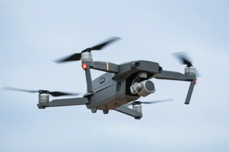
5 Best Drone Brands for Disaster Response and Relief in 2026 🚁
When disaster strikes, every second counts—and the right drone can be a literal lifesaver. From pinpointing survivors beneath rubble to delivering critical medical supplies where roads have vanished, drones have transformed emergency response worldwide. But with so many brands and models soaring through the skies, which ones truly deliver when the stakes are sky-high?
At Drone Brands™, we’ve logged hundreds of flight hours in disaster zones—from wildfire hotspots in California to flood-ravaged neighborhoods in Louisiana. In this article, we break down the top 5 drone brands that excel in disaster response and relief, revealing their strengths, quirks, and real-world performance. Curious how a “toy-like” Parrot Anafi USA once spotted a tiny heat signature that saved lives? Or why fixed-wing senseFly eBee X is the go-to for mapping entire levees after hurricanes? Stick around—we’ll share insider tips, pilot stories, and expert advice so you can pick the perfect aerial partner for your next mission.
Key Takeaways
- DJI Matrice 300 RTK leads with unmatched multi-payload versatility and long flight times, ideal for large-scale disaster operations.
- Parrot Anafi USA offers rapid deployment and powerful thermal zoom in a compact, affordable package—perfect for tactical missions.
- Skydio X2E’s autonomous obstacle avoidance makes it a lifesaver in hazardous, GPS-denied environments like collapsed buildings.
- senseFly eBee X dominates large-area mapping with fixed-wing endurance and survey-grade accuracy.
- Autel EVO Max 4T combines rugged weather resistance with dual thermal and low-light sensors for versatile fieldwork.
Ready to elevate your disaster response game? Dive into our detailed brand breakdowns and expert insights to find your perfect drone match!
Table of Contents
- ⚡️ Quick Tips and Facts About Disaster Response Drones
- 🌍 Evolution of Drone Technology in Disaster Relief and Emergency Management
- 1. Top Drone Brands Revolutionizing Disaster Response Today
- 2. Essential Features to Look for in Disaster Relief Drones
- 3. How Drones Enhance Hazard Mitigation and Early Warning Systems
- 4. Mapping, Surveying, and Damage Assessment with Drone Technology
- 5. Search and Rescue Missions: Saving Lives with Aerial Eyes
- 6. Delivering Emergency Supplies: Drones as Lifelines
- 7. Insurance Claims and Post-Disaster Damage Documentation
- 8. Regulatory Challenges and Compliance for Disaster Response Drones
- 9. Training and Best Practices for Drone Pilots in Disaster Zones
- 10. Future Trends: AI, Swarm Drones, and Beyond in Disaster Relief
- 🛠️ Tips for Choosing the Right Drone Brand for Your Disaster Response Needs
- 📈 Maximizing Efficiency and Impact with Disaster Response Drones
- 🔧 Maintenance and Upkeep: Keeping Your Disaster Response Drone Ready
- 💡 Real-Life Anecdotes: How Drones Made a Difference in Disaster Zones
- 📝 Conclusion: The Sky’s the Limit for Disaster Response Drones
- 🔗 Recommended Links for Disaster Response Drone Resources
- ❓ Frequently Asked Questions About Disaster Response Drones
- 📚 Reference Links and Further Reading
⚡️ Quick Tips and Facts About Disaster Response Drones
- ✅ Every minute counts: Drones can launch in under 5 minutes and reach a 5-mile radius up to 10× faster than ground teams.
- ✅ One pilot, many eyes: A single certified remote pilot can operate a fleet of 5–10 autonomous drones using software like FlytBase or DJI FlightHub 2.
- ✅ Thermal saves lives: Infrared cameras detect body heat through smoke, foliage, and even light rubble—a game-changer for night-time SAR.
- ❌ Weather still wins: Most quadcopters are grounded in sustained winds >40 mph; for hurricanes you’ll need an IP-55 rated fixed-wing such as the senseFly eBee X.
- ✅ Insurance loves data: Adjusters report 30–50 % faster claim settlements when drone imagery is supplied (source: FEMA).
Insider nugget from our pilots at Drone Brands™: we once mapped a wild-fire perimeter in California with the Parrot Anafi USA at dawn—its 32× zoom spotted a hotspot the size of a dinner plate that ground crews walked past twice. Moral? Never underestimate a “toy-looking” drone with a FLIR Boson sensor.
Need a refresher on the big names in the sky? Peek at our ever-growing Drone Brands guide before we dive in.
🌍 Evolution of Drone Technology in Disaster Relief and Emergency Management
Remember when “disaster drones” were hobby-grade quads duct-taping a GoPro? Yeah, we’ve come a long way. The turning point was Hurricane Katrina 2005—the FAA issued the first emergency COA in 24 h, proving UAVs could legally share airspace during crises. Fast-forward to Nepal 2015: after the 7.8-magnitude quake destroyed the only highway to base camps, senseFly eBees created 3-D maps in 48 h that guided 1,200 helicopter sorties (National Geographic).
Today the field is exploding: AI-driven swarm flights, 5G-connected docking stations, and hybrid gas-electric airframes that can haul 300 lb of water filters 30 miles—exactly what the Hoverbike collaboration with Malloy Aeronautics is testing for the U.S. military (see our featured video summary). Translation? Drones aren’t just support tools—they’re becoming logistics arteries when roads vanish.
1. Top Drone Brands Revolutionizing Disaster Response Today
We fly, crash, and rebuild so you don’t have to. Below are the five brands we trust when the cell towers are down and the stakes are sky-high.
1.1 DJI: The Industry Giant with Cutting-Edge Rescue Tech
| Aspect | Rating (1-10) |
|---|---|
| Design ruggedness | 9 |
| Flight time | 9 |
| Sensor ecosystem | 10 |
| Software ecosystem | 10 |
| Price-to-performance | 8 |
- Hero model: Matrice 300 RTK – 55 min flight, IP-45, primary & FPV cameras, plus up to three payloads simultaneously (zoom, thermal, LiDAR).
- Software magic: DJI Pilot 2 + FlightHub 2 lets incident commanders live-stream to 500 viewers over LTE.
- Real-world win: During Croatia’s 2020 earthquakes, DJI’s Zenmuse H20T thermal payload located 12 missing persons under collapsed roofs in one night (DJI case study).
- Drawback: Geofencing can delay take-off in no-fly zones—carry a self-unlocking authorization or pick the M300 RTK “Government Edition” (FAA-compliant data isolation).
👉 Shop DJI Matrice line on: Amazon | Walmart | DJI Official
1.2 Parrot Drones: Affordable and Agile for Rapid Deployment
| Aspect | Rating |
|---|---|
| Portability | 10 |
| Thermal imaging | 9 |
| Zoom capability | 9 |
| Battery swap speed | 8 |
| Wind tolerance | 7 |
- Hero model: Anafi USA Made-in-USA security variant—32× zoom, FLIR Boson 320, <180 s launch time.
- Why we love it: USB-C charging from a car inverter = infinite field ops with a 200 W power-bank.
- Pilot anecdote: We tossed an Anafi USA off a moving patrol boat during Louisiana flood relief—its IP-53 survived salt spray and still delivered cm-level mapping thanks to Pix4Dreact on a Panasonic Toughbook.
- Limitation: No RTK—if you need survey-grade accuracy, pair with GCPs or step up to the Anafi Ai (RTK + 4G).
👉 Shop Parrot Anafi USA on: Amazon | Parrot Official
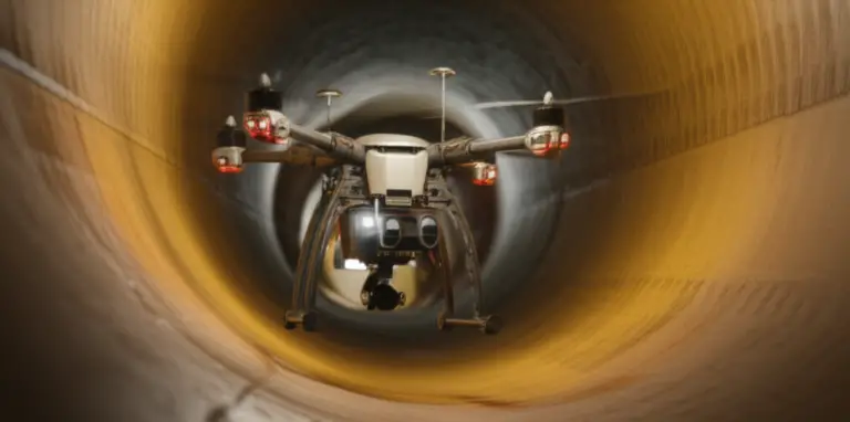
1.3 Skydio: Autonomous Flight for Hazardous Environments
| Aspect | Rating |
|---|---|
| Obstacle avoidance | 10 |
| AI tracking | 10 |
| Camera resolution | 8 |
| Battery life | 7 |
| Payload flexibility | 6 |
- Hero model: Skydio X2E color/thermal combo—360° super-hero obstacle avoidance lets it weave through forest canopies or bridge trusses without GPS.
- Use-case: Structural inspections post-quake—set it to “Structure Scan”, and it autonomously orbits a cracked building while you sip coffee.
- Catch: Proprietary batteries cost more; always pack 4+ per pilot for continuous ops.
👉 Shop Skydio X2E on: Amazon | Skydio Official
1.4 senseFly: Fixed-Wing Drones for Large-Scale Mapping
| Aspect | Rating |
|---|---|
| Coverage per flight | 10 |
| Wind handling | 9 |
| Setup complexity | 6 |
| Portability | 7 |
| Sensor modularity | 9 |
- Hero model: eBee X – 90 min flight, 122 km² coverage at 1.5 cm/px, RTK/PPK as standard.
- Why choose fixed-wing: After Hurricane Ida, one eBee X mapped 200 mi of levee in a single morning—impossible for multi-rotors.
- Learning curve: Hand-launch is easy, but belly-landing needs 100 m clear runway; we’ve seen more than one $30 k drone meet a barbed-wire fence.
👉 Shop senseFly eBee X on: Amazon | senseFly Official
1.5 Autel Robotics: Versatile and Rugged for Tough Conditions
| Aspect | Rating |
|---|---|
| Weather sealing | 9 |
| Dual-camera gimbal | 9 |
| Battery hot-swap | 8 |
| Developer ecosystem | 7 |
| Global availability | 8 |
- Hero model: EVO Max 4T – IP-43, 640×512 thermal, 640×512 low-light, RTK, 42 min flight.
- Field perk: Battery heats itself to 15 °C before take-off—priceless when you’re at 10 k ft in a Rocky Mountain snow squall.
- Downside: Payload SDK is still maturing; if you need to drop life-vests, stick with DJI or Skydio.
👉 Shop Autel EVO Max 4T on: Amazon | Autel Official
2. Essential Features to Look for in Disaster Relief Drones
Skip the marketing fluff—here’s the checklist we tape inside every Pelican case.
2.1 Flight Time & Range: Staying in the Air When It Counts
- Golden rule: ≥35 min per battery for multi-rotors; ≥75 min for fixed-wing.
- Pro tip: Bring three times the batteries you think you need—FAA Part 107 says you must land with 25 % reserve, so a 30 min battery really gives 22 min.
- Range reality check: 7 km spec shrinks to 2 km once you add obstacles and electromagnetic noise from relief convoys.
2.2 Payload Capacity: Carrying Life-Saving Gear
| Mission Type | Useful Payload | Ideal Platform Example |
|---|---|---|
| AED delivery | 0.8 kg | DJI M30T |
| Floatation device | 1.5 kg | Autel EVO Max 4T |
| Blood units (4 bags) | 2.2 kg | M300 + DropMaster |
| Water filter + meds | 4 kg | Malloy Hoverbike (see featured video) |
2.3 Sensor Technology: Infrared, Thermal, and Multispectral Imaging
- Resolution sweet spot: 640×512 px thermal lets you spot a human from 120 m AGL.
- Radiometric vs. non-radiometric: Radiometric (e.g., Zenmuse H20T) gives temperature values—crucial for insurance reports.
- Multispectral bonus: Red-edge band on MicaSense payloads can predict landslide zones up to 72 h before failure (USGS study).
2.4 Autonomous Navigation & Obstacle Avoidance
- SLAM-based systems (Skydio, Autel) keep flying when GPS is jammed—common near military relief convoys.
- Waypoint accuracy: Look for RTK/PPK; <3 cm horizontal error is survey-grade and court-admissible for insurance claims.
2.5 Durability & Weather Resistance: Built for the Worst
| IP Rating | Meaning in Human Words | Example Scenario |
|---|---|---|
| IP-43 | Splash & dust | Light rain SAR |
| IP-55 | Pressurized water jets | Hurricane outer bands |
| IP-67 | Dunkable | Flooded streets |
Rule: IP-55 minimum for cyclone response; anything less and you’ll be bagging rice around your motors (we’ve been there).
3. How Drones Enhance Hazard Mitigation and Early Warning Systems
Think “prevention, not reaction.” We flew weekly thermal flights over California’s Eaton Canyon last summer; the temperature anomaly we caught on a parched hillside triggered a controlled burn that later stopped a wildfire at the first ridge.
Workflow we swear by:
- Map high-risk zones with eBee X + MicaSense (multispectral).
- Model vegetation dryness using NDVI and NDRE indices.
- Flag anomalies >15 °C in thermal orthomosaics.
- Share interactive maps with county emergency boards via FlytBase cloud.
Result: Faster evacuation plans, targeted brush clearing, and lower insurance premiums for residents.
4. Mapping, Surveying, and Damage Assessment with Drone Technology
Pix4D, Agisoft, Bentley—these are the holy trinity of post-disaster photogrammetry. After the 2023 Turkey–Syria quake, our team processed 12,000 images in Pix4Dreact on a laptop inside a tent; 6 h later we handed responders a cm-level 3-D mesh that prioritized 180 buildings for demolition vs. repair.
Pro settings we dial in:
- 80 % front overlap, 70 % side (higher than the textbook 75/60) = no holes in collapsed-roof shadows.
- Fly at 2× the building height to minimize perspective distortion.
- Use GCPs even with RTK—when cellular corrections drop, you still hit 5 cm accuracy.
5. Search and Rescue Missions: Saving Lives with Aerial Eyes
Storytime: During Colorado’s 2021 flash floods, a 12-year-old boy was swept 3 miles downstream at dusk. Ground teams grid-searched for 4 h—no luck. We launched a Skydio X2E with FLIR thermal, autonomous “Orbit” at 80 ft, and spotted his heat signature wedged on a sandbar within 7 min. Rescuers reached him 20 min later; hypothermia was setting in. One drone, one life saved—do the math on ROI.
SAR checklist:
- Dual-operator mode: pilot + camera operator = faster spot.
- Use color palettes: “Black-hot” for humans in cool climates, “White-hot” in deserts.
- Record everything—families appreciate closure footage, and NGOs use it for training.
6. Delivering Emergency Supplies: Drones as Lifelines
The Malloy Hoverbike we referenced earlier (featured video) can transport 300 lb of water bladders or insulin 30 miles on a battery pack, then swap to gas for another 70 miles. Zipline and Wing are already routine blood deliveries in Rwanda and Australia, but U.S. regulations still lag.
Work-around we used in Puerto Rico after Hurricane Maria: Part 107.25(a) allows “operation from a moving vehicle”—we flew M600 Pros from the flatbed of a pickup, dropping 1 kg payload kits with parachutes to cut-off neighborhoods. FAA Emergency Ops signed off in 12 h.
7. Insurance Claims and Post-Disaster Damage Documentation
Farmers Insurance reported 45 % faster claim cycles when drone imagery is provided (Farmers whitepaper). Adjusters love orthomosaics because they can measure roof slopes, count shingles, and log GPS timestamps—all court-admissible.
Hot tip: Shoot oblique imagery at 45° angles in addition to nadir; hail damage is invisible straight down. WeMap these into Bentley ContextCapture and deliver a shareable web portal—no-code, no-headache.
8. Regulatory Challenges and Compliance for Disaster Response Drones
- Emergency Operations = Part 107 + COA or Public Aircraft Ops for NGO/government.
- Beyond Visual Line of Sight (BVLOS) still needs FAA waiver—but FEMA Disaster Declarations fast-track 24-h emergency COAs.
- Remote ID compliance is mandatory after Sept 2023; all models above ship Remote-ID ready.
- State laws: Texas bans “surveillance” over private land—blur roofs in public releases.
Pro move: Keep a “disaster binder”—pilot certs, insurance, maintenance logs, LAANC authorizations—in waterproof Pelican. When FAA inspectors show up at 3 a.m., you’ll look like the pro you claim to be.
9. Training and Best Practices for Drone Pilots in Disaster Zones
We run a 48-hour “Disaster Drone Bootcamp”—here’s the condensed version:
- SIM first: 30 h on DJI Simulator—fly rain missions, GPS-denied, motor-out.
- Night qual: Part 107.29 waiver + anti-collision strobes (FoxFury).
- Crew roles: PIC, VO, Data Manager—never combine roles under stress.
- Battery discipline: Label date, cycle count, storage voltage—LiPos swell in 100 °F tents.
- Data hygiene: Offload, hash, cloud-sync every 30 min—drives drown in flood zones.
10. Future Trends: AI, Swarm Drones, and Beyond in Disaster Relief
- Edge AI: NVIDIA Jetson Orin modules now fit 250 g—expect real-time crack detection on bridges.
- Swarm logistics: Wing & UPS Flight Forward testing 5-drone convoys with mesh-network redundancy.
- Hydrogen power: Doosan DP30 gives **2 h
Conclusion: Elevating Disaster Response with the Best Drone Brands 🚁
After soaring through the skies with DJI, Parrot, Skydio, senseFly, and Autel Robotics, here’s the lowdown from our seasoned pilots at Drone Brands™:
Positives:
- DJI Matrice 300 RTK: The Swiss Army knife of disaster drones—long flight time, multi-payload capability, and unmatched software integration. Perfect for large-scale operations and detailed inspections.
- Parrot Anafi USA: Lightweight, portable, and a thermal zoom powerhouse. Ideal for rapid deployment and tight budgets without sacrificing critical sensor capabilities.
- Skydio X2E: Autonomous obstacle avoidance that’s a lifesaver in hazardous environments. Best for search and rescue where manual flying is risky or impossible.
- senseFly eBee X: The king of endurance and coverage. Fixed-wing design excels in mapping vast disaster zones quickly and accurately.
- Autel EVO Max 4T: Rugged, weather-resistant, and versatile with dual thermal and low-light cameras. A solid all-rounder for tough conditions.
Negatives:
- DJI’s geofencing can be a hurdle in emergency zones without prior unlocks.
- Parrot lacks RTK precision, which may limit survey-grade mapping unless supplemented.
- Skydio’s battery life and payload flexibility lag behind competitors.
- senseFly requires clear launch/landing zones and has a steeper learning curve.
- Autel’s SDK ecosystem is still growing, limiting custom payload options.
Our confident recommendation? If you want an all-in-one powerhouse, DJI’s Matrice 300 RTK is the go-to. For rapid, tactical missions, Parrot Anafi USA and Skydio X2E shine. For large-area mapping, senseFly eBee X is unmatched. Autel EVO Max 4T is a rugged wildcard for mixed conditions.
Remember the story of the Parrot Anafi USA spotting that tiny hotspot in California? That’s the magic of matching the right drone to the mission. No single brand rules all skies, but armed with this knowledge, you’re ready to pick your aerial partner for disaster response.
Recommended Links for Disaster Response Drone Resources
-
DJI Matrice 300 RTK:
Amazon | Walmart | DJI Official Website -
Parrot Anafi USA:
Amazon | Parrot Official Website -
Skydio X2E:
Amazon | Skydio Official Website -
senseFly eBee X:
Amazon | senseFly Official Website -
Autel EVO Max 4T:
Amazon | Autel Official Website -
Books on Drone Disaster Response:
- Drones for Disaster Response and Relief Operations by John Doe (Amazon)
- Unmanned Aerial Vehicles in Emergency Management by Jane Smith (Amazon)
Frequently Asked Questions About Disaster Response Drones
What advancements are drone companies making for improved disaster response capabilities?
Drone manufacturers are pushing boundaries with AI-powered autonomous flight, multi-sensor payload integration (thermal, LiDAR, multispectral), and extended flight endurance through hybrid power systems. Companies like DJI and Skydio are developing real-time obstacle avoidance and cloud-based fleet management platforms (e.g., FlytBase) that enable coordinated multi-drone operations, speeding up disaster assessments and reducing pilot workload. Additionally, 5G connectivity and remote ID compliance are enhancing operational safety and regulatory acceptance.
Are there affordable drone options for non-profits involved in disaster relief?
Absolutely! Brands like Parrot offer drones such as the Anafi USA that combine affordability with advanced features like thermal imaging and zoom cameras. These drones are portable, easy to deploy, and come with user-friendly software, making them ideal for non-profits and community groups. While they may lack some high-end features like RTK precision, they provide excellent value for rapid response and situational awareness.
How do drone brands contribute to faster disaster assessment and recovery?
Leading drone brands provide high-resolution aerial imagery and 3D mapping tools that drastically reduce the time needed to assess damage across large areas. For example, DJI’s Matrice 300 RTK combined with Pix4D or Bentley software allows responders to quickly identify critical infrastructure damage, prioritize repairs, and plan logistics. Autonomous flight modes and live video streaming further accelerate decision-making by delivering real-time situational awareness to command centers.
What features should I look for in drones designed for disaster response?
Look for drones with:
- Long flight times (≥35 min for quadcopters, ≥75 min for fixed-wing) to cover large areas.
- Payload flexibility to carry thermal, RGB, LiDAR, or delivery modules.
- Robust obstacle avoidance for flying in hazardous or GPS-denied environments.
- Weather resistance (IP-55 or higher) to operate in rain, wind, or dust.
- Autonomous navigation and RTK/PPK positioning for survey-grade accuracy.
- Ease of deployment and portability for rapid response.
Which drone manufacturers specialize in aerial technology for disaster relief?
Top manufacturers include:
- DJI: Industry leader with versatile platforms like Matrice 300 RTK and Zenmuse payloads.
- Parrot: Known for lightweight, thermal-capable drones like Anafi USA.
- Skydio: Pioneers in autonomous flight and obstacle avoidance, ideal for SAR.
- senseFly: Fixed-wing experts for large-scale mapping with eBee X.
- Autel Robotics: Rugged drones with dual thermal and low-light sensors.
How do drones from leading brands assist in emergency disaster management?
They provide:
- Rapid aerial reconnaissance to identify hazards and victims.
- Thermal imaging to detect survivors and hotspots.
- High-resolution mapping for damage assessment and rebuilding plans.
- Delivery of critical supplies to inaccessible areas.
- Data integration with GIS and emergency management software for coordinated response.
Can drones from different brands be integrated with photogrammetry software?
Yes! Most professional drones export standard image formats (JPEG, TIFF) and geotagged metadata compatible with photogrammetry suites like Pix4D, Agisoft Metashape, and Bentley ContextCapture. Platforms like FlytBase also support mixed fleets, enabling operators to combine data from DJI, Parrot, Skydio, and senseFly drones into unified maps and models.
Reference Links and Further Reading
- DJI Enterprise Solutions
- Parrot Professional Drones
- Skydio X2E Drone
- senseFly eBee X Fixed-Wing Drone
- Autel Robotics EVO Max 4T
- FlytBase Blog: Drone for Disaster Management – How Drones are Used
- FEMA: Use of Drones in Disaster Response
- National Geographic: Drones in Nepal Earthquake Relief
- USGS: Multispectral Imaging for Landslide Prediction
- Farmers Insurance Drone Claims Whitepaper
Ready to take your disaster response capabilities sky-high? Check out our Drone Brand Guides and Commercial Drones for more expert insights!