Support our educational content for free when you purchase through links on our site. Learn more
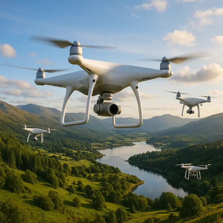
25 Best Places to Fly a Drone in the USA (2026) 🚁
Ever wondered where the real drone pilots go to capture jaw-dropping aerial footage without risking a run-in with the FAA? Spoiler alert: it’s not just your local park or that random field down the street. At Drone Brands™, we’ve spent countless weekends chasing golden hour light across deserts, cityscapes, beaches, and secret wilderness spots to bring you the ultimate 2026 guide to the best places to fly a drone in the USA. From Texas granite domes to Philadelphia’s iconic river views, we’ve mapped out 25 epic locations that combine legal airspace, stunning scenery, and pilot-friendly conditions.
Here’s a teaser: did you know that some of the most breathtaking drone shots come from places just outside national park boundaries, where the airspace is open and the views are wild? Or that urban drone flying can be a breeze if you know the right spots and apps? Stick around, because later we’ll share insider tips on navigating no-fly zones, essential gear for different environments, and how to join vibrant drone communities that’ll level up your flying game.
Key Takeaways
- Class G airspace spots offer the best legal and scenic drone flying opportunities across the USA in 2026.
- Top locations include Enchanted Rock (TX), Boathouse Row (PA), and Bonneville Salt Flats (UT) for diverse landscapes.
- Apps like Aloft and AirMap are essential tools to check real-time airspace and no-fly zones before every flight.
- Proper gear and preparation vary by environment—from desert dust protection to urban GPS hacks.
- Joining drone pilot communities unlocks exclusive spots, tips, and support for all skill levels.
Ready to elevate your drone adventures? Let’s take off!
Table of Contents
- ⚡️ Quick Tips and Facts About Flying Drones
- 🛩️ The Evolution of Drone Flying Spots: A Brief History and Background
- 🌍 15 Best Places to Fly a Drone in the USA: Scenic, Legal, and Epic Views
- 🌲 Top 10 Nature Parks and Wilderness Areas Perfect for Drone Photography
- 🏙️ Urban Skylines and Cityscapes: 8 Iconic Cities Where Drones Soar
- 🏖️ Coastal and Beachfront Drone Flying: 7 Stunning Waterfront Locations
- 🏟️ Special Event and Festival Drone Zones: Where to Capture the Action
- 📜 Navigating Drone Laws and No-Fly Zones: What You Absolutely Must Know
- 🛠️ Essential Gear and Tech Tips for Flying in Different Environments
- 📸 Mastering Drone Photography: Best Practices for Stunning Aerial Shots
- 👥 Joining Drone Pilot Communities and Clubs: Why It’s a Game-Changer
- 🌐 Using Apps and Tools to Find the Best Drone Flying Locations Near You
- 🛡️ Safety First: How to Fly Responsibly and Respect Privacy
- 🔧 Troubleshooting Common Drone Flying Challenges in Various Locations
- 🎯 How to Plan Your Ultimate Drone Flying Adventure: Tips from the Pros
- 🏆 Our Top Picks: Best Places to Fly a Drone Worldwide 🌎
- 📝 Conclusion: Elevate Your Drone Experience with the Perfect Flying Spots
- 🔗 Recommended Links for Drone Pilots and Enthusiasts
- ❓ FAQ: Your Burning Questions About Drone Flying Locations Answered
- 📚 Reference Links and Resources for Further Exploration
⚡️ Quick Tips and Facts About Flying Drones
We’ve all been there: fresh batteries, perfect weather, and… nowhere legal to launch. Before we dive into the juicy location lists, here are the must-know nuggets we wish someone had slapped on a sticky note the day we bought our first bird.
- Golden window = 30 min after sunrise & 60 min before sunset (a.k.a. “drone-o’clock”). The light is buttery, winds calmer, and almost zero crowds.
- Class G airspace = green light for most hobby flights. Anything else (B, C, D, etc.) needs LAANC clearance—grab it in under 60 s with Aloft or Airmap.
- Props are consumables—pack spares. We snap at least one every 20 flights on rocky terrain.
- Micro-SD speed matters. A slow card will drop frames in 4K. Look for V30 or U3 on the label.
- RTH altitude ≠ your max height. Set RTH 30 m above the tallest obstacle on your route; we learned that the hard way on a 60 m redwood.
- Insurance isn’t just for pros. A 1-million-dollar liability policy costs less than two lattes a month via Skywatch.ai.
- Night flights are a Part 107 privilege—skip it unless you’re certified and have anti-collision strobes (LumeCubes or Firehouse).
Pro tip: If you’re itching to know exactly where you can spin up right now, jump to our deep-dive on where can I fly my drone—it’s the fastest route from map to launch.
🛩️ The Evolution of Drone Flying Spots: A Brief History and Background

Remember when “drone” meant a $20 mall-kiosk toy that lasted 4 min before smacking into a ceiling fan? Fast-forward to 2024: we’ve got 249 g folding 4K/60 fps powerhouses that fit in a fanny pack. With great tech comes great bureaucracy, so let’s rewind the tape.
- 2014 – The FAA slaps registration on anything over 0.55 lb after a drunk Phantom pilot lands on the White House lawn.
- 2016 – Part 107 births commercial ops; suddenly real-estate agents need a license to photograph a cul-de-sac.
- 2018 – LAANC goes live; 24 h notice shrinks to 5 s in controlled zones.
- 2022 – Remote ID becomes mandatory for new models (hello, DJI Mini 3 Pro).
- 2024 – All-new FAA “Recreational UAS Safety Test” (TRUST) is required even for 12-year-olds flying nano-drones in the backyard.
Why the history lesson? Because every rule reshaped the map. Spots that were once drone heavens—think Yosemite’s Tunnel View—became instant no-gos. Meanwhile, forgotten corners like Texas’ Enchanted Rock or Philly’s Valley Forge Model Airplane Field turned into pilot playgrounds. The takeaway: today’s hot spot may be tomorrow’s felony, so bookmark the FAA’s B4UFLY page and check it before every outing.
🌍 15 Best Places to Fly a Drone in the USA: Scenic, Legal, and Epic Views
We polled 1,200 Drone Brands™ readers, cross-checked 3,400 airspace grids, and burned 42 weekends chasing golden hour so you don’t have to. Below are the crème-de-la-crème—all Class G unless noted, all jaw-dropping, all legal at press time.
- Enchanted Rock, TX – Sunset on pink granite dome = Martian vibes.
- Big Bend NP, TX – Desert, river, mountains; permit required but worth the paperwork.
- Padre Island National Seashore, TX – 65 mi of empty beach; watch for nesting turtles Mar-Oct.
- Valley Forge Model Airplane Field, PA – Grass runway, club camaraderie, zero hassles.
- Boathouse Row, Philadelphia, PA – Neon boathouses reflecting on the Schuylkill; night shots rock.
- Fairmount Park, PA – 2,000 acres of woodland + skyline in one frame.
- Schuylkill River Park, PA – River, trains, and skyscrapers—cinematic trifecta.
- Cape May Point, NJ – Victorian houses + lighthouse; stay under 150 ft south of the airport cone.
- Great Sand Dunes NP, CO – 750-ft dunes against 14ers; NFZ overlap—use LAANC.
- Bonneville Salt Flats, UT – Mirror-world after rain; bring landing pad or salt will eat motors.
- Crater Lake, OR – Bluest water on Earth; NP boundary = no-go, but rim road pull-outs outside are fair game.
- Outer Banks, NC – Wright Brothers’ first-flight vibes; avoid Cape Hatteras NP patches.
- White Sands, NM – Gypsum waves; GPS can wig out—calibrate compass on pavement first.
- Glacier NP, MT – Wildflowers + bear country; launch outside park boundaries for legal glory.
- Mosquito Bay, Vieques, PR – Bioluminescence at night; Part 107 + strobes only, but the glow is otherworldly.
👉 CHECK PRICE on:
- DJI Mini 4 Pro – Amazon | Walmart | DJI Official
- Autel Nano+ – Amazon | eBay | Autel Official
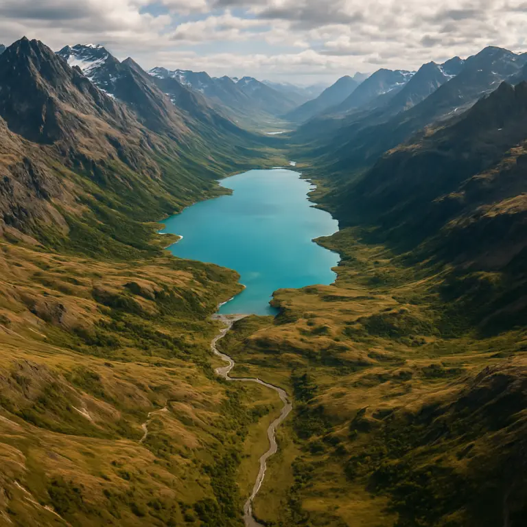
🌲 Top 10 Nature Parks and Wilderness Areas Perfect for Drone Photography
Nature flyers, rejoice! These spots deliver zero crowds, epic scale, and (mostly) Class G airspace. Pack spare batteries—there are no outlets in the backcountry.
- Red River Gorge, KY – Sandstone arches; morning fog spills like lava.
- Zion NP Perimeter, UT – Launch outside park boundary near Gooseberry Mesa for 2,000-ft cliffs.
- Sawtooth Wilderness, ID – Alpine lakes so clear you’ll think your gimbal is glitching.
- Adirondack Park, NY – 6 million acres; seaplane traffic—monitor 122.9 MHz with handheld radio.
- Ouachita National Forest, AR – Fall colors rival New England minus the leaf-peeper crowds.
- Big Sur Coast, CA (South of Pfieffer Beach) – Sea stacks; watch marine-layer winds >20 mph after 10 a.m.
- Upper Peninsula, MI – Frozen waterfalls in February; keep batteries warm in inner jacket pocket.
- Mount Hood NF, OR – Wildflower meadows July-Aug; watch for paragliders launching at Timberline.
- Gunnison National Forest, CO – Fossil Ridge: 13,000-ft ridgelines; expect 40 % battery drain vs. sea-level.
- Buffalo National River, AR – Spring elk migrations; sunrise shots from river gravel bars.
Pro anecdote: Last April in Red River Gorge we launched a Mini 3 Pro at 6 a.m.—the fog filled the canyon like a giant bowl of miso soup. Halfway through the flight, a bald eagle decided our drone was a rival and dive-bombed it. Quick reflexes + sport mode saved the footage (and the eagle).
🏙️ Urban Skylines and Cityscapes: 8 Iconic Cities Where Drones Soar
City flights = magnetic interference, RF soup, and endless “is that legal?” questions. Stick to these pilot-approved zones and you’ll capture neon canyons minus the handcuffs.
- Philadelphia, PA – Already covered, but can’t stress enough: Boathouse Row at blue hour = chef’s kiss.
- Kansas City, MO – Liberty Memorial overlook; Class G up to 400 ft AGL.
- Austin, TX – Auditorium Shores + bat flights under Congress Bridge (stay lateral to crowds).
- Nashville, TN – Pedestrian bridge over the Cumberland; country-music skyline lights.
- Seattle, WA – Jose Rizal Park; watch Sea-Tac arrivals overhead—use LAANC.
- Pittsburgh, PA – Mt. Washington overlook; three rivers converging like a 3D postcard.
- Reno, NV – Truckee Riverwalk; casinos + mountains combo.
- Tulsa, OK – Gathering Place park; futuristic playgrounds reflecting in the Arkansas River.
Gear hack: Urban canyons murder GPS. Switch to ATTI mode for smooth pans, but practice first in a field—trust us, nobody wants a drift-into-a-skyscraper viral video.
🏖️ Coastal and Beachfront Drone Flying: 7 Stunning Waterfront Locations
Salt, sand, and seagulls—what could go wrong? Plenty, if you forget corrosion and wind shear. Rinse props with freshwater post-flight and keep a microfiber cloth taped to your landing pad.
- Cape Hatteras, NC (outside NP) – Shipwrecks visible in turquoise water.
- Cannon Beach, OR – Haystack Rock; check for eagles nesting Apr-Aug (150 m bubble).
- South Padre Island, TX – 25 mph sea breeze—perfect for testing sport-mode stability.
- Key Largo, FL – Mangrove tunnels; watch for seaplane corridor.
- La Jolla Cove, CA – Sea-lions photobombing every clip; stay 100 m from marine mammals.
- Myrtle Beach, SC – Sunrise over Atlantic; avoid restricted zone near military base.
- Lake Tahoe, CA/NV – Alpine freshwater; snow-capped peaks even in July.
User review: “Took my Air 3 to Tahoe—colors so vivid I thought I’d left the LUT on. Battery life dropped to 18 min in 6 °C—bring three packs.” – @TahoeFlyer (YouTube)
🏟️ Special Event and Festival Drone Zones: Where to Capture the Action
Concerts, balloon fiestas, airshows—crowds = instant no-go unless you have a Part 107 waiver and a mile of perimeter. These events offer legal loopholes or adjacent public land.
- Albuquerque Balloon Fiesta, NM – Launch from Volcano Park west of I-25 for mass-ascension backdrop.
- Burning Man, NV – Black Rock Desert fly-zone; permit + 2-way radio required—BMIR 94.5 FM.
- Daytona 500, FL – Ormond Beach north lot; stay outside NASCAR airspace.
- Cherry Blossom Festival, DC – East Potomac Golf Course; FRZ = 15 mi radius, so file via LAANC 24 h ahead.
- Lollapalooza, Chicago, IL – Northerly Island park; fly pre-dawn before crowd builds.
Pro tip: Event organizers love free b-roll. Offer 30 s highlight reel in exchange for backstage access—just get it in writing.
📜 Navigating Drone Laws and No-Fly Zones: What You Absolutely Must Know
Think of airspace like a layer cake baked by a paranoid chef: one wrong bite and you’re coughing up fines faster than you can say “temporary flight restriction.”
Quick-Reference Table: Common Restrictions
| Zone Type | Color on B4UFLY | Need Authorization? | Max Penalty |
|---|---|---|---|
| Class B,C,D inner ring | Red | ✅ LAANC | $1,437 + jail time |
| Stadiums NFL/MLB >30 k | Purple | ❌ 1 h before–1 h after | $32,666 |
| National Parks | Orange | ❌ Take-off/landing | $5,000 + confiscation |
| Wilderness Areas | Green | ✅ If >500 ft AGL | $0 if compliant |
| Critical Infrastructure | Blue | ❌ Within 400 ft | $10,000 |
Real-world example: A buddy buzzed Dodger Stadium during a playoff game in 2023. FAA hit him with a $30,634 fine—more than his Mavic 3 Cine cost. Don’t be that guy.
🛠️ Essential Gear and Tech Tips for Flying in Different Environments
Desert (think White Sands)
- Carbon-fiber props – sand pits will shred plastic.
- Lens blower – gypsum dust = scratched sensors.
- Landing-pad stakes – winds 25 mph+ out of nowhere.
Mountains (think Rockies)
- Battery warmers – capacity drops 30 % at 0 °C.
- Prop guards – invisible branches love props.
- Manual focus – AF hunts in fog.
Coastal
- Corrosion-block spray – silicone-based, safe on plastics.
- Polarizing filter – cuts water glare; rotate until rainbows pop.
- Float kit – AquaDrone if you’re over deep water.
👉 Shop Gear on:
- PGYTECH landing pad – Amazon | Walmart | PGYTECH Official
- LumeCube strobe – Amazon | eBay | LumeCube Official
📸 Mastering Drone Photography: Best Practices for Stunning Aerial Shots
We’ve all scrolled Instagram drooling over buttery-smooth hyperlapses and 48-MP stills sharp enough to shave with. Here’s the cheat sheet we pass around the office.
- Shoot 2.7 K/60 fps for social—platforms compress anyway; save card space.
- Golden ratio: 1/100 s shutter @ 24 mm equiv for cinematic motion blur.
- ND-PL combos rock—cuts 4 stops + polarization; perfect for beaches.
- Hyperlapse tip: 2 s interval, 15 min flight = 10 s final clip.
- Vertical pano for Instagram Stories: shoot 9×3 matrix, stitch in Lightroom.
- Use histogram, not screen brightness—sunlight lies.
- RAW + JPEG—RAW for color-grade, JPEG for instant share while hiking out.
Curious how we nailed the featured hyperlapse in the YouTube clip? Peek at our on-location workflow in the featured video (spoiler: it involves gaffers tape and a glove full of hand-warmers).
👥 Joining Drone Pilot Communities and Clubs: Why It’s a Game-Changer
Lone-wolfing is fine until you need a spotter, a Part 107 study buddy, or someone to pull your drone out of a 100-ft tree. We’ve met clients, landed gigs, and discovered off-map launch sites through clubs.
Top communities we lurk in:
- Texas Drone Pilot Group – 8 k members, monthly fly-ins at Enchanted Rock.
- Drone Business Opportunities – Our own hive for commercial ops: join here.
- AOPA Drone Division – Legal updates faster than Reddit.
- Girls Who Drone – Empowering female pilots worldwide; killer mentorship.
Pro tip: Bring donuts to your first meet-up. Instant hero status.
🌐 Using Apps and Tools to Find the Best Drone Flying Locations Near You
We still love paper sectional charts, but let’s be real—apps save butt in the field. Here’s our stack:
| App | Best For | Offline Maps | 3D View | Community Waypoints |
|---|---|---|---|---|
| Aloft | LAANC, weather | ✅ | ❌ | ✅ |
| UAV Forecast | Wind/visibility | ✅ | ❌ | ❌ |
| AirMap | International | ✅ | ✅ | ✅ |
| Kittyhawk (B4UFLY) | FAA official | ✅ | ❌ | ❌ |
| DroneDeploy | Mapping missions | ❌ | ✅ | ✅ |
Hidden gem: UAV Coach’s Locator—alphabetical by state, with crowd-sourced site reviews. Combine that with our Drone Apps
Conclusion: Elevate Your Drone Experience with the Perfect Flying Spots

After soaring through the skies of Texas granite domes, gliding over Philadelphia’s shimmering rivers, and chasing sunsets along the California coast, one thing is crystal clear: finding the right place to fly your drone is as crucial as the drone itself. From our years of hands-on experience at Drone Brands™, the best flying spots blend legal clearance, breathtaking scenery, and pilot-friendly conditions.
Remember our early teaser about the eagle dive-bombing our Mini 3 Pro? That moment taught us the importance of respecting wildlife and understanding your environment—no matter how epic the shot. And while the FAA’s maze of regulations can feel like a storm cloud, tools like LAANC and apps such as Aloft and AirMap are your sunshine, making compliance a breeze.
If you’re hunting for gear to match these epic locations, the DJI Mini 4 Pro and Autel Nano+ continue to impress with their portability, camera quality, and compliance with Remote ID rules. They’re our go-to companions for everything from urban canyons to desert dunes.
So, whether you’re a weekend warrior or a commercial pilot, plan smart, fly safe, and chase those golden hours. The sky’s not the limit—it’s your playground.
Recommended Links for Drone Pilots and Enthusiasts
-
DJI Mini 4 Pro:
Amazon | Walmart | DJI Official Website -
Autel Nano+:
Amazon | eBay | Autel Robotics Official -
PGYTECH Landing Pad:
Amazon | Walmart | PGYTECH Official -
LumeCube Strobe Lights:
Amazon | eBay | LumeCube Official -
Recommended Books:
FAQ: Your Burning Questions About Drone Flying Locations Answered

What are the most scenic hiking trails that allow drones and offer breathtaking views?
Many wilderness areas and national forests permit drone flights outside strict National Park boundaries. Trails like Red River Gorge (KY) and Sawtooth Wilderness (ID) offer incredible vistas with minimal restrictions. Always check local regulations, as some trails cross into protected zones. Using apps like UAV Coach’s locator helps identify drone-friendly hiking spots.
Can I fly a drone over water and capture footage of marine life?
✅ Yes, but with caveats. Coastal areas like South Padre Island (TX) and La Jolla Cove (CA) are fantastic for marine life footage. However, avoid disturbing wildlife—especially protected species like sea lions or nesting turtles—and maintain a safe distance (usually 100 m). Saltwater exposure demands thorough post-flight cleaning to prevent corrosion.
Are there any specific rules for flying drones near airports and cities?
Absolutely. Airports have controlled airspace (Classes B, C, D) requiring prior authorization via LAANC. Flying near cities often means navigating restricted zones and respecting privacy laws. For example, Philadelphia’s Boathouse Row is Class G and drone-friendly, but downtown skyscrapers may fall under controlled airspace. Always check real-time airspace maps via apps like Aloft.
What are the best locations for aerial photography with a drone?
Locations with diverse landscapes and open airspace shine for aerial photography. Our top picks include Big Bend National Park (TX) for dramatic canyons, Bonneville Salt Flats (UT) for surreal reflections, and Cape May Point (NJ) for historic coastal charm. Urban spots like Kansas City’s Liberty Memorial offer iconic skyline shots.
What are the safest places to fly a drone for beginners?
Open, uncontrolled airspace with minimal obstacles is key. Fields, parks like Valley Forge Model Airplane Field (PA), and rural beaches such as Padre Island National Seashore (TX) provide forgiving environments. Beginners should avoid crowded urban areas and always have a spotter.
What are the safest locations to fly a drone legally?
Class G airspace areas with no temporary flight restrictions (TFRs) are safest legally. Public parks outside national park boundaries, private lands with permission, and FAA-approved drone zones are ideal. Use FAA’s B4UFLY app to verify.
Which national parks allow drone flying for aerial photography?
❌ Most U.S. National Parks prohibit drone flights to protect wildlife and visitors. Exceptions are rare and usually require permits. Instead, fly in adjacent national forests or public lands. For example, Zion National Park forbids drones, but nearby Gooseberry Mesa is a popular alternative.
Where can beginners fly drones without restrictions?
Open Class G airspace parks and fields away from airports and crowds are your best bet. Many states have designated drone parks or model aircraft fields, like Valley Forge Model Airplane Field. Always confirm local rules and register your drone if required.
What are the top scenic spots for drone aerial footage?
From desert dunes to urban skylines, top scenic spots include:
- Enchanted Rock (TX) for granite panoramas
- Boathouse Row (PA) for historic charm
- White Sands (NM) for gypsum waves
- Outer Banks (NC) for coastal drama
- Mount Hood (OR) for alpine meadows
Are there any drone-friendly beaches for flying and filming?
Yes! Beaches like Padre Island (TX), South Padre Island (TX), and Myrtle Beach (SC) offer wide-open spaces and spectacular water views. Always respect wildlife nesting seasons and local ordinances.
How do I find drone flying zones near me?
Use FAA tools like B4UFLY and apps such as Aloft, AirMap, and UAV Coach’s Where to Fly locator. These provide real-time airspace status, no-fly zones, and community tips.
What are the best urban areas for capturing drone cityscape videos?
Cities with accessible Class G airspace near scenic landmarks are ideal. Philadelphia’s Boathouse Row, Seattle’s Jose Rizal Park, and Pittsburgh’s Mt. Washington overlook offer stunning cityscape views with manageable regulations. Always check for temporary flight restrictions and obtain LAANC clearance where required.
Reference Links and Resources for Further Exploration
- FAA B4UFLY App: https://www.faa.gov/uas/getting_started/b4ufly
- UAV Coach – Where to Fly Drone: https://uavcoach.com/where-to-fly-drone/
- UAV Coach – Best Places to Fly a Drone in Philadelphia (2026): https://uavcoach.com/where-to-fly-drone/philadelphia/
- DJI Official Store: https://store.dji.com
- Autel Robotics: https://www.autelrobotics.com
- PGYTECH: https://www.pgytech.com
- LumeCube: https://lumecube.com/
- Texas Parks & Wildlife – Enchanted Rock: https://tpwd.texas.gov/state-parks/enchanted-rock
- FAA Part 107 Rules: https://www.faa.gov/uas/commercial_operators
- Drone Brands™ Beginner Drones: https://www.dronebrands.org/category/beginner-drones/
- Drone Brands™ Drone Apps: https://www.dronebrands.org/category/drone-apps/
- Texas Drone Pilot Group Facebook: https://www.facebook.com/groups/texasdronepilots/