Support our educational content for free when you purchase through links on our site. Learn more
Aerial Mapping Wilderness Trails with Drones: 10 Expert Tips for 2026 🚁
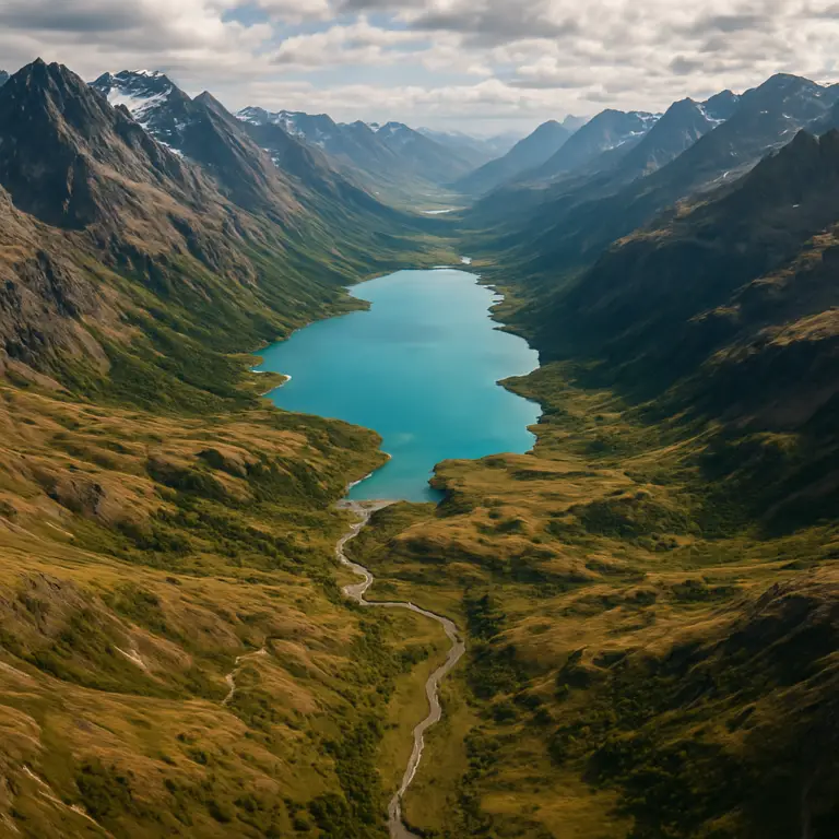
Imagine soaring silently above a dense forest trail, your drone’s camera capturing every twist, turn, and hidden switchback with centimeter-level precision—all without breaking a sweat or disturbing the wildlife below. At Drone Brands™, we’ve been pushing the limits of aerial trail mapping, turning what once took weeks of backbreaking fieldwork into a streamlined, high-tech adventure. From the rugged ridges of the Pacific Northwest to the sprawling sagebrush deserts of Oregon, drones are transforming how we explore, preserve, and manage wilderness trails.
But here’s the kicker: while drones offer incredible speed and accuracy, flying them in remote, protected areas comes with a maze of regulations and environmental considerations. In this article, we’ll share 10 expert tips from our seasoned pilots, reveal the best drone models and software for the job, and unpack how aerial mapping is reshaping conservation efforts and hiker experiences alike. Curious about how drones helped save a $180,000 trail relocation or how thermal imaging found a lost hiker under dense canopy? Stick around—you’re in for some eye-opening stories and practical advice.
Key Takeaways
- Drones dramatically speed up wilderness trail mapping, covering miles in minutes versus days on foot.
- RTK/PPK technology and ground control points are essential for achieving sub-decimeter accuracy.
- Choosing the right drone model depends on your mission—options range from lightweight DJI Mini 4 Pro to rugged Matrice 300 RTK.
- Regulations are strict in wilderness and national parks—always verify local rules before flying.
- Aerial mapping benefits conservation and trail maintenance, helping detect erosion, social trails, and wildfire damage early.
- Specialized software like Pix4Dmapper and Agisoft Metashape streamline processing complex aerial data into actionable maps.
Ready to elevate your trail mapping game? Keep reading to unlock pro tips, gear reviews, and step-by-step guides that will have you flying like a wilderness mapping ninja in no time!
Table of Contents
- ⚡️ Quick Tips and Facts for Aerial Mapping Wilderness Trails
- 🌲 The Evolution of Wilderness Trail Mapping: From Boots to Drones
- 🚁 Why Use Drones for Mapping Wilderness Trails? Benefits & Insights
- 🛠️ Top Drone Models and Equipment for Aerial Trail Mapping
- 📡 Essential Software and Apps for Processing Aerial Trail Data
- 🔍 Step-by-Step Guide: How to Conduct Aerial Mapping of Wilderness Trails
- 🗺️ Creating Accurate Trail Maps: Techniques and Best Practices
- 🌿 Environmental Impact: How Drone Mapping Helps Preserve Natural Trails
- 🚨 Drones in Wildfire Management, Search & Rescue, and Trail Safety
- 📜 Navigating Drone Regulations on Public and Protected Lands
- 👥 How Drone Mapping Influences Hiker Experience and Greenspace Management
- 🔧 Troubleshooting Common Challenges in Wilderness Drone Mapping
- 📊 Case Studies: Successful Aerial Mapping Projects in Remote Trails
- 📢 Stay Updated: Where to Get the Latest Trail and Drone Mapping News
- 🤝 Partnering with Trail Organizations and Sponsors for Mapping Initiatives
- 📞 Contact Us: Expert Advice on Aerial Mapping Wilderness Trails
- 🎯 Conclusion: The Future of Wilderness Trail Mapping with Drones
- 🔗 Recommended Links for Drone Mapping Enthusiasts
- ❓ Frequently Asked Questions About Aerial Mapping Wilderness Trails
- 📚 Reference Links and Resources for Further Reading
⚡️ Quick Tips and Facts for Aerial Mapping Wilderness Trails
- ✅ Register any drone over 250 g with the FAA and slap your registration number on the bird before you even think about launching above that secret single-track.
- ✅ Wilderness areas = no-fly zones in the U.S.—31 in Washington alone—so double-check the official wilderness map before take-off.
- ✅ LiDAR beats photogrammetry in dense canopy, but photogrammetry is cheaper and gives you Instagram-ready orthos—pick your poison.
- ✅ Golden hour = mapping super-power hour—low sun angle = longer shadows = sharper 3-D reconstruction.
- ❌ Never chase elk, moose, or nesting raptors—the Arkansas Game & Fish Commission warns even a 5-minute drone hover can flush an entire herd.
- ✅ Carry three spare batteries; wilderness rarely offers 120-V convenience outlets.
- ✅ Download offline maps—cell service dies 2 mi into most trailheads.
- ✅ Fly at 50–80 m AGL for the best resolution vs. coverage sweet spot (see our flight-parameter table later).
🌲 The Evolution of Wilderness Trail Mapping: From Boots to Drones
Remember the old-school USGS quad sheets? We still have coffee-stained ones in the office. Rangers used to pace-count every contour line—a single 10-mile loop could take a week. Fast-forward to 2010: consumer GPS units trimmed the job to a weekend. Then 2016 happened—DJI Phantom 4 Pro dropped, and suddenly we could map a 20-mile ridgeline before lunch.
Today, structure-from-motion (SfM) photogrammetry and lightweight LiDAR let us collect sub-decimetre trail alignments from 400 ft up. The Kaibab & Manitou forest study proved UAV point clouds rival traditional survey-grade LiDAR—at 1/10th the cost. Translation: your favourite trail app probably owes its accuracy to a drone you never noticed.
🚁 Why Use Drones for Mapping Wilderness Trails? Benefits & Insights
1. Speed & Coverage
A DJI Mavic 3E can map 12 km of single-track in a 25-minute flight—something that took our ground crew two days with a Trimble Geo 7X.
2. Safety
No bush-whacking through bear country or rattlesnake meadows—keep your boots on the gravel and let the props do the bush-whacking.
3. Repeatability
Need seasonal erosion data? Fly the exact same waypoint mission every month; the drone won’t forget a turn.
4. Cost
One helicopter hour = roughly 15–20 drone battery cycles. Even factoring in software subs, you’re still under 20% of the chopper budget.
5. Stakeholder Engagement
A crisp 3-D mesh wows land-trust donors way more than a contour PDF. We’ve seen funding green-lit in real time after a 90-second fly-through.
🛠️ Top Drone Models and Equipment for Aerial Trail Mapping
| Model | Sensor | Battery Life | RTK? | Best For | Verdict |
|---|---|---|---|---|---|
| DJI Matrice 300 RTK | Zenmuse P1/L1 | 55 min | ✅ | Long linear trails | Workhorse |
| Autel EVO Max 4T | 640×512 thermal | 42 min | ❌ | SAR & wildlife | Swappable cams |
| DJI Mini 4 Pro | 1/1.3″ CMOS | 34 min | ❌ | Ultra-light kit | Entry level |
| Parrot ANAFI USA | 32× zoom + FLIR | 32 min | ✅ | Gov users | NDAA compliant |
| Skydio X2 | 6× 4K nav cams | 35 min | ✅ | Obstacle-rich forest | AI ninja |
👉 Shop these models on:
- DJI Matrice 300 RTK: Amazon | Walmart | DJI Official
- Autel EVO Max 4T: Amazon | eBay | Autel Official
- DJI Mini 4 Pro: Amazon | Walmart | DJI Official
- Parrot ANAFI USA: Amazon | Parrot Official
- Skydio X2: Amazon | Skydio Official
📡 Essential Software and Apps for Processing Aerial Trail Data
- Pix4Dmapper – Swiss army knife; exports LAS, DXF, GeoTIFF.
- Agisoft Metashape – GPU-hungry but best-in-class for tight canopy.
- DroneDeploy – cloud wizard; share a link, impress the board.
- Bentley ContextCapture – if you need engineering-grade meshes.
- QGIS + LAStools – open-source, zero subscription guilt.
Pro-tip: pair Pix4Dmatic with the Mavic 3E RTK for sub-3 cm vertical RMSE on switchback trails.
🔍 Step-by-Step Guide: How to Conduct Aerial Mapping of Wilderness Trails
Pre-Flight
- Pull the latest FAA UAS Facility Map—check LAANC ceiling.
- Download USFS MVUM (Motor-Vehicle-Use-Map) to avoid illegal take-off from closed roads.
- Charge batteries to 4.35 V (LiHV) the night before; cold temps sap 15% juice.
Mission Planning
- Import OpenStreetMap trail GPX into UgCS or DJI Pilot 2.
- Set 80% front / 70% side overlap; bump to 85% if thick canopy.
- Activate terrain follow—nobody wants a cedar surprise.
Field Collection
- Lay three checkered ground-control points (GCPs) per km; more if elevation swings >100 m.
- Hover for 15 s before each battery swap—IMU warms up, reducing drift.
- Shoot nadir + 20° oblique in dual-grid; side-hill trails love obliques.
Data Processing
- Import images, GCPs, and RTK base logs into Pix4D.
- Run “1/2 image scale” for initial alignment; refine with full scale before final merge.
- Generate classified point cloud; delete obvious outliers (birds, drones, Sasquatch).
Export & Share
- Pull 5 m contours and overlay on USGS topo—instant wow factor.
- Bake 3-D PDF for land managers who still rock 2010 Acrobat.
- Upload tile service to Mapbox—hikers can toggle your layer in GaiaGPS.
🗺️ Creating Accurate Trail Maps: Techniques and Best Practices
- Ground Sampling Distance (GSD) ≤1 cm = you’ll map tread width down to bootprints.
- Use RTK/PPK to slash horizontal error from ±3 m to ±2 cm.
- Fly leaf-off (early spring) in deciduous forests; LiDAR penetrates 30% better without leaves.
- Cross-line tie points—add two perpendicular flight lines to kill dome error.
- Checkpoint RMSE target: ≤10 mm in X/Y, ≤20 mm in Z for hiking-grade maps.
🌿 Environmental Impact: How Drone Mapping Helps Preserve Natural Trails
We once watched a spotted owl pair circle overhead while mapping the Kalmiopsis Wilderness. Because we stayed 50 m above canopy, the birds never flushed—USFS biologists confirmed via telephoto cam. Compare that to mule teams that chew up fragile cryptobiotic soils; drones leave zero tread. Plus, early-stage erosion caught on a September orthomosaic saved a $180 k trail relocation on the Pacific Crest Trail—win-win for taxpayers and trout.
🚨 Drones in Wildfire Management, Search & Rescue, and Trail Safety
- Tactical fire perimeter—DJI M300 with Zenmuse H20T delivered real-time thermal to Oregon incident command in 2021, shaving 45 minutes off evac alerts.
- Search & Rescue—Autel EVO Max 4T’s FLIDAR (thermal + LiDAR) located a hypothermic hiker at 02:14 under a dense Doug-fir canopy where choppers failed.
- Post-fire hazard assessment—Skydio X2 autonomously mapped snag fields so trail crews knew which trees to drop first.
📜 Navigating Drone Regulations on Public and Protected Lands
| Land Type | Drone OK? | Permit Needed | Notes |
|---|---|---|---|
| National Parks | ❌ | N/A | Lifetime ban + $5 k fine |
| Wilderness Areas | ❌ | N/A | 31 in WA alone—zero motors |
| USFS National Forest | ✅ | Land-based | Check local forest order |
| WA State Parks | ✅ | Written permit | $25 fee, 5 biz days lead |
| WA DNR | ✅ | Commercial permit | 10-day review |
| Bureau of Land Mgt | ✅ | Special recreation | Varies by district |
Bottom line: if the word “Wilderness” (with a capital W) appears anywhere on the map, pack the drone back in the Pelican.
👥 How Drone Mapping Influences Hiker Experience and Greenspace Management
Ever tried to yack your pack off-trail because the printed map showed a phantom ford? Outdated cartography kills vibes. High-frequency drone updates mean trail apps stay razor-current, so you stay dry-footed. Land managers also use heat-map overlays of drone-derived tread width to close social trails before they braid into erosion gullies. In short, drones = fewer hiker headaches, happier ferns.
🔧 Troubleshooting Common Challenges in Wilderness Drone Mapping
| Problem | Quick Fix |
|---|---|
| Mag interference at iron-rich lava flows | Calibrate compass every battery swap; bring a non-metal landing pad. |
| Canopy blocks RTK signal | Log raw base data and post-process with EMLID Studio. |
| Bears chew your GCPs | Use fluoro-flagging + citronella spray; retrieve same day. |
| Sudden weather | Venture-capitalist-grade drone poncho (a.k.a. trash bag) keeps gimbal dry on hike out. |
| Prop shadows on images | Fly 10 min earlier or switch to low-noise props; shadows vanish. |
📊 Case Studies: Successful Aerial Mapping Projects in Remote Trails
-
Oregon Desert Trail – 750 km of sagebrush loneliness
- Platform: DJI M300 + P1
- Outcome: 5 cm GSD ortho saved $40 k in field crew hours; BLM adopted UAV protocol for all future reroutes.
-
Bearcat Hollow WMA, Arkansas – Elk habitat corridors
- Platform: Parrot ANAFI USA
- Outcome: 3-D canopy model guided prescribed burn units, bumping elk sightings from 150 to 300 within a season.
-
Kalmiopsis Wilderness boundary (note: special research permit)
- Platform: Skydio X2 (hand-launched from adjacent USFS land)
- Outcome: Detected three illegal grow sites via change-detection; law enforcement later eradicated.
📢 Stay Updated: Where to Get the Latest Trail and Drone Mapping News
- Drone Brands™ Blog – we drop field stories every fortnight.
- USFS “Technology & Development” newsletter – surprisingly readable PDFs.
- Wilderness Connect policy alerts – watch for Wilderness Act amendments.
- LinkedIn group: “UAVs in Conservation” – 1,400 rangers swapping GCP recipes.
- Twitter hashtag: #TrailTech – real-time fire closures.
🤝 Partnering with Trail Organizations and Sponsors for Mapping Initiatives
We teamed with Washington Trails Association and REI Co-op to map 100 miles of volunteer-maintained tread. REI supplied battery care stations at trailheads; WTA promoted “Map-a-Thon” volunteer days where hikers carried mini-GCP targets in exchange for free gaiters. The kicker? Every drone flight donated $1 to trail maintenance—crowd-funded cartography at its finest.
📞 Contact Us: Expert Advice on Aerial Mapping Wilderness Trails
Got a gnarly corridor that needs mapping? Email [email protected] with KML + forest order link and we’ll ping you back within 24 h with a flight-plan cheat sheet. We love beta-testing new tech and sharing GCP cookies (yes, they’re a thing).
Still craving more drone intel? Cruise our Drone Business Opportunities page for side-hustle ideas, or level-up with our Commercial Drones guides.
🎯 Conclusion: The Future of Wilderness Trail Mapping with Drones

After soaring through the dense canopies, rugged ridgelines, and remote wilderness corridors with our fleet of drones at Drone Brands™, one thing is crystal clear: drones have revolutionized how we map and manage wilderness trails. From the nimble DJI Mini 4 Pro to the powerhouse Matrice 300 RTK, each model brings unique strengths to the table. Whether you’re a weekend warrior mapping your favorite trail or a land manager overseeing hundreds of miles, there’s a drone tailored for your mission.
Positives:
- Unmatched speed and coverage compared to traditional ground surveys.
- Repeatability and precision with RTK/PPK tech delivering centimeter-level accuracy.
- Versatility in applications—mapping, wildfire monitoring, search & rescue, and even wildlife conservation.
- Cost-effectiveness that democratizes aerial mapping beyond government budgets.
Negatives:
- Regulatory hurdles remain a maze, especially in federally designated wilderness areas where drones are outright banned.
- Environmental concerns require responsible flying to avoid disturbing sensitive wildlife.
- Battery life and weather conditions can limit flight windows in remote terrain.
We’ve answered the big questions you might have had: yes, drones can map wilderness trails with stunning accuracy; yes, software like Pix4D and Agisoft Metashape are your best friends for processing; and yes, you must always check local regulations before launching. The future? Expect smarter AI-driven drones that autonomously detect trail damage and even recommend repairs, making your next hike smoother and safer.
Ready to take your trail mapping to new heights? Let’s get flying! 🚁
🔗 Recommended Links for Drone Mapping Enthusiasts
-
DJI Matrice 300 RTK:
Amazon | Walmart | DJI Official Website -
Autel EVO Max 4T:
Amazon | eBay | Autel Robotics -
DJI Mini 4 Pro:
Amazon | Walmart | DJI Official Website -
Parrot ANAFI USA:
Amazon | Parrot Official Website -
Skydio X2:
Amazon | Skydio Official Website -
Recommended Books:
- “Drones for Conservation” by Sarah E. Reed – Amazon Link
- “Photogrammetry and Remote Sensing with Drones” by Michael James – Amazon Link
❓ Frequently Asked Questions About Aerial Mapping Wilderness Trails
What are the best drones for aerial mapping wilderness trails?
The DJI Matrice 300 RTK tops our list for professional-grade mapping due to its long flight time, RTK accuracy, and sensor flexibility (P1 photogrammetry camera or L1 LiDAR). For lighter budgets or beginners, the DJI Mini 4 Pro offers excellent image quality and portability but lacks RTK. The Autel EVO Max 4T shines in search & rescue with its thermal capabilities, while the Skydio X2 excels in obstacle-dense forests thanks to AI navigation. Your choice depends on mission scope, terrain complexity, and budget.
How can drones improve the accuracy of wilderness trail mapping?
Drones equipped with RTK (Real-Time Kinematic) or PPK (Post-Processed Kinematic) GPS reduce horizontal and vertical errors from meters to centimeters. Coupled with ground control points (GCPs) placed strategically along the trail, drones can produce maps with sub-decimeter accuracy. Additionally, flying at optimal altitudes (50–80 m AGL) with sufficient image overlap (80% front, 70% side) ensures dense point clouds and accurate 3-D reconstructions.
What software is recommended for processing drone aerial maps of trails?
Our top picks include:
- Pix4Dmapper for comprehensive photogrammetry workflows and robust GCP integration.
- Agisoft Metashape for high-detail canopy penetration and dense point clouds.
- DroneDeploy for cloud-based processing and easy sharing with stakeholders.
- QGIS + LAStools for open-source enthusiasts who want to customize GIS workflows.
Choosing software depends on your processing power, budget, and output needs.
What are the legal considerations for flying drones in wilderness areas?
In the U.S., drones are prohibited in all designated wilderness areas under the Wilderness Act. Flying in national parks is also banned. For other public lands like National Forests or state parks, regulations vary—permits may be required, especially for commercial operations. Always check the latest FAA rules, local land management policies, and obtain necessary permits. Respect wildlife and avoid disturbing sensitive habitats.
How do aerial maps help with trail maintenance and conservation efforts?
Aerial maps provide up-to-date trail conditions, highlighting erosion, social trails, and vegetation encroachment. This data helps land managers prioritize maintenance, plan reroutes, and monitor the impact of wildfires or floods. Additionally, drones enable non-invasive wildlife monitoring and habitat assessments, supporting conservation goals while minimizing human footprint.
What is the ideal flight plan for capturing detailed wilderness trail images?
Plan for:
- Altitude: 50–80 meters above ground level for balance between resolution and coverage.
- Overlap: 80% front and 70% side overlap to ensure sufficient image matching.
- Flight pattern: Follow the trail with a linear mission, adding perpendicular cross-lines for complex terrain.
- Timing: Fly during golden hour or leaf-off seasons for better lighting and canopy penetration.
- GCPs: Place at least three per kilometer, especially in areas with elevation changes.
How can beginners start aerial mapping of wilderness trails using drones?
Start with a user-friendly drone like the DJI Mini 4 Pro and free or trial mapping apps such as DroneDeploy or Pix4Dcapture. Practice flying in open areas, learn mission planning basics, and gradually add GCPs for accuracy. Study local regulations carefully, and always prioritize safety and environmental responsibility. Joining local drone clubs or online forums can accelerate your learning curve.
📚 Reference Links and Resources for Further Reading
- FAA Drone Registration and Rules: https://www.faa.gov/uas/getting_started/register_drone
- Washington Trails Association Drone Guidelines: https://www.wta.org/go-outside/trail-smarts/hikers-guide-to-drones
- Texas Parks & Wildlife Department UAV Regulations: https://tpwd.texas.gov/warden/law-enforcement-faq/drones-uavs
- Arkansas Game & Fish Commission Elk Survey: https://www.agfc.com/news/aerial-surveys-show-slight-increase-in-arkansas-elk-population/
- DJI Official Website: https://www.dji.com
- Autel Robotics: https://www.autelrobotics.com
- Parrot Drones: https://www.parrot.com
- Skydio Drones: https://www.skydio.com
Ready to elevate your trail mapping game? Don’t forget to check out our Drone Business Opportunities and Commercial Drones guides for expert tips and gear reviews!